


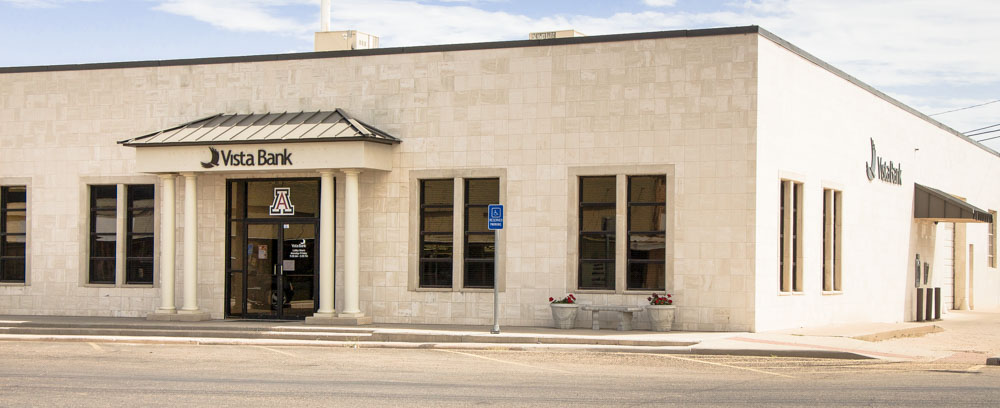


Why visit Abernathy
Townapedia lists 3 museums and landmarks, 2 parks and trails and 5 places to eat in and around town.
July is the warmest month, with average highs of 91°F; January lows average 24°F.
Weather in Abernathy
Forecast from the National Weather Service. Full forecast
About Abernathy
Abernathy is a city in Hale and Lubbock Counties in the U.S. state of Texas. As of the 2020 census, Abernathy had a population of 2,865.
From the Wikipedia article Abernathy, Texas (this version), under CC BY-SA 4.0.
Museums and landmarks3

Parks, trails and playgrounds2


Restaurants and cafes5

Code 3
Restaurant · Coffee Shop, Meat Market, Sandwich, Soad Shop · 1.0 mi
1615 West Service Road, Abernathy
Ricky’s on Main
Restaurant · Chicken, Beef, Steak House, Barbecue · 0.6 mi
310 Main Street, Abernathy
Mo-Fr 11:00-14:00

Nana's Donuts
Fast food · Donut · 0.5 mi
400-498 Avenue D, Abernathy
Tu-Fr 06:00-13:00
Churches and places of worship5

Saint Isidore Catholic Church
Church · Roman Catholic · 0.8 mi
17813 North Interstate 27, Abernathy
Abernathy Church of Christ
Church · Church Of Christ · 0.6 mi
916 Avenue E, Abernathy
First Baptist Church Abernathy
Church · Baptist · 0.5 mi
411 7th Street, Abernathy
History
The Santa Fe Railroad wanted to follow a straight line from Plainview to Lubbock. A straight-line survey was run, and it went east of the present site of Abernathy. This route did not please the residents of Hale Center, which had been established since the 1890s. They influenced the Santa Fe to come southwest out of Plainview to serve them, and from there the Santa Fe followed an approximate straight line into Lubbock.
The developers of the town sites along the new railroad wanted to organize a town on a section 4 miles (6 km) north of the present town of Abernathy. The owners, who lived in Wisconsin, were contacted. They thought gold might be on the land and refused to sell. Therefore, the last section south in Hale County was chosen as the town site.
Originally owned by John Y. Ligon, the section that was to become the Abernathy town site was purchased by J.C. Roberds from E.S. and W.L. Stanfield. When the South Plains Investment Company was formed by Roberds, Dr. M.C. Overton, and Monroe Abernathy, Mr. Roberds deeded the section to the firm and became the president of the firm. Dr. Overton was secretary and Mr. Abernathy was treasurer.
From the History section of Abernathy, Texas on Wikipedia, under CC BY-SA 4.0.
Shopping1
Gas and EV charging2
Schools, colleges and libraries5
Healthcare1
Map of Abernathy
24 places. The map loads OpenStreetMap tiles when you open it.
Climate by month
Monthly table
| Month | High | Low | Rain | Snow |
|---|---|---|---|---|
| Jan | 54°F | 24°F | 0.7 in | 1.4 in |
| Feb | 58°F | 28°F | 0.7 in | 1.6 in |
| Mar | 66°F | 35°F | 1.1 in | 0.4 in |
| Apr | 74°F | 43°F | 1.2 in | 0.1 in |
| May | 81°F | 54°F | 2.9 in | 0.0 in |
| Jun | 89°F | 63°F | 2.7 in | 0.0 in |
| Jul | 91°F | 67°F | 1.9 in | 0.0 in |
| Aug | 90°F | 66°F | 2.0 in | 0.0 in |
| Sep | 84°F | 58°F | 2.5 in | 0.0 in |
| Oct | 75°F | 46°F | 1.7 in | 0.1 in |
| Nov | 63°F | 34°F | 0.9 in | 1.1 in |
| Dec | 55°F | 26°F | 0.8 in | 1.8 in |
U.S. Climate Normals 1991-2020 for Abernathy (1 mi away), NOAA NCEI.
People and cost of living
American Community Survey 5-year estimates, 2020-2024, U.S. Census Bureau. Estimates have margins of error, larger for small towns.
Disaster history
Hale County has had 9 federal disaster declarations since 2000, most often for hurricanes.
- 2021-02-19: Severe Winter Storms (Severe Ice Storm)
- 2021-02-14: Severe Winter Storm (Severe Ice Storm)
- 2020-03-25: Covid-19 Pandemic (Biological)
- 2020-03-13: Covid-19 (Biological)
- 2008-03-14: Wildfires (Fire)
- 2006-01-11: Extreme Wildfire Threat (Fire)
OpenFEMA disaster declarations summaries.
Getting there and nearby towns
Lubbock Preston Smith International Airport (LBB) is the nearest airport with scheduled flights listed in OpenStreetMap, 11 miles away.
- Shallowater 12 mi southwest, about 20 min by car
- Idalou 15 mi southeast, about 24 min by car
- Hale Center 17 mi north, about 27 min by car
- Lubbock 18 mi south, about 30 min by car
- Plainview 26 mi north, about 42 min by car
- Seth Ward 28 mi north, about 46 min by car
- Ralls 29 mi east, about 46 min by car
- Olton 29 mi northwest, about 47 min by car
- Floydada 31 mi east, about 51 min by car
- Levelland 34 mi southwest, about 55 min by car
Drive times are estimates from straight-line distance, not routes.
Local news
Headlines from INDB, the NEMICO news database.
Reviews, tips and questions
Loading what members have shared...
Sources and licences
- NCES EDGE (Public domain): public schools
- NOAA NCEI U.S. Climate Normals 1991-2020 (Public domain): climate by month
- OpenFEMA (Public domain): disaster declarations
- OpenStreetMap contributors (ODbL 1.0): places, airports, map data
- U.S. Census Bureau (Public domain): population, income, housing, education, commute
- Wikidata (CC0 1.0): elevation, founding date, time zone, website
- Wikimedia Commons (see each image): photos
- Wikipedia (CC BY-SA 4.0): overview and history text
Photo credits
- Abernathy TX, Fredlyfish4, CC BY-SA 4.0
- Abernathy-VistaBank, Erinrwarren, CC BY-SA 4.0
- Abernathy Texas Plains Grain Elevator 2010, Leaflet, CC BY-SA 3.0
Page built October 30, 2026. Spotted a mistake? Tell us or suggest a place.