


Albany, New York
Albany is a city of 100,492 people in Albany County, New York, founded in 1686.
Why visit Albany
Townapedia lists 128 museums and landmarks, 47 parks and trails, 260 places to eat, 10 places to stay and 17 attractions in and around town.
Highlights include The Madison Theater, Spectrum 8 Theatres, Walter Merchant House and 48 Hudson Avenue.
July is the warmest month, with average highs of 84°F; January lows average 16°F, and about 59 inches of snow fall in a normal year.
Weather in Albany
Forecast from the National Weather Service. Full forecast
About Albany
Albany is the capital city of the U.S. state of New York. It is also the county seat of, and the most populous city in Albany County. Albany is located on the west bank of the Hudson River, approximately ten miles (16 km) south of its confluence with the Mohawk River. Its population was 99,224 at the time of the 2020 census and was estimated at 102,305 in 2026.
From the Wikipedia article Albany, New York (this version), under CC BY-SA 4.0.
Things to do17


5 more on the map.
Museums and landmarks128

Walter Merchant House
Monument and historic site · National Register of Historic Places · 1.9 mi
Historic house in New York, United States
188 Washington Avenue, Albany

48 Hudson Avenue
Monument and historic site · National Register of Historic Places · 2.7 mi
United States historic place in Albany, New York

A. Mendelson and Son Company Building
Monument and historic site · National Register of Historic Places · 3.0 mi
Building in New York, United States

Aiken House
Monument and historic site · National Register of Historic Places · 3.2 mi
Historic house in Rensselaer, New York


Albany Rural Cemetery
Monument and historic site · National Register of Historic Places · 4.3 mi
Cemetery in Menands, New York, United States; located outside of the city of Albany

Albert Slingerlands House
Monument and historic site · National Register of Historic Places · 4.0 mi
Historic house in New York, United States

Alfred H. Renshaw House
Monument and historic site · National Register of Historic Places · 4.7 mi
Historic house in Colonie, New York

Arbor Hill Historic District–Ten Broeck Triangle
Monument and historic site · National Register of Historic Places · 2.5 mi
Historic district in Albany, New York
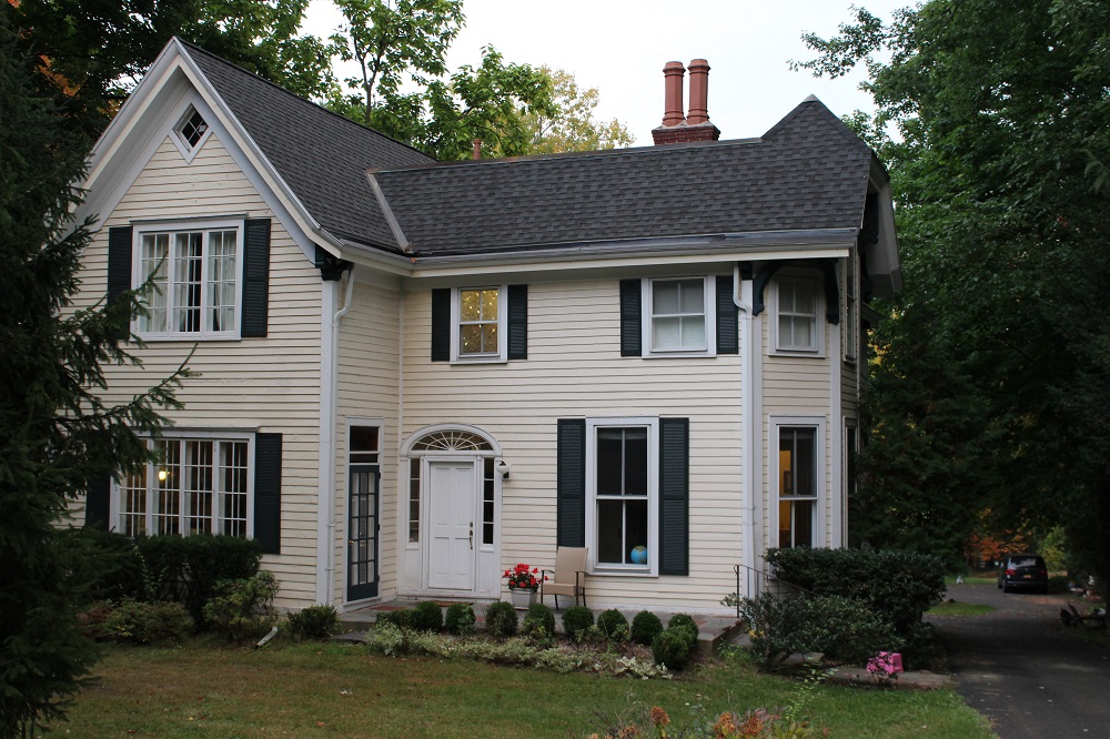


Bacon-Stickney House
Monument and historic site · National Register of Historic Places · 3.6 mi
Historic home located at Colonie in Albany County, New York
Benjamin Walworth Arnold House and Carriage House
Monument and historic site · National Register of Historic Places · 1.6 mi
United States historic place
Broadway–Livingston Avenue Historic District
Monument and historic site · National Register of Historic Places · 2.6 mi
Historic district in the United States
116 more on the map.
Parks, trails and playgrounds47


Washington Avenue Armory Sports and Convention Arena
Sports field and stadium · 1.9 mi
195 Washington Avenue, Albany
35 more on the map.
Restaurants and cafes260

Lazeez
Restaurant · Indian · 1.8 mi
Pakistani-Indian Cuisine
35 Central Avenue, Albany
Mo-Th 11:30-22:00; Fr-Sa 11:30-23:00; Su 12:00-22:00

Madison Pour House
Bar and pub · American
Two-story watering hole with a rustic-chic vibe serving an extensive selection of beer & bar fare.
1110 Madison Avenue, Albany
Mo-Su 16:00-24:00
Aashiana
Restaurant · Indian · 1.8 mi
31 Central Avenue, Albany
Mo-Fr 11:30-15:00, 17:30-20:00; Sa 12:00-15:00

Cafe Madison
Restaurant · American, Breakfast
1100 Madison Avenue, Albany
Mo-Fr 07:30-14:00; Sa-Su 07:30-15:00
Curry House
Restaurant · Indian
1112 Madison Avenue, Albany
Mo-Fr 11:30-22:00; Sa 12:00-23:00; Su 12:00-22:00
DC’s Pizza
Restaurant · Pizza · 1.5 mi
1182 Western Avenue, Albany
Mo, Tu 11:00-20:00; We-Fr 09:00-21:00; Sa, Su 11:00-21:00
Grappa'72 Ristorante
Restaurant · Italian · 1.0 mi
818 Central Avenue, Albany
Mo-Th 11:30-15:00,16:30-21:30; Fr 11:30-15:00,16:30-22:00; Sa...

Jewel of India on Lark
Restaurant · Indian · 1.9 mi
187 Lark Street, Albany
Mo-Th 11:30-22:00; Fr 11:30-22:30; Sa 12:00-22:30; Su 12:00-22:00
Kismet Mediterranean Grill
Restaurant · Mediterranean
1116 Madison Avenue, Albany
We,Th,Su 17:00-21:00; Fr-Sa 17:00-21:30
L'Roca Restaurant & Lounge
Restaurant · Caribbean · 2.0 mi
170 Delaware Avenue, Albany
Mo-Th 11:00-22:00; Fr-Sa 11:00-01:00; Su 11:00-21:00
248 more on the map.
Where to stay10
Albany Ramada Plaza
Motel and hotel · 1.3 mi
3 Watervliet Avenue Extension, Albany
Churches and places of worship67
Saint Vincent De Paul Roman Catholic Church
Church · Roman Catholic · 0.8 mi
900 Madison Avenue, Albany
Capital City Seventh-day Adventist Church
Church · Seventh Day Adventist
168 South Allen Street, Albany
Shopping25
Gas and EV charging25
Schools, colleges and libraries84
Blessed Sacrament School and Parish Center
School · Roman Catholic · 1.0 mi
605 Central Avenue, Albany
Albany Public Library - Delaware Branch
Library · 1.9 mi
331 Delaware Avenue, Albany
Healthcare24
Map of Albany
250 places. The map loads OpenStreetMap tiles when you open it.
Climate by month
Monthly table
| Month | High | Low | Rain | Snow |
|---|---|---|---|---|
| Jan | 33°F | 16°F | 2.6 in | 15.6 in |
| Feb | 36°F | 18°F | 2.3 in | 13.7 in |
| Mar | 45°F | 26°F | 3.1 in | 12.0 in |
| Apr | 59°F | 37°F | 3.1 in | 1.6 in |
| May | 71°F | 48°F | 3.4 in | 0.1 in |
| Jun | 79°F | 57°F | 4.0 in | 0.0 in |
| Jul | 84°F | 62°F | 4.5 in | 0.0 in |
| Aug | 82°F | 61°F | 3.8 in | 0.0 in |
| Sep | 74°F | 53°F | 3.7 in | 0.0 in |
| Oct | 62°F | 41°F | 3.9 in | 0.3 in |
| Nov | 49°F | 32°F | 3.0 in | 2.6 in |
| Dec | 38°F | 23°F | 3.3 in | 13.3 in |
U.S. Climate Normals 1991-2020 for Albany Ap Hcn 72518 (5 mi away), NOAA NCEI.
People and cost of living
American Community Survey 5-year estimates, 2020-2024, U.S. Census Bureau. Estimates have margins of error, larger for small towns.
Disaster history
Albany County has had 18 federal disaster declarations since 2000, most often for severe storms.
- 2021-08-22: Hurricane Henri (Hurricane)
- 2020-03-20: Covid-19 Pandemic (Biological)
- 2020-03-13: Covid-19 (Biological)
- 2017-07-12: Severe Winter Storm And Snowstorm (Snowstorm)
- 2012-10-28: Hurricane Sandy (Hurricane)
- 2011-09-08: Remnants Of Tropical Storm Lee (Severe Storm)
OpenFEMA disaster declarations summaries.
Getting there and nearby towns
Albany International Airport (ALB) is the nearest airport with scheduled flights listed in OpenStreetMap, 6 miles away.
- Roessleville 2 mi north, about 3 min by car
- Loudonville 4 mi northeast, about 6 min by car
- Rensselaer 4 mi east, about 6 min by car
- Westmere 4 mi west, about 7 min by car
- Colonie 4 mi northwest, about 7 min by car
- Menands 4 mi northeast, about 6 min by car
- Siena College 4 mi northeast, about 7 min by car
- Hampton Manor 5 mi southeast, about 8 min by car
- Latham 6 mi northeast, about 9 min by car
- Watervliet 6 mi northeast, about 10 min by car
Drive times are estimates from straight-line distance, not routes.
Local news
Headlines from INDB, the NEMICO news database.
Reviews, tips and questions
Loading what members have shared...
Sources and licences
- NCES EDGE (Public domain): public schools
- NOAA NCEI U.S. Climate Normals 1991-2020 (Public domain): climate by month
- OpenFEMA (Public domain): disaster declarations
- OpenStreetMap contributors (ODbL 1.0): places, airports, map data
- U.S. Census Bureau (Public domain): population, income, housing, education, commute
- Wikidata (CC0 1.0): elevation, founding date, time zone, website, landmarks and historic places
- Wikimedia Commons (see each image): photos
- Wikipedia (CC BY-SA 4.0): overview and history text
Photo credits
- Albany, New York, Quintin Soloviev, CC BY 4.0
- Race and ethnicity 2020 Albany, NY, CensusDots, CC BY-SA 4.0
- Madison Theatre, Albany New York, Kenneth C. Zirkel, CC BY-SA 4.0
- Rainbow - Albany, NY (51222838590), яіску ѕнояе, CC BY 2.0
- AlbanyHighBackView, Albany NY, CC BY-SA 3.0
- Saint Vincent de Paul Parish, Albany NY, Kenneth C. Zirkel, CC BY-SA 4.0
- Albany High School Entrance, UpstateNYer, CC BY-SA 3.0
- Albany High School Pano, UpstateNYer, CC BY-SA 3.0
- Jermain Street Albany, UpstateNYer, CC BY-SA 3.0
- Race and ethnicity 2010- Albany (5560416516), Eric Fischer, CC BY-SA 2.0
- Stewart's at Central Ave and Manning Blvd, Albany, NY, Daniel Case, CC BY-SA 4.0
- Walter Merchant House, This image or media was taken or created by Matt H. Wade . To see his entire portfolio, click here . @ thatmattwade This image is protected by copyright ! If you would like to use it, please read..., CC BY-SA 3.0
- Albany Rural Cemetery 16, Postdlf, CC BY-SA 3.0
- Albert Slingerland House 36 Bridge St Slingerlands NY, TrudiJ, CC BY-SA 4.0
- Fort Crailo 2010, UpstateNYer, CC BY-SA 3.0
- Nut Grove, This image or media was taken or created by Matt H. Wade . To see his entire portfolio, click here . @ thatmattwade This image is protected by copyright ! If you would like to use it, please read..., CC BY-SA 3.0
- Cherry Hill Albany, This image or media was taken or created by Matt H. Wade . To see his entire portfolio, click here . @ thatmattwade This image is protected by copyright ! If you would like to use it, please read..., CC BY-SA 3.0
- Casparus F. Pruyn House Nov 10, Doug Kerr from Upstate New York, CC BY-SA 2.0
- Aiken House Rensselaer NY Oct 10, Doug Kerr from Albany, Upstate New York, United States, CC BY-SA 2.0
- 744-750 Broadway Albany Morning, This image or media was taken or created by Matt H. Wade . To see his entire portfolio, click here . @ thatmattwade This image is protected by copyright ! If you would like to use it, please read..., CC BY-SA 3.0
- Bryan's Store, Collin Manley, CC BY-SA 3.0
- Y.M.C.A. - Albany, NY, Publichall, CC BY-SA 3.0
- 48 Hudson Ave Albany, UpstateNYer, CC BY-SA 3.0
- North Pearl Street Albany, UpstateNYer, CC BY-SA 3.0
- SUNY System Admin Building 2011 1, This image or media was taken or created by Matt H. Wade . To see his entire portfolio, click here . @ thatmattwade This image is protected by copyright ! If you would like to use it, please read..., CC BY-SA 3.0
- Delmar, NY, post office, Daniel Case, CC BY-SA 3.0
- Albany Union Station 2, UpstateNYer, CC BY-SA 3.0
- TenBroeckMansion, UpstateNYer, CC BY-SA 3.0
- Schuyler Mansion Panorama Left, This image or media was taken or created by Matt H. Wade . To see his entire portfolio, click here . @ thatmattwade This image is protected by copyright ! If you would like to use it, please read..., CC BY-SA 3.0
- First Trust Company Building Albany, This image or media was taken or created by Matt H. Wade . To see his entire portfolio, click here . @ thatmattwade This image is protected by copyright ! If you would like to use it, please read..., CC BY-SA 3.0
- Cathedral of the Immaculate Conception Panorama 1, This image or media was taken or created by Matt H. Wade . To see his entire portfolio, click here . @ thatmattwade This image is protected by copyright ! If you would like to use it, please read..., CC BY-SA 3.0
- Old Post Office Albany Pano 2, This image or media was taken or created by Matt H. Wade . To see his entire portfolio, click here . @ thatmattwade This image is protected by copyright ! If you would like to use it, please read..., CC BY-SA 3.0
- Mendelson and Son Company Building NE Corner, This image or media was taken or created by Matt H. Wade . To see his entire portfolio, click here . @ thatmattwade This image is protected by copyright ! If you would like to use it, please read..., CC BY-SA 3.0
- GenPhilipSchuylerHouse HABS cropped, Unknown author Unknown author, Public domain
- Bacon-Stickney House, Collin Manley, CC BY-SA 3.0
- United Traction Company Albany, This image or media was taken or created by Matt H. Wade . To see his entire portfolio, click here . @ thatmattwade This image is protected by copyright ! If you would like to use it, please read..., CC BY-SA 3.0
- Ten Broek Triangle, UpstateNYer, CC BY-SA 3.0
- Railroad history and a gnome in the Capital District of NY (35163856116), Henry Bellagnome from Troy, New York, United States, CC BY-SA 2.0
- Calvary Methodist Episcopal Church, This image or media was taken or created by Matt H. Wade . To see his entire portfolio, click here . @ thatmattwade This image is protected by copyright ! If you would like to use it, please read..., CC BY-SA 3.0
- First Railroad Marker, Igoldste ( talk ), CC BY-SA 3.0


Page built October 30, 2026. Spotted a mistake? Tell us or suggest a place.