


Allegan, Michigan
Allegan is a city of 5,172 people in Allegan County, Michigan, founded in 1833.
Why visit Allegan
Townapedia lists 14 museums and landmarks, 10 parks and trails, 12 places to eat and 1 attraction in and around town.
Highlights include Old Regent Theatre, Augustus Lilly House, Downtown Allegan Historic District and Mahan Park.
July is the warmest month, with average highs of 82°F; January lows average 16°F.
Weather in Allegan
Forecast from the National Weather Service. Full forecast
About Allegan
Allegan is a city in and the county seat of Allegan County, Michigan. Its population was 5,222 at the 2020 census. It is located 40 miles (64 km) southwest of Grand Rapids and 30 miles (48 km) northwest of Kalamazoo, both via US 131. It lies within Allegan Township but is administratively autonomous.
From the Wikipedia article Allegan, Michigan (this version), under CC BY-SA 4.0.
Things to do1

Museums and landmarks14

Augustus Lilly House
Monument and historic site · National Register of Historic Places · 0.6 mi
Private house located at 132 Cora Street in Allegan, Michigan

Downtown Allegan Historic District
Monument and historic site · National Register of Historic Places · 0.6 mi
Historic district in Allegan, Michigan
Edward D. Born House
Monument and historic site · National Register of Historic Places
Historic house in Michigan, United States
Engelbert B. Born House
Monument and historic site · National Register of Historic Places
House in Allegan, United States of America
Griswold Civic Center Historic District
Monument and historic site · National Register of Historic Places · 0.7 mi
Small historic district containing eight civic and religious buildings, roughly bounded by Hubbard, Walnut, and Trowbridge Streets, in...

Henry Franks House
Monument and historic site · National Register of Historic Places · 1.1 mi
Historic house in Allegan, Michigan, USA

Marshall Street Historic District
Monument and historic site · National Register of Historic Places · 0.7 mi
Historic district in Michigan, United States

Oakwood Cemetery Chapel
Monument and historic site · National Register of Historic Places · 1.2 mi
Historic chapel in Allegan, Michigan
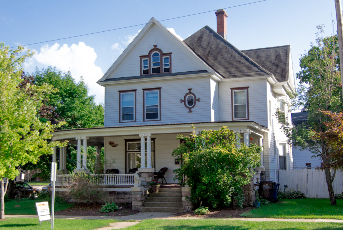
Pritchard's Outlook Historic District
Monument and historic site · National Register of Historic Places · 0.8 mi
Historic district in Allegan, Michigan

Sarah Lowe Stedman House
Monument and historic site · National Register of Historic Places
Historic home in Allegan, Michigan

Second Street Bridge
Bridge · National Register of Historic Places · 0.6 mi
NRHP-listed bridge in Allegan, Michigan


William C. Messenger House
Monument and historic site · National Register of Historic Places · 0.5 mi
House in Allegan, Michigan
2 more on the map.
Parks, trails and playgrounds10



Restaurants and cafes12



Burger King
Fast food · Burger · 1.7 mi
1583 Lincoln Road, Allegan
Mo-Th 06:00-21:00; Fr-Sa 06:00-24:00; Su 07:00-21:00
Taco Bell
Fast food · Tex-Mex · 1.6 mi
1575 Lincoln Road, Allegan
Mo-Fr 06:00-02:00; Sa-Su 07:00-02:00
The Mobile Crave
Fast food · Tacos, Nachos · 0.7 mi
131 Marshall Street, Allegan
Tu-Fr 11:00-18:00; Sa 17:00-22:00
History
The men after whom Allegan's downtown streets were named – Elisha Ely, Samuel Hubbard, Charles Christopher Trowbridge, Pliny Cutler, and Edmund Monroe – patented land in the area in 1833. They considered the site a prime location for industry, due to its potential for water power (since it straddled the Kalamazoo River) and water bound transportation. By 1835, a dam and sawmill had been established.
Allegan was named in a neologism by Michigan historian Henry Rowe Schoolcraft in 1837 to sound like a Native American word. Land was purchased from government to form the downtown business district; village organization came in 1838 with city incorporation authorized in 1907.
In 1886, a one-lane bridge was built over the Kalamazoo River to connect limited highway M-89 to the downtown area. The bridge fell into disrepair and was going to be removed until a group of activists raised the money to restore the bridge in 1983. Now a highlight of Allegan, the one-lane bridge is used in the city logo and is considered an important part of the city.
In 1914, Allegan entered the automobile race car industry as the manufacturing site of Howard E. Blood and Louis Chevrolet's chain-drive Cornelian automobile. The venture was short-lived, and less than 100 Cornelians were produced.
From the History section of Allegan, Michigan on Wikipedia, under CC BY-SA 4.0.
Churches and places of worship1
Shopping2
Gas and EV charging6
Schools, colleges and libraries12
Healthcare1
Map of Allegan
59 places. The map loads OpenStreetMap tiles when you open it.
Climate by month
Monthly table
| Month | High | Low | Rain |
|---|---|---|---|
| Jan | 30°F | 16°F | 2.7 in |
| Feb | 33°F | 16°F | 2.1 in |
| Mar | 43°F | 24°F | 2.2 in |
| Apr | 58°F | 34°F | 3.5 in |
| May | 68°F | 45°F | 4.1 in |
| Jun | 78°F | 55°F | 3.8 in |
| Jul | 82°F | 58°F | 3.4 in |
| Aug | 80°F | 58°F | 3.8 in |
| Sep | 73°F | 50°F | 3.4 in |
| Oct | 61°F | 40°F | 4.0 in |
| Nov | 47°F | 31°F | 3.1 in |
| Dec | 35°F | 22°F | 2.4 in |
U.S. Climate Normals 1991-2020 for Allegan 5Ne Hcn (4 mi away), rain and snow from Hopkins 1 N, NOAA NCEI.
People and cost of living
American Community Survey 5-year estimates, 2020-2024, U.S. Census Bureau. Estimates have margins of error, larger for small towns.
Disaster history
Allegan County has had 7 federal disaster declarations since 2000, most often for floods.
- 2026-06-30: Severe Storms, Tornadoes, And Flooding (Flood)
- 2020-03-27: Covid-19 Pandemic (Biological)
- 2020-03-13: Covid-19 (Biological)
- 2013-06-18: Flooding (Flood)
- 2008-07-14: Severe Storms, Tornadoes, And Flooding (Severe Storm)
- 2005-09-07: Hurricane Katrina Evacuation (Hurricane)
OpenFEMA disaster declarations summaries.
Getting there and nearby towns
Kalamazoo-Battle Creek International Airport (AZO) is the nearest airport with scheduled flights listed in OpenStreetMap, 25 miles away.
- Otsego 9 mi southeast, about 14 min by car
- Plainwell 12 mi southeast, about 19 min by car
- Fennville 14 mi west, about 23 min by car
- Parchment 20 mi southeast, about 32 min by car
- Douglas 20 mi west, about 32 min by car
- Holland 21 mi northwest, about 34 min by car
- Bangor 21 mi southwest, about 33 min by car
- Kalamazoo 22 mi southeast, about 35 min by car
- Cutlerville 23 mi north, about 37 min by car
- Wyoming 26 mi north, about 41 min by car
Drive times are estimates from straight-line distance, not routes.
Local news
Headlines from INDB, the NEMICO news database.
Reviews, tips and questions
Loading what members have shared...
Sources and licences
- NCES EDGE (Public domain): public schools
- NOAA NCEI U.S. Climate Normals 1991-2020 (Public domain): climate by month
- OpenFEMA (Public domain): disaster declarations
- OpenStreetMap contributors (ODbL 1.0): places, airports, map data
- U.S. Census Bureau (Public domain): population, income, housing, education, commute
- Wikidata (CC0 1.0): elevation, founding date, time zone, website, landmarks and historic places
- Wikimedia Commons (see each image): photos
- Wikipedia (CC BY-SA 4.0): overview and history text
Photo credits
- Allegan Michigan main street, Chris Light ( talk ), CC BY-SA 3.0
- Allegan MI banner, Craigphillips, CC BY-SA 3.0
- 2nd street bridge Allegan, Michigan, Craigphillips, CC BY-SA 3.0
- First Presbyterian Church, Allegan, Michigan 01, Kzoo Cowboy, CC BY 2.0
- First Presbyterian Church, Allegan, Michigan 02, Kzoo Cowboy, CC BY 2.0
- Allegan District Library, Jesse Sallak, CC BY-SA 4.0
- Griswold 02 Allegan Public Library, Alwen7, CC BY-SA 3.0
- William C. Messenger, rossograph, CC BY-SA 3.0
- Orson G. Vahue House, rossograph, CC BY-SA 4.0
- Henry Franks House, rossograph, CC BY-SA 4.0
- Marshall Street Allegan MI, Weilenga, Public domain
- Augustus Lilly, rossograph, CC BY-SA 3.0
- Sarah Lowe Stedman, rossograph, CC BY-SA 3.0
- William Brown, rossograph, CC BY-SA 3.0
- Allegan Michigan 2nd street bridge, Chris Light ( talk ), CC BY-SA 3.0
- Oakwood Cemetery Chapel, rossograph, CC BY-SA 3.0
- EngelbertBBornHouse, Alwen7, CC BY-SA 3.0
- EdwardDBornHouse, Alwen7, CC BY-SA 3.0
- Second St Bridge P9130009, Chris Light, CC BY-SA 4.0
- North portal P9130010, Chris Light, CC BY-SA 4.0
- Pedestrian way P9130010, Chris Light, CC BY-SA 4.0
- 1886 plaque P9130012, Chris Light, CC BY-SA 4.0
- North portal P9130014, Chris Light, CC BY-SA 4.0
- North Portal P9130011, Chris Light, CC BY-SA 4.0
- North portal P9130008, Chris Light, CC BY-SA 4.0
- Griswold 03 First Baptist, Alwen7, CC BY-SA 3.0
- Griswold 04 Episcopal Church of the Good Shepherd, Alwen7, CC BY-SA 3.0
- Griswold 01 Griswold Memorial Civic Center, Alwen7, CC BY-SA 3.0
- Griswold 05 United Methodist, Alwen7, CC BY-SA 3.0


Page built October 30, 2026. Spotted a mistake? Tell us or suggest a place.