

Why visit Anza
Townapedia lists 2 museums and landmarks, 2 parks and trails, 2 places to eat, 11 places to stay and 2 attractions in and around town.
Highlights include Cave Rocks.
August is the warmest month, with average highs of 86°F; December lows average 30°F, and about 31 inches of snow fall in a normal year.
Weather in Anza
Forecast from the National Weather Service. Full forecast
About Anza
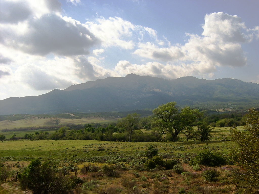
Anza is a census-designated place in Riverside County, California, in the Anza Valley, a semi-arid region at a mean elevation of 3,921 feet (1,195 m) above sea level. It is located 13 miles (21 km) south of Idyllwild, 32 miles (51 km) east-northeast of Temecula, 40 miles (64 km) southwest of Palm Springs, and 90 miles (140 km) northeast of San Diego, being traversed by State Route 371. Anza is on the Pacific Crest Trail and the Juan Bautista de Anza National Historic Trail. The population was 3,075 at the 2020 census.
From the Wikipedia article Anza, California (this version), under CC BY-SA 4.0.
Things to do2

Museums and landmarks2

Parks, trails and playgrounds2

Restaurants and cafes2

History
It is estimated that the Cahuilla aboriginal tribes inhabited an area including what is today the Anza Valley more than two thousand years ago and encountered Europeans only as late as 1774, when a Spanish expedition in search of an overland route from Sonora to Alta California made its way from Tubac, Sonora through the valley to Monterey, Alta California. Explorer Juan Bautista de Anza first passed through the valley on March 16, 1774, and again on December 27, 1775. De Anza originally named the valley "San Carlos"; it was renamed in his honor from Cahuilla Valley to Anza Valley on September 16, 1926.
Up until about 1580 the area was in the proximity of a larger body of inland water known as Lake Cahuilla, but that inland lake larger than the current Salton Sea, which occupies a portion of its former location, evaporated, thus increasing the desert character of the Anza Valley. During the 19th century, settlement included ranchers, a limited number of miners, and honey producers. The mid-to-late 19th century witnessed moderate population and above average economic prosperity for this isolated community.
From the History section of Anza, California on Wikipedia, under CC BY-SA 4.0.
Where to stay11
Churches and places of worship4
Shopping1
Gas and EV charging3
Schools, colleges and libraries5
Map of Anza
32 places. The map loads OpenStreetMap tiles when you open it.
Climate by month
Monthly table
| Month | High | Low | Rain | Snow |
|---|---|---|---|---|
| Jan | 55°F | 31°F | 4.7 in | 6.3 in |
| Feb | 54°F | 30°F | 5.3 in | 9.8 in |
| Mar | 59°F | 32°F | 3.3 in | 4.1 in |
| Apr | 64°F | 35°F | 1.7 in | 3.5 in |
| May | 71°F | 41°F | 0.7 in | 0.5 in |
| Jun | 80°F | 48°F | 0.1 in | 0.0 in |
| Jul | 85°F | 55°F | 0.5 in | 0.0 in |
| Aug | 86°F | 55°F | 0.6 in | 0.0 in |
| Sep | 81°F | 50°F | 0.8 in | 0.0 in |
| Oct | 72°F | 42°F | 1.2 in | 0.0 in |
| Nov | 62°F | 35°F | 1.9 in | 2.3 in |
| Dec | 54°F | 30°F | 3.6 in | 4.2 in |
U.S. Climate Normals 1991-2020 for Idyllwild Fire Dept (14 mi away), NOAA NCEI.
People and cost of living
American Community Survey 5-year estimates, 2020-2024, U.S. Census Bureau. Estimates have margins of error, larger for small towns.
Disaster history
Riverside County has had 47 federal disaster declarations since 2000, most often for fires.
- 2026-05-20: Bain Fire (Fire)
- 2024-09-11: Airport Fire (Fire)
- 2024-07-21: Hawarden Fire (Fire)
- 2023-11-21: Tropical Storm Hilary (Hurricane)
- 2023-01-09: Severe Winter Storms, Flooding, And Mudslides (Flood)
- 2022-09-06: Fairview Fire (Fire)
OpenFEMA disaster declarations summaries.
Getting there and nearby towns
Palm Springs International Airport (PSP) is the nearest airport with scheduled flights listed in OpenStreetMap, 22 miles away.
- Valle Vista 16 mi northwest, about 26 min by car
- East Hemet 18 mi northwest, about 29 min by car
- Palm Springs 19 mi northeast, about 31 min by car
- Hemet 21 mi northwest, about 34 min by car
- Rancho Mirage 21 mi northeast, about 33 min by car
- Palm Desert 23 mi northeast, about 36 min by car
- Cathedral City 23 mi northeast, about 37 min by car
- San Jacinto 24 mi northwest, about 38 min by car
- French Valley 24 mi west, about 38 min by car
- Temecula 26 mi west, about 41 min by car
Drive times are estimates from straight-line distance, not routes.
Local news
Headlines from INDB, the NEMICO news database.
Reviews, tips and questions
Loading what members have shared...
Sources and licences
- NCES EDGE (Public domain): public schools
- NOAA NCEI U.S. Climate Normals 1991-2020 (Public domain): climate by month
- OpenFEMA (Public domain): disaster declarations
- OpenStreetMap contributors (ODbL 1.0): places, airports, map data
- U.S. Census Bureau (Public domain): population, income, housing, education, commute
- Wikidata (CC0 1.0): elevation, founding date, time zone, website
- Wikimedia Commons (see each image): photos
- Wikipedia (CC BY-SA 4.0): overview and history text
Photo credits
- Anza2005, Trios2007, Public domain
Page built October 30, 2026. Spotted a mistake? Tell us or suggest a place.