


Why visit Aransas Pass
Townapedia lists 9 museums and landmarks, 2 parks and trails, 10 places to eat, 10 places to stay and 2 attractions in and around town.
Highlights include Port Aransas Light Station.
August is the warmest month, with average highs of 89°F; January lows average 50°F.
Weather in Aransas Pass
Forecast from the National Weather Service. Full forecast
About Aransas Pass
Aransas Pass is a city in Aransas, Nueces, and San Patricio counties in Texas, United States. The population was 7,941 at the 2020 census.
From the Wikipedia article Aransas Pass, Texas (this version), under CC BY-SA 4.0.
Things to do2
Port Aransas Light Station
Lighthouse · National Register of Historic Places · 4.4 mi
Historic district in Port Aransas (vicinity), Aransas County, Texas

Museums and landmarks9



Parks, trails and playgrounds2

Restaurants and cafes10



The G.O.A.T. Sports Grill
Restaurant · 1.5 mi
306 East Goodnight Avenue, Aransas Pass
Mo-Sa 07:00-24:00; Su 00:00-01:00,07:00-24:00
Butter Churn - Aransas Pass
Restaurant · 3.3 mi
1275 Hwy 35 Bypass, Aransas Pass

Where to stay10
Executive Inn & Suites
Motel and hotel · 2.8 mi
1515 West Wheeler Avenue, Aransas Pass
The getaway RV and storage
Campground · 2.7 mi
340 North 13th Street, Aransas Pass
Churches and places of worship8
Shopping4
Gas and EV charging3
Schools, colleges and libraries15
Healthcare1
H-E-B Pharmacy
Clinic and pharmacy · 1.7 mi
101 East Goodnight Avenue, Aransas Pass
Map of Aransas Pass
64 places. The map loads OpenStreetMap tiles when you open it.
Climate by month
Monthly table
| Month | High | Low | Rain | Snow |
|---|---|---|---|---|
| Jan | 62°F | 50°F | 2.1 in | 0.0 in |
| Feb | 65°F | 54°F | 1.9 in | 0.0 in |
| Mar | 70°F | 60°F | 2.4 in | 0.0 in |
| Apr | 76°F | 67°F | 2.0 in | 0.0 in |
| May | 81°F | 73°F | 4.0 in | 0.0 in |
| Jun | 87°F | 78°F | 3.7 in | 0.0 in |
| Jul | 88°F | 80°F | 2.6 in | 0.0 in |
| Aug | 89°F | 80°F | 1.8 in | 0.0 in |
| Sep | 86°F | 77°F | 6.5 in | 0.0 in |
| Oct | 81°F | 71°F | 3.9 in | 0.0 in |
| Nov | 72°F | 61°F | 2.9 in | 0.0 in |
| Dec | 65°F | 53°F | 1.7 in | 0.0 in |
U.S. Climate Normals 1991-2020 for Port Aransas (5 mi away), NOAA NCEI.
People and cost of living
American Community Survey 5-year estimates, 2020-2024, U.S. Census Bureau. Estimates have margins of error, larger for small towns.
Disaster history
Aransas County has had 22 federal disaster declarations since 2000, most often for hurricanes.
- 2024-07-09: Hurricane Beryl (Hurricane)
- 2021-02-19: Severe Winter Storms (Severe Ice Storm)
- 2021-02-14: Severe Winter Storm (Severe Ice Storm)
- 2020-08-24: Tropical Storms Marco And Laura (Hurricane)
- 2020-07-26: Hurricane Hanna (Hurricane)
- 2020-03-25: Covid-19 Pandemic (Biological)
OpenFEMA disaster declarations summaries.
Getting there and nearby towns
Aransas County Airport (RKP) is the nearest airport with scheduled flights listed in OpenStreetMap, 14 miles away.
- Port Aransas 5 mi south, about 9 min by car
- Corpus Christi 10 mi south, about 16 min by car
- Gregory 11 mi west, about 17 min by car
- Rockport 12 mi north, about 19 min by car
- Portland 13 mi west, about 21 min by car
- Taft 18 mi west, about 28 min by car
- Taft Southwest 18 mi west, about 29 min by car
- Lamar 19 mi northeast, about 30 min by car
- Refugio 30 mi north, about 48 min by car
- Robstown 34 mi west, about 55 min by car
Drive times are estimates from straight-line distance, not routes.
Local news
Headlines from INDB, the NEMICO news database.
Reviews, tips and questions
Loading what members have shared...
Sources and licences
- NCES EDGE (Public domain): public schools
- NOAA NCEI U.S. Climate Normals 1991-2020 (Public domain): climate by month
- OpenFEMA (Public domain): disaster declarations
- OpenStreetMap contributors (ODbL 1.0): places, airports, map data
- U.S. Census Bureau (Public domain): population, income, housing, education, commute
- Wikidata (CC0 1.0): elevation, founding date, time zone, website, landmarks and historic places
- Wikimedia Commons (see each image): photos
- Wikipedia (CC BY-SA 4.0): overview and history text
Photo credits
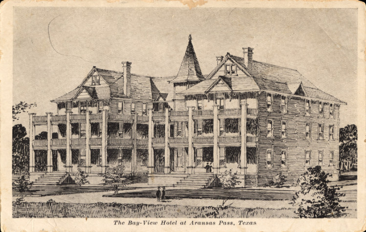
- Bay-View Hotel, Aransas Pass, TX, The University of Houston Digital Library, Public domain
- Lydia Ann Lighthouse near Port Aransas, Jon Lebkowsky, CC BY-SA 2.0
- Castilleja halophila - dehiscent seed capsules, sonnia hill, CC BY 2.0
- Castilleja halophila - roadside habitat, sonnia hill, CC BY 2.0
- Castilleja halophila - habitat, sonnia hill, CC BY 2.0
- Castilleja halophila - 51279886207, sonnia hill, CC BY 2.0
- Padre Mustang Island, Cliff, CC BY 2.0
- 2026 Pre Event-GC2601a OB N RGB-raw-187011 0119261758586 083 RGB1, NOAA / NODD, Public domain
- 2026 Pre Event-GC2601a OB N RGB-raw-187011 0119261758586 083 RGB2, NOAA / NODD, Public domain
- 2026 Pre Event-GC2601a OB N RGB-raw-187012 0119261759053 083 RGB2, NOAA / NODD, Public domain
- 2026 Pre Event-GC2601a OB N RGB-raw-187012 0119261759053 083 RGB1, NOAA / NODD, Public domain
- 2026 Pre Event-GC2601a OB N RGB-raw-187010 0119261758519 083 RGB1, NOAA / NODD, Public domain
- 2026 Pre Event-GC2601a OB N RGB-raw-187010 0119261758519 083 RGB2, NOAA / NODD, Public domain
- 2026 Pre Event-GC2601a OB N RGB-raw-187013 0119261759120 083 RGB2, NOAA / NODD, Public domain
- 2026 Pre Event-GC2601a OB N RGB-raw-187013 0119261759120 083 RGB1, NOAA / NODD, Public domain
- 2026 Pre Event-GC2601a OB N RGB-raw-187009 0119261758453 083 RGB1, NOAA / NODD, Public domain
- 2026 Pre Event-GC2601a OB N RGB-raw-187009 0119261758453 083 RGB2, NOAA / NODD, Public domain
- ISS059-E-59813 - View of Earth, Earth Science and Remote Sensing Unit, NASA Johnson Space Center, Public domain
- ISS047-E-51429 - View of Earth, Earth Science and Remote Sensing Unit , Lyndon B. Johnson Space Center, Public domain
- ISS047-E-51430 - View of Earth, Earth Science and Remote Sensing Unit , Lyndon B. Johnson Space Center, Public domain
- ISS044-E-43773 - View of Earth, Earth Science and Remote Sensing Unit , Lyndon B. Johnson Space Center, Public domain
- Port Aransas and the Intracoastal Waterway, Texas ISS038-E-57806, NASA ISS Expedition 38, Public domain
- ISS047-E-51431 - View of Earth, Earth Science and Remote Sensing Unit , Lyndon B. Johnson Space Center, Public domain
- 2026 Pre Event-GC2601a OB N RGB-raw-187014 0119261759188 083 RGB2, NOAA / NODD, Public domain
- 2026 Pre Event-GC2601a OB N RGB-raw-187014 0119261759188 083 RGB1, NOAA / NODD, Public domain
- 2026 Pre Event-GC2601a OB N RGB-raw-187008 0119261758385 083 RGB1, NOAA / NODD, Public domain
- 2026 Pre Event-GC2601a OB N RGB-raw-187008 0119261758385 083 RGB2, NOAA / NODD, Public domain
- 2026 Pre Event-GC2601a OB N RGB-raw-187015 0119261759255 083 RGB2, NOAA / NODD, Public domain
- 2026 Pre Event-GC2601a OB N RGB-raw-187015 0119261759255 083 RGB1, NOAA / NODD, Public domain
- 2026 Pre Event-GC2601a OB N RGB-raw-187007 0119261758318 083 RGB1, NOAA / NODD, Public domain
- 2026 Pre Event-GC2601a OB N RGB-raw-187007 0119261758318 083 RGB2, NOAA / NODD, Public domain
- 2026 Pre Event-GC2601a OB N RGB-raw-187016 0119261759323 083 RGB2, NOAA / NODD, Public domain
- 2026 Pre Event-GC2601a OB N RGB-raw-187016 0119261759323 083 RGB1, NOAA / NODD, Public domain
- 2026 Pre Event-GC2601a OB N RGB-raw-187006 0119261758251 083 RGB1, NOAA / NODD, Public domain
- 2026 Pre Event-GC2601a OB N RGB-raw-187006 0119261758251 083 RGB2, NOAA / NODD, Public domain
- 2026 Pre Event-GC2601a OB N RGB-raw-187017 0119261759392 083 RGB2, NOAA / NODD, Public domain
- 2026 Pre Event-GC2601a OB N RGB-raw-187017 0119261759392 083 RGB1, NOAA / NODD, Public domain


Page built October 30, 2026. Spotted a mistake? Tell us or suggest a place.