


Why visit Baytown
Townapedia lists 31 museums and landmarks, 41 parks and trails, 80 places to eat, 25 places to stay and 2 attractions in and around town.
Highlights include Fred Hartman Bridge, San Jacinto Battleground State Historic Site, San Jacinto Monument and N C Foote Park.
August is the warmest month, with average highs of 92°F; January lows average 41°F.
Weather in Baytown
Forecast from the National Weather Service. Full forecast
About Baytown
Baytown is a city in the U.S. state of Texas, within Harris and Chambers counties. Located in the metropolitan statistical area of Greater Houston, it lies on the northern side of the Galveston Bay complex near the outlets of the San Jacinto River and Buffalo Bayou. It is the sixth-largest city within this metropolitan area and seventh largest community (including The Woodlands CDP). Major highways serving the city include State Highway 99, State Highway 146 and Interstate 10.
From the Wikipedia article Baytown, Texas (this version), under CC BY-SA 4.0.
Things to do2

Fred Hartman Bridge
Bridge · 5.4 mi
Bridge in United States of America

Museums and landmarks31

San Jacinto Battleground State Historic Site
Monument and historic site · National Register of Historic Places · 7.2 mi
Historic site in Houston (vicinity), Harris County, Texas
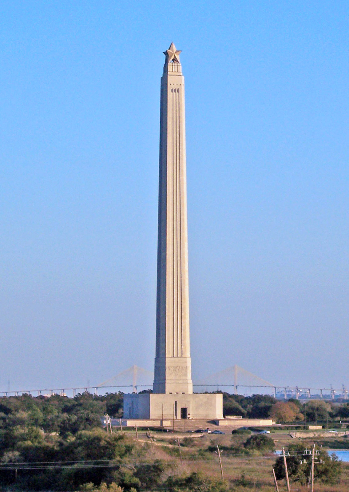


San Jacinto Monument
Monument and historic site · 7.2 mi
Masonry column in Harris County, Texas, U.S


Cedar Bayou United Methodist Church
Monument and historic site · Methodist · 2.3 mi
19 more on the map.
Parks, trails and playgrounds41



Newcastle Park
Park · 0.7 mi
Playground, covered basketball court, fitness station, 1/4-mile gravel walking trail, day-use pavilion with picnic tables and BBQ pit
3208 Newcastle Drive, Baytown
29 more on the map.
Restaurants and cafes80

Dutch Bros. Coffee
Cafe · Coffee Shop · 2.8 mi
7100 Garth Road, Baytown
Mo-Th 05:00-22:00; Fr-Sa 05:00-23:00

Olive Garden
Restaurant · Italian · 2.5 mi
6744 Garth Road, Baytown
Su-Th 11:00-22:00, Fr-Sa 11:00-23:00
The Cuban Cafe
Restaurant · Caribbean · 2.9 mi
4231 Decker Drive, Baytown
Mo-Fr 04:00-17:00; Sa 08:00-15:00

Chili's
Restaurant · Tex-Mex · 2.9 mi
5050 East Freeway, Baytown
Mo-Su 10:45-23:00
Outback Steakhouse
Restaurant · American, Steak · 2.8 mi
5218 East Freeway, Baytown
Mo-Su 11:00-22:00
Golden Corral
Restaurant · American, Buffet · 1.0 mi
4610 Garth Road, Baytown
closed "per website: 'operations temporarily suspended'"
68 more on the map.
History
White American settlers first arrived in the now-Baytown area in 1822. One of its earliest settlers was Nathaniel Lynch, who set up a ferry crossing at the junction of the San Jacinto River and Buffalo Bayou. The still-operating ferry service is known as the Lynchburg Ferry. Other early settlers of Baytown included William Scott, one of Stephen F. Austin's Old Three Hundred, and Ashbel Smith, who owned a plantation in the area.
The city now known as Baytown was originally three separate towns. The first of these was Goose Creek, named for the bayou of the same name where Canada geese wintered and whose name is still reflected in the area's Goose Creek school district, whose establishment dates back to before 1850. With the discovery of the Goose Creek Oil Field, the rival communities of Pelly in the late 1910s, and East Baytown in the early 1920s, developed as early boomtowns. The "East" in East Baytown was later dropped because it was west of Goose Creek.
Serious talk of merging the three cities began shortly after World War I, but the community of Baytown was opposed to this idea. However, in 1947, the three cities finally agreed to consolidate. The citizens settled on the name Baytown for the new combined city. Baytown as it is known today was officially founded January 24, 1948.
From the History section of Baytown, Texas on Wikipedia, under CC BY-SA 4.0.
Where to stay25
Churches and places of worship50
Baytown Congregational Methodist Church
Church · Methodist · 3.5 mi
1908 Lee Drive, Baytown
Templo Bethel
Church · Assemblies Of God · 1.0 mi
814 East Cedar Bayou Lynchburg Road, Baytown
Shopping15
Gas and EV charging35
Schools, colleges and libraries63
Healthcare11
Sports Medic Clinic
Clinic and pharmacy · 2.2 mi
801 West Sterling Avenue, Baytown
Map of Baytown
250 places. The map loads OpenStreetMap tiles when you open it.
Climate by month
Monthly table
| Month | High | Low | Rain | Snow |
|---|---|---|---|---|
| Jan | 63°F | 41°F | 4.8 in | 0.0 in |
| Feb | 66°F | 45°F | 3.8 in | 0.0 in |
| Mar | 72°F | 52°F | 3.9 in | 0.0 in |
| Apr | 78°F | 58°F | 4.5 in | 0.0 in |
| May | 84°F | 67°F | 6.0 in | 0.0 in |
| Jun | 89°F | 73°F | 7.1 in | 0.0 in |
| Jul | 92°F | 75°F | 5.5 in | 0.0 in |
| Aug | 92°F | 74°F | 6.8 in | 0.0 in |
| Sep | 88°F | 69°F | 6.4 in | 0.0 in |
| Oct | 82°F | 60°F | 6.1 in | 0.0 in |
| Nov | 71°F | 50°F | 4.9 in | 0.0 in |
| Dec | 64°F | 44°F | 4.8 in | 0.0 in |
U.S. Climate Normals 1991-2020 for Baytown (10 mi away), NOAA NCEI.
People and cost of living
American Community Survey 5-year estimates, 2020-2024, U.S. Census Bureau. Estimates have margins of error, larger for small towns.
Disaster history
Chambers County has had 18 federal disaster declarations since 2000, most often for hurricanes.
- 2024-07-09: Hurricane Beryl (Hurricane)
- 2021-02-19: Severe Winter Storms (Severe Ice Storm)
- 2021-02-14: Severe Winter Storm (Severe Ice Storm)
- 2020-08-24: Tropical Storms Marco And Laura (Hurricane)
- 2020-03-25: Covid-19 Pandemic (Biological)
- 2020-03-13: Covid-19 (Biological)
OpenFEMA disaster declarations summaries.
Getting there and nearby towns
Baytown Airport (HPY) is the nearest airport with scheduled flights listed in OpenStreetMap, 1 miles away.
- Pasadena 14 mi southwest, about 22 min by car
- Atascocita 20 mi northwest, about 32 min by car
- League City 21 mi southwest, about 34 min by car
- Houston 26 mi west, about 41 min by car
- Pearland 26 mi southwest, about 42 min by car
- Aldine 27 mi west, about 43 min by car
- Alvin 28 mi southwest, about 46 min by car
- Sugar Land 42 mi west, about 1 h by car
- The Woodlands 43 mi northwest, about 1 h 15 min by car
- Conroe 50 mi northwest, about 1 h 15 min by car
Drive times are estimates from straight-line distance, not routes.
Local news
Headlines from INDB, the NEMICO news database.
Reviews, tips and questions
Loading what members have shared...
Sources and licences
- NCES EDGE (Public domain): public schools
- NOAA NCEI U.S. Climate Normals 1991-2020 (Public domain): climate by month
- OpenFEMA (Public domain): disaster declarations
- OpenStreetMap contributors (ODbL 1.0): places, airports, map data
- U.S. Census Bureau (Public domain): population, income, housing, education, commute
- Wikidata (CC0 1.0): elevation, founding date, time zone, website, landmarks and historic places
- Wikimedia Commons (see each image): photos
- Wikipedia (CC BY-SA 4.0): overview and history text
Photo credits
- Sunrise Texas, Baytownbert, CC BY-SA 3.0
- ASI Tom Latson in Baytown, TX (14426220190), NTSBgov, Public domain
- Old Baytown Post Office, Jim Evans, CC BY-SA 4.0
- Abandoned truss railroad lift bridge over Cedar Bayou, south of Spur 55, Baytown, Texas (0228101501), Patrick Feller from Humble, Texas, USA, CC BY 2.0
- Fred Hartman bridge Baytown Tx, Jeffsmithbaytowntowing, CC BY 4.0
- Fred Hartman Bridge, Baytown, Texas 1209261519, Patrick Feller, CC BY 2.0
- UAV view of the San Jacinto Battlefield site and Texas Monument, Steve Rowell, CC BY-SA 3.0
- Fred Hartman Bridge Houston, United States Coast Guard, PA2 James Dillard, Public domain
- San Jacinto Monument, Tijuana Brass at English Wikipedia, Public domain
- Cedar Bayou Masonic Lodge No. 321, A. F. & A. M, Jim Evans, CC BY-SA 4.0
- Cup on a Shelf (Unsplash), DaRio Valenzuela darva0405, CC0
- HermannLifeFlight, Firehat87 at English Wikipedia, CC BY 3.0
- ISS036-E-24695 - View of Texas, Earth Science and Remote Sensing Unit , Lyndon B. Johnson Space Center, Public domain
- ISS063-E-79918 - View of Earth, Earth Science and Remote Sensing Unit, NASA Johnson Space Center, Public domain
- ISS036-E-24696 - View of Texas, Earth Science and Remote Sensing Unit , Lyndon B. Johnson Space Center, Public domain
- ISS006-E-38772 - View of the Gulf of Mexico, Earth Science and Remote Sensing Unit , Lyndon B. Johnson Space Center, Public domain
- ISS036-E-24697 - View of Texas, Earth Science and Remote Sensing Unit , Lyndon B. Johnson Space Center, Public domain
- ISS012-E-13943 - View of Texas, Earth Science and Remote Sensing Unit , Lyndon B. Johnson Space Center, Public domain
- ISS063-E-79917 - View of Earth, Earth Science and Remote Sensing Unit, NASA Johnson Space Center, Public domain
- ISS021-E-21457 - View of Earth, Earth Science and Remote Sensing Unit , Lyndon B. Johnson Space Center, Public domain
- 200915-H-DO456-002, CBP Photography, Public domain
- 200915-H-DO456-003, CBP Photography, Public domain
- 200915-H-DO456-001, CBP Photography, Public domain
- Nobody Here But Us Chickens (5236412186), BFS Man from Webster, TX, USA, CC BY 2.0
- FEMA - 38737 - Boats moved on shore and damaged by Hurricane Ike, Walter Jennings, Public domain
- ISS038-E-20550 - View of Earth, Earth Science and Remote Sensing Unit , Lyndon B. Johnson Space Center, Public domain
- ISS063-E-79920 - View of Earth, Earth Science and Remote Sensing Unit, NASA Johnson Space Center, Public domain
- ISS063-E-79919 - View of Earth, Earth Science and Remote Sensing Unit, NASA Johnson Space Center, Public domain
- ISS038-E-20552 - View of Earth, Earth Science and Remote Sensing Unit , Lyndon B. Johnson Space Center, Public domain
- ISS028-E-14055 - View of Earth, Earth Science and Remote Sensing Unit , Lyndon B. Johnson Space Center, Public domain
- ISS023-E-21264 - View of Earth, Earth Science and Remote Sensing Unit , Lyndon B. Johnson Space Center, Public domain
- ISS038-E-10149 - View of Earth, Earth Science and Remote Sensing Unit , Lyndon B. Johnson Space Center, Public domain


Page built October 30, 2026. Spotted a mistake? Tell us or suggest a place.