
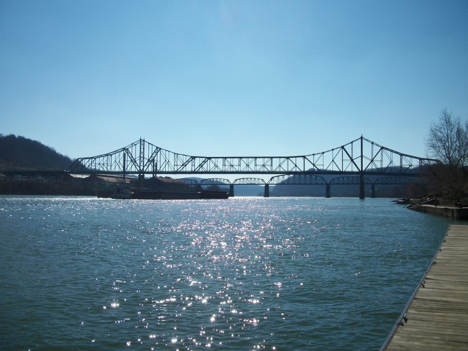


Bellaire, Ohio
Bellaire is a village of 3,800 people in Belmont County, Ohio, founded in 1834.
Why visit Bellaire
Townapedia lists 17 museums and landmarks, 3 parks and trails, 5 places to eat and 1 attraction in and around town.
Highlights include Bellaire Bridge, Belleview Heights and Centre Market Square Historic District.
July is the warmest month, with average highs of 85°F; January lows average 22°F.
Weather in Bellaire
Forecast from the National Weather Service. Full forecast
About Bellaire
Bellaire is a village in Belmont County, Ohio, United States, along the Ohio River. The population was 3,870 at the 2020 census, having peaked in 1920. It is part of the Wheeling metropolitan area.
From the Wikipedia article Bellaire, Ohio (this version), under CC BY-SA 4.0.
Things to do1

Museums and landmarks17

Belleview Heights
Monument and historic site · National Register of Historic Places · 0.8 mi
Building in Ohio, United States

Centre Market Square Historic District
Monument and historic site · National Register of Historic Places · 3.2 mi
Wheeling, West Virginia, listed on the NRHP in Ohio County, West Virginia

Chapline Street Row Historic District
Monument and historic site · National Register of Historic Places · 2.6 mi
Historic district in West Virginia, United States

Imperial Glass Company
Museum · National Register of Historic Places · 0.4 mi
Manufacturer of glasswares, and company museum

McMechen Lockmaster Houses on the Ohio River
Monument and historic site · National Register of Historic Places · 2.0 mi
Building in West Virginia, United States

Robert W. Hazlett House
Monument and historic site · National Register of Historic Places · 3.4 mi
Historic house in West Virginia, United States

Wheeling Historic District
Monument and historic site · National Register of Historic Places · 3.3 mi
Historic district in downtown Wheeling, West Virginia, United States

Wheeling Warehouse Historic District
Monument and historic site · National Register of Historic Places · 3.3 mi
Historic district in Wheeling, West Virginia, USA

Zweig Building
Monument and historic site · National Register of Historic Places
Building in Ohio, United States of America

B & O Railroad Viaduct
Bridge · National Register of Historic Places · 0.5 mi


Center Wheeling Market
Monument and historic site · National Register of Historic Places · 3.2 mi
Donald B.
Monument and historic site · National Register of Historic Places · 0.6 mi
5 more on the map.
Parks, trails and playgrounds3

Restaurants and cafes5


Burger King
Fast food · Burger · 0.5 mi
2544 Belmont Street, Bellaire
Mo-Fr 05:30-22:00; Sa 06:00-22:00; Su 07:00-22:00
McDonald's
Fast food · Burger · 0.4 mi
300 28th Street, Bellaire
Mo-Th 05:00-23:00; Fr-Sa 05:00-24:00; Su 05:00-23:00
Wendy's
Fast food · Burger · 1.3 mi
205 Marshall Street North, Benwood
Mo-Sa 08:00-22:00; Su 08:00-20:00
History
Mound builders occupied numerous areas along the Ohio River and built complex earthworks. None of their distinctive prehistoric remains has been found within the present-day city limits. The Mingo, Shawnee, and Delaware were historic tribes who inhabited the area at the time of European encounter and settlement. The latter were involved in the Northwest Indian Wars after settlement began in the post- Revolutionary War years. Unhappy that the United States had ignored their grievances in the 1789 Treaty of Fort Harmar, the Indians tried to push out the settlers over the next several years.
The first documented European visitors to the Ohio River Valley and this area were French trappers and priests in the early and mid-1700s. They were impressed with the river's heavily wooded and hilly shores, and with the abundance of fish and wildlife. The young George Washington had explored and surveyed lands in the Ohio River Valley before the Revolutionary War. After the war, he supported plans to have the federal government make land grants to veterans as payment for their services, in lieu of cash.
From the History section of Bellaire, Ohio on Wikipedia, under CC BY-SA 4.0.
Churches and places of worship21
Rock Hill Presbyterian Church
Church · National Register of Historic Places · 2.0 mi
Shopping1
Gas and EV charging2
Schools, colleges and libraries30
Map of Bellaire
80 places. The map loads OpenStreetMap tiles when you open it.
Climate by month
Monthly table
| Month | High | Low | Rain |
|---|---|---|---|
| Jan | 39°F | 22°F | 3.4 in |
| Feb | 42°F | 23°F | 2.7 in |
| Mar | 51°F | 30°F | 3.8 in |
| Apr | 64°F | 40°F | 3.5 in |
| May | 74°F | 50°F | 4.2 in |
| Jun | 81°F | 59°F | 4.3 in |
| Jul | 85°F | 64°F | 4.1 in |
| Aug | 85°F | 63°F | 3.2 in |
| Sep | 79°F | 56°F | 3.5 in |
| Oct | 66°F | 44°F | 2.9 in |
| Nov | 54°F | 34°F | 2.9 in |
| Dec | 43°F | 27°F | 3.4 in |
U.S. Climate Normals 1991-2020 for Wheeling (3 mi away), NOAA NCEI.
People and cost of living
American Community Survey 5-year estimates, 2020-2024, U.S. Census Bureau. Estimates have margins of error, larger for small towns.
Disaster history
Belmont County has had 12 federal disaster declarations since 2000, most often for severe storms.
- 2020-03-31: Covid-19 Pandemic (Biological)
- 2020-03-13: Covid-19 (Biological)
- 2019-04-08: Severe Storms, Flooding, And Landslides (Flood)
- 2018-04-17: Severe Storms, Landslides, And Mudslides (Flood)
- 2012-08-20: Severe Storms And Straight-Line Winds (Severe Storm)
- 2012-06-30: Severe Storms (Severe Storm)
OpenFEMA disaster declarations summaries.
Getting there and nearby towns
Glendale Fokker Field (GWV) is the nearest airport with scheduled flights listed in OpenStreetMap, 4 miles away.
- Bridgeport 3 mi north, about 5 min by car
- Wolfhurst 4 mi northwest, about 6 min by car
- Wheeling 5 mi northeast, about 8 min by car
- Tiltonsville 11 mi north, about 18 min by car
- Bethesda 17 mi west, about 28 min by car
- Brilliant 18 mi north, about 29 min by car
- Cadiz 21 mi northwest, about 34 min by car
- Barnesville 23 mi west, about 36 min by car
- Steubenville 25 mi north, about 40 min by car
- Weirton 29 mi north, about 47 min by car
Drive times are estimates from straight-line distance, not routes.
Local news
Headlines from INDB, the NEMICO news database.
Reviews, tips and questions
Loading what members have shared...
Sources and licences
- NCES EDGE (Public domain): public schools
- NOAA NCEI U.S. Climate Normals 1991-2020 (Public domain): climate by month
- OpenFEMA (Public domain): disaster declarations
- OpenStreetMap contributors (ODbL 1.0): places, airports, map data
- U.S. Census Bureau (Public domain): population, income, housing, education, commute
- Wikidata (CC0 1.0): elevation, founding date, time zone, website, landmarks and historic places
- Wikimedia Commons (see each image): photos
- Wikipedia (CC BY-SA 4.0): overview and history text
Photo credits
- Bellaire Ohio River Picture, Legomine, CC BY-SA 3.0
- St. John's Central High School and St. John's Church, Bellaire, Ohio (82933), Pub. by Photo Crafters, Weeling, West Virginia. "Tichnor Quality Views," Reg. U. S. Pat. Off. Made Only by Tichnor Bros., Inc., Boston, Mass., Public domain
- Auto Choice Chevrolet-Buick, Bellaire, OH - panoramio, bills14, CC BY 3.0
- Bellaire Bridge, Brian M. Powell (user Bitmapped on en.wikipedia ), CC BY-SA 3.0
- Bellaire, Ohio Bridge - panoramio, RojAdrik, CC BY-SA 3.0
- Imperial glass, Bwsmith84 ( talk ), CC BY 3.0
- Wheeling Warehouse HD, Main and 22nd, Nyttend, Public domain
- Center Market Square Historic District, Bwsmith84 ( talk ), CC BY 3.0
- Rhpc, Bwsmith84 ( talk ), CC BY 3.0
- Robert W Hazlett House Wheeling WV, Bwsmith84 ( talk ), CC BY 3.0
- Belleview Heights, Bwsmith84 ( talk ), CC BY 3.0
- McMechen Lockmaster Houses site, Nyttend, Public domain
- Zweig building, Bwsmith84 ( talk ), CC BY 3.0
- Chapline Street Row HD in Wheeling, Nyttend, Public domain
- Bellaire viaduct 01, Bwsmith84 ( talk ) at en.wikipedia, CC BY 3.0
- Center Market Wheeling WV, Bwsmith84 ( talk ), CC BY 3.0
- La Belle Iron Works, Jack Boucher, Public domain
- B&O Railroad Viaduct from Benwood, William E. Barrett, Public domain
- Rusted (12998567675), Thomas from Philadelphia Area, USA, CC BY-SA 2.0
- MADISONANDSISTER, Wikiuser102723, CC BY-SA 4.0


Page built October 30, 2026. Spotted a mistake? Tell us or suggest a place.