


Belleair Beach, Florida
Belleair Beach is a city of 1,526 people in Pinellas County, Florida, founded in 1950.
Why visit Belleair Beach
Townapedia lists 9 museums and landmarks, 16 parks and trails, 7 places to eat, 3 places to stay and 4 attractions in and around town.
Highlights include Belleair Causeway, Capitol Theater, Belleview-Biltmore Hotel and Cleveland Street United States Post Office.
August is the warmest month, with average highs of 91°F; January lows average 52°F.
Weather in Belleair Beach
Forecast from the National Weather Service. Full forecast
About Belleair Beach
Belleair Beach is a city in Pinellas County, Florida, United States. It is part of Tampa–St. Petersburg–Clearwater Metropolitan Statistical Area, more commonly known as the Tampa Bay Area. The population was 1,633 at the 2020 census.
From the Wikipedia article Belleair Beach, Florida (this version), under CC BY-SA 4.0.
Things to do4

Belleair Causeway
Bridge · 1.1 mi
Bridge in Florida, United States of America

Capitol Theater
Cinema and theater · 3.0 mi
Movie theater and theater in Clearwater, Florida, United States
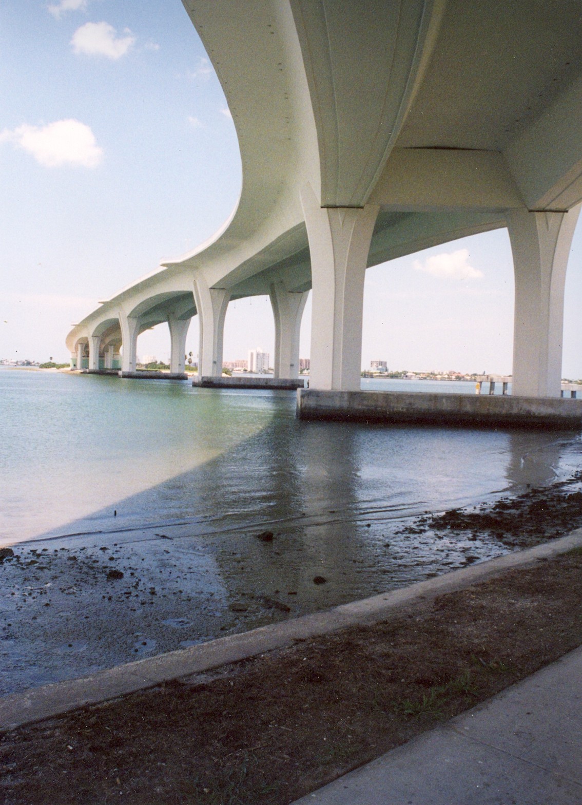
Clearwater Memorial Causeway
Bridge · 3.0 mi
Bridge in United States of America

Sand Key Bridge
Bridge · 2.2 mi
Bridge in Florida, United States of America
Museums and landmarks9

Belleview-Biltmore Hotel
Monument and historic site · National Register of Historic Places · 1.2 mi
Hotel in Clearwater, United States of America

Cleveland Street United States Post Office
Monument and historic site · National Register of Historic Places · 3.2 mi
Post office in Florida, United States of America

Donald Roebling Estate
Monument and historic site · National Register of Historic Places · 2.5 mi
Historic residential estate in Clearwater, within Pinellas County, FL

Harbor Oaks Residential District
Monument and historic site · National Register of Historic Places · 2.5 mi
Historic district in Florida, United States

Louis Ducros House
Monument and historic site · National Register of Historic Places · 2.4 mi
Historic house in Florida, United States

Louis Johnson Building
Monument and historic site · National Register of Historic Places · 3.0 mi
Building in Florida, United States

Old Belleair Town Hall
Monument and historic site · National Register of Historic Places · 1.8 mi
Rathaus in Belleair, United States of America

Old Pinellas County Courthouse
Monument and historic site · National Register of Historic Places · 2.9 mi
County courthouse in Florida, United States of America


South Ward School
Monument and historic site · National Register of Historic Places · 2.7 mi
Listed on the National Register of Historic Places in Florida
Parks, trails and playgrounds16

Clearwater Marine Aquarium
Park · 3.2 mi
Non-profit organization in the USA
Largo Central Park
Park · 3.2 mi
Public park in Largo, Florida, United States
4 more on the map.
Restaurants and cafes7

Columbia Restaurant Sand Key
Restaurant · Spanish · 1.4 mi
1241 Gulf Boulevard
Mo-Th,Su 11:00-23:00; Fr-Sa 11:00-22:00


Taste of Italy Authentic Gelateria & Cafe
Ice cream · Donut, Coffee Shop · 1.4 mi
1261 Gulf Boulevard
Mo 09:00-14:00; Tu-Su 09:00-22:00


Panera Bread
Fast food · Sandwich, Bakery · 1.5 mi
2928 West Bay Drive, Belleair Bluffs
Mo-Sa 06:30-21:00; Su 07:00-20:00
History
Prior to the 1940s, the current city limits on Sand Key where Belleair Beach is located was uninhabited land without any settlers. The then deserted part of the island where the city now sits was temporarily used as a bombing range by the US military during WWII by military pilots from MacDill Field & other air bases used by the US Army Air Forces that now function as Tampa International Airport (formerly Drew Army Airfield) and St. Pete–Clearwater International Airport (formerly Pinellas Army Air Field). After the war ended, major development of the land began to be platted around 1946 through 1947. The City of Bellair Beach was officially incorporated as a municipality on March 16, 1950.
From the History section of Belleair Beach, Florida on Wikipedia, under CC BY-SA 4.0.
Where to stay3
Clearwater Beach Marriott Resort on Sand Key
Motel and hotel · 1.5 mi
1201 Gulf Boulevard, Clearwater Beach
Belleair Beach Resort Motel
Motel and hotel · 0.8 mi
2040 Gulf Boulevard, Belleair Beach
Churches and places of worship4
Mount Olive African Methodist Episcopal Church
Church · National Register of Historic Places · 3.3 mi
Shopping2
Gas and EV charging1
Schools, colleges and libraries34
Clearwater Fundamental Middle School
School · 5.1 mi
1660 Palmetto St, Clearwater
Map of Belleair Beach
80 places. The map loads OpenStreetMap tiles when you open it.
Climate by month
Monthly table
| Month | High | Low | Rain |
|---|---|---|---|
| Jan | 71°F | 52°F | 2.6 in |
| Feb | 73°F | 55°F | 2.4 in |
| Mar | 77°F | 59°F | 2.4 in |
| Apr | 82°F | 64°F | 2.6 in |
| May | 87°F | 70°F | 2.7 in |
| Jun | 90°F | 75°F | 8.9 in |
| Jul | 90°F | 76°F | 9.7 in |
| Aug | 91°F | 76°F | 8.8 in |
| Sep | 89°F | 75°F | 6.4 in |
| Oct | 84°F | 70°F | 2.5 in |
| Nov | 77°F | 61°F | 1.6 in |
| Dec | 73°F | 56°F | 2.9 in |
U.S. Climate Normals 1991-2020 for St Petersburg Intl Ap (9 mi away), NOAA NCEI.
People and cost of living
American Community Survey 5-year estimates, 2020-2024, U.S. Census Bureau. Estimates have margins of error, larger for small towns.
Disaster history
Pinellas County has had 30 federal disaster declarations since 2000, most often for hurricanes.
- 2024-10-11: Hurricane Milton (Hurricane)
- 2024-10-07: Hurricane Milton (Hurricane)
- 2024-09-28: Hurricane Helene (Hurricane)
- 2024-09-24: Tropical Storm Helene (Tropical Storm)
- 2024-08-10: Hurricane Debby (Tropical Storm)
- 2024-08-03: Tropical Storm Debby (Tropical Storm)
OpenFEMA disaster declarations summaries.
Getting there and nearby towns
Clearwater Executive Airport (CLW) is the nearest airport with scheduled flights listed in OpenStreetMap, 6 miles away.
- Largo 4 mi southeast, about 7 min by car
- Clearwater 5 mi northeast, about 8 min by car
- Seminole 7 mi southeast, about 11 min by car
- Bardmoor 7 mi southeast, about 12 min by car
- Dunedin 8 mi north, about 12 min by car
- Pinellas Park 9 mi southeast, about 15 min by car
- Safety Harbor 10 mi northeast, about 16 min by car
- West Lealman 10 mi southeast, about 16 min by car
- Palm Harbor 11 mi northeast, about 18 min by car
- Lealman 12 mi southeast, about 19 min by car
Drive times are estimates from straight-line distance, not routes.
Local news
Headlines from INDB, the NEMICO news database.
Reviews, tips and questions
Loading what members have shared...
Sources and licences
- NCES EDGE (Public domain): public schools
- NOAA NCEI U.S. Climate Normals 1991-2020 (Public domain): climate by month
- OpenFEMA (Public domain): disaster declarations
- OpenStreetMap contributors (ODbL 1.0): places, airports, map data
- U.S. Census Bureau (Public domain): population, income, housing, education, commute
- Wikidata (CC0 1.0): elevation, founding date, time zone, website, landmarks and historic places
- Wikimedia Commons (see each image): photos
- Wikipedia (CC BY-SA 4.0): overview and history text
Photo credits
- Florida SR585-PMR03, No machine-readable author provided. Philipp Michel Reichold assumed (based on copyright claims)., CC BY-SA 2.5
- Sunset at Belleair Beach Resort Motel - panoramio, qwesy qwesy, CC BY 3.0
- Belleair Beach Resort Motel - panoramio (1), qwesy qwesy, CC BY 3.0
- Sunset at Belleair Beach Resort Motel - panoramio (1), qwesy qwesy, CC BY 3.0
- Sunset at Belleair Beach Resort Motel - panoramio (2), qwesy qwesy, CC BY 3.0
- Belleair Beach Resort Motel - panoramio, qwesy qwesy, CC BY 3.0
- Clearwater FL Ducros House02, Ebyabe, CC BY-SA 3.0
- Clearwater Pinellas cty crths01, Ebyabe, CC BY 2.5
- Clearwater Mt Olive AME church01, Ebyabe, CC BY 2.5
- Clearwater Roebling Estate01, Ebyabe, CC BY 2.5
- Clearwater Harbor Oaks Res Dist01, Ebyabe, CC BY 2.5
- Cleveland Street Post Office - Clearwater - Florida, Swinkler, CC BY-SA 3.0
- Clearwater South Ward School01, Ebyabe, CC BY 2.5
- Belleair FL Town Hall01, Ebyabe, CC BY 2.5
- Clearwater B-B hotel01, Ebyabe, CC BY 2.5
- Largo Johnson Bldg01, Ebyabe, CC BY 2.5
- Memorial Causeway Bridge, Dlohcierekim's sock at en.wikipedia, CC BY-SA 2.5
- Belleair Causeway, Mykhaylovdimitriy, CC BY-SA 4.0
- Sand Key, Clearwater, FL 33767, USA - panoramio (3), Evan Nichols (Virtua…, CC BY 3.0
- Sand Key, Clearwater, FL 33767, USA - panoramio (2), Evan Nichols (Virtua…, CC BY 3.0
- Pinellas County - panoramio (1), qwesy qwesy, CC BY 3.0
- Sand Key, Clearwater, FL 33767, USA - panoramio (4), Evan Nichols (Virtua…, CC BY 3.0
- Pteria colymbus 104530486, Nicole Michel, CC BY 4.0
- Pteria colymbus 104530564, Nicole Michel, CC BY 4.0
- Pinellas County - panoramio, qwesy qwesy, CC BY 3.0
- Shooting Fire, David Jank, CC BY 3.0
- Sand Key, Clearwater, FL 33767, USA - panoramio (5), Evan Nichols (Virtua…, CC BY 3.0
- Bellaire beach causeway - panoramio, qwesy qwesy, CC BY 3.0
- Atrina rigida 365465304, Paul, CC0
- Sand Key, Clearwater, FL 33767, USA - panoramio (6), Evan Nichols (Virtua…, CC BY 3.0
- Clearwater, FL. - panoramio, Outdoor Craziness, CC BY-SA 3.0


Page built October 30, 2026. Spotted a mistake? Tell us or suggest a place.