


Benson, Utah
Benson is a community of 1,776 people in Cache County, Utah, founded in May 3, 1871.
Why visit Benson
Townapedia lists 22 museums and landmarks, 20 parks and trails, 12 places to eat and 2 attractions in and around town.
Highlights include Ellen Eccles Theatre, Utah State University, David Eccles House and Benson Elementary School.
July is the warmest month, with average highs of 89°F; January lows average 14°F, and about 44 inches of snow fall in a normal year.
Weather in Benson
Forecast from the National Weather Service. Full forecast
About Benson
Benson is a census-designated place (CDP) in Cache County, Utah, United States. It is immediately south of Amalga, across Utah State Route 218, and is west of the Logan-Cache Airport. The population was 1,492 at the 2020 census. It is included in the Logan, Utah-Idaho Metropolitan Statistical Area.
From the Wikipedia article Benson, Utah (this version), under CC BY-SA 4.0.
Things to do2
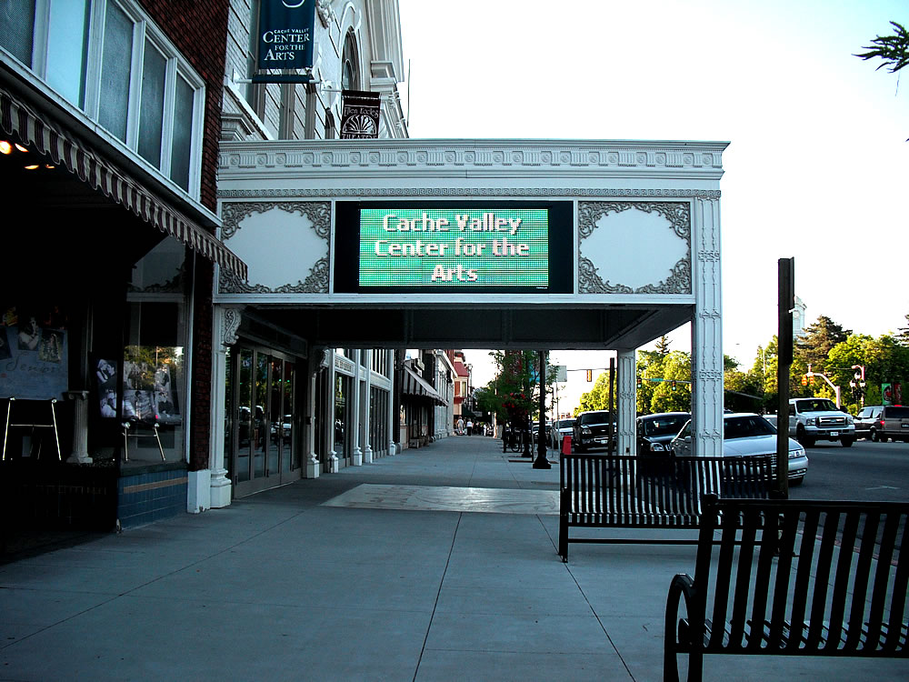
Ellen Eccles Theatre
Cinema and theater · 4.9 mi
Theater and former movie theater in Logan, Utah, United States

Utah State University
School · 5.9 mi
Public university in Logan, Utah, United States
Museums and landmarks22

David Eccles House
Monument and historic site · National Register of Historic Places · 4.6 mi
Single-family detached home in Logan, United States of America
250 West Center Street, Logan

Benson Elementary School
Monument and historic site · National Register of Historic Places · 3.2 mi
School built in 1935, recognised as a historic place

Erick Lehi and Ingrid Larsen Olson House
Monument and historic site · National Register of Historic Places · 5.8 mi
Historic house in River Heights, Utah

Family Life Building
Monument and historic site · National Register of Historic Places · 6.0 mi
University building in Logan, Utah

Forster Hotel
Monument and historic site · National Register of Historic Places · 3.9 mi
Historic house in Utah, United States

George Washington Baker House
Monument and historic site · National Register of Historic Places · 4.0 mi
House in Mendon, Utah
James Gardner House
Monument and historic site · National Register of Historic Places · 3.9 mi
House in Mendon, Utah

John E. Lee House
Monument and historic site · National Register of Historic Places · 6.3 mi
Historic two-story house in Hyde Park, Utah
Logan High School Gymnasium
Monument and historic site · National Register of Historic Places · 4.8 mi
Gymnasium in Logan, Utah

Logan Utah Temple
Monument and historic site · National Register of Historic Places · 5.2 mi
Temple of The Church of Jesus Christ of Latter-day Saints in Logan, Utah, United States
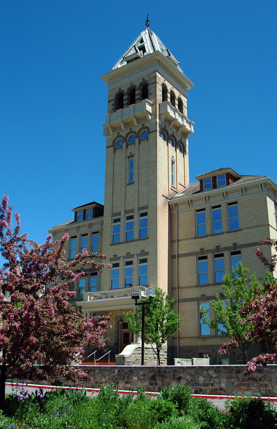
Old Main
Monument and historic site · National Register of Historic Places · 5.8 mi
University building in Utah State University in Logan, Utah, United States


Providence LDS Chapel and Meetinghouse
Monument and historic site · National Register of Historic Places · 6.4 mi
Historic building in Providence, Utah, United States
10 more on the map.
Parks, trails and playgrounds20

Logan Aquatic Center
Sports field and stadium · 4.4 mi
Aquatic center with lap pool, leisure/kids pool, slides. Concessions and rentals available. Swim lessons, water aerobics, and other...
451 South 500 West
Tu-Sa 12:00-19:00; Mo 12:00-20:00


8 more on the map.
Restaurants and cafes12

Crumb Brothers Artisan Bread
Bakery · 4.6 mi
Bakery does delivery and hosts special events only. The cafe/retail is closed (as of 2023).
291 South 300 West, Logan
Tu-Fr 07:00-15:00


Hobbled Dog Cidery
Brewery and winery · 3.6 mi
918 West 700 North, Logan


Costco Food Court
Fast food · Hot Dog, Pizza, Sandwich · 3.6 mi
Churches and places of worship15
Logan LDS Sixth Ward Church
Church · National Register of Historic Places · 5.1 mi
Logan Tabernacle
Church · National Register of Historic Places · 5.0 mi
The Church of Jesus Christ of Latter-day Saints
Church · Mormon · 4.4 mi
825 North 200 West, Logan
Prince of Peace Lutheran Church (ELCA)
Church · Lutheran · 4.2 mi
930 North 400 West, Logan
The Church of Jesus Christ of Latter-day Saints
Church · Mormon · 3.2 mi
3472 North 3000 West, Benson
The Church of Jesus Christ of Latter-day Saints
Church · Mormon · 4.4 mi
280 West 1200 North, Logan
The Church of Jesus Christ of Latter-day Saints
Church · Mormon · 4.6 mi
207 West 200 North, Logan
The Church of Jesus Christ of Latter-day Saints
Church · Mormon · 4.7 mi
89 South 200 West, Logan
Shopping13
Gas and EV charging6
Schools, colleges and libraries28
Bridgerland Applied Technology College
School · 3.8 mi
1301 North 600 West, Logan
Healthcare1
Map of Benson
119 places. The map loads OpenStreetMap tiles when you open it.
Climate by month
Monthly table
| Month | High | Low | Rain | Snow |
|---|---|---|---|---|
| Jan | 32°F | 14°F | 1.7 in | 13.9 in |
| Feb | 37°F | 17°F | 1.4 in | 8.3 in |
| Mar | 50°F | 27°F | 1.7 in | 3.9 in |
| Apr | 59°F | 34°F | 1.9 in | 2.5 in |
| May | 69°F | 42°F | 2.0 in | 0.0 in |
| Jun | 79°F | 48°F | 1.1 in | 0.0 in |
| Jul | 89°F | 55°F | 0.5 in | 0.0 in |
| Aug | 88°F | 53°F | 0.6 in | 0.0 in |
| Sep | 78°F | 44°F | 1.3 in | 0.0 in |
| Oct | 63°F | 33°F | 1.6 in | 0.7 in |
| Nov | 47°F | 24°F | 1.3 in | 4.0 in |
| Dec | 34°F | 16°F | 1.4 in | 10.7 in |
U.S. Climate Normals 1991-2020 for Logan Radio Kvnu (4 mi away), NOAA NCEI.
People and cost of living
American Community Survey 5-year estimates, 2020-2024, U.S. Census Bureau. Estimates have margins of error, larger for small towns.
Disaster history
Cache County has had 5 federal disaster declarations since 2000, most often for biologicals.
- 2020-04-04: Covid-19 Pandemic (Biological)
- 2020-03-13: Covid-19 (Biological)
- 2017-04-21: Severe Winter Storms And Flooding (Flood)
- 2011-08-08: Flooding (Flood)
- 2005-09-05: Hurricane Katrina Evacuation (Coastal Storm)
OpenFEMA disaster declarations summaries.
Getting there and nearby towns
Logan-Cache Airport (LGU) is the nearest airport with scheduled flights listed in OpenStreetMap, 4 miles away.
- Logan 4 mi east, about 7 min by car
- North Logan 6 mi east, about 10 min by car
- Smithfield 8 mi northeast, about 12 min by car
- Hyrum 9 mi southeast, about 15 min by car
- Tremonton 14 mi west, about 22 min by car
- Brigham City 18 mi south, about 29 min by car
- Franklin 18 mi north, about 30 min by car
- Preston 24 mi north, about 39 min by car
- Pleasant View 30 mi south, about 48 min by car
- North Ogden 31 mi south, about 49 min by car
Drive times are estimates from straight-line distance, not routes.
Local news
Headlines from INDB, the NEMICO news database.
Reviews, tips and questions
Loading what members have shared...
Sources and licences
- NCES EDGE (Public domain): public schools
- NOAA NCEI U.S. Climate Normals 1991-2020 (Public domain): climate by month
- OpenFEMA (Public domain): disaster declarations
- OpenStreetMap contributors (ODbL 1.0): places, airports, map data
- U.S. Census Bureau (Public domain): population, income, housing, education, commute
- Wikidata (CC0 1.0): elevation, founding date, time zone, website, landmarks and historic places
- Wikimedia Commons (see each image): photos
- Wikipedia (CC BY-SA 4.0): overview and history text
Photo credits
- Eccles House Logan Utah, Ntsimp, CC0
- Logan Utah Temple, Cory Maylett, CC BY-SA 3.0
- Whittier School Logan Utah, Tricia Simpson, CC BY-SA 3.0
- Old Rock Church Providence Utah, Tricia Simpson, CC BY-SA 3.0
- Logan Tabernacle (Logan, UT), Cornellrockey, CC BY-SA 2.5
- Family Life Building USU, Ntsimp, CC0
- Old Main Utah St Univ, Cory Maylett, CC BY-SA 3.0
- Forster Hotel Mendon Utah, Tricia Simpson, CC BY-SA 3.0
- George Baker House Mendon Utah, Tricia Simpson, CC BY-SA 3.0
- Sixth Ward Church Logan Utah, Tricia Simpson, CC BY-SA 3.0
- Olson House River Heights Utah, Ntsimp, CC0
- Lee House Hyde Park Utah, Tricia Simpson, CC BY-SA 3.0
- Logan Temple Barn, Louise T. Taft, Photographer, Public domain
- Crockett House Logan Utah, Tricia Simpson, CC BY-SA 3.0
- Ellen eccles theater, UtahStizzle, Public domain
- Red Brick School House 1897, Deannaleeshaw, CC BY-SA 4.0
- Artifical Spawning at June Sucker Hatchery (17279759133), USFWS Mountain Prairie, Public domain
- Logan Utah Fish Hatchery Caretaker's Residence, Ntsimp, CC0
- Lithobates pipiens frog, Jbjensen1, CC BY 4.0
- ISS066-E-22416 - View of Earth, Earth Science and Remote Sensing Unit , Lyndon B. Johnson Space Center, Public domain
- ISS030-E-293034 - View of Earth, Earth Science and Remote Sensing Unit , Lyndon B. Johnson Space Center, Public domain
- ISS040-E-78926 - View of Earth, Earth Science and Remote Sensing Unit , Lyndon B. Johnson Space Center, Public domain
- ISS040-E-78927 - View of Earth, Earth Science and Remote Sensing Unit , Lyndon B. Johnson Space Center, Public domain
- ISS040-E-125476 - View of Earth, Earth Science and Remote Sensing Unit , Lyndon B. Johnson Space Center, Public domain
- ISS015-E-17446 - View of Earth, Earth Science and Remote Sensing Unit , Lyndon B. Johnson Space Center, Public domain
- ISS030-E-100743 - View of Earth, Earth Science and Remote Sensing Unit , Lyndon B. Johnson Space Center, Public domain
- STS131-E-8824 - View of Earth, NASA, Public domain
- ISS017-E-18874 - View of Utah, Earth Science and Remote Sensing Unit , Lyndon B. Johnson Space Center, Public domain
- Threehive for 2-digit UT-30 - panoramio, Rover_0, CC BY 3.0
- Hordeum marinum ssp. gussoneanum, iNaturalist user: crothfels, CC BY 4.0
- SR-30 Street Placard Text - panoramio, Rover_0, CC BY 3.0
- SR-252-1000 W Street Placard - panoramio, Rover_0, CC BY 3.0
- UT-23 in Mendon UT - panoramio, Rover_0, CC BY 3.0
- Looking East at UT-252 Shields at 2500 N ^ 1000 W - panoramio, Rover_0, CC BY 3.0
- ISS047-E-93177 - View of Earth, Earth Science and Remote Sensing Unit , Lyndon B. Johnson Space Center, Public domain
- ISS031-E-146239 - View of Earth, Earth Science and Remote Sensing Unit , Lyndon B. Johnson Space Center, Public domain
- UT-252 Shield turning left shield - panoramio, Rover_0, CC BY 3.0
- UT-252 Shield at 2500 N ^ 1000 W - panoramio, Rover_0, CC BY 3.0
- Mendon, United States (Unsplash), Greg Rakozy grakozy, CC0
- William Joseph Floyd signature, Willson500, CC BY-SA 4.0


Page built October 30, 2026. Spotted a mistake? Tell us or suggest a place.