
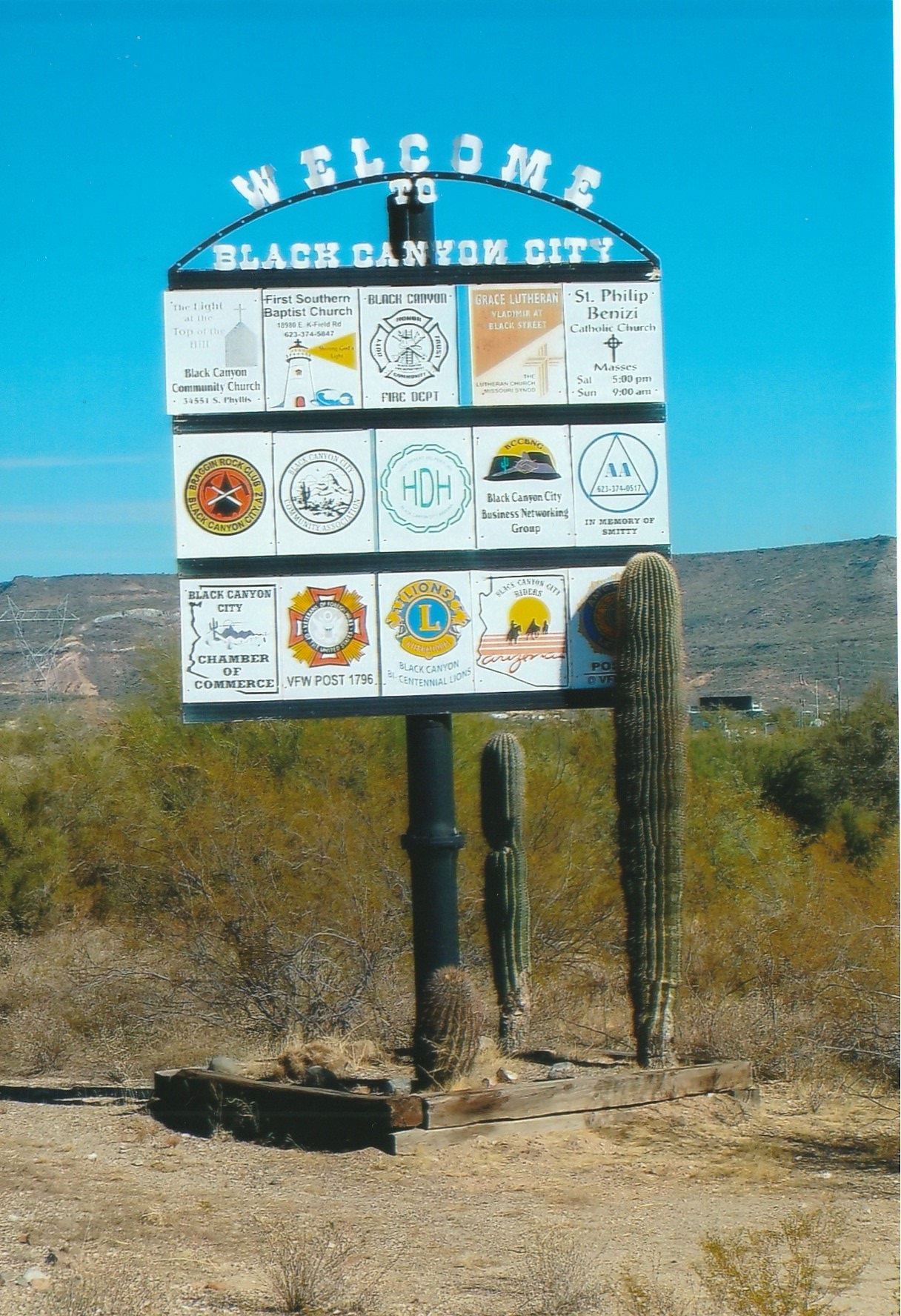


Black Canyon City, Arizona
Black Canyon City is a community of 2,181 people in Yavapai County, Arizona.
Why visit Black Canyon City
Townapedia lists 1 museum or landmark, 4 parks and trails, 7 places to eat, 8 places to stay and 1 attraction in and around town.
Highlights include Hósh Flat.
July is the warmest month, with average highs of 105°F; December lows average 42°F.
Weather in Black Canyon City
Forecast from the National Weather Service. Full forecast
About Black Canyon City
Black Canyon City is an unincorporated community and census-designated place (CDP) in Yavapai County, Arizona, United States. The population is 2,677 as of the 2020 census.
From the Wikipedia article Black Canyon City, Arizona (this version), under CC BY-SA 4.0.
Things to do1

Museums and landmarks1

Parks, trails and playgrounds4


Restaurants and cafes7

Beni's Pizza
Restaurant · Pizza, Italian · 1.6 mi
34351 South Old Black Canyon Highway, Black Canyon City
Su-Th 11:00-20:00; Fr-Sa 11:00-21:00
Rock Springs Cafe
Restaurant · Breakfast, Burger, Chicken, Steak House · 2.2 mi
35900 South Old Black Canyon Highway, Black Canyon City
07:00-20:00
Two Brothers Kitchen
Restaurant · Diner · 1.7 mi
18850 East School House Road, Black Canyon City
07:00-14:30
Chileen's on 17
Restaurant · 1.3 mi
33150 South Coldwater Road, Black Canyon City
Mo-Th 11:00-21:00; Fr,Sa 11:00-22:00; Su 11:00-21:00

Javalina Crossing Saloon
Bar and pub · 1.6 mi
34441 South Old Black Canyon Highway, Black Canyon City
Su 11:00-23:00; Mo-Th 11:00-24:00; Fr-Sa 11:00-01:00


History
Black Canyon City has been known by several names, including Goddard or Goddards, Cañon, and Black Canyon. Goddard's was a stage stop on the Phoenix to Prescott line, a military stopover en route to Fort Whipple and Fort Verde during Territorial days, and a supply center for mines in the southern Bradshaw Mountains.
Pre-Columbian Native Americans have inhabited the area around Black Canyon for thousands of years, Evident from petroglyphs and pottery shards discovered in the area.
The area was first settled by people of Anglo-European origin in the 1870s, and the first post office was established as Cañon in May 1894, with postmaster Charles E. Goddard, and was discontinued in October 1899. It was reestablished again from February 1903 to November 1906. An early settler was Jack Swilling and his wife Trinidad Swilling, who moved there in 1871. The walls of his ranch house, Swillings Cabin – the community's oldest building still stand.
In 2004, residents proposed incorporating the area as a town and submitted sufficient signatures to hold an election.
However, the initiative failed with 72% voting against incorporation.
From the History section of Black Canyon City, Arizona on Wikipedia, under CC BY-SA 4.0.
Where to stay8
Mountain Breeze Motel
Motel and hotel · 1.7 mi
34500 South Old Black Canyon Highway, Black Canyon City
Black Canyon Ranch RV Resort
Campground · 1.8 mi
33900 South Old Black Canyon Highway, Black Canyon City
Green 'N' Lush RV Park
Campground · 1.6 mi
19061 East Palm Lane, Black Canyon City
Midway RV & Mobile Home Park
Campground · 1.6 mi
19200 East K-Mine Road, Black Canyon City
Rivers Edge RV Resort
Campground · 1.9 mi
18801 East School House Road, Black Canyon City
Tractors of the West RV Park
Campground · 1.5 mi
19101 East Palm Lane, Black Canyon City
Churches and places of worship8
Saint Phillip Benizi Catholic Church
Church · Roman Catholic · 1.5 mi
34621 South Old Black Canyon Highway, Black Canyon City
First Southern Baptist Church
Church · Southern Baptist · 1.8 mi
18980 East K Field Road, Black Canyon City
Grace Lutheran Church
Church · Lutheran · 1.8 mi
18994 East Black Street, Black Canyon City
Kingdom Hall of Jehovah's Witnessess
Church · Jehovahs Witness · 1.5 mi
34596 South Phyllis Street, Black Canyon City
Black Mountain Community Church
Church · 1.5 mi
34595 South Phyllis Street, Black Canyon City
Shopping4
Arizona Native Gift Shop
Shop · 1.6 mi
34361 South Old Black Canyon Highway, Black Canyon City
Ron's Market
Grocery · 1.7 mi
34360 South Old Black Canyon Highway, Black Canyon City
Barney's Bargain Barn
Hardware store · 1.6 mi
34571 South Old Black Canyon Highway, Black Canyon City
Gas and EV charging2
Shell
Gas station · 1.7 mi
34400 South Old Black Canyon Highway, Black Canyon City
Schools, colleges and libraries4
Black Mountain Community Library
Library · 1.5 mi
34701 South Old Black Canyon Highway, Black Canyon City
Map of Black Canyon City
39 places. The map loads OpenStreetMap tiles when you open it.
Climate by month
Monthly table
| Month | High | Low | Rain | Snow |
|---|---|---|---|---|
| Jan | 70°F | 43°F | 2.0 in | 0.0 in |
| Feb | 71°F | 45°F | 2.1 in | 0.0 in |
| Mar | 77°F | 49°F | 1.6 in | 0.0 in |
| Apr | 84°F | 54°F | 0.4 in | 0.0 in |
| May | 93°F | 62°F | 0.2 in | 0.0 in |
| Jun | 102°F | 70°F | 0.1 in | 0.0 in |
| Jul | 105°F | 77°F | 1.3 in | 0.0 in |
| Aug | 104°F | 77°F | 2.3 in | 0.0 in |
| Sep | 99°F | 71°F | 1.1 in | 0.0 in |
| Oct | 89°F | 60°F | 0.9 in | 0.0 in |
| Nov | 78°F | 50°F | 0.7 in | 0.0 in |
| Dec | 68°F | 42°F | 1.4 in | 0.0 in |
U.S. Climate Normals 1991-2020 for Castle Hot Springs (15 mi away), NOAA NCEI.
People and cost of living
American Community Survey 5-year estimates, 2020-2024, U.S. Census Bureau. Estimates have margins of error, larger for small towns.
Disaster history
Yavapai County has had 20 federal disaster declarations since 2000, most often for fires.
- 2022-04-19: Crooks Fire (Fire)
- 2021-05-27: Spur Fire (Fire)
- 2020-04-04: Covid-19 Pandemic (Biological)
- 2020-03-13: Covid-19 (Biological)
- 2018-05-11: 89 East Fire (Fire)
- 2017-06-25: Goodwin Fire (Fire)
OpenFEMA disaster declarations summaries.
Getting there and nearby towns
Phoenix Deer Valley Airport (DVT) is the nearest airport with scheduled flights listed in OpenStreetMap, 27 miles away.
- New River 13 mi south, about 21 min by car
- Anthem 16 mi south, about 25 min by car
- Cave Creek 18 mi southeast, about 29 min by car
- Carefree 21 mi southeast, about 34 min by car
- Peoria 23 mi southwest, about 36 min by car
- Scottsdale 31 mi southeast, about 49 min by car
- Sun City West 31 mi southwest, about 49 min by car
- Sun City 33 mi south, about 53 min by car
- Surprise 34 mi southwest, about 54 min by car
- Phoenix 35 mi south, about 56 min by car
Drive times are estimates from straight-line distance, not routes.
Local news
Headlines from INDB, the NEMICO news database.
Reviews, tips and questions
Loading what members have shared...
Sources and licences
- NCES EDGE (Public domain): public schools
- NOAA NCEI U.S. Climate Normals 1991-2020 (Public domain): climate by month
- OpenFEMA (Public domain): disaster declarations
- OpenStreetMap contributors (ODbL 1.0): places, airports, map data
- U.S. Census Bureau (Public domain): population, income, housing, education, commute
- Wikidata (CC0 1.0): elevation, founding date, time zone, website
- Wikimedia Commons (see each image): photos
- Wikipedia (CC BY-SA 4.0): overview and history text
Photo credits
- Black Canyon City-(A) Welcome to Black Canyon City, Marine 69-71, CC BY-SA 4.0
- Black Canyon City Winterfest (53739643993), BLMArizona, Public domain
- Art Galleries Rock Springs, Black Canyon City, AZ 2013 - panoramio, Chris English, CC BY-SA 3.0
- Boot Hill, Rock Springs, Black Canyon City, AZ 2013 - panoramio, Chris English, CC BY-SA 3.0
- Pump House, Farmer's Market, Rock Springs, Black Canyon City, AZ 2013 - panoramio, Chris English, CC BY-SA 3.0
- Rock Springs Cafe etc. , Black Canyon City, AZ 2013 - panoramio, Chris English, CC BY-SA 3.0
- Rock Springs, Black Canyon City, AZ 2013 - panoramio (1), Chris English, CC BY-SA 3.0
- Counter, Rock Springs Store and Cafe, Black Canyon City, AZ 2013 - panoramio, Chris English, CC BY-SA 3.0
- Freight Wagon and Early 20th Century Water Wagon, Black Canyon City, AZ - panoramio, Chris English, CC BY-SA 3.0
- Rock Springs Cafe, Black Canyon City, AZ 2013 - panoramio, Chris English, CC BY-SA 3.0
- Indoor Mural and Pie Case, Rock Springs, Black Canyon City, AZ 2013 - panoramio, Chris English, CC BY-SA 3.0
- The Bar, Rock Springs, Black Canyon City, AZ 2013 - panoramio, Chris English, CC BY-SA 3.0
- Murals, Rock Springs, Black Canyon City, AZ 2013 - panoramio, Chris English, CC BY-SA 3.0
- Rock Springs, Black Canyon City, AZ 2013 - panoramio, Chris English, CC BY-SA 3.0
- Mural Nostalgia Detail, Rock Springs, Black Canyon City, AZ 2013 - panoramio (3), Chris English, CC BY-SA 3.0
- Mural Nostalgia Detail, Rock Springs, Black Canyon City, AZ 2013 - panoramio (2), Chris English, CC BY-SA 3.0
- Con-way Truckload semi-trailer at truck stop, Robert Couse-Baker, CC BY 2.0
- Bobbyg1, Bobbyginaz, CC BY-SA 3.0
- Bobbyg2, Bobbyginaz, CC BY-SA 3.0
- 2013 Arizona Classic Bronco Stampede - panoramio (1), Chris English, CC BY-SA 3.0
- 2013 Arizona Classic Bronco Stampede - panoramio (3), Chris English, CC BY-SA 3.0
- 2013 Arizona Classic Bronco Stampede - panoramio, Chris English, CC BY-SA 3.0
- 2013 Arizona Classic Bronco Stampede - panoramio (2), Chris English, CC BY-SA 3.0
- Black Canyon National Recreation Trail (54645596782), BLMArizona, Public domain
- Rock Shop, Rock Springs, Arizona (32761241273), Judy Gallagher, CC BY 2.0
- Early Solid Rim, Solid Tire Truck Wheel - panoramio, Chris English, CC BY-SA 3.0
- Budd Wheel Corporation - 1916 - 1925 - panoramio, Chris English, CC BY-SA 3.0
- A Life in the Mines and on the Range - panoramio, Chris English, CC BY-SA 3.0
- ISS018-E-6616 - View of Arizona, Earth Science and Remote Sensing Unit , Lyndon B. Johnson Space Center, Public domain
- ISS032-E-23475 - View of Earth, Earth Science and Remote Sensing Unit , Lyndon B. Johnson Space Center, Public domain
- Cylindropuntia acanthocarpa, Staghorn Cholla, Sonoran Desert - panoramio, Chris English, CC BY-SA 3.0
- Cylindropuntia acanthocarpa, Staghorn Cholla, Sonoran Desert, Late Winter 2013 - panoramio, Chris English, CC BY-SA 3.0
- Desert Danger - Saguaro Cactus Protected by Powerline Tower, Sonoran Desert Late Winter 2013 - panoramio, Chris English, CC BY-SA 3.0
- Late Winter 2013 in the Sonoran Desert - panoramio, Chris English, CC BY-SA 3.0
- Chain Fruit Cholla, Opuntia fulgida, Late Winter, Sonoran Desert, 2013 - panoramio, Chris English, CC BY-SA 3.0
- Dying Chain Fruit Cholla, Opuntia fulgida, Late Winter, Sonoran Desert, 2013 - panoramio, Chris English, CC BY-SA 3.0
- Fruit of the Chain Fruit Cholla, Late Winter, Opuntia fulgida, Sonoran Desert, 2013 - panoramio, Chris English, CC BY-SA 3.0
- Carnegiea gigantea, Saguaro, Late Winter, Sonoran Desert, 2013 - panoramio (1), Chris English, CC BY-SA 3.0
- Sonoran Desert, Jojoba Nut, Simmodsia chinensis Female Shrub - panoramio, Chris English, CC BY-SA 3.0
- Ocotillo, Fouquieria splendens, Late Winter, Sonoran Desert, 2013 - panoramio, Chris English, CC BY-SA 3.0


Page built October 30, 2026. Spotted a mistake? Tell us or suggest a place.