


Bon Air, Virginia
Bon Air is a community of 16,904 people in Chesterfield County, Virginia.
Why visit Bon Air
Townapedia lists 16 museums and landmarks, 13 parks and trails, 150 places to eat, 11 places to stay and 11 attractions in and around town.
Highlights include Victory Theater, Atlantic Coast Line Railroad Bridge, Agecroft Hall and Bellona Arsenal.
July is the warmest month, with average highs of 90°F; January lows average 29°F.
Weather in Bon Air
Forecast from the National Weather Service. Full forecast
About Bon Air
Bon Air is a census-designated place (CDP) in Chesterfield County, Virginia, United States. The population was 18,022 at the 2020 census. The community is considered a suburb of the independent city of Richmond in the Richmond-Petersburg region and is a part of the Southside neighborhoods. Originally developed as a resort, a central portion of Bon Air has been designated as a National Historic District with many structures of Victorian design from the late 19th and early 20th centuries.
From the Wikipedia article Bon Air, Virginia (this version), under CC BY-SA 4.0.
Things to do11


Atlantic Coast Line Railroad Bridge
Bridge · 4.4 mi
Bridge in United States of America
Edward E. Willey Bridge
Bridge · 2.9 mi
Bridge in United States of America
Huguenot Memorial Bridge
Bridge · 3.4 mi
Bridge in United States of America
Powhite Parkway Bridge
Bridge · 4.3 mi
Bridge in United States of America

University of Richmond
School · 4.5 mi
University in Richmond, Virginia, United States
University of Richmond School of Professional & Continuing Studies
School · 4.4 mi
School at the University of Richmond
Museums and landmarks16

Agecroft Hall
Monument and historic site · National Register of Historic Places · 4.3 mi
Manor house

Bellona Arsenal
Monument and historic site · National Register of Historic Places · 3.6 mi
19th-century United States Army and Confederate arsenal in Virginia, U.S

Jerman House
Monument and historic site · National Register of Historic Places · 4.1 mi
Historic house in Virginia, United States

John Rolfe Apartments
Monument and historic site · National Register of Historic Places · 4.4 mi
Historic apartment building in Richmond, Virginia

Laurel Meadow
Monument and historic site · National Register of Historic Places · 4.1 mi
Historic house in Richmond, Virginia

North Court
Monument and historic site · National Register of Historic Places · 4.3 mi
University dorm in Virginia, United States

Pleasant View
Monument and historic site · National Register of Historic Places · 2.8 mi
Human settlement in Virginia, United States of America

Redesdale
Monument and historic site · National Register of Historic Places · 3.6 mi
Building in Virginia, United States

Rice House
Monument and historic site · National Register of Historic Places · 3.9 mi
Historic house in Virginia, United States

Rockfalls
Monument and historic site · National Register of Historic Places · 3.4 mi
Historic house in Virginia, United States
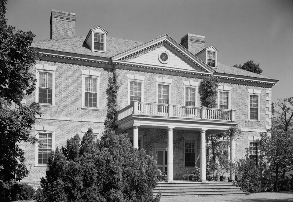
Rocky Mills
Monument and historic site · National Register of Historic Places · 3.5 mi
Historic house in Henrico County, Virginia, United States moved from Hanover County, Virginia


Ryland Hall
Monument and historic site · National Register of Historic Places · 4.6 mi
Academic building in Richmond, Virginia
4 more on the map.
Parks, trails and playgrounds13

Midlothian Mines Park
Park · 4.2 mi
Park in Midlothian, Virginia, United States


Richmond Ice Zone
Sports field and stadium · 1.6 mi
Year-round indoor ice skating rink.
636 Johnston Willis Drive, North Chesterfield

Moody Conservation Area
Hiking and trails · 2.6 mi
The Moody Conservation Area is a private conservation area and is not open to the public. The land is protected from development.
600 North Courthouse Road, North Chesterfield

1 more on the map.
Restaurants and cafes150

First Watch
Restaurant · American, Breakfast · 2.4 mi
Upscale Cafe with breakfast and lunch items.
1403 West Huguenot Road, Richmond
Mo-Su 07:00-14:30

7 Brew
Cafe · Coffee Shop, Tea · 2.4 mi
11601 Midlothian Turnpike
Su-Th 05:30-22:00; Fr-Sa 05:30-23:00
A Kitchen
Restaurant · Asian · 0.9 mi
9726 Midlothian Turnpike
Mo, We-Sa 11:00-15:00, 16:00-21:30; Su 12:00-21:00

Bruster's Ice Cream
Ice cream · Ice Cream · 2.2 mi
11501 Robious Road, North Chesterfield
Mo-Su 12:00-21:00
Candela's Pizzeria
Restaurant · Pizza · 2.2 mi
11541 Robious Road, North Chesterfield
Tu-Th 11:00-21:30; Fr-Sa 11:00-22:30; Su 12:00-21:30
Chuck E. Cheese
Restaurant · Pizza · 1.2 mi
10430 Midlothian Turnpike, Richmond
Su-Th 11:00-21:00; Fr 11:00-22:00; Sa 10:00-22:00
Cold Stone Creamery
Ice cream · Ice Cream · 2.5 mi
1220 Alverser Plaza
Su-Th 12:00-21:00; Fr-Sa 12:00-22:00
Extra Billy's Smokehouse & Brewery
Restaurant · Barbecue · 2.7 mi
1110 Alverser Drive, Midlothian
Tu-Th 16:00-20:30; Fr 16:00-21:30; Sa 12:00-21:30; Su 12:00-16:30
Fleming's
Restaurant · Steak House · 2.3 mi
9200 Stony Point Parkway, Richmond
Mo-Sa 16:00-22:00; Su 16:00-21:00
138 more on the map.
Where to stay11
Best Western Plus Governor's Inn
Motel and hotel · 0.9 mi
9826 Midlothian Turnpike, North Chesterfield
Residence Inn Richmond West/Midlothian
Motel and hotel · 1.6 mi
1350 Johnston Willis Drive, Midlothian
Extended Stay America - North Chesterfield - Arboretum
Motel and hotel · 1.6 mi
241 Arboretum Place
Four Points by Sheraton Richmond
Motel and hotel · 1.0 mi
9901 Midlothian Turnpike, Richmond
Holiday Inn Express Richmond E - Midlothian Trnpke
Motel and hotel · 1.6 mi
8710 Midlothian Turnpike, North Chesterfield
Churches and places of worship18
Henry Mansfield Cannon Memorial Chapel
Church · National Register of Historic Places · 4.3 mi
Stony Point Reformed Presbyterian Church
Church · Presbyterian Church In America · 1.0 mi
2330 Buford Road
Huguenot United Methodist Church
Church · Methodist · 1.7 mi
10661 Duryea Drive, Richmond
Saint Edward the Confessor Catholic Church
Church · Catholic · 1.6 mi
10701 West Huguenot Road
Saint Matthias Episcopal Church
Church · Episcopal · 2.0 mi
11300 West Huguenot Road
Shopping35
Gas and EV charging20
Schools, colleges and libraries60
Healthcare17
Children's Hospital of Richmond - Bon Air (South) Therapy Center
Clinic and pharmacy · 1.7 mi
206 Twinridge Lane, Richmond
Virginia Urology - Stony Point Office & Surgery Center
Clinic and pharmacy · 2.2 mi
9101 Stony Point Drive, Richmond
MedExpress Urgent Care
Clinic and pharmacy · 2.5 mi
11603 Midlothian Turnpike, Midlothian
Map of Bon Air
250 places. The map loads OpenStreetMap tiles when you open it.
Climate by month
Monthly table
| Month | High | Low | Rain | Snow |
|---|---|---|---|---|
| Jan | 48°F | 29°F | 3.2 in | 3.7 in |
| Feb | 52°F | 30°F | 2.6 in | 2.2 in |
| Mar | 60°F | 37°F | 4.0 in | 1.1 in |
| Apr | 70°F | 46°F | 3.2 in | 0.0 in |
| May | 78°F | 56°F | 4.0 in | 0.0 in |
| Jun | 86°F | 64°F | 4.6 in | 0.0 in |
| Jul | 90°F | 69°F | 4.4 in | 0.0 in |
| Aug | 88°F | 68°F | 4.9 in | 0.0 in |
| Sep | 81°F | 61°F | 4.6 in | 0.0 in |
| Oct | 71°F | 49°F | 3.4 in | 0.0 in |
| Nov | 60°F | 39°F | 3.1 in | 0.0 in |
| Dec | 52°F | 32°F | 3.5 in | 1.8 in |
U.S. Climate Normals 1991-2020 for Richmond Intl Ap 72401 (14 mi away), NOAA NCEI.
People and cost of living
American Community Survey 5-year estimates, 2020-2024, U.S. Census Bureau. Estimates have margins of error, larger for small towns.
Disaster history
Chesterfield County has had 13 federal disaster declarations since 2000, most often for hurricanes.
- 2026-01-23: Severe Winter Storm (Winter Storm)
- 2021-05-10: Severe Winter Storms (Severe Ice Storm)
- 2020-04-02: Covid-19 Pandemic (Biological)
- 2020-03-13: Covid-19 (Biological)
- 2018-12-18: Tropical Storm Michael (Hurricane)
- 2018-10-15: Hurricane Florence (Hurricane)
OpenFEMA disaster declarations summaries.
Getting there and nearby towns
Richmond International Airport (RIC) is the nearest airport with scheduled flights listed in OpenStreetMap, 14 miles away.
- Manchester 2 mi southeast, about 4 min by car
- Rockwood 4 mi south, about 6 min by car
- Richmond 5 mi east, about 8 min by car
- Tuckahoe 5 mi north, about 8 min by car
- Midlothian 5 mi southwest, about 8 min by car
- Brandermill 7 mi southwest, about 12 min by car
- Dumbarton 7 mi northeast, about 12 min by car
- Meadowbrook 8 mi southeast, about 13 min by car
- Lakeside 8 mi northeast, about 13 min by car
- Laurel 9 mi northeast, about 14 min by car
Drive times are estimates from straight-line distance, not routes.
Local news
Headlines from INDB, the NEMICO news database.
Reviews, tips and questions
Loading what members have shared...
Sources and licences
- NCES EDGE (Public domain): public schools
- NOAA NCEI U.S. Climate Normals 1991-2020 (Public domain): climate by month
- OpenFEMA (Public domain): disaster declarations
- OpenStreetMap contributors (ODbL 1.0): places, airports, map data
- U.S. Census Bureau (Public domain): population, income, housing, education, commute
- Wikidata (CC0 1.0): elevation, founding date, time zone, website, landmarks and historic places
- Wikimedia Commons (see each image): photos
- Wikipedia (CC BY-SA 4.0): overview and history text
Photo credits
- Bon Air Hotel Annex, User: Morgan Riley, CC BY-SA 3.0
- Bon Air Juvenile Correctional Center, Packer1028, CC0
- 2017-07-07 20 01 01 View east along Virginia State Route 324 (Chatsworth Avenue) at Old Bon Air Road (Virginia State Secondary Route 718) in Bon Air, Chesterfield County, Virginia, Famartin, CC BY-SA 4.0
- Bon Air Elementary School, Packer1028, CC0
- Bon Air Library, James Shelton32, CC BY-SA 3.0
- Bon Air Library - new, Packer1028, CC0
- Bon Air Baptist Church Columbarium, Packer1028, CC0
- John rolfe apartments, Crazyale, CC0
- TheTuckahoeRichmond, Morgan Riley, CC BY 3.0
- North Court, Michael Kotrady, CC BY-SA 4.0
- Ryland Hall, Michael Kotrady, CC BY-SA 4.0
- Pleasant View, Bluesnote, CC BY-SA 3.0
- Rockfalls entrance, Nyttend, Public domain
- Jerman House in Richmond, Nyttend, Public domain
- Agecroft Hall, phoebe reid, CC BY 2.0
- Redesdale estate entrance, Nyttend, Public domain
- Laurel Meadow from the south, Nyttend, Public domain
- Rocky Mills Mansion VA, Unknown author Unknown author, Public domain
- Rice House entrance, Nyttend, Public domain
- Bellona Arsenal, Workshops, State Route 673 vicinity, Richmond vicinity (Chesterfield County, Virginia), Unknown author Unknown author, Public domain
- Virginia House front, Jennifer M. Guild, Media Relations Specialist, Virginia Historical Society, CC BY 3.0
- Jimi Hendrix Tree - panoramio, Peter Fisher-Duke (z…, CC BY-SA 3.0
- Powhite Creek - panoramio, Peter Fisher-Duke (z…, CC BY-SA 3.0
- Fire Spinning - panoramio, Peter Fisher-Duke (z…, CC BY-SA 3.0
- The Cliffs - panoramio (1), Peter Fisher-Duke (z…, CC BY-SA 3.0
- Mount Nebo Baptist Church Cemetery, Packer1028, CC0
- Girlscout Lake - panoramio, Peter Fisher-Duke (z…, CC BY-SA 3.0
- Girlscout Lake - panoramio (1), Peter Fisher-Duke (z…, CC BY-SA 3.0
- Bethlehem Baptist Church Cemetery (North Chesterfield), Packer1028, CC0
- W241AP tower, Packer1028, CC0
- Tinsleys, Virginia, Packer1028, CC0
- Sheffield Court, Packer1028, CC0
- Dónde Tennis Trail - panoramio (1), Peter Fisher-Duke (z…, CC BY-SA 3.0
- Powhite Creek - panoramio (1), Peter Fisher-Duke (z…, CC BY-SA 3.0
- Rocky Creek Bridge - panoramio, Peter Fisher-Duke (z…, CC BY-SA 3.0
- Buford Oaks, Packer1028, CC0
- Dónde Tennis Trail - panoramio, Peter Fisher-Duke (z…, CC BY-SA 3.0
- Spring Grove (Chesterfield County, Virginia), Packer1028, CC0
- Broad Winged Hawk - panoramio, Peter Fisher-Duke (z…, CC BY-SA 3.0
- Greenfield Elementary School, Packer1028, CC0


Page built October 30, 2026. Spotted a mistake? Tell us or suggest a place.