



Bonners Ferry, Idaho
Bonners Ferry is a city of 2,669 people in Boundary County, Idaho, founded in 1864.
Why visit Bonners Ferry
Townapedia lists 5 museums and landmarks, 3 parks and trails, 11 places to eat, 4 places to stay and 1 attraction in and around town.
Highlights include North Side School and Bonners Ferry Main Post Office.
July is the warmest month, with average highs of 85°F; January lows average 24°F, and about 54 inches of snow fall in a normal year.
Weather in Bonners Ferry
Forecast from the National Weather Service. Full forecast
About Bonners Ferry
Bonners Ferry is the largest city in and the county seat of Boundary County, Idaho, United States. The population was 2,520 at the 2020 census.
From the Wikipedia article Bonners Ferry, Idaho (this version), under CC BY-SA 4.0.
Things to do1

Museums and landmarks5

North Side School
Monument and historic site · National Register of Historic Places · 0.7 mi
Historic building in Bonners Ferry, Idaho, United States
6497 Comanche Street, Bonners Ferry
Bonners Ferry Main Post Office
Monument and historic site · National Register of Historic Places
Post office in Bonners Ferry, Idaho
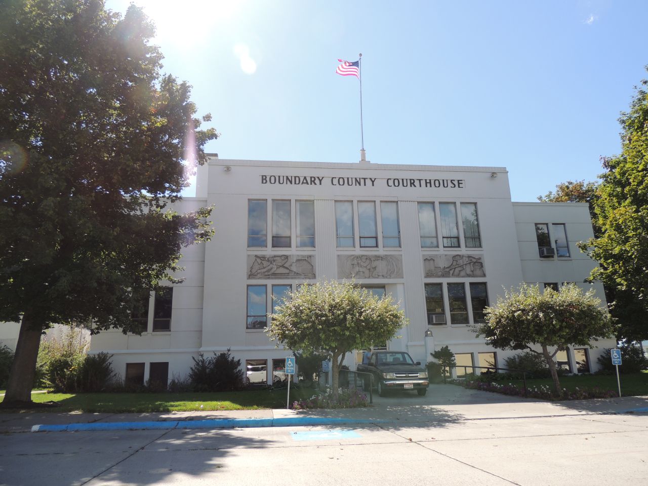
Boundary County Courthouse
Monument and historic site · National Register of Historic Places
County courthouse in Idaho, United States of America
Russell and Pearl Soderling House
Monument and historic site · National Register of Historic Places
Historic house in Idaho, United States

Parks, trails and playgrounds3

Restaurants and cafes11

The Rusty Moose Tavern & Grill
Diner · American · 0.4 mi
Mo 10:00-16:00; Tu-We 10:00-20:00; Th 10:00-20:30; Fr 10:00-21:00;...



Kootenai River Brewing Company
Bar and pub · 0.4 mi
6424 Riverside Street, Bonners Ferry
History
When gold was discovered in the East Kootenays of British Columbia in 1863, thousands of prospectors from all over the West surged northward over a route that became known as the Wildhorse Trail. Edwin Bonner, a merchant from Walla Walla, Washington, established a ferry in 1864 where the trail crossed the broad Kootenai River. In 1875, Richard Fry, and his Sinixt wife, Justine Su-steel Fry, leased the business, but the location retained the name of the original founder and later became the town of Bonners Ferry.
Before the gold rush, only a few visitors had come to the region; one of the first was explorer David Thompson, a cartographer for the North West Company. Thompson and four fellow fur traders arrived in 1808 to trade with the Lower Kootenais. The local natives gave Thompson's party dried fish and moss bread. Thompson returned the next year and established a trading post on Lake Pend Oreille. He was followed in 1846 by Jesuit Priest Father DeSmet, a missionary to the Kootenai Tribe.
The Oregon Question was settled by the Oregon Treaty of 1846 which established the 49th Parallel north as the boundary between the US and British North America. Government surveyors of the Boundary Commission came in 1858 to establish the border between the United States and British Columbia.
From the History section of Bonners Ferry, Idaho on Wikipedia, under CC BY-SA 4.0.
Where to stay4
Best Western Plus Kootenai River Inn Casino & Spa
Motel and hotel · 0.5 mi
7169 Plaza Street, Bonners Ferry
Churches and places of worship5
Saint Ann Catholic Church
Church · Roman Catholic · 0.6 mi
6712 El Paso Street, Bonners Ferry
The Church of Jesus Christ of Latter-day Saints
Church · Mormon · 0.9 mi
6568 Alderson Lane, Bonners Ferry
Shopping8
Gas and EV charging3
Schools, colleges and libraries5
Healthcare1
Map of Bonners Ferry
46 places. The map loads OpenStreetMap tiles when you open it.
Climate by month
Monthly table
| Month | High | Low | Rain | Snow |
|---|---|---|---|---|
| Jan | 34°F | 24°F | 2.6 in | 15.0 in |
| Feb | 39°F | 25°F | 1.8 in | 10.8 in |
| Mar | 48°F | 30°F | 2.0 in | 3.7 in |
| Apr | 59°F | 36°F | 1.3 in | 0.4 in |
| May | 69°F | 43°F | 1.8 in | 0.0 in |
| Jun | 75°F | 49°F | 1.9 in | 0.0 in |
| Jul | 85°F | 53°F | 0.6 in | 0.0 in |
| Aug | 85°F | 52°F | 0.5 in | 0.0 in |
| Sep | 73°F | 44°F | 1.0 in | 0.0 in |
| Oct | 56°F | 36°F | 1.7 in | 0.2 in |
| Nov | 42°F | 30°F | 2.5 in | 6.4 in |
| Dec | 33°F | 24°F | 3.2 in | 17.3 in |
U.S. Climate Normals 1991-2020 for Bonners Ferry (0 mi away), NOAA NCEI.
People and cost of living
American Community Survey 5-year estimates, 2020-2024, U.S. Census Bureau. Estimates have margins of error, larger for small towns.
Disaster history
Boundary County has had 6 federal disaster declarations since 2000, most often for biologicals.
- 2026-04-07: Straight-Line Winds (Straight-Line Winds)
- 2020-04-09: Covid-19 Pandemic (Biological)
- 2020-03-13: Covid-19 (Biological)
- 2017-05-18: Severe Storms, Flooding, Landslides, And Mudslides (Flood)
- 2015-12-23: Severe Storm And Straight-Line Wind (Severe Storm)
- 2005-09-13: Hurricane Katrina (Hurricane)
OpenFEMA disaster declarations summaries.
Getting there and nearby towns
Coeur d'Alene Airport (COE) is the nearest airport with scheduled flights listed in OpenStreetMap, 68 miles away.
- Moyie Springs 6 mi east, about 10 min by car
- Troy 25 mi southeast, about 41 min by car
- Kootenai 28 mi south, about 45 min by car
- Ponderay 29 mi south, about 46 min by car
- Sandpoint 31 mi south, about 49 min by car
- Dover 33 mi southwest, about 53 min by car
- Clark Fork 38 mi south, about 1 h by car
- Libby 41 mi southeast, about 1 h by car
- Priest River 44 mi southwest, about 1 h 15 min by car
- White Haven 44 mi southeast, about 1 h 15 min by car
Drive times are estimates from straight-line distance, not routes.
Local news
Headlines from INDB, the NEMICO news database.
Reviews, tips and questions
Loading what members have shared...
Sources and licences
- NOAA NCEI U.S. Climate Normals 1991-2020 (Public domain): climate by month
- OpenFEMA (Public domain): disaster declarations
- OpenStreetMap contributors (ODbL 1.0): places, airports, map data
- U.S. Census Bureau (Public domain): population, income, housing, education, commute
- Wikidata (CC0 1.0): elevation, founding date, time zone, website, landmarks and historic places
- Wikimedia Commons (see each image): photos
- Wikipedia (CC BY-SA 4.0): overview and history text
Photo credits
- Bonners Ferry along Kootenai River th, Unknown author Unknown author, Public domain
- Soderling House - Bonners Ferry Idaho, Ian Poellet, CC BY-SA 4.0
- US Post Office - Bonners Ferry Idaho, Ian Poellet, CC BY-SA 4.0
- -IDAHO-B-0233- Kootenay River - Bonners Ferry (50011371752), WaterArchives.org from Las Cruces, New Mexico, United States, CC BY-SA 2.0
- North Side School - Bonners Ferry Idaho, Ian Poellet, CC BY-SA 4.0
- Boundary County Courthouse, Richard Bauer ( rustejunk ), CC BY 2.0
- ISS065-E-467401 - View of Earth, Earth Science and Remote Sensing Unit , Lyndon B. Johnson Space Center, Public domain
- ISS020-E-5478 - View of Washington, Earth Science and Remote Sensing Unit , Lyndon B. Johnson Space Center, Public domain
- ISS036-E-48468 - View of British Columbia, Earth Science and Remote Sensing Unit , Lyndon B. Johnson Space Center, Public domain
- ISS059-E-19243 - View of Earth, Earth Science and Remote Sensing Unit, NASA Johnson Space Center, Public domain
- ISS065-E-467400 - View of Earth, Earth Science and Remote Sensing Unit , Lyndon B. Johnson Space Center, Public domain
- ISS065-E-467402 - View of Earth, Earth Science and Remote Sensing Unit , Lyndon B. Johnson Space Center, Public domain
- Chikungunya vaccine, 2026-02-25, Doc James, CC BY-SA 4.0


Page built October 30, 2026. Spotted a mistake? Tell us or suggest a place.