


Boulder, Colorado
Boulder is a city of 106,433 people in Boulder County, Colorado, founded in 1858.
Why visit Boulder
Townapedia lists 29 museums and landmarks, 47 parks and trails, 310 places to eat, 15 places to stay and 16 attractions in and around town.
Highlights include Boulder Creek Bridge, Century Boulder, Carnegie Library and Fiske Planetarium.
Weather in Boulder
Forecast from the National Weather Service. Full forecast
About Boulder
Boulder is a home rule city that is the county seat of, and the most populous municipality in, Boulder County, Colorado, United States. With a population of 108,250 at the 2020 census, it is the 12th-most populous city in Colorado. Boulder is the primary city of the Boulder metropolitan area, which had 330,758 residents in 2020, and is part of the Front Range Urban Corridor.
From the Wikipedia article Boulder, Colorado (this version), under CC BY-SA 4.0.
Things to do16

Boulder Creek Bridge
Bridge · National Register of Historic Places · 3.8 mi
Road bridge in Boulder County, Colorado


Chautauqua Auditorium
Cinema and theater · National Register of Historic Places · 2.4 mi
Performing arts venue

Boulder Farmers Market
Farm and orchard · 1.5 mi
13th Street, Boulder
Apr-Nov Sa 08:00-14:00; May-Sep We 15:30-19:30

University of Colorado Boulder
School · 1.5 mi
Public university in Boulder, Colorado, United States, and flagship of the University of Colorado System
Macky Auditorium
Cinema and theater · 1.5 mi
CU's beautifully renovated concert hall serves the campus and community.
1595 Pleasant Street, Boulder
4 more on the map.
Museums and landmarks29

Carnegie Library
Monument and historic site · National Register of Historic Places · 1.6 mi
Historic building in Boulder, Colorado, United States
1125 Pine Street, Boulder

Fiske Planetarium
Museum · 1.6 mi
Star theatre and teaching facility, the largest of its kind between Chicago and Los Angeles.
2414 Regent Drive, Boulder

Arnett-Fullen House
Monument and historic site · National Register of Historic Places · 2.0 mi
Historical building in Boulder, Colorado, United States
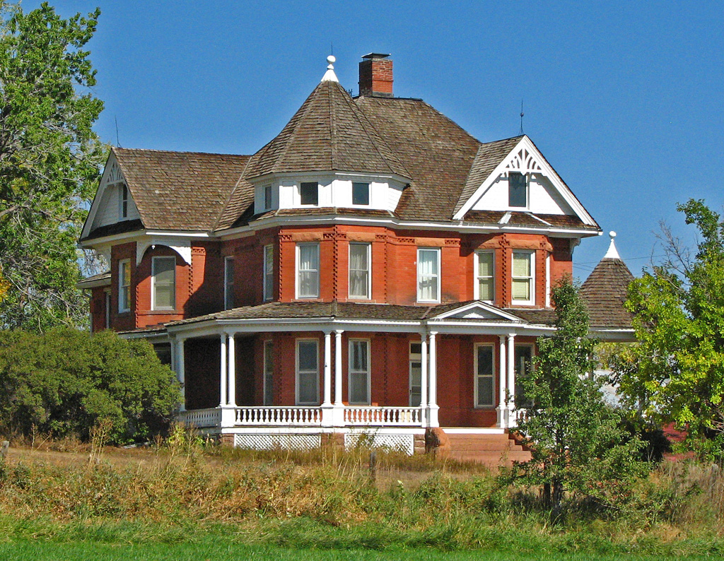
Boulder County Poor Farm
Monument and historic site · National Register of Historic Places · 2.8 mi
Place in Colorado listed on National Register of Historic Places

Colorado Chautauqua
Monument and historic site · National Register of Historic Places · 2.4 mi
Human settlement in Boulder, Colorado, United States of America

Downtown Boulder Historic District
Monument and historic site · National Register of Historic Places · 1.3 mi
Historic district in Boulder, Colorado

Highland School
Monument and historic site · National Register of Historic Places · 1.9 mi
Listed on the National Register of Historic Places in Boulder, Colorado



Norlin Quadrangle Historic District
Monument and historic site · National Register of Historic Places · 1.6 mi
Historic district in Colorado, United States
McKenzie Well
Monument and historic site · National Register of Historic Places · 1.4 mi
Boulder History Museum
Museum · 1.9 mi
History museum in Boulder, Colorado
17 more on the map.
Parks, trails and playgrounds47


Folsom Field
Sports field and stadium · 1.3 mi
Athletics and events stadium, expanded with skyboxes and club seats;campus offices
2085 Colorado Avenue, Boulder
Niwot Ridge
Park · 3.1 mi
Biosphere reserve in United States Of America | designated in 1979

35 more on the map.
Restaurants and cafes310

Boulder Dushanbe Tea House
Restaurant · Asian, Teahouse · 1.5 mi
1770 13th Street, Boulder
Mo-Su 08:00-21:00


The Rayback Collective
Bar and pub · 0.6 mi
Rayback Collective is Boulder's first ever food truck park, a beer garden, and a live music venue
2775 Valmont Road, Boulder
Mo 08:00-20:00; Tu-Fr 08:00-22:00; Sa 10:00-22:00; Su 10:00-20:00
Arabesque
Restaurant · Middle Eastern, Mediterranean · 1.3 mi
1634 Walnut Street, Boulder
Mo-Sa 09:00-15:00

Baby Goat
Cafe · Coffee Shop · 1.4 mi
2907 55th Street, Boulder
Mo-Fr 06:30-17:30; Sa 08:00-15:00; Su 08:00-13:00
Barchetta
Restaurant · Pizza · 1.2 mi
1644 Walnut Street, Boulder
Mo,We,Th,Su 11:00-21:00, Fr,Sa 11:00-22:00, Tu off
Bohemian Biergarten
Restaurant · Austrian, German, Hungarian, Polish, Czech · 1.5 mi
2017 13th Street, Boulder
Su-Th 11:30-22:00; Fr-Sa 11:30-23:00
Boxcar Coffee Roasters
Cafe · Coffee Shop · 1.1 mi
1825 Pearl Street
Mo-Sa 07:00-16:00; Su 08:00-16:00
298 more on the map.
History
Archaeological evidence shows that Boulder Valley has been continuously inhabited by Native American tribes for over 13,000 years, beginning in the late Pleistocene era. Between 9500 BC and 1550 AD, indigenous peoples moved seasonally between the mountains and plains, taking shelter in winter along the Front Range trough where Boulder now lies. By the 1500s, the Ute people held primary occupation of Boulder Valley. In the early 1800s, the Arapaho migrated to the region. Additional Native American nations with historical ties to the broader Front Range include the Apache, Arapaho, Cheyenne, Comanche, Kiowa, Pawnee, Shoshone, Sioux, and Ute peoples. In the 1800s, European Americans settled in the area.
From the History section of Boulder, Colorado on Wikipedia, under CC BY-SA 4.0.
Where to stay15
Hotel Boulderado
Motel and hotel · National Register of Historic Places · 1.5 mi
2115 13th Street, Boulder
Churches and places of worship18
First Baptist Church of Boulder
Church · National Register of Historic Places · 1.5 mi
Bethel United Methodist Church
Church · Methodist · 1.3 mi
1925 Glenwood Drive, Boulder
Saint Andrew Presbyterian Church
Church · Presbyterian · 1.8 mi
3700 Baseline Road, Boulder
Shopping89
Gas and EV charging31
Schools, colleges and libraries49
Boulder Public Library Carnegie Branch of Local History
Library · 1.7 mi
1109 Pine Street, Boulder
Healthcare15
Map of Boulder
250 places. The map loads OpenStreetMap tiles when you open it.
People and cost of living
American Community Survey 5-year estimates, 2020-2024, U.S. Census Bureau. Estimates have margins of error, larger for small towns.
Disaster history
Boulder County has had 17 federal disaster declarations since 2000, most often for fires.
- 2024-07-31: Stone Mountain Fire (Fire)
- 2021-12-31: Wildfires And Straight-Line Winds (Fire)
- 2021-12-30: Marshall Fire (Fire)
- 2020-10-17: Calwood Fire (Fire)
- 2020-03-28: Covid-19 Pandemic (Biological)
- 2020-03-13: Covid-19 (Biological)
OpenFEMA disaster declarations summaries.
Getting there and nearby towns
Boulder Municipal Airport (WBU) is the nearest airport with scheduled flights listed in OpenStreetMap, 2 miles away.
- Gunbarrel 5 mi northeast, about 8 min by car
- Louisville 7 mi southeast, about 11 min by car
- Lafayette 8 mi east, about 13 min by car
- Superior 8 mi southeast, about 13 min by car
- Erie 11 mi east, about 18 min by car
- Broomfield 12 mi southeast, about 19 min by car
- Longmont 13 mi northeast, about 20 min by car
- Westminster 14 mi southeast, about 23 min by car
- Arvada 14 mi south, about 23 min by car
- Northglenn 16 mi southeast, about 26 min by car
Drive times are estimates from straight-line distance, not routes.
Local news
Headlines from INDB, the NEMICO news database.
Reviews, tips and questions
Loading what members have shared...
Sources and licences
- NCES EDGE (Public domain): public schools
- OpenFEMA (Public domain): disaster declarations
- OpenStreetMap contributors (ODbL 1.0): places, airports, map data
- U.S. Census Bureau (Public domain): population, income, housing, education, commute
- Wikidata (CC0 1.0): elevation, founding date, time zone, website, landmarks and historic places
- Wikimedia Commons (see each image): photos
- Wikipedia (CC BY-SA 4.0): overview and history text
Photo credits
- BoulderBearPeak, Gtj82 at English Wikipedia, Public domain
- USPS Boulder 1, Elkman, CC BY-SA 3.0
- Fiske Planetarium (2022), Nwest21, CC BY-SA 4.0
- Carnegie Library Boulder CO, Hustvedt, CC BY-SA 3.0
- Boulderado Hotel exterior, Kvng, CC BY-SA 3.0
- Colorado Chautauqua Auditorium Boulder CO, Hustvedt, CC BY-SA 3.0
- First Baptist Church of Boulder Boulder CO, Hustvedt, CC BY-SA 3.0
- Once the Boulder County Poor Farm, dok1 Don O'Brien, CC BY 2.0
- Chautauqua auditorium, Laura Scudder, CC BY-SA 3.0
- Boulder Creek Signage and Bridge, Violin Theory, CC BY-SA 3.0
- Highland School Boulder Colorado USA, Hustvedt, CC BY-SA 3.0
- Woodbury Arts and Sciences building, Gribeco, CC BY-SA 3.0
- Arnett Fullen house, Jooojay, CC BY-SA 4.0

Page built October 30, 2026. Spotted a mistake? Tell us or suggest a place.