


Bridgeport, Connecticut
Bridgeport is a city of 149,153 people in Connecticut, founded in 1821.
Why visit Bridgeport
Townapedia lists 76 museums and landmarks, 57 parks and trails, 196 places to eat, 1 place to stay and 13 attractions in and around town.
Highlights include The Bijou Theatre, Beardsley Zoological Gardens, Barnum/Palliser Historic District and Bassickville Historic District.
July is the warmest month, with average highs of 83°F; January lows average 24°F, and about 34 inches of snow fall in a normal year.
Weather in Bridgeport
Forecast from the National Weather Service. Full forecast
About Bridgeport
Bridgeport is the most populous city in the U.S. state of Connecticut. The population was 148,654 in 2020, making it the fifth-most populous city in New England. It is a port city in eastern Fairfield County at the mouth of the Pequonnock River on Long Island Sound, 60 miles (97 km) from Manhattan and 40 miles (64 km) from The Bronx. Bridgeport and other towns in Fairfield County make up the Greater Bridgeport Planning Region, as well as the Bridgeport–Stamford–Norwalk–Danbury metropolitan statistical area, the second largest metropolitan area in Connecticut and a component of the greater New York metropolitan area.
From the Wikipedia article Bridgeport, Connecticut (this version), under CC BY-SA 4.0.
Things to do13



Fairfield University
School · 4.9 mi
University located in Fairfield, Connecticut
Regina A. Quick Center for the Arts
Cinema and theater · 3.6 mi
University arts center in Fairfield, Connecticut


1 more on the map.
Museums and landmarks76

Barnum/Palliser Historic District
Monument and historic site · National Register of Historic Places · 1.5 mi
Historic district in Connecticut, United States
Bassickville Historic District
Monument and historic site · National Register of Historic Places · 1.4 mi
Historic district in Connecticut, United States
Black Rock Gardens Historic District
Monument and historic site · National Register of Historic Places · 2.6 mi
Area in Bridgeport, Connecticut, US

Black Rock Historic District
Monument and historic site · National Register of Historic Places · 2.7 mi
Historic district in Bridgeport, Connecticut
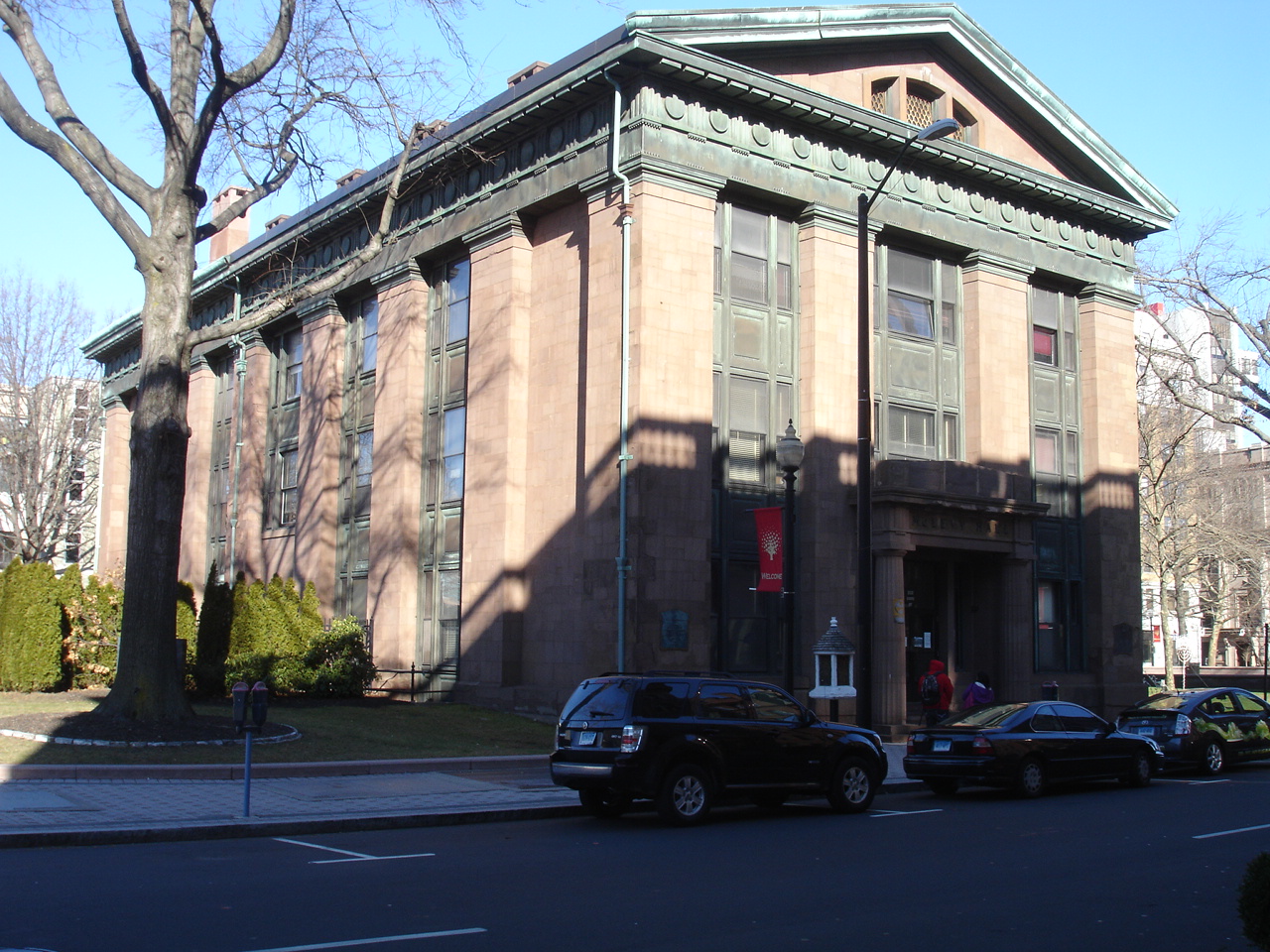
Bridgeport City Hall
Monument and historic site · National Register of Historic Places · 0.8 mi
Rathaus in Connecticut, United States of America
45 Lyon Terrace, Bridgeport
Bridgeport Downtown North Historic District
Monument and historic site · National Register of Historic Places · 0.6 mi
Historic district in Connecticut, United States
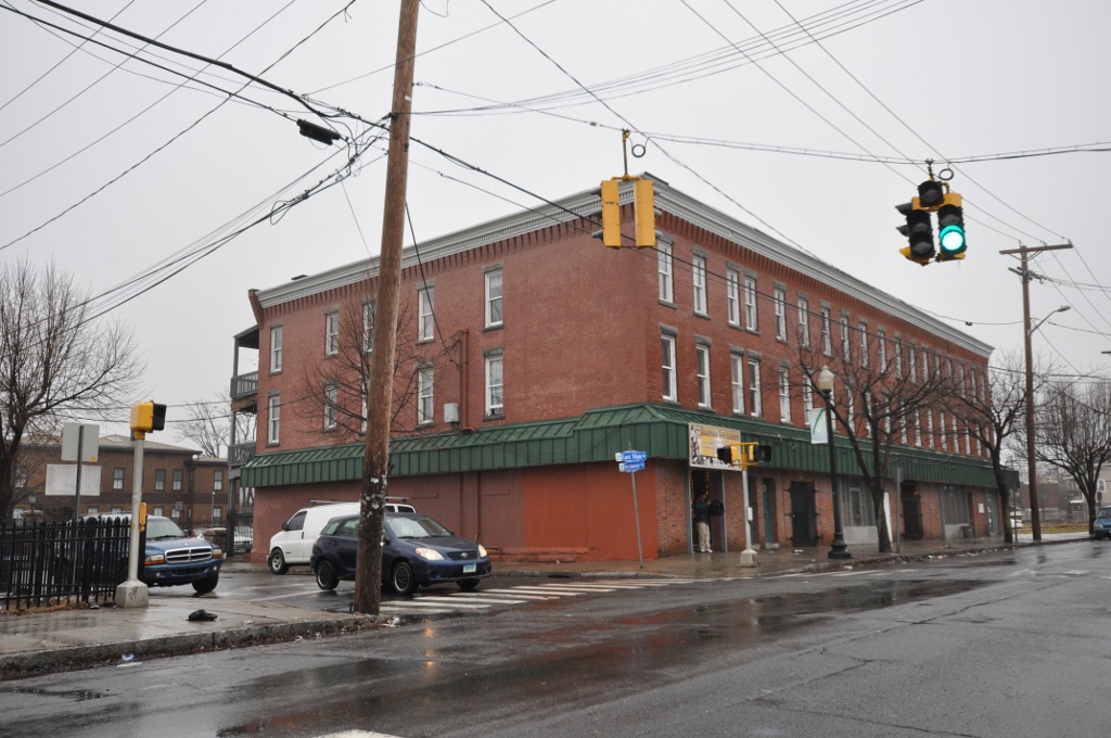
East Main Street Historic District
Monument and historic site · National Register of Historic Places · 0.8 mi
Historic district in Connecticut, United States
Gateway Village Historic District
Monument and historic site · National Register of Historic Places · 2.0 mi
Historic district in Bridgeport, Connecticut
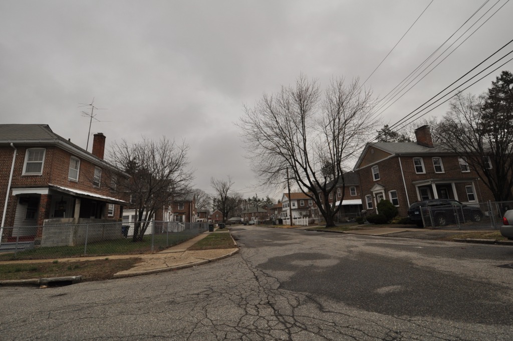
Lakeview Village Historic District
Monument and historic site · National Register of Historic Places · 1.2 mi
Park in Fairfield County, Connecticut, United States of America
Marina Park Historic District
Monument and historic site · National Register of Historic Places · 1.7 mi
Park in Fairfield County, Connecticut, United States of America


Nathaniel Wheeler Memorial Fountain
Monument and historic site · National Register of Historic Places · 0.9 mi
Sculpture in Connecticut, United States of America
Remington City Historic District
Monument and historic site · National Register of Historic Places · 1.6 mi
Park in Fairfield County, Connecticut, United States of America
64 more on the map.
Parks, trails and playgrounds57



45 more on the map.
Restaurants and cafes196

LC Chen's
Restaurant · Asian · 2.3 mi
303 Tunxis Hill Cut Off, Fairfield
Mo-Th 11:00-22:00; Fr-Sa 11:00-23:00; Su 12:00-22:00
Mainport Fish & Chips
Restaurant · Fish And Chips
1010 North Avenue, Bridgeport
Mo-Su 00:00-05:00,09:30-24:00
O'Manel Restaurant
Restaurant · Portuguese
1909 Main Street, Bridgeport
Mo-Su 12:00-21:00; Fr,Sa 12:00-23:00
Pizza Mediterranean
Restaurant · Pizza · 2.5 mi
1557 Black Rock Turnpike, Fairfield
Su-Th 11:00-22:00; Fr-Sa 11:00-23:00
Sally's Apizza
Restaurant · Pizza · 2.6 mi
665 Commerce Drive, Fairfield
Mo-Th 16:30-21:00; Fr 16:30-22:00; Sa 11:30-22:00; Su 11:30-21:00
The Post
Restaurant · Pizza · 1.8 mi
200 Tunxis Hill Road, Fairfield
Mo 04:00-21:00; Tu-Th 11:00-20:30; Fr-Sa 11:00-22:00; Su 12:00-20:30

Alina's Patisserie
Bakery · 2.5 mi
1525 Black Rock Turnpike, Fairfield
Mo off; Tu-Fr 09:00-18:00; Sa 08:00-18:00; Su 08:00-14:00
Mac n' Out
Restaurant · Macaroni And Cheese · 1.9 mi
690 Beechmont Avenue, Bridgeport
Su-Th 11:00-21:00; Fr-Sa 11:00-22:00

Beijing
Restaurant · Chinese · 1.7 mi
131 Tunxis Hill Rd, Fairfield
Mo-Th 11:00-22:30; Fr 11:00-23:00; Sa 16:00-23:00; Su 17:00-22:00
184 more on the map.
History
Bridgeport was inhabited by the Paugussett Native American tribe during the start of European colonization. The earliest European communal settlement was in the historical Stratfield district, along US Route 1, known in colonial times as the King's Highway. Close by, Mount Grove Cemetery was laid out on what was a native village that extended past the 1650s. It is also an ancient Paugussett burial ground.
The burgeoning farming community grew and became a center of trade, shipbuilding, and whaling. The town was incorporated to subsidize the Housatonic Railroad and rapidly industrialized following the rail line's connection to the New York and New Haven railroad. The town was given its name because of the need for bridges over the Pequonnock River that provided a navigable port at the mouth of the river. Manufacturing was the mainstay of the local economy until the 1970s.
From the History section of Bridgeport, Connecticut on Wikipedia, under CC BY-SA 4.0.
Where to stay1
Churches and places of worship138
First Baptist Church
Church · Baptist · National Register of Historic Places · 0.8 mi
United Congregational Church
Church · United Church Of Christ · National Register of Historic Places · 0.9 mi
St. John's Episcopal Church
Church · National Register of Historic Places · 0.9 mi
Congregation B'nai Israel
Place of worship · Reform · 1.2 mi
2710 Park Avenue, Bridgeport
Ephraim French Seventh-day Adventist Church
Church · Seventh Day Adventist · 0.7 mi
1541 Iranistan Avenue, Bridgeport
Shopping39
Gas and EV charging28
Schools, colleges and libraries96
Saint Andrew Catholic Academy of Bridgeport
School · Roman Catholic · 2.6 mi
395 Anton Street, Bridgeport
Saint Ann Catholic Academy of Bridgeport
School · Roman Catholic · 2.7 mi
521 Brewster Street, Bridgeport
Healthcare24
Black Rock Pharmacy
Clinic and pharmacy · 2.7 mi
1838 Black Rock Turnpike, Fairfield
Map of Bridgeport
250 places. The map loads OpenStreetMap tiles when you open it.
Climate by month
Monthly table
| Month | High | Low | Rain | Snow |
|---|---|---|---|---|
| Jan | 38°F | 24°F | 3.2 in | 8.5 in |
| Feb | 40°F | 26°F | 3.1 in | 10.7 in |
| Mar | 47°F | 32°F | 4.1 in | 7.0 in |
| Apr | 58°F | 42°F | 4.2 in | 0.9 in |
| May | 68°F | 52°F | 3.6 in | 0.0 in |
| Jun | 78°F | 62°F | 3.8 in | 0.0 in |
| Jul | 83°F | 68°F | 3.3 in | 0.0 in |
| Aug | 82°F | 67°F | 4.0 in | 0.0 in |
| Sep | 75°F | 60°F | 4.0 in | 0.0 in |
| Oct | 64°F | 48°F | 3.8 in | 0.1 in |
| Nov | 54°F | 38°F | 3.1 in | 0.9 in |
| Dec | 44°F | 30°F | 4.0 in | 5.5 in |
U.S. Climate Normals 1991-2020 for Bridgeport Sikorsky Mem Ap 72504 (4 mi away), NOAA NCEI.
People and cost of living
American Community Survey 5-year estimates, 2020-2024, U.S. Census Bureau. Estimates have margins of error, larger for small towns.
Disaster history
The county has had 25 federal disaster declarations since 2000, most often for hurricanes.
- 2024-09-20: Severe Storm, Flooding, Landslides, And Mudslides (Severe Storm)
- 2024-08-21: Severe Storms, Flooding, Landslides, And Mudslides (Severe Storm)
- 2021-10-30: Remnants Of Hurricane Ida (Hurricane)
- 2021-08-22: Hurricane Henri (Hurricane)
- 2021-01-12: Tropical Storm Isaias (Hurricane)
- 2020-08-06: Tropical Storm Isaias (Hurricane)
OpenFEMA disaster declarations summaries.
Getting there and nearby towns
Igor I. Sikorsky Memorial Airport (BDR) is the nearest airport with scheduled flights listed in OpenStreetMap, 4 miles away.
- Trumbull Center 4 mi north, about 6 min by car
- Milford city (balance) 7 mi east, about 12 min by car
- Shelton 9 mi north, about 14 min by car
- Orange 11 mi northeast, about 18 min by car
- Derby 11 mi northeast, about 18 min by car
- Norwalk 13 mi southwest, about 22 min by car
- West Haven 13 mi northeast, about 21 min by car
- Ansonia 13 mi northeast, about 20 min by car
- New Haven 16 mi northeast, about 26 min by car
- Bethel 16 mi northwest, about 26 min by car
Drive times are estimates from straight-line distance, not routes.
Local news
Headlines from INDB, the NEMICO news database.
Reviews, tips and questions
Loading what members have shared...
Sources and licences
- NCES EDGE (Public domain): public schools
- NOAA NCEI U.S. Climate Normals 1991-2020 (Public domain): climate by month
- OpenFEMA (Public domain): disaster declarations
- OpenStreetMap contributors (ODbL 1.0): places, airports, map data
- U.S. Census Bureau (Public domain): population, income, housing, education, commute
- Wikidata (CC0 1.0): elevation, founding date, time zone, website, landmarks and historic places
- Wikimedia Commons (see each image): photos
- Wikipedia (CC BY-SA 4.0): overview and history text
Photo credits
- Bridgeport, Connecticut downtown, Quintin Soloviev, CC BY 4.0
- Greetings from Bridgeport, Connecticut - Large Letter Postcard (8571756694), Steve Shook from Moscow, Idaho, USA, CC BY 2.0
- Ping-pong at Bridgeport JCC Youth Conference, February 26, 1947 (4710047477), Center for Jewish History, NYC, No restrictions
- Bridgeport, Connecticut - Large Letter Postcard (4237349758), Steve Shook from Moscow, Idaho, USA, CC BY 2.0
- Youth conference activities, Bridgeport, Conn., circa 1950 (4351404743), Center for Jewish History, NYC, No restrictions
- Court House, Bridgeport, Conn. (2382370360), Boston Public Library, CC BY 2.0
- Harbor view, Bridgeport, Conn. (2382370646), Boston Public Library, CC BY 2.0
- Main Street south, showing Financial District, Bridgeport, Conn. (2381536599), Boston Public Library, CC BY 2.0
- Birdseye view Main Street, Bridgeport, Conn. (2382371566), Boston Public Library, CC BY 2.0
- Fairfield Avenue, looking west, Bridgeport, Conn. (2381537199), Boston Public Library, CC BY 2.0
- Public Library, Bridgeport, Conn. (2381537787), Boston Public Library, CC BY 2.0
- General Electric Buildings, Bridgeport, Conn. (2382352374), Boston Public Library, CC BY 2.0
- Bird's eye view, showing Business Section, Bridgeport, Conn. (2382368876), Boston Public Library, CC BY 2.0
- Plaza and Bridgeport Harbor, Bridgeport, Conn. (2381536307), Boston Public Library, CC BY 2.0
- R. R. Station, N.Y., N.H.&H. R. R., Bridgeport, Conn. (2382368320), Boston Public Library, CC BY 2.0
- South Main Street, Bridgeport, Conn. (2382369432), Boston Public Library, CC BY 2.0
- Housatonic Rail Trail Bridgeport 047, Pedro Xing, CC0
- Edinburgh Crescent - Bridgeport, Connecticut, Farragutful, CC BY-SA 4.0
- St. Augustine Academy - Bridgeport, Connecticut, Farragutful, CC BY-SA 4.0
- St. Augustine Cathedral interior - Bridgeport, Connecticut 11, Farragutful, CC BY-SA 4.0
- St. Augustine Cathedral interior - Bridgeport, Connecticut 10, Farragutful, CC BY-SA 4.0
- St. Augustine Cathedral interior - Bridgeport, Connecticut 01, Farragutful, CC BY-SA 4.0
- St. Augustine Cathedral interior - Bridgeport, Connecticut 17, Farragutful, CC BY-SA 4.0
- St. Augustine Cathedral interior - Bridgeport, Connecticut 07, Farragutful, CC BY-SA 4.0
- St. Augustine Cathedral interior - Bridgeport, Connecticut 08, Farragutful, CC BY-SA 4.0
- St. Augustine Cathedral - Bridgeport, Connecticut 10, Farragutful, CC BY-SA 4.0
- St. Augustine Cathedral interior - Bridgeport, Connecticut 02, Farragutful, CC BY-SA 4.0
- St. Augustine Cathedral - Bridgeport, Connecticut 06, Farragutful, CC BY-SA 4.0
- St. Augustine Cathedral - Bridgeport, Connecticut 01, Farragutful, CC BY-SA 4.0
- St. Augustine Cathedral - Bridgeport, Connecticut 09, Farragutful, CC BY-SA 4.0
- St. Augustine Cathedral interior - Bridgeport, Connecticut 15, Farragutful, CC BY-SA 4.0
- Bridgeport Islamic Community Center, Kenneth C. Zirkel, CC BY 4.0
- Nathaniel Wheeler Memorial Fountain, Kenneth C. Zirkel, CC BY 4.0
- First Baptist Church (Bridgeport, Connecticut), Kenneth C. Zirkel, CC BY 4.0
- BridgeportCityHall 2, KForce ( talk ) ( Uploads ), CC BY-SA 3.0
- BridgeportCT EastMainStreetHD, User:Magicpiano, CC BY-SA 4.0
- BridgeportCT LakeviewVillageHD 2, User:Magicpiano, CC BY-SA 4.0
- BridgeportCT BlackRockHD JohnWheelerHouse, User:Magicpiano, CC BY-SA 4.0
- BridgeportCT SeasidePark PerryMemorialArch, User:Magicpiano, CC BY-SA 4.0
- BridgeportCT RemingtonVillageHD, User:Magicpiano, CC BY-SA 4.0


Page built October 30, 2026. Spotted a mistake? Tell us or suggest a place.