


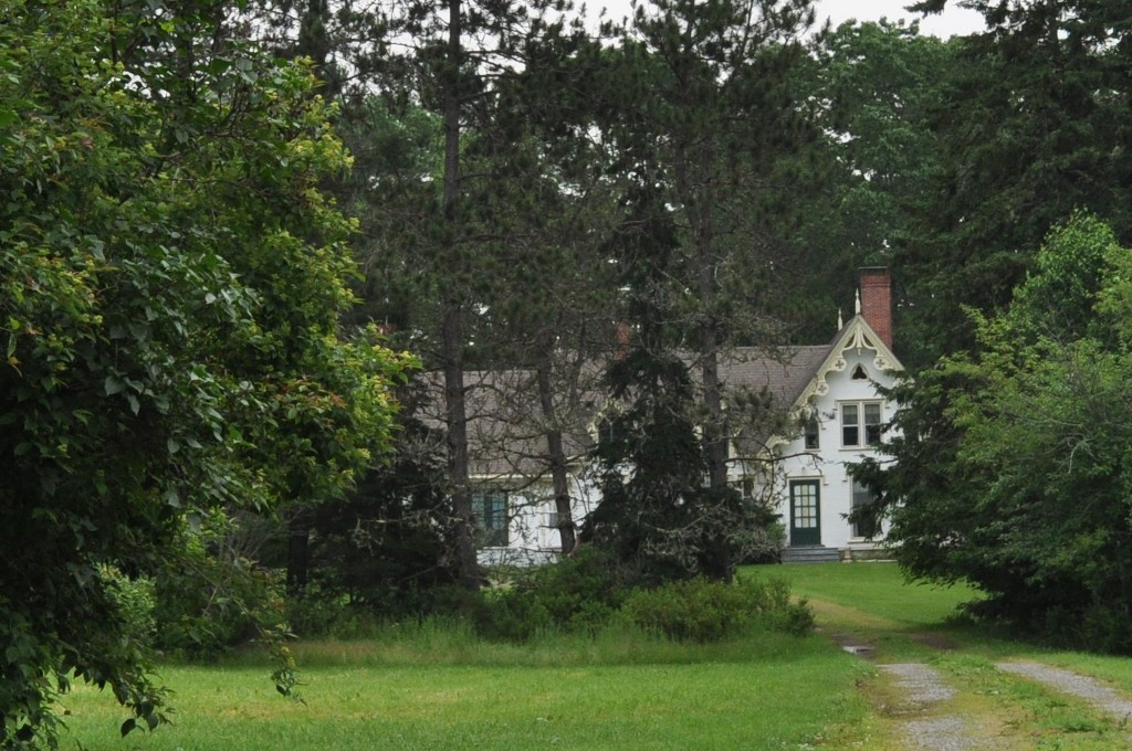

Calais, Maine
Calais is a city of 3,097 people in Washington County, Maine, founded in 1779.
Why visit Calais
Townapedia lists 19 museums and landmarks, 12 parks and trails, 19 places to eat, 3 places to stay and 14 attractions in and around town.
Highlights include Whitlocks Mill Light, State Cinemas, Calais Free Library and Calais Historic District.
July is the warmest month, with average highs of 77°F; January lows average 11°F, and about 95 inches of snow fall in a normal year.
Weather in Calais
Forecast from the National Weather Service. Full forecast
About Calais
Calais (; similar to the word "callous") is a city in Washington County, Maine, United States. As of the 2020 census, it had a population of 3,079, making Calais the largest municipality by population in Washington County, but the third least-populous city in Maine (after Hallowell and Eastport). The city has three Canada–US border crossings (known as ports of entry) over the St. Croix River connecting to St. Stephen, New Brunswick, Canada.
From the Wikipedia article Calais, Maine (this version), under CC BY-SA 4.0.
Things to do14

Whitlocks Mill Light
Lighthouse · National Register of Historic Places · 1.4 mi
Lighthouse in Maine, United States


Ferry Point International Bridge
Bridge · 4.6 mi
Bridge in St. Stephen, New Brunswick

International Avenue Bridge
Bridge · 4.3 mi
Bridge in St. Stephen, New Brunswick
Milltown International Bridge
Bridge · 4.3 mi
Bridge in St. Stephen, New Brunswick
Saint Croix River Light
Lighthouse · 4.2 mi
Lighthouse in Maine, United States


2 more on the map.
Museums and landmarks19

Calais Free Library
Monument and historic site · National Register of Historic Places · 4.3 mi
Public library in Calais, Maine, U.S

Calais Historic District
Monument and historic site · National Register of Historic Places · 4.3 mi
Historic district in Maine, United States

Calais Observatory
Monument and historic site · National Register of Historic Places · 4.2 mi

Calais Residential Historic District
Monument and historic site · National Register of Historic Places · 4.0 mi
Historic district in Maine, United States

Dr. Job Holmes House
Monument and historic site · National Register of Historic Places · 4.1 mi
Calais, Maine, listed on the NRHP in Washington County

George Washburn House
Monument and historic site · National Register of Historic Places · 3.6 mi
House in Calais, Maine, USA
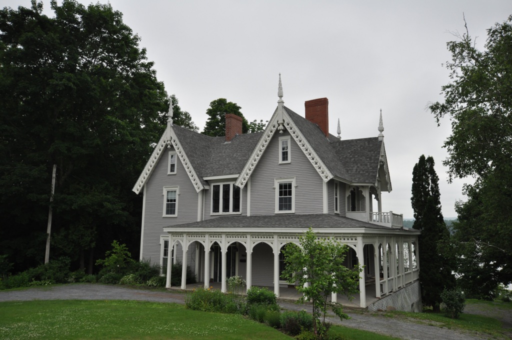
Gilmore House
Monument and historic site · National Register of Historic Places · 3.6 mi
Listed on the National Register of Historic Places (NRHP) in Washington County, Maine

Henrietta Brewer House
Monument and historic site · National Register of Historic Places · 6.6 mi
Robbinston, Maine, NRHP-listed

Hinckley Hill Historic District
Monument and historic site · National Register of Historic Places · 3.6 mi
Historic district in Maine, United States

Holmes Cottage
Monument and historic site · National Register of Historic Places · 4.1 mi
Historic house at 521 Main Street in Calais, Maine


John N.M. Brewer House
Monument and historic site · National Register of Historic Places · 6.7 mi
Historic house in Maine, United States

Joshua Pettegrove House
Monument and historic site · National Register of Historic Places · 3.7 mi
Historic house in the Red Beach area of Calais, Maine, United States
7 more on the map.
Parks, trails and playgrounds12



Saint Croix Island International Historic Site
Park · 3.8 mi
The US public interpretive area for Saint Croix Island.

Restaurants and cafes19

Game Time Sports Bar
Bar and pub · 4.5 mi
1 Milltown Boulevard, St. Stephen
Su-We 10:00-24:00; Th-Sa 10:00-02:30

Diner 81
Restaurant · Korean, Sushi · 4.7 mi
124 King Street, St. Stephen
We-Sa 11:30-19:30; Su-Tu 11:30-19:00
Carman's Diner
Restaurant · Regional · 4.8 mi
164 King Street, St. Stephen
Golden Chinese Restaurant
Restaurant · Chinese · 4.5 mi
43 Milltown Boulevard, St. Stephen
Sia's Kitchen
Restaurant · Indian · 4.5 mi
26 King Street, St. Stephen


7 more on the map.
History
This area was occupied for thousands of years by indigenous peoples. The historic Passamaquoddy, an Algonquian-speaking people of the Wabanaki Confederacy, was predominant in this area at the time of European encounter and settlement.
The St. Croix River and its area were first explored by the French Samuel de Champlain when he and his men spent a winter on St. Croix Island in 1604. The first permanent settler was Daniel Hill of Jonesboro, who arrived in 1779 during the American Revolutionary War, when this was still part of Massachusetts. With other settlers, he built the first sawmill in 1782. On June 27, 1789, the Massachusetts General Court sold the township to Waterman Thomas for 19¢ an acre (0.4 hectares) (approx. $2.86 an acre in 2018 dollars). Early occupations in the settlement included farming, hunting and ship building.
On June 16, 1809, Plantation Number 5 PS was incorporated as Calais after Calais, France, in honor of French assistance during the American Revolution. The river provided the mill town with water power for industry, which included sawmills, clapboard and shingle mills, two planing mills, a saw factory, two axe factories and four grain mills. There were foundries, machine shops, granite works, shoe factories and a tannery. Other businesses produced bricks, bedsteads, brooms, carriages and plaster.
From the History section of Calais, Maine on Wikipedia, under CC BY-SA 4.0.
Where to stay3
Churches and places of worship20
St. Anne's Episcopal Church
Church · Episcopal · National Register of Historic Places · 4.2 mi
29 Church Street, Calais
Grace Episcopal Church
Church · National Register of Historic Places · 6.4 mi
Sewall Memorial Congregational Church
Church · National Register of Historic Places · 6.6 mi
Immaculate Conception Catholic Church
Church · Roman Catholic · 4.2 mi
31 Calais Avenue, Calais
Milltown Baptist Church
Church · Baptist · 4.8 mi
327 Milltown Boulevard, St. Stephen
St. Stephen Catholic Church
Church · Catholic · 4.5 mi
407 Milltown Boulevard, St. Stephen
Shopping7
Element 506 Made Local Boutique
Shop · 4.6 mi
182 Milltown Boulevard, St. Stephen
Gas and EV charging8
Schools, colleges and libraries9
St Croix Regional Technical Center
School · 1.9 mi
34 Blue Devil Hill Suite 1, Calais
Healthcare3
Map of Calais
114 places. The map loads OpenStreetMap tiles when you open it.
Climate by month
Monthly table
| Month | High | Low | Rain | Snow |
|---|---|---|---|---|
| Jan | 29°F | 11°F | 4.8 in | 24.8 in |
| Feb | 32°F | 13°F | 4.2 in | 21.9 in |
| Mar | 40°F | 22°F | 4.8 in | 18.9 in |
| Apr | 51°F | 32°F | 4.4 in | 6.0 in |
| May | 62°F | 41°F | 4.3 in | 0.2 in |
| Jun | 71°F | 50°F | 4.1 in | 0.0 in |
| Jul | 77°F | 56°F | 3.2 in | 0.0 in |
| Aug | 77°F | 56°F | 3.5 in | 0.0 in |
| Sep | 69°F | 49°F | 4.2 in | 0.0 in |
| Oct | 57°F | 39°F | 5.4 in | 0.3 in |
| Nov | 45°F | 30°F | 5.5 in | 3.6 in |
| Dec | 34°F | 19°F | 6.3 in | 19.3 in |
U.S. Climate Normals 1991-2020 for Robbinston (6 mi away), NOAA NCEI.
People and cost of living
American Community Survey 5-year estimates, 2020-2024, U.S. Census Bureau. Estimates have margins of error, larger for small towns.
Disaster history
Washington County has had 18 federal disaster declarations since 2000, most often for severe storms.
- 2024-03-20: Severe Storms And Flooding (Severe Storm)
- 2024-01-30: Severe Storm And Flooding (Severe Storm)
- 2023-09-14: Hurricane Lee (Hurricane)
- 2020-04-04: Covid-19 Pandemic (Biological)
- 2020-03-13: Covid-19 (Biological)
- 2013-03-25: Severe Winter Storm, Snowstorm, And Flooding (Severe Storm)
OpenFEMA disaster declarations summaries.
Getting there and nearby towns
Princeton Municipal Airport (PNN) is the nearest airport with scheduled flights listed in OpenStreetMap, 17 miles away.
- Woodland 9 mi west, about 15 min by car
- Eastport 19 mi southeast, about 31 min by car
- Machias 33 mi southwest, about 53 min by car
- Jonesport 46 mi southwest, about 1 h 15 min by car
- Danforth 48 mi northwest, about 1 h 15 min by car
- Milbridge 54 mi southwest, about 1 h 30 min by car
Drive times are estimates from straight-line distance, not routes.
Local news
Headlines from INDB, the NEMICO news database.
Reviews, tips and questions
Loading what members have shared...
Sources and licences
- NCES EDGE (Public domain): public schools
- NOAA NCEI U.S. Climate Normals 1991-2020 (Public domain): climate by month
- OpenFEMA (Public domain): disaster declarations
- OpenStreetMap contributors (ODbL 1.0): places, airports, map data
- U.S. Census Bureau (Public domain): population, income, housing, education, commute
- Wikidata (CC0 1.0): elevation, founding date, time zone, website, landmarks and historic places
- Wikimedia Commons (see each image): photos
- Wikipedia (CC BY-SA 4.0): overview and history text
Photo credits
- Calais ME, P199, CC BY-SA 3.0
- CalaisME TheodoreJellisonHouse, Magicpiano, CC BY-SA 3.0
- CalaisME ThomasHamiltonHouse, Magicpiano, CC BY-SA 3.0
- CalaisME McGlashanNickersonHouse, Magicpiano, CC BY-SA 3.0
- CalaisME JonathanPettegroveHouse, Magicpiano, CC BY-SA 3.0
- St Anne's Episcopal Church, Calais, Maine, Ken Gallager, CC BY-SA 3.0
- Hinckley Hill HD, Calais, Maine 2012, Ken Gallager, CC BY-SA 3.0
- Calais Historic District, Maine, Ken Gallager, CC BY-SA 3.0
- John Brewer House, Robbinston, Maine 2012, Ken Gallager, CC BY-SA 3.0
- Grace Episcopal Church, Robbinston, Maine 2012, Ken Gallager, CC BY-SA 3.0
- CalaisME 764RiverRoad, User:Magicpiano, CC BY-SA 4.0
- RobbinstonME SewallCongChurch, Magicpiano, CC BY-SA 3.0
- Calais Free Library, Ken Gallager, CC BY-SA 3.0
- Holmestead, Calais, Maine 2012, Ken Gallager, CC BY-SA 3.0
- Calais Residential Historic District, Maine1, Ken Gallager, CC BY-SA 3.0
- Holmes Cottage, Calais, Maine 2012, Ken Gallager, CC BY-SA 3.0
- RobbinstonME TheMansion, Magicpiano, CC BY-SA 3.0
- RobbinstonME HenriettaBrewerHouse, Magicpiano, CC BY-SA 3.0
- CalaisME 772RiverRoad, User:Magicpiano, CC BY-SA 4.0
- CastineME Observatory, Magicpiano, CC BY-SA 3.0
- CalaisME FerryPointBridge, User:Magicpiano, CC BY-SA 4.0
- Whitlocks Mill Light (5539983858), J Labrador from Huntsville, TX, USA, CC BY 2.0
- Upper Magurrewock dam and fish spillway at Moosehorn National Wildlife Refuge (ME) (19733986449), U. S. Fish and Wildlife Service - Northeast Region, Public domain
- Dike near Upper Magurrewock Spillway at Moosehorn National Wildlife Refuge (ME) (19913107692), U. S. Fish and Wildlife Service - Northeast Region, Public domain
- Magurrewock Dike and Spillway Project, Moosehorn National Wildlife Refuge (ME) (22048683481), U. S. Fish and Wildlife Service - Northeast Region, Public domain
- Upper Magurrewock dam wall at Moosehorn National Wildlife Refuge (ME) (19733986789), U. S. Fish and Wildlife Service - Northeast Region, Public domain
- Upper Magurrewock impoundment, dam and spillway at Moosehorn National Wildlife Refuge (ME) (19299693923), U. S. Fish and Wildlife Service - Northeast Region, Public domain
- ISS036-E-33350 - View of Earth, Earth Science and Remote Sensing Unit , Lyndon B. Johnson Space Center, Public domain
- ISS036-E-33349 - View of Earth, Earth Science and Remote Sensing Unit , Lyndon B. Johnson Space Center, Public domain
- ISS030-E-12581 - View of Earth, Earth Science and Remote Sensing Unit , Lyndon B. Johnson Space Center, Public domain
- ISS036-E-33511 - View of Earth, Earth Science and Remote Sensing Unit , Lyndon B. Johnson Space Center, Public domain
- Spruce grouse at Moosehorn National Wildlife Refuge. Credit- USFWS (11713901455), U. S. Fish and Wildlife Service - Northeast Region, Public domain
- River otter in the winter at Moosehorn National Wildlife Refuge. Credit- USFWS (11714269014), U. S. Fish and Wildlife Service - Northeast Region, Public domain
- Winter at Moosehorn (11714166893), U. S. Fish and Wildlife Service - Northeast Region, Public domain
- Moosehorn in spring (11713899075), U. S. Fish and Wildlife Service - Northeast Region, Public domain
- ISS057-E-115401 - View of Earth, Earth Science and Remote Sensing Unit, NASA Johnson Space Center, Public domain
- ISS062-E-144808 - View of Earth, Earth Science and Remote Sensing Unit, NASA Johnson Space Center, Public domain
- ISS043-E-241383 - View of Earth, Earth Science and Remote Sensing Unit , Lyndon B. Johnson Space Center, Public domain
- ISS053-E-245912 - View of Earth, Earth Science and Remote Sensing Unit , Lyndon B. Johnson Space Center, Public domain
- ISS065-E-213370 - View of Earth, Earth Science and Remote Sensing Unit , Lyndon B. Johnson Space Center, Public domain


Page built October 30, 2026. Spotted a mistake? Tell us or suggest a place.