
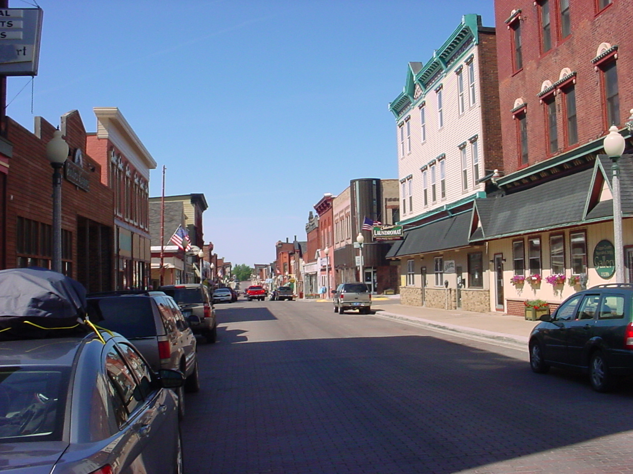


Calumet, Michigan
Calumet is a village of 645 people in Houghton County, Michigan, founded in 1864.
Why visit Calumet
Townapedia lists 18 museums and landmarks, 12 parks and trails, 13 places to eat, 2 places to stay and 2 attractions in and around town.
Highlights include Calumet Theatre, Douglass Houghton Falls, Calumet and Hecla Industrial District and Calumet Downtown Historic District.
July is the warmest month, with average highs of 75°F; February lows average 9°F.
Weather in Calumet
Forecast from the National Weather Service. Full forecast
About Calumet
Calumet is a village in the Upper Peninsula of the U.S. state of Michigan. The village is located within Calumet Township, Houghton County, and had a population of 621 at the 2020 census.
From the Wikipedia article Calumet, Michigan (this version), under CC BY-SA 4.0.
Things to do2

Calumet Theatre
Cinema and theater · National Register of Historic Places
Theater and movie theater in Calumet, Michigan, United States
340 6th Street, Calumet

Douglass Houghton Falls
Waterfall · 3.1 mi
Waterfall in Houghton County, Michigan
Museums and landmarks18

Calumet and Hecla Industrial District
Monument and historic site · National Register of Historic Places · 0.4 mi
Historic district in Michigan, United States
Calumet Downtown Historic District
Monument and historic site · National Register of Historic Places
Historic district in Michigan, United States

Calumet Fire Station
Monument and historic site · National Register of Historic Places
NRHP-listed firehouse in Michigan

Calumet Historic District
Monument and historic site · National Register of Historic Places · 2.2 mi
Historic district in Michigan, United States
Italian Hall
Monument and historic site · National Register of Historic Places
Demolished building in Calumet, Michigan

J. Vivian, Jr. and Company Building
Monument and historic site · National Register of Historic Places · 0.9 mi
Historic building in Laurium, Michigan

Smith-Dengler House
Monument and historic site · National Register of Historic Places · 1.8 mi
Historic house in Michigan, United States

Thomas H. Hoatson House
Monument and historic site · National Register of Historic Places · 1.0 mi
Historic house in Michigan, United States
Upper Peninsula Firefighters Museum
Museum
327 6th Street, Calumet
Mo-Sa 13:00-16:30

Keweenaw National Historical Park, Calumet Unit
Monument and historic site · 0.5 mi
6 more on the map.
Parks, trails and playgrounds12




George Gipp Arena
Sports field and stadium · 1.3 mi
200 Isle Royale Street, Laurium

Restaurants and cafes13



5th & Elm Coffee House
Cafe
501 Elm Street
Mo-Fr 07:00-18:30; Sa 08:00-20:00; Su 12:00-18:00
Calumet Pizza Works
Restaurant
318 5th Street
Su-Th 15:00-22:00; Fr-Sa 15:00-23:00
Camalitas Mexican Restaurant
Restaurant
618 Oak Street
Mo-Fr 11:00-22:00; Sa-Su 08:00-22:00

Copper Country Sweets
Bakery · 0.9 mi
323 Hecla Street, Laurium


Burger King
Fast food · Burger · 0.6 mi
56795 6th Street, Calumet Twp
Mo-Th 06:00-22:00; Fr-Sa 06:00-23:00; Su 07:00-22:00
1 more on the map.
History
What is now Calumet was settled in 1864, originally under the name of Red Jacket, for a Native American Chief of the Seneca tribe. Until 1895 the name "Calumet" was used by the nearby town of Laurium, Michigan; present-day Calumet was not legally named so until 1929.
Red Jacket grew due to the copper mines in the area. It was incorporated as a town in 1867. The copper mines were particularly rich; the Boston-based Calumet and Hecla Mining Company produced more than half of the United States' copper from 1871 through 1880. In addition to copper mining and smelting, the region also supported the dairy industry and truck farming. Many immigrants (from Poland and other countries) settled there in the late 19th century.
From the History section of Calumet, Michigan on Wikipedia, under CC BY-SA 4.0.
Where to stay2
Churches and places of worship10
Shopping7
Gas and EV charging6
Schools, colleges and libraries6
Healthcare2
Map of Calumet
78 places. The map loads OpenStreetMap tiles when you open it.
Climate by month
Monthly table
| Month | High | Low | Rain |
|---|---|---|---|
| Jan | 22°F | 10°F | 2.9 in |
| Feb | 25°F | 9°F | 1.8 in |
| Mar | 34°F | 17°F | 1.5 in |
| Apr | 46°F | 29°F | 2.8 in |
| May | 61°F | 40°F | 3.2 in |
| Jun | 70°F | 49°F | 3.1 in |
| Jul | 75°F | 55°F | 3.3 in |
| Aug | 74°F | 54°F | 2.8 in |
| Sep | 66°F | 47°F | 3.5 in |
| Oct | 52°F | 36°F | 3.4 in |
| Nov | 38°F | 26°F | 3.0 in |
| Dec | 28°F | 16°F | 3.4 in |
U.S. Climate Normals 1991-2020 for Hancock Houghton Co Ap 72744 (6 mi away), rain and snow from Calumet 5.8 Ene, NOAA NCEI.
People and cost of living
American Community Survey 5-year estimates, 2020-2024, U.S. Census Bureau. Estimates have margins of error, larger for small towns.
Disaster history
Houghton County has had 6 federal disaster declarations since 2000, most often for floods.
- 2020-03-27: Covid-19 Pandemic (Biological)
- 2020-03-13: Covid-19 (Biological)
- 2018-08-02: Severe Storms, Flooding, Landslides, And Mudslides (Flood)
- 2013-06-18: Flooding (Flood)
- 2005-09-07: Hurricane Katrina Evacuation (Hurricane)
- 2002-05-06: Flooding (Flood)
OpenFEMA disaster declarations summaries.
Getting there and nearby towns
Houghton County Memorial Airport (CMX) is the nearest airport with scheduled flights listed in OpenStreetMap, 6 miles away.
- Laurium 1 mi southeast, about 2 min by car
- Lake Linden 5 mi southeast, about 8 min by car
- Hubbell 5 mi south, about 8 min by car
- Dollar Bay 8 mi south, about 13 min by car
- Hancock 10 mi southwest, about 16 min by car
- Houghton 11 mi southwest, about 17 min by car
- Chassell 15 mi south, about 24 min by car
- Baraga 32 mi south, about 52 min by car
- L'Anse 34 mi south, about 55 min by car
- Ontonagon 48 mi southwest, about 1 h 15 min by car
Drive times are estimates from straight-line distance, not routes.
Local news
Headlines from INDB.
Reviews, tips and questions
Loading what members have shared...
Sources and licences
- NCES EDGE (Public domain): public schools
- NOAA NCEI U.S. Climate Normals 1991-2020 (Public domain): climate by month
- OpenFEMA (Public domain): disaster declarations
- OpenStreetMap contributors (ODbL 1.0): places, airports, map data
- U.S. Census Bureau (Public domain): population, income, housing, education, commute
- Wikidata (CC0 1.0): elevation, founding date, time zone, website, landmarks and historic places
- Wikimedia Commons (see each image): photos
- Wikipedia (CC BY-SA 4.0): overview and history text
Photo credits
- CALUMET MICHIGAN DSC01842, Catatonique, CC BY-SA 3.0
- Calumet Theatre Calumet MI 2009, Andrew Jameson, CC BY-SA 3.0
- Calumet MI Downtown 5th St A 2009, Andrew Jameson, CC BY-SA 3.0
- J Vivian Jr and Company Building Laurium Michigan 2021-4567, Paul R. Burley, CC BY-SA 4.0
- Smith-Dengler House Houghton County MI 2009, Andrew Jameson, CC BY-SA 3.0
- Thomas H Hoatson House Laurium MI 2009, Andrew Jameson, CC BY-SA 3.0
- Calumet Fire Station Calumet MI 2009, Andrew Jameson, CC BY-SA 3.0
- Calumet Colosseum, Fondycardinals, CC BY-SA 4.0
- DouglassHoughtonFallsMI, Phoenix-Five, CC BY-SA 4.0
Page built November 2, 2026. Spotted a mistake? Tell us or suggest a place.