


Cape Coral, Florida
Cape Coral is a city of 215,536 people in Lee County, Florida, founded in 1957.
Why visit Cape Coral
Townapedia lists 33 museums and landmarks, 85 parks and trails, 218 places to eat, 26 places to stay and 12 attractions in and around town.
Highlights include AMC Merchants Crossing 16, Billy's Creek Bridge, Edison and Ford Winter Estates and Alderman House.
August is the warmest month, with average highs of 92°F; January lows average 54°F.
Weather in Cape Coral
Forecast from the National Weather Service. Full forecast
About Cape Coral
Cape Coral is a city in Lee County, Florida, United States, on the Gulf of Mexico. Founded in 1957, the city's population had grown to 194,016 as of the 2020 census, a 26% increase from 154,309 at the 2010 census, making it the ninth-most populous city in Florida. With an area of 120 square miles (310 km2), Cape Coral is the largest city between Tampa and Miami in both population and area. It is the largest and principal city in the Cape Coral-Fort Myers, Florida Metropolitan Statistical Area.
From the Wikipedia article Cape Coral, Florida (this version), under CC BY-SA 4.0.
Things to do12


Billy's Creek Bridge
Bridge · 8.7 mi
Bridge in Florida, United States of America
Caloosahatchee Bridge
Bridge · 7.6 mi
Bridge in Florida, United States of America
Cape Coral Bridge
Bridge · 7.1 mi
Bridge in Florida, United States of America
Matlacha Bridge
Bridge · 4.4 mi
Bridge in Florida, United States of America
Midpoint Memorial Bridge
Bridge · 6.7 mi
Bridge in Florida, United States of America
Cultural Park Theater
Cinema and theater · 2.4 mi
528 Cultural Park Boulevard, Cape Coral

Museums and landmarks33

Edison and Ford Winter Estates
Museum · 7.3 mi
Historical museum in Fort Myers, Florida, USA
2350 McGregor Boulevard
Mo-Su 09:00-17:30

Alderman House
Monument and historic site · National Register of Historic Places · 8.4 mi
House in Fort Myers, Florida

Archeological Resources of the Caloosahatchee Region MPS
Monument and historic site · National Register of Historic Places · 6.5 mi
Multiple listing in the U.S. National Register of Historic Places

Casa Rio
Monument and historic site · National Register of Historic Places · 7.2 mi
Historic house in Florida, United States

Dean Park Historic Residential District
Monument and historic site · National Register of Historic Places · 8.6 mi
Historic district located at Fort Myers, Florida, USA
Demere Key
Monument and historic site · National Register of Historic Places · 9.1 mi
Island in the United States of America

Edison Park Elementary School
Monument and historic site · National Register of Historic Places · 7.6 mi
Historic school in Fort Myers, Florida, USA
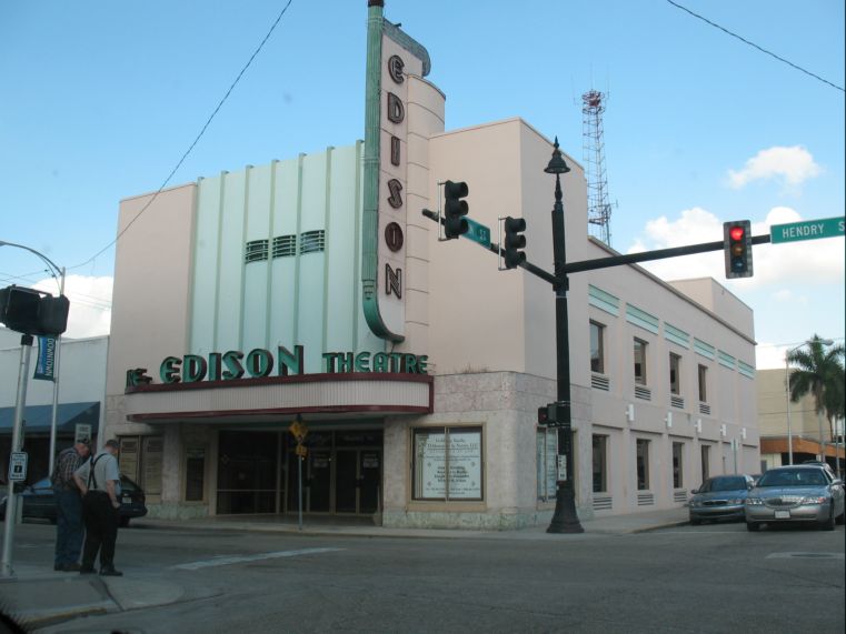
Fort Myers Downtown Commercial District
Monument and historic site · National Register of Historic Places · 8.0 mi
Historic district in Fort Myers, Florida, USA

Gilmer Heitman House
Monument and historic site · National Register of Historic Places · 8.4 mi
Historic house in Fort Myers, Florida, United States

J. Colin English School
Monument and historic site · National Register of Historic Places · 7.3 mi
School and historic school building in North Fort Myers, Florida, USA


Jewett-Thompson House
Monument and historic site · National Register of Historic Places · 7.0 mi
Historic home in Fort Myers, USA
Josslyn Island Site
Monument and historic site · National Register of Historic Places · 9.7 mi
Archaeological site in Lee County, Florida, USA
21 more on the map.
Parks, trails and playgrounds85

Matlacha Pass National Wildlife Refuge
Hiking and trails · 5.2 mi

Burton Memorial Park
Park · 3.5 mi
This 8.5 acre park is home of the Cape Coral Girls’ Softball League for ages 5 to 15 and has also hosted several state softball tournaments.
1502 Northeast 3rd Terrace, Cape Coral
Giuffrida Park
Park · 3.0 mi
This 3.7 acre park was the first neighborhood park in Cape Coral and offers a nice setting for small gatherings, playing basketball, and...
1044 Northeast 4th Street, Cape Coral
Joe Stonis Park
Park · 3.0 mi
This beautifully landscaped 7 acre neighborhood park offers a quaint atmosphere for a leisurely walk, afternoon workout, picnic with the...
3444 Ceitus Parkway, Cape Coral

Sun Splash Family Waterpark
Sports field and stadium · 1.2 mi
400 Santa Barbara Boulevard, Cape Coral
Yacht Club Community Park
Park · 7.5 mi
Located directly on the Caloosahatchee River in a beautifully landscaped setting, the Yacht Club Community Park encompasses a wide range...
5819 Driftwood Parkway, Cape Coral
Bernice Braden Park
Park · 6.8 mi
This 10 acre linear park is located at the foot of the Cape Coral Bridge. Spanning on both the north and south sides of Cape Coral...
2051 Cape Coral Parkway E, Cape Coral
Burnt Store Boat Ramp
Park · 2.7 mi
This 4.5 acre boat launch facility provides access to the North West Spreader canal and lake system, as well as Matlacha Pass and the...
230 Burnt Store Road South, Cape Coral
Caloosa Park
Park · 3.4 mi
This 15 acre complex is the home of the Cape Coral Junior Football Program for Boys and Girls ages 5 to 15 and hosts many of the local...
610 Del Prado Boulevard South, Cape Coral
Camelot Park
Park · 6.3 mi
This 6.4 acre neighborhood park is nestled in a beautiful single family area and offers a great setting for playing tennis or...
1718 Southwest 52nd Terrace, Cape Coral
Cape Coral Sports Complex
Park · 1.8 mi
This 52 acre park, which opened in March 1994, is the largest of the City of Cape Coral’s Athletic facilities.
1410 Sports Boulevard, Cape Coral

73 more on the map.
Restaurants and cafes218

Cork Soakers Deck & Wine Bar
Diner · American · 6.0 mi
837 Southeast 47th Terrace
Tu-Th 11:30-21:00; Fr-Sa 11:30-22:00; Su 10:00-16:00

Penny's Coffee Bar
Cafe · Coffee Shop · 6.2 mi
1112 Southeast 47th Terrace, Cape Coral
Mo-Sa 07:00-14:00

Pizza Hut
Restaurant · Pizza · 2.8 mi
2311 Santa Barbara Boulevard, Cape Coral
Mo-Fr 10:00-24:00; Sa,Su 00:00-01:00,10:00-24:00
Tortilleria Y Taqueria La Bamba
Restaurant · Mexican · 7.4 mi
1232 North Tamiami Trail, North Fort Myers
Mo, Tu, Th 10:00-20:30; Fr-Sa 09:00-20:30; Su 09:00-19:00
Chicago Pizza Bar & Grill
Restaurant · Pizza · 6.3 mi
Mo 11:30-20:00; Tu-Th 11:30-21:00; Fr 11:30-22:00; Sa 12:00-22:00;...
206 more on the map.
History
At the time of first European contact, during the Spanish expedition led by Juan Ponce de León, the Cape Coral area was inhabited by the Calusa. They are believed to have constructed a canoe canal that crossed the Cape Coral peninsula from Matlacha Pass to Yellow Fever Creek, a tributary of the Caloosahatchee River. The development of Cape Coral since the 1950s has destroyed all evidence of the canal. After Florida became a state in 1845, multiple pioneers started selling and buying land in what is now Cape Coral under the Homestead Act. Cape Coral's modern history began in 1957 when two brothers from Baltimore, Maryland, Leonard and Jack Rosen, flew over the peninsula known as Redfish Point, across the Caloosahatchee River near present-day Fort Myers. The brothers, who were real estate developers, purchased a 103-square-mile (270 km2) tract with a small group of partners for $678,000 and in 1958 began development of the city as a planned community.
From the History section of Cape Coral, Florida on Wikipedia, under CC BY-SA 4.0.
Where to stay26
Fairfield by Marriott Inn & Suites Cape Coral/North Fort Myers
Motel and hotel · 4.0 mi
1701 Old Pondella Road, Cape Coral
Hampton Inn & Suites - Cape Coral/Fort Myers Area, FL
Motel and hotel · 5.9 mi
619 Southeast 47th Terrace, Cape Coral
Del Prado Inn-East Richard
Motel and hotel · 6.6 mi
1734 Cape Coral Parkway East, Cape Coral
El Rancho Motel
Motel and hotel · 7.3 mi
1441 North Tamiami Trail, North Fort Myers
Holiday Inn Express Cape Coral-Fort Myers Area
Motel and hotel · 6.5 mi
1538 Cape Coral Parkway East, Cape Coral
Knoll's Court Motel
Motel and hotel · 4.8 mi
4755 Pine Island Road Northwest, Matlacha
Luminary Hotel & Co., Autograph Collection
Motel and hotel · 7.8 mi
2200 Edwards Drive, Fort Myers
Churches and places of worship67
International Ministry Christ His Power in Action Bilingual Church
Church · Evangelical · 6.4 mi
Islamic Center of Cape Coral - Masjid Quba
Place of worship · 3.6 mi
1404 Del Prado Blvd S, Cape Coral
Calvary Baptist Church
Church · Baptist · 2.1 mi
Southeast 10th Street, Cape Coral
Gulf Coast Baptist Church
Church · Baptist · 4.5 mi
312 Southeast 24th Avenue, Cape Coral
Shopping53
Gas and EV charging36
Schools, colleges and libraries53
Island Coast High School
School · 7.2 mi
2125 De Navarra Parkway, Cape Coral
Healthcare30
MD Now Urgent Care
Clinic and pharmacy · 1.1 mi
313 Southwest Pine Island Road, Cape Coral
Map of Cape Coral
250 places. The map loads OpenStreetMap tiles when you open it.
Climate by month
Monthly table
| Month | High | Low | Rain |
|---|---|---|---|
| Jan | 75°F | 54°F | 2.4 in |
| Feb | 78°F | 57°F | 1.8 in |
| Mar | 81°F | 60°F | 2.1 in |
| Apr | 85°F | 64°F | 2.4 in |
| May | 90°F | 69°F | 3.5 in |
| Jun | 91°F | 74°F | 9.7 in |
| Jul | 92°F | 75°F | 9.4 in |
| Aug | 92°F | 75°F | 10.4 in |
| Sep | 90°F | 74°F | 9.0 in |
| Oct | 87°F | 69°F | 3.1 in |
| Nov | 81°F | 62°F | 1.8 in |
| Dec | 77°F | 57°F | 1.9 in |
U.S. Climate Normals 1991-2020 for Ft Myers Page Fld Ap Hcn (9 mi away), NOAA NCEI.
People and cost of living
American Community Survey 5-year estimates, 2020-2024, U.S. Census Bureau. Estimates have margins of error, larger for small towns.
Disaster history
Lee County has had 32 federal disaster declarations since 2000, most often for hurricanes.
- 2024-10-11: Hurricane Milton (Hurricane)
- 2024-10-07: Hurricane Milton (Hurricane)
- 2024-09-28: Hurricane Helene (Hurricane)
- 2024-09-24: Tropical Storm Helene (Tropical Storm)
- 2024-08-10: Hurricane Debby (Tropical Storm)
- 2024-08-03: Tropical Storm Debby (Tropical Storm)
OpenFEMA disaster declarations summaries.
Getting there and nearby towns
Page Field (FMY) is the nearest airport with scheduled flights listed in OpenStreetMap, 9 miles away.
- Iona 9 mi south, about 14 min by car
- Cypress Lake 9 mi southeast, about 15 min by car
- Fort Myers 10 mi east, about 17 min by car
- North Fort Myers 11 mi northeast, about 17 min by car
- Villas 11 mi southeast, about 17 min by car
- San Carlos Park 16 mi southeast, about 26 min by car
- Gateway 16 mi east, about 26 min by car
- Punta Gorda 18 mi north, about 29 min by car
- Estero 19 mi southeast, about 31 min by car
- Lehigh Acres 22 mi east, about 36 min by car
Drive times are estimates from straight-line distance, not routes.
Local news
Headlines from INDB, the NEMICO news database.
Reviews, tips and questions
Loading what members have shared...
Sources and licences
- NCES EDGE (Public domain): public schools
- NOAA NCEI U.S. Climate Normals 1991-2020 (Public domain): climate by month
- OpenFEMA (Public domain): disaster declarations
- OpenStreetMap contributors (ODbL 1.0): places, airports, map data
- U.S. Census Bureau (Public domain): population, income, housing, education, commute
- Wikidata (CC0 1.0): elevation, founding date, time zone, website, landmarks and historic places
- Wikimedia Commons (see each image): photos
- Wikipedia (CC BY-SA 4.0): overview and history text
Photo credits
- Cape coral fort myers, Unknown author, Public domain
- Cyanocitta cristata semplei, Cape Coral, Florida 1, marcelllo, CC BY 4.0
- Pelican, Cape Coral, United States (Unsplash), Ray Hennessy rayhennessy, CC0
- Fordwinterhome2006, Rolf Müller ( User:Rolfmueller ), CC BY-SA 3.0
- Paul Laurence Dunbar School, Wknight94, CC BY-SA 3.0
- Fort Myers FL Dean Park Historic Residential District 01, Pietro, CC BY-SA 3.0
- Fort Myers FL Heitman House02, Ebyabe, CC BY-SA 3.0
- Alderman House, Wknight94, CC BY-SA 3.0
- Edison theatre, ReignMan at English Wikipedia, Public domain
- Murphy-Burroughs House, Wknight94, CC BY-SA 3.0
- Casa Rio, Wknight94, CC BY-SA 3.0
- Edison Park Elementary School 2, Wknight94, CC BY-SA 3.0
- J. Colin English School, Wknight94, CC BY-SA 3.0
- Jewett-Thompson House, Wknight94, CC BY-SA 3.0
- Old Lee County Courthouse 2, Wknight94, CC BY-SA 3.0
- Fort Myers Terry Park Ballfield02, Ebyabe, CC BY-SA 3.0
- Fort Myers FL Towles House01, Ebyabe, CC BY-SA 3.0
- Florida-188, Hans Stieglitz, CC BY-SA 3.0
- Bald Eagle with nestling, Hans Stieglitz, CC BY-SA 3.0
- Sturnella magna (Eastern Meadowlark) 06, gary_leavens, CC BY-SA 2.0
- ISS026-E-39541 - View of Earth, Earth Science and Remote Sensing Unit , Lyndon B. Johnson Space Center, Public domain
- AdonidiamerrilliiFloridaPlanted, CoolGuySlate, CC BY-SA 4.0
- Sturnella magna (Eastern Meadowlark) 32, gary_leavens, CC BY-SA 2.0
- ISS036-E-2955 - View of Earth, Earth Science and Remote Sensing Unit , Lyndon B. Johnson Space Center, Public domain
- ISS036-E-2954 - View of Earth, Earth Science and Remote Sensing Unit , Lyndon B. Johnson Space Center, Public domain
- ISS047-E-84355 - View of Earth, Earth Science and Remote Sensing Unit , Lyndon B. Johnson Space Center, Public domain
- Sturnella magna (Eastern Meadowlark) 41, gary_leavens, CC BY-SA 2.0
- Alert Owl (Unsplash), Ray Hennessy rayhennessy, CC0
- Eric P. Feichthaler, Capecoraler, CC BY-SA 4.0
- 20170913bC0815830w263600n, NOAA / NODD, Public domain
- Florida-211, Hans Stieglitz, CC BY-SA 3.0
- Athene cunicularia-001, Hans Stieglitz, CC BY-SA 3.0
- Mapillary (o6X9kAHRtyPQ8lixYau5sm) (uwrapid) 2022-10-02 17H19mn10s000, UW RAPID (uwrapid), CC BY-SA 4.0
- Mapillary (o6X9kAHRtyPQ8lixYau5sm) (uwrapid) 2022-10-02 17H19mn10s500, UW RAPID (uwrapid), CC BY-SA 4.0
- Mapillary (o6X9kAHRtyPQ8lixYau5sm) (uwrapid) 2022-10-02 17H19mn09s500, UW RAPID (uwrapid), CC BY-SA 4.0
- Mapillary (o6X9kAHRtyPQ8lixYau5sm) (uwrapid) 2022-10-02 17H19mn11s000, UW RAPID (uwrapid), CC BY-SA 4.0
- Mapillary (o6X9kAHRtyPQ8lixYau5sm) (uwrapid) 2022-10-02 17H19mn09s000, UW RAPID (uwrapid), CC BY-SA 4.0
- Mapillary (o6X9kAHRtyPQ8lixYau5sm) (uwrapid) 2022-10-02 17H19mn11s500, UW RAPID (uwrapid), CC BY-SA 4.0
- Mapillary (o6X9kAHRtyPQ8lixYau5sm) (uwrapid) 2022-10-02 17H19mn12s000, UW RAPID (uwrapid), CC BY-SA 4.0
- Mapillary (o6X9kAHRtyPQ8lixYau5sm) (uwrapid) 2022-10-02 17H19mn08s500, UW RAPID (uwrapid), CC BY-SA 4.0


Page built October 30, 2026. Spotted a mistake? Tell us or suggest a place.