
Why visit Carlin
Townapedia lists 1 park or trail, 3 places to eat and 2 places to stay in and around town.
July is the warmest month, with average highs of 92°F; December lows average 15°F, and about 41 inches of snow fall in a normal year.
Weather in Carlin
Forecast from the National Weather Service. Full forecast
About Carlin
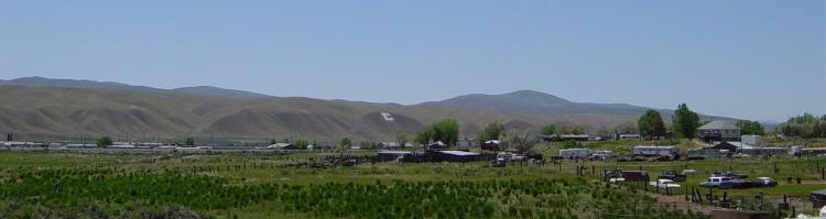
Carlin is a small city in Elko County in northeast Nevada, United States, and 23 miles (37 km) west of the city of Elko. As of the 2020 census, Carlin had a population of 2,050. Carlin sits along Interstate 80 at an elevation of approximately 4,900 feet (1,500 m). The city was named for Civil War general William Passmore Carlin.
From the Wikipedia article Carlin, Nevada (this version), under CC BY-SA 4.0.
Parks, trails and playgrounds1

Restaurants and cafes3




Where to stay2

Shopping1

History
The town was founded in December 1868, at the eastern terminus of the Central Pacific Railroad's Humboldt Division. The railroad built extensive facilities, including a roundhouse, machine shops, and a new depot in 1906. An ice-harvesting industry also developed, supplying ice for the railroad's refrigerator cars.
The Southern Pacific Railroad maintained the Carlin Shops, a major repair and maintenance center, near the depot at the foot of Sixth Street in Carlin. Construction of the Carlin Shops began in 1869. Its history was documented around 1968 by the Historic American Engineering Record.
On August 12, 1939, the City of San Francisco train derailed while crossing a bridge near Carlin, killing 24 and injuring 121. The wreck appeared to have been caused by sabotage but remains unsolved to this day. The train was operated by a joint partnership of the Chicago and North Western Railway, the Southern Pacific Railroad, and the Union Pacific Railroad.
Carlin was the home of John "Rolling Thunder" Pope (1916–1997), who had worked as a brakeman on the railway.
From the History section of Carlin, Nevada on Wikipedia, under CC BY-SA 4.0.
Gas and EV charging2
Schools, colleges and libraries7
Map of Carlin
16 places. The map loads OpenStreetMap tiles when you open it.
Climate by month
Monthly table
| Month | High | Low | Rain | Snow |
|---|---|---|---|---|
| Jan | 38°F | 16°F | 1.2 in | 10.4 in |
| Feb | 43°F | 20°F | 0.9 in | 6.8 in |
| Mar | 53°F | 27°F | 1.0 in | 5.5 in |
| Apr | 60°F | 32°F | 1.1 in | 3.3 in |
| May | 70°F | 38°F | 1.2 in | 0.4 in |
| Jun | 82°F | 45°F | 0.6 in | 0.0 in |
| Jul | 92°F | 52°F | 0.4 in | 0.0 in |
| Aug | 90°F | 49°F | 0.3 in | 0.0 in |
| Sep | 80°F | 40°F | 0.6 in | 0.0 in |
| Oct | 66°F | 29°F | 0.7 in | 0.5 in |
| Nov | 50°F | 22°F | 0.9 in | 4.1 in |
| Dec | 38°F | 15°F | 1.2 in | 10.2 in |
U.S. Climate Normals 1991-2020 for Elko Rgnl Ap Hcn (18 mi away), NOAA NCEI.
People and cost of living
American Community Survey 5-year estimates, 2020-2024, U.S. Census Bureau. Estimates have margins of error, larger for small towns.
Disaster history
Elko County has had 18 federal disaster declarations since 2000, most often for fires.
- 2020-04-04: Covid-19 Pandemic (Biological)
- 2020-03-13: Covid-19 (Biological)
- 2017-07-17: Oil Well Fire (Fire)
- 2017-03-27: Severe Winter Storms, Flooding, And Mudslides (Severe Storm)
- 2011-10-03: Indian Creek Fire (Fire)
- 2007-07-23: Murphy Fire Complex (Fire)
OpenFEMA disaster declarations summaries.
Getting there and nearby towns
Elko Regional Airport (EKO) is the nearest airport with scheduled flights listed in OpenStreetMap, 18 miles away.
- Elko 20 mi northeast, about 32 min by car
- Spring Creek 27 mi east, about 43 min by car
- Osino 28 mi northeast, about 45 min by car
- Crescent Valley 32 mi southwest, about 52 min by car
- Battle Mountain 44 mi west, about 1 h 15 min by car
Drive times are estimates from straight-line distance, not routes.
Local news
Headlines from INDB, the NEMICO news database.
Reviews, tips and questions
Loading what members have shared...
Sources and licences
- NCES EDGE (Public domain): public schools
- NOAA NCEI U.S. Climate Normals 1991-2020 (Public domain): climate by month
- OpenFEMA (Public domain): disaster declarations
- OpenStreetMap contributors (ODbL 1.0): places, airports, map data
- U.S. Census Bureau (Public domain): population, income, housing, education, commute
- Wikidata (CC0 1.0): elevation, founding date, time zone, website
- Wikimedia Commons (see each image): photos
- Wikipedia (CC BY-SA 4.0): overview and history text
Photo credits
- Carlin, NV-750px, Unknown author, CC BY-SA 3.0
Page built October 30, 2026. Spotted a mistake? Tell us or suggest a place.