



Carlisle, Pennsylvania
Carlisle is a borough of 21,852 people in Cumberland County, Pennsylvania, founded in 1751.
Why visit Carlisle
Townapedia lists 13 museums and landmarks, 23 parks and trails, 55 places to eat, 14 places to stay and 6 attractions in and around town.
Highlights include R/C Carlisle Commons, The Carlisle Theatre, Carlisle Armory and Carlisle Historic District.
July is the warmest month, with average highs of 86°F; January lows average 20°F, and about 28 inches of snow fall in a normal year.
Weather in Carlisle
Forecast from the National Weather Service. Full forecast
About Carlisle
Carlisle is a borough in and the county seat of Cumberland County, Pennsylvania, United States. Carlisle is located within the Cumberland Valley, a highly productive agricultural region. As of the 2020 census, the borough population was 20,118; including suburbs in the neighboring townships, 37,695 live in the Carlisle urban cluster. Carlisle is the smaller principal city of the Harrisburg–Carlisle metropolitan statistical area, which includes Cumberland and Dauphin and Perry counties in South Central Pennsylvania.
From the Wikipedia article Carlisle, Pennsylvania (this version), under CC BY-SA 4.0.
Things to do6


Museums and landmarks13

Carlisle Armory
Monument and historic site · National Register of Historic Places · 1.9 mi
Listed on the National Register of Historic Places in Cumberland County, Pennsylvania

Carlisle Historic District
Monument and historic site · National Register of Historic Places · 1.1 mi
Historic district in Pennsylvania, United States
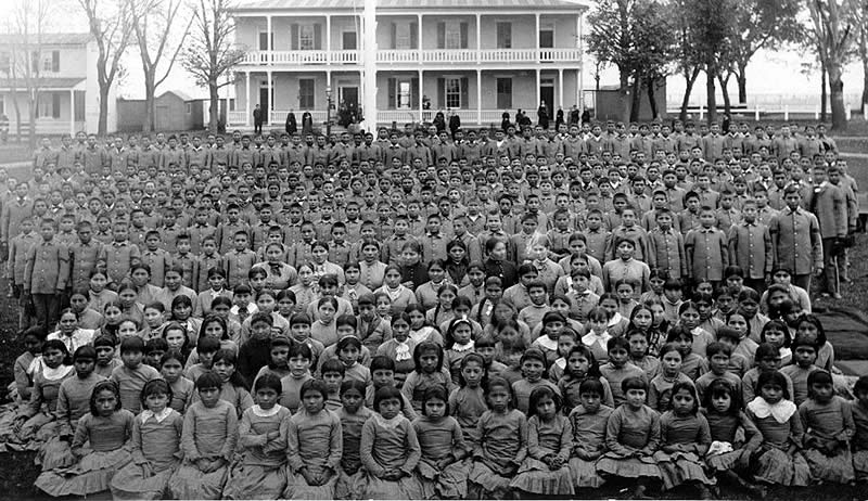
Carlisle Indian Industrial School
Monument and historic site · National Register of Historic Places · 1.5 mi
Former school in Carlisle, Pennsylvania, USA

Cumberland County Historical Society
Museum · 0.7 mi
Pay-what-you-can
21 North Pitt Street, Carlisle
Tu-Fr 10:00-16:00; Sa 10:00-14:00


James Given Tavern
Monument and historic site · National Register of Historic Places · 1.6 mi
House in Pennsylvania, United States of America
Old West, Dickinson College
Monument and historic site · National Register of Historic Places · 0.5 mi
College in Pennsylvania, United States of America
Hessian Powder Magazine
Museum · National Register of Historic Places · 1.4 mi
1 more on the map.
Parks, trails and playgrounds23

Letort Spring Garden Preserve
Park · 2.2 mi
1110 South Spring Garden Street, Carlisle
24/7



11 more on the map.
Restaurants and cafes55

Issei Noodle
Restaurant · Japanese, Pan-Asian · 0.7 mi
Pan-Asian Noodles
54 West High Street, Carlisle
Tu-Sa 11:00-14:00,17:00-20:00

Applebee's
Diner · American · 0.8 mi
260 Noble Boulevard, Carlisle
Mo-Th,Su 11:00-23:00; Fr-Sa 11:00-24:00

Bruster's Ice Cream
Ice cream · Ice Cream · 0.7 mi
220 Penrose Place, Carlisle
Mo-Th,Su 12:00-20:30; Fr-Sa 12:00-21:00
Cracker Barrel
Diner · American · 1.2 mi
3 East Garland Drive, Carlisle
Mo-Th,Sa-Su 07:00-21:00; Fr 07:00-22:00

Denim
Cafe · Coffee Shop · 0.5 mi
Denim Coffee finds lovely coffees, carefully roasts & sends to your doorstep. We geek out on tastes, times & temps because great coffee...
51 North College Street, Carlisle
Mo-Fr 07:30-17:00; Sa-Su 08:00-17:00
Denim Coffee
Cafe · Coffee, Espresso, Sandwich, Coffee Shop, Cafe · 0.8 mi
1 South Hanover Street, Carlisle
Mo-Sa 07:00-18:00; Su 07:30-18:00
Hoss's Steak & Sea House
Restaurant · Seafood, Steak · 1.1 mi
909 Walnut Bottom Road, Carlisle
Mo-Th,Su 11:00-20:00; Fr,Sa 11:00-20:30
Molly Pitcher Brewing Company
Restaurant · 0.6 mi
139 West High Street, Carlisle
Mo off; Tu-We,Su 11:00-21:00; Th-Sa 11:00-23:00
Round-A-Bout Bagels Cat Cafe
Cafe · Bagel · 0.9 mi
150 North Hanover Street, Carlisle
Tu-Th 11:00-18:00; Fr-Su 10:00-19:00
Cafe Bruges
Restaurant · 0.7 mi
16 North Pitt Street, Carlisle
Mo-Tu off; We-Sa 11:30-20:30; Su 11:30-18:00
43 more on the map.
History
The French-born fur trader James Le Tort may have built a cabin in the area as early as 1720. During the colonial era, Scots-Irish settlers began to settle in the Cumberland Valley beginning in the early 1730s. The settlement of Carlisle, at the intersection of several Indigenous trails, was designated by the Pennsylvania assembly and the Penn family in 1751 as the seat of Cumberland County (named for the county of the same name in England). American engineer John Armstrong Sr., a surveyor for the Penn family, laid the plan for the settlement of Carlisle in 1751. Armstrong Sr. settled there and fathered John Armstrong Jr. in 1758. They named the settlement after its sister town of the same name in Cumberland, England, and even designed its former jailhouse (which now serve as general government offices in the county) to resemble the Carlisle Citadel.
From the History section of Carlisle, Pennsylvania on Wikipedia, under CC BY-SA 4.0.
Where to stay14
IHG Army Hotels Carlisle Barracks - Historia
Motel and hotel · 1.4 mi
36 Flower Road, Carlisle
Churches and places of worship20
St. John's Episcopal Church
Church · Episcopal · 0.8 mi
1 North Hanover Street, Carlisle
St. Paul Lutheran Church
Church · Evangelical Lutheran · 0.6 mi
201 West Louther Street, Carlisle
Carlisle United Methodist Church
Church · United Methodist · 1.5 mi
333 South Spring Garden Street, Carlisle
Shopping13
Gas and EV charging9
Schools, colleges and libraries29
Healthcare4
Map of Carlisle
186 places. The map loads OpenStreetMap tiles when you open it.
Climate by month
Monthly table
| Month | High | Low | Rain | Snow |
|---|---|---|---|---|
| Jan | 38°F | 20°F | 3.1 in | 7.7 in |
| Feb | 41°F | 22°F | 2.6 in | 9.6 in |
| Mar | 50°F | 29°F | 4.0 in | 4.8 in |
| Apr | 63°F | 38°F | 3.8 in | 0.2 in |
| May | 72°F | 49°F | 4.7 in | 0.0 in |
| Jun | 81°F | 58°F | 4.4 in | 0.0 in |
| Jul | 86°F | 62°F | 5.5 in | 0.0 in |
| Aug | 84°F | 61°F | 4.0 in | 0.0 in |
| Sep | 77°F | 53°F | 5.0 in | 0.0 in |
| Oct | 66°F | 42°F | 4.3 in | 0.5 in |
| Nov | 54°F | 32°F | 3.1 in | 0.9 in |
| Dec | 42°F | 25°F | 3.6 in | 4.0 in |
U.S. Climate Normals 1991-2020 for Carlisle Wtp (2 mi away), NOAA NCEI.
People and cost of living
American Community Survey 5-year estimates, 2020-2024, U.S. Census Bureau. Estimates have margins of error, larger for small towns.
Disaster history
Cumberland County has had 11 federal disaster declarations since 2000, most often for hurricanes.
- 2020-03-30: Covid-19 Pandemic (Biological)
- 2020-03-13: Covid-19 (Biological)
- 2016-03-23: Severe Winter Storm And Snowstorm (Snowstorm)
- 2012-10-29: Hurricane Sandy (Hurricane)
- 2011-09-12: Tropical Storm Lee (Flood)
- 2011-09-08: Remnants Of Tropical Storm Lee (Flood)
OpenFEMA disaster declarations summaries.
Getting there and nearby towns
Capital City Airport (HAR) is the nearest airport with scheduled flights listed in OpenStreetMap, 19 miles away.
- Carlisle Barracks 2 mi east, about 3 min by car
- Schlusser 3 mi north, about 5 min by car
- Boiling Springs 4 mi southeast, about 7 min by car
- Mount Holly Springs 6 mi south, about 10 min by car
- Westminster 44 mi south, about 1 h 15 min by car
- Hagerstown 48 mi southwest, about 1 h 15 min by car
- Halfway 50 mi southwest, about 1 h 15 min by car
- Frederick 54 mi south, about 1 h 30 min by car
- Linganore 55 mi south, about 1 h 30 min by car
- Reisterstown 56 mi south, about 1 h 30 min by car
Drive times are estimates from straight-line distance, not routes.
Local news
Headlines from INDB, the NEMICO news database.
Reviews, tips and questions
Loading what members have shared...
Sources and licences
- NCES EDGE (Public domain): public schools
- NOAA NCEI U.S. Climate Normals 1991-2020 (Public domain): climate by month
- OpenFEMA (Public domain): disaster declarations
- OpenStreetMap contributors (ODbL 1.0): places, airports, map data
- U.S. Census Bureau (Public domain): population, income, housing, education, commute
- Wikidata (CC0 1.0): elevation, founding date, time zone, website, landmarks and historic places
- Wikimedia Commons (see each image): photos
- Wikipedia (CC BY-SA 4.0): overview and history text
Photo credits
- Carlisle, Pennsylvania, Doug Kerr, CC BY-SA 2.0
- Carlisle pupils, Unknown author Unknown author, Public domain
- CARLISLE ARMORY; CUMBERLAND COUNTY, Jerrye & Roy Klotz, MD, CC BY-SA 4.0
- JAMES GIVEN TAVERN, CUMBERLAND COUNTY, Jerrye & Roy Klotz, MD, CC BY-SA 4.0
Page built October 30, 2026. Spotted a mistake? Tell us or suggest a place.