


Why visit Carterville
Townapedia lists 5 museums and landmarks, 5 parks and trails, 7 places to eat, 1 place to stay and 1 attraction in and around town.
Highlights include Downtown Webb City Historic District, Elijah Thomas Webb Residence and King Jack Park.
July is the warmest month, with average highs of 90°F; January lows average 25°F.
Weather in Carterville
Forecast from the National Weather Service. Full forecast
About Carterville
Carterville is a city in Jasper County, Missouri, United States. The population was 1,855 at the 2020 census. It is part of the Joplin, Missouri Metropolitan Statistical Area.
From the Wikipedia article Carterville, Missouri (this version), under CC BY-SA 4.0.
Things to do1

Museums and landmarks5

Downtown Webb City Historic District
Monument and historic site · National Register of Historic Places · 1.4 mi
Building in Missouri, United States

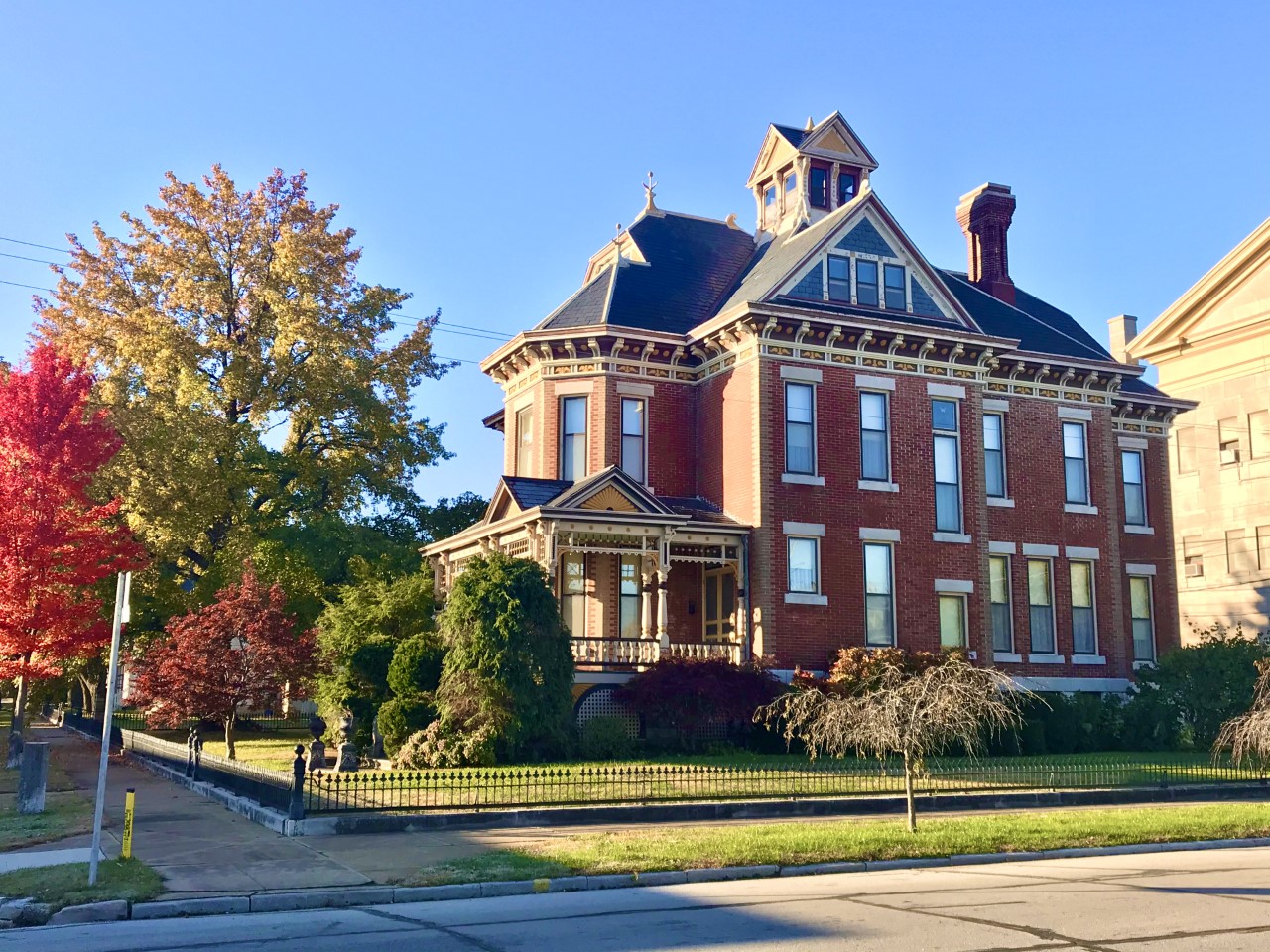
Elijah Thomas Webb Residence
Monument and historic site · National Register of Historic Places · 1.5 mi
House in Webb City, Missouri


Middle West Hotel
Monument and historic site · National Register of Historic Places · 1.3 mi
Hotel in Missouri, United States of America
Parks, trails and playgrounds5


Restaurants and cafes7

Bradbury Bishop Deli (closed)
Restaurant · 1.3 mi
Opened in 1931, closed in late 2012. For sale (according to the internet). As of May 2018 the storefront is still empty.
closed

Carterville Superman Museum & Ice Cream Parlor
Ice cream · 0.4 mi
221 West Main Street, Carterville

Shirley's Neighborhood Tavern
Bar and pub · 0.5 mi
321 West Main Street, Carterville
History
While one James Carter settled in Jasper County in 1841, the land on which Carterville was built was originally owned by his son, James Gilbert Leroy Carter, who created a farm in the 1860’s. The town considers itself founded in 1875, when a post office called Carterville opened that year. However, the settlement was not officially incorporated until 1882. Early Carterville was little more than a lead-mining camp, one of many in the tri-state mining district in southwestern Missouri, southeastern Kansas and northwestern Oklahoma. It nevertheless thrived, and at one time had a population of over 12,000 residents, making it larger than nearby Webb City.
When interurban transportation came to the mining district in 1889, it was in the form of a horsecar line (other sources say a mule road) between Webb City and Carterville. That operation was absorbed in 1892 by the Southwest Missouri Electric Railway Company, later the Southwest Missouri Railroad Company, and by 1894 an electrified streetcar line linked Carterville to Webb City and Joplin in one direction, and Prosperity in the other. Two additional rail lines, that of the Missouri Pacific Railway and the Kansas City, Fort Scott and Memphis Railway, ran down the west border of Carterville.
The town began its decline in size after World War I, when the mining industry began to dry up.
From the History section of Carterville, Missouri on Wikipedia, under CC BY-SA 4.0.
Where to stay1
Churches and places of worship10
Gas and EV charging3
Schools, colleges and libraries22
Map of Carterville
54 places. The map loads OpenStreetMap tiles when you open it.
Climate by month
Monthly table
| Month | High | Low | Rain |
|---|---|---|---|
| Jan | 45°F | 25°F | 1.9 in |
| Feb | 50°F | 29°F | 2.0 in |
| Mar | 60°F | 37°F | 3.3 in |
| Apr | 69°F | 47°F | 5.0 in |
| May | 77°F | 56°F | 6.6 in |
| Jun | 86°F | 65°F | 5.6 in |
| Jul | 90°F | 70°F | 4.0 in |
| Aug | 90°F | 68°F | 3.4 in |
| Sep | 82°F | 59°F | 4.2 in |
| Oct | 71°F | 48°F | 3.8 in |
| Nov | 58°F | 37°F | 3.3 in |
| Dec | 48°F | 28°F | 2.6 in |
U.S. Climate Normals 1991-2020 for Joplin Regional Airport (3 mi away), NOAA NCEI.
People and cost of living
American Community Survey 5-year estimates, 2020-2024, U.S. Census Bureau. Estimates have margins of error, larger for small towns.
Disaster history
Jasper County has had 19 federal disaster declarations since 2000, most often for severe storms.
- 2026-08-03: Severe Storms, Straight-Line Winds, Tornadoes, And Flooding (Severe Storm)
- 2020-03-26: Covid-19 Pandemic (Biological)
- 2020-03-13: Covid-19 (Biological)
- 2019-07-09: Severe Storms, Tornadoes, And Flooding (Severe Storm)
- 2017-06-02: Severe Storms, Tornadoes, Straight-Line Winds And Flooding (Flood)
- 2016-01-21: Severe Storms, Tornadoes, Straight-Line Winds, And Flooding (Flood)
OpenFEMA disaster declarations summaries.
Getting there and nearby towns
Joplin Regional Airport (JLN) is the nearest airport with scheduled flights listed in OpenStreetMap, 3 miles away.
- Webb City 2 mi west, about 3 min by car
- Joplin 6 mi southwest, about 10 min by car
- Carthage 6 mi east, about 10 min by car
- Galena 12 mi southwest, about 19 min by car
- Baxter Springs 19 mi southwest, about 30 min by car
- Neosho 21 mi south, about 34 min by car
- Columbus 22 mi west, about 36 min by car
- Pittsburg 23 mi northwest, about 38 min by car
- Frontenac 26 mi northwest, about 42 min by car
- Miami 30 mi southwest, about 48 min by car
Drive times are estimates from straight-line distance, not routes.
Local news
Headlines from INDB, the NEMICO news database.
Reviews, tips and questions
Loading what members have shared...
Sources and licences
- NCES EDGE (Public domain): public schools
- NOAA NCEI U.S. Climate Normals 1991-2020 (Public domain): climate by month
- OpenFEMA (Public domain): disaster declarations
- OpenStreetMap contributors (ODbL 1.0): places, airports, map data
- U.S. Census Bureau (Public domain): population, income, housing, education, commute
- Wikidata (CC0 1.0): elevation, founding date, time zone, website, landmarks and historic places
- Wikimedia Commons (see each image): photos
- Wikipedia (CC BY-SA 4.0): overview and history text
Photo credits
- Old Rock Filling Station, TheWhitePelican, CC BY 3.0
- Andrew Carnegie Funded Public Library Webb City Missouri, Kaethesson, CC BY-SA 3.0
- Middle West Hotel, AbeEzekowitz, CC BY-SA 3.0
- Marcasite (47859648122), Pacific Museum of Earth from Canada, CC BY-SA 2.0
- Elijah Thomas Webb House, Elijah Thomas Webb Residence, CC BY-SA 4.0
Page built October 30, 2026. Spotted a mistake? Tell us or suggest a place.