
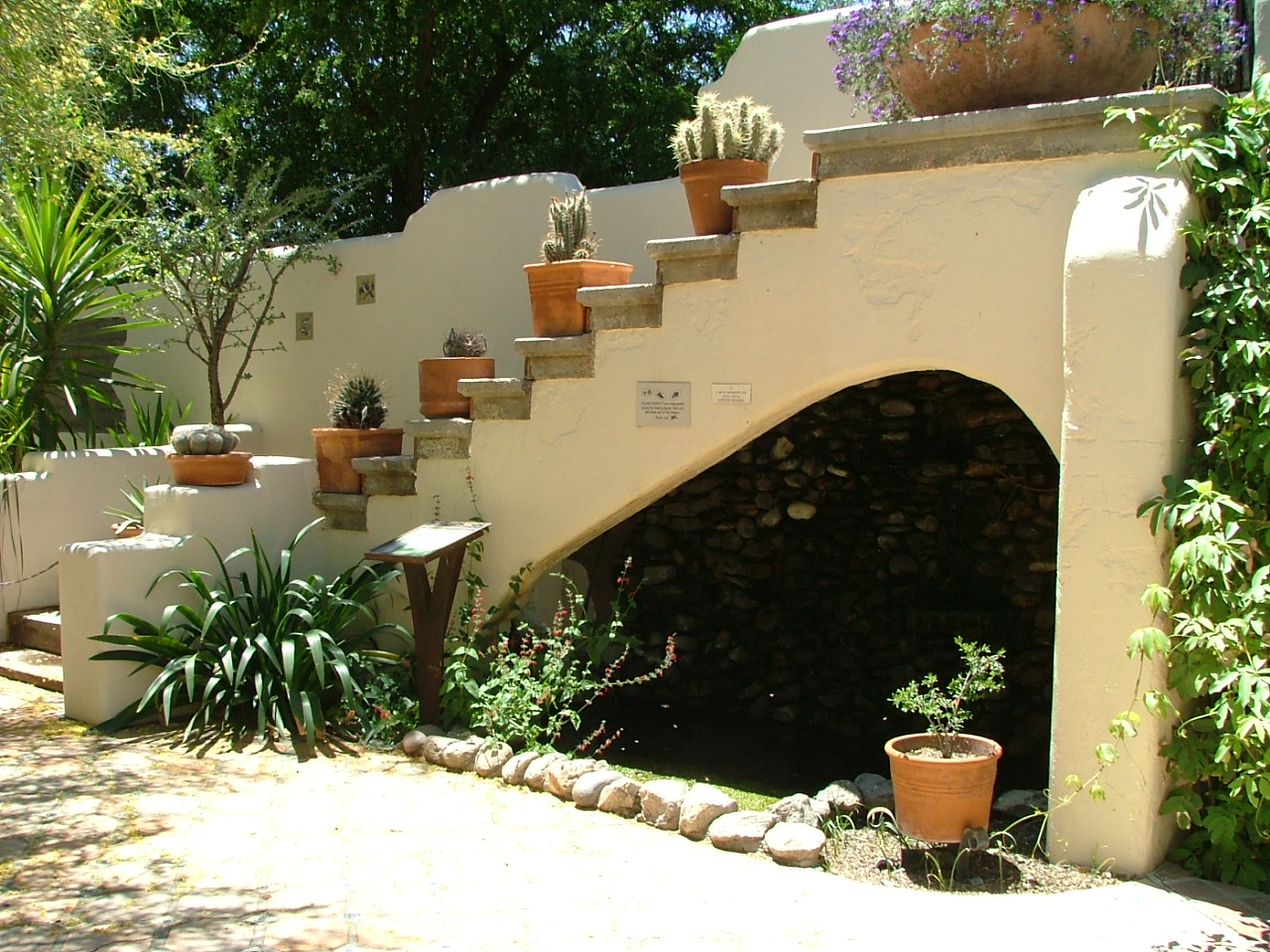


Casas Adobes, Arizona
Casas Adobes is a community of 72,059 people in Pima County, Arizona.
Why visit Casas Adobes
Townapedia lists 11 museums and landmarks, 50 parks and trails, 190 places to eat, 18 places to stay and 1 attraction in and around town.
Highlights include AMC Foothills 15, Casa Juan Paisano, Ghost Ranch Lodge & Restaurant and Oro Valley Country Club Golf Course.
June is the warmest month, with average highs of 102°F; January lows average 37°F.
Weather in Casas Adobes
Forecast from the National Weather Service. Full forecast
About Casas Adobes
Casas Adobes (Spanish: "Adobe Houses") is an unincorporated community and census-designated place (CDP) located in the northern metropolitan area of Tucson, Arizona (in Pima County). The population was 70,973 at the 2020 census. Casas Adobes is situated south and southwest of the town of Oro Valley, and west of the community of Catalina Foothills.
From the Wikipedia article Casas Adobes, Arizona (this version), under CC BY-SA 4.0.
Things to do1

Museums and landmarks11

Casa Juan Paisano
Monument and historic site · National Register of Historic Places · 5.7 mi
House in Tucson, Arizona
Ghost Ranch Lodge & Restaurant
Monument and historic site · National Register of Historic Places · 5.8 mi
1941 former motel in Tucson, Arizona; National Register of Historic Places nominated in 2012


Ramada House
Monument and historic site · National Register of Historic Places · 5.4 mi
Building in Arizona, United States

Gadsden-Pacific Division Toy Train Operating Museum
Museum · 4.3 mi
3975 North Miller Avenue, Tucson
Sep-May Su 13:00-17:00
Parks, trails and playgrounds50

Oro Valley Country Club Golf Course
Golf course · 3.9 mi
18 hole Par 72
300 West Greenock Drive, Oro Valley

Danny Lopez Park
Park · 4.0 mi
Park Amenities: Little League Fields (2) Picnic Tables (20) Ramadas (8) RC Model Airfields (6) Grills (14) Restrooms (2) Silverbell...
4300 North Silverbell Road, Tucson

Mason Center
Hiking and trails · 2.7 mi
3835 West Hardy Road, Tucson
Mo-Fr 08:00-17:00; Sa-Su dawn-dusk
Omni Tucson National Golf Resort
Golf course · 1.2 mi
18 hole Par 73 Catalina Course & 18 hole Par 70 Sonoran Course
2727 West Club Drive, Tucson
Dan Felix Memorial Park
Park · 2.4 mi
5790 N Camino De La Tierra, Tucson
Mo-Su 07:00-22:00
38 more on the map.
Restaurants and cafes190

La Parrilla Suiza
Restaurant · Mexican · 2.6 mi
Mexican Restaurant in Tucson, AZ
4250 W Ina Rd, Tucson
Su-Th 11:00-21:00, Fr-Sa 11:00-22:00

Beyond Bread
Restaurant · Sandwich, Bread · 2.1 mi
421 West Ina Road, Tucson
Mo-Fr 06:30-20:00; Sa 07:00-20:00; Su 07:00-18:00

Champps
Diner · American
7625 North La Cholla Boulevard, Tucson
Mo-Tu 11:00-12:00; We 11:00-12:00; Fr-Sa 11:00-02:00; Su 11:00-24:00
Cheng's Beijing Chinese Restaurant
Restaurant · Chinese, Sushi · 2.1 mi
7705 North Oracle Road, Oro Valley
10:30-20:00

First Watch
Restaurant · American, Breakfast · 3.6 mi
5055 North Oracle Road, Tucson
Su-Sa 07:00-14:30
Goyita's
Restaurant · Mexican · 3.9 mi
10420 North La Cañada Drive, Oro Valley
Tu-Th 11:00-20:00; Fr-Sa 11:00-21:00
178 more on the map.
History
Though Casas Adobes is an unincorporated community, it is older than both the towns of Oro Valley and Marana.
The area bordering the Cañada del Oro in the north, and the Rillito River in the south was primarily inhabited and utilized by cattle ranchers. Cattle ranches dominated the Casas Adobes area until the 1920s, when Tucson had grown far enough north and the advent of the automobile made the area more easily accessible.
One of the first individuals to build a home in the area was Maurice L. Reid, who came to Tucson in 1923 seeking a "walking cure" for tuberculosis. In the late 1920s Reid bought a 1,500 acres (6.1 km2) former ranch, bounded by North Oracle Road to the east, Orange Grove Road to the south, Ina Road to the north, and North La Cholla Boulevard to the west. Reid planted more than 200 acres (0.81 km2) of citrus trees and date palms, that would become the heart of Tucson's citrus industry. Over the years, Reid sold parcels of land for home sites, and in 1950 he sold the last of his land. Some larger residential estates continue to maintain the remaining citrus groves and orchards nearly a century later.
From the History section of Casas Adobes, Arizona on Wikipedia, under CC BY-SA 4.0.
Where to stay18
Fairfield Inn & Suites Tucson North/Oro Valley
Motel and hotel · 4.4 mi
10150 North Oracle Road, Oro Valley
La Posada Lodge & Casitas, Ascend Hotel Collection
Motel and hotel · 2.8 mi
5900 North Oracle Road, Tucson
Churches and places of worship20
St. Philip's in the Hills Episcopal Church
Church · National Register of Historic Places · 5.5 mi
St. Andrew's Presbyterian Church and Preschool (NE Campus)
Church · Presbyterian · 1.7 mi
7650 North Paseo del Norte, Tucson
Faith Church
Church · Nondenominational · 1.5 mi
2551 West Orange Grove Road, Tucson
St Andrew's Presbyterian Church (SW Campus)
Church · Presbyterian (Pcusa) · 1.7 mi
7575 North Paseo del Norte, Tucson
The Church of Jesus Christ of Latter-day Saints
Church · Mormon · 1.5 mi
939 West Chapala Drive, Tucson
Shopping54
Gas and EV charging28
Schools, colleges and libraries68
Academy of Math And Science Advanced Virtual Academy
School · 5.8 mi
3448 N 1St Ave, Tucson
Healthcare24
Banner - University Medical Group Cholla Pediatrics
Clinic and pharmacy · 1.4 mi
2167 West Orange Grove Road, Tucson
Carondelet Medical Group
Clinic and pharmacy · 2.1 mi
551 West Magee Road, Tucson
Map of Casas Adobes
250 places. The map loads OpenStreetMap tiles when you open it.
Climate by month
Monthly table
| Month | High | Low | Rain |
|---|---|---|---|
| Jan | 67°F | 37°F | 0.9 in |
| Feb | 70°F | 39°F | 1.1 in |
| Mar | 77°F | 44°F | 0.7 in |
| Apr | 84°F | 50°F | 0.2 in |
| May | 92°F | 59°F | 0.2 in |
| Jun | 102°F | 68°F | 0.3 in |
| Jul | 101°F | 74°F | 2.4 in |
| Aug | 100°F | 72°F | 2.1 in |
| Sep | 96°F | 67°F | 1.2 in |
| Oct | 88°F | 56°F | 0.7 in |
| Nov | 76°F | 44°F | 0.6 in |
| Dec | 67°F | 37°F | 1.0 in |
U.S. Climate Normals 1991-2020 for Tohono Chul (2 mi away), rain and snow from Tucson 10.7 Nnw, NOAA NCEI.
People and cost of living
American Community Survey 5-year estimates, 2020-2024, U.S. Census Bureau. Estimates have margins of error, larger for small towns.
Disaster history
Pima County has had 7 federal disaster declarations since 2000, most often for fires.
- 2020-06-11: Big Horn Fire (Fire)
- 2020-04-04: Covid-19 Pandemic (Biological)
- 2020-03-13: Covid-19 (Biological)
- 2006-09-07: Severe Storms And Flooding (Severe Storm)
- 2005-09-12: Hurricane Katrina Evacuation (Hurricane)
- 2003-07-14: Aspen Fire (Fire)
OpenFEMA disaster declarations summaries.
Getting there and nearby towns
Marana Regional Airport (AVW) is the nearest airport with scheduled flights listed in OpenStreetMap, 13 miles away.
- Flowing Wells 3 mi south, about 5 min by car
- Oro Valley 6 mi north, about 9 min by car
- Tucson Mountains 6 mi southwest, about 9 min by car
- Catalina Foothills 8 mi east, about 13 min by car
- Marana 11 mi northwest, about 18 min by car
- Tucson Estates 13 mi southwest, about 21 min by car
- Drexel Heights 14 mi south, about 22 min by car
- Tucson 15 mi southeast, about 25 min by car
- Valencia West 16 mi southwest, about 25 min by car
- Tanque Verde 16 mi east, about 26 min by car
Drive times are estimates from straight-line distance, not routes.
Local news
Headlines from INDB, the NEMICO news database.
Reviews, tips and questions
Loading what members have shared...
Sources and licences
- NCES EDGE (Public domain): public schools
- NOAA NCEI U.S. Climate Normals 1991-2020 (Public domain): climate by month
- OpenFEMA (Public domain): disaster declarations
- OpenStreetMap contributors (ODbL 1.0): places, airports, map data
- U.S. Census Bureau (Public domain): population, income, housing, education, commute
- Wikidata (CC0 1.0): elevation, founding date, time zone, website, landmarks and historic places
- Wikimedia Commons (see each image): photos
- Wikipedia (CC BY-SA 4.0): overview and history text
Photo credits
- Tohono Chul wall, DrStarbuck from Madison, WI, USA, CC BY 2.0
- Ramada house (Tucson, Arizona) 2, Ammodramus, CC0
- St. Philip in the Hills (Tucson) from S 2, Ammodramus, CC0
- Tucson Arizona Temple 2017, JonRidinger, CC BY-SA 4.0
- Cactus in Bloom - Flickr - alykat, Alyson Hurt from Arlington, Va., USA, CC BY 2.0
- Gambel's Quail - Flickr - treegrow (1), Katja Schulz from Washington, D. C., USA, CC BY 2.0
- Gambel's Quail - Flickr - treegrow, Katja Schulz from Washington, D. C., USA, CC BY 2.0
- Moorish garden, Casa Adobes, Chanel Wheeler, CC BY-SA 2.0
- The Big Cactus - Flickr - docoverachiever, Sheila Sund from Salem, United States, CC BY 4.0
- Tohono Chul Park, a rancid amoeba, CC BY-SA 2.0
- Cute water feature, a rancid amoeba, CC BY-SA 2.0
- Moorish garden, a rancid amoeba, CC BY-SA 2.0
- A nice place to escape that sun, a rancid amoeba, CC BY-SA 2.0
- Azurite and malachite display, a rancid amoeba, CC BY-SA 2.0
- Century plant by a rancid amoeba, a rancid amoeba, CC BY-SA 2.0
- Olneya tesota (4821620454), Matt Lavin from Bozeman, Montana, USA, CC BY-SA 2.0
- Olneya tesota (4821622732), Matt Lavin from Bozeman, Montana, USA, CC BY-SA 2.0
- Olneya tesota (4821629352), Matt Lavin from Bozeman, Montana, USA, CC BY-SA 2.0
- Olneya tesota (4821621610), Matt Lavin from Bozeman, Montana, USA, CC BY-SA 2.0
- Olneya tesota (4821007405), Matt Lavin from Bozeman, Montana, USA, CC BY-SA 2.0
- Olneya tesota (4821002751), Matt Lavin from Bozeman, Montana, USA, CC BY-SA 2.0
- Olneya tesota (4821000369), Matt Lavin from Bozeman, Montana, USA, CC BY-SA 2.0
- Olneya tesota (4821615878), Matt Lavin from Bozeman, Montana, USA, CC BY-SA 2.0
- Olneya tesota (4821013929), Matt Lavin from Bozeman, Montana, USA, CC BY-SA 2.0
- Olneya tesota (4821001519), Matt Lavin from Bozeman, Montana, USA, CC BY-SA 2.0
- Olneya tesota (4821627238), Matt Lavin from Bozeman, Montana, USA, CC BY-SA 2.0
- Olneya tesota (4821008483), Matt Lavin from Bozeman, Montana, USA, CC BY-SA 2.0
- Olneya tesota (4821614778), Matt Lavin from Bozeman, Montana, USA, CC BY-SA 2.0
- Desert Mistletoe - Flickr - treegrow (4), Katja Schulz from Washington, D. C., USA, CC BY 2.0
- Desert Mistletoe - Flickr - treegrow (3), Katja Schulz from Washington, D. C., USA, CC BY 2.0
- Desert Mistletoe - Flickr - treegrow (5), Katja Schulz from Washington, D. C., USA, CC BY 2.0
- Tuscon Arizona Desert Sunset Over Mountains - panoramio (2), Michelle Maria, CC BY 3.0
- Ferguson House Pima County, ArizonaArt, CC BY-SA 4.0
- Tuscon Arizona Desert Sunset Over Mountains - panoramio (1), Michelle Maria, CC BY 3.0
- Tuscon Arizona Desert Sunset Over Mountains - panoramio (11), Michelle Maria, CC BY 3.0
- Tarentola annularis 312706720, kylieknight, CC0
- Tuscon Arizona Desert Sunset Over Mountains - panoramio, Michelle Maria, CC BY 3.0
- Tuscon Arizona Desert Sunset Over Mountains - panoramio (12), Michelle Maria, CC BY 3.0
- Krummschnabel-Spottdrossel (Toxostoma curvirostre), Henry, CC BY 2.0
- Helmwachtel (Callipepla gambelii), Männchen, Henry, CC BY 2.0


Page built October 30, 2026. Spotted a mistake? Tell us or suggest a place.