
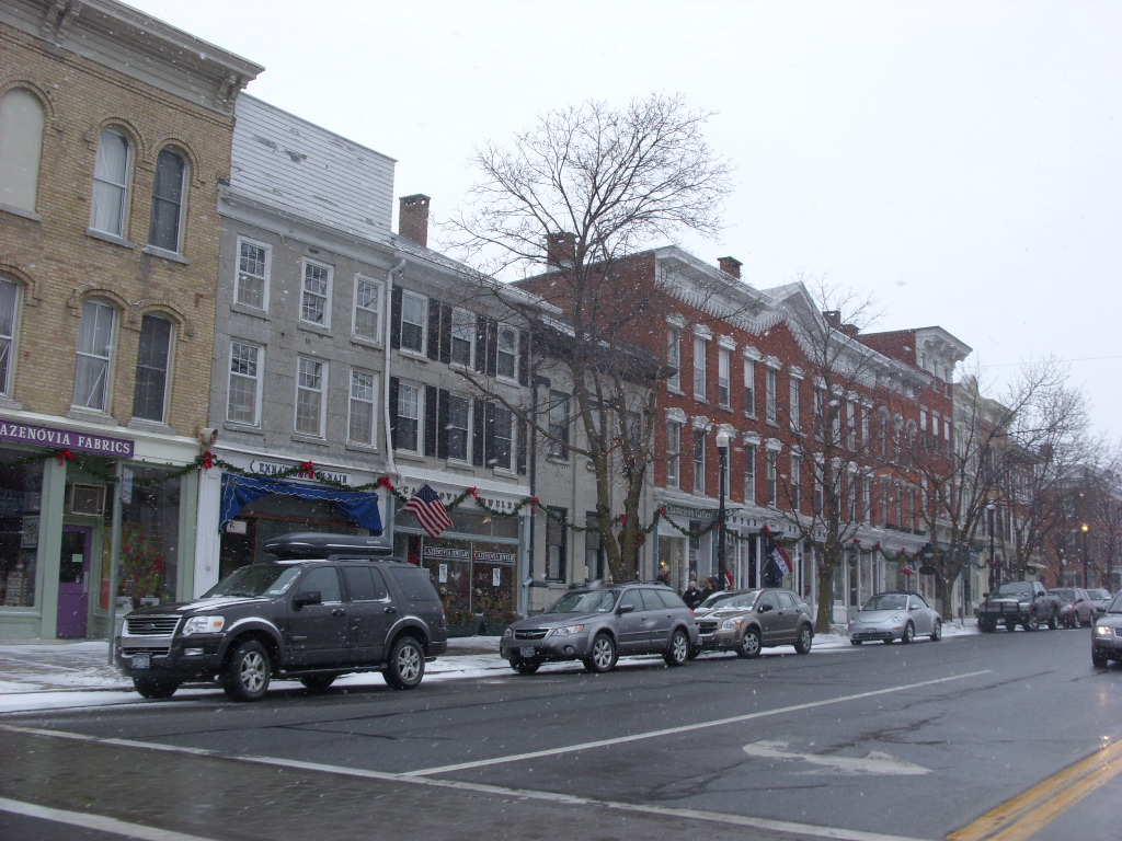


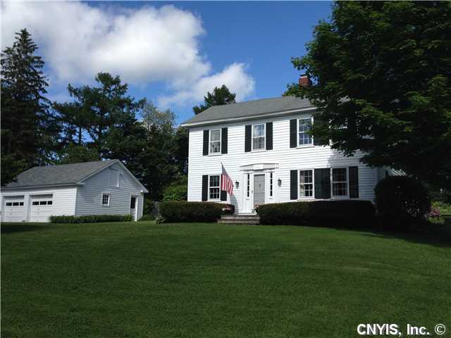

Cazenovia, New York
Cazenovia is a village of 2,753 people in Madison County, New York, founded in 1794.
Why visit Cazenovia
Townapedia lists 36 museums and landmarks, 8 parks and trails, 22 places to eat, 5 places to stay and 2 attractions in and around town.
Highlights include Catherine Cummings Theatre, Stone Quarry Hill, Abell Farmhouse and Barn and Albany Street Historic District.
July is the warmest month, with average highs of 77°F; January lows average 11°F.
Weather in Cazenovia
Forecast from the National Weather Service. Full forecast
About Cazenovia
Cazenovia is a village in the town of Cazenovia in Madison County, New York, United States. As of the 2020 census, the village had a population of 2,767. The village lies at the south end of Cazenovia Lake and is within a half hour of Syracuse. The village is located on US Route 20 and New York State Route 13, and was home to Cazenovia College.
From the Wikipedia article Cazenovia (village), New York (this version), under CC BY-SA 4.0.
Things to do2


Museums and landmarks36

Abell Farmhouse and Barn
Monument and historic site · National Register of Historic Places · 2.2 mi
Listed on the NRHP in New York
Albany Street Historic District
Monument and historic site · National Register of Historic Places
Historic district in Cazenovia, New York
Annas Farmhouse
Monument and historic site · National Register of Historic Places · 2.0 mi
Historic house in Cazenovia, New York
Beckwith Farmhouse
Monument and historic site · National Register of Historic Places · 2.2 mi
Historic house in New York, United States
Brick House
Monument and historic site · National Register of Historic Places · 1.9 mi
Historic house in Cazenovia, New York

Cazenovia Village Historic District
Monument and historic site · National Register of Historic Places
Historic district in New York, United States
Cedar Cove
Monument and historic site · National Register of Historic Places · 1.6 mi
Historic house listed on the National Register of Historic Places
Chappell Farmhouse
Monument and historic site · National Register of Historic Places · 1.4 mi
Cazenovia, New York, listed on the NRHP in New York
Cobblestone House
Monument and historic site · National Register of Historic Places · 1.9 mi
Historic house in Cazenovia, New York, United States
Crandall Farm Complex
Monument and historic site · National Register of Historic Places · 2.5 mi
Historic house in New York, United States
Evergreen Acres
Monument and historic site · National Register of Historic Places · 1.3 mi
Historic house in New York, United States
Hillcrest
Monument and historic site · National Register of Historic Places · 0.8 mi
Historic house in Cazenovia, New York, United States
24 more on the map.
Parks, trails and playgrounds8

Lorenzo State Historic Site
Park · National Register of Historic Places · 0.8 mi
State historic site of New York, United States




Restaurants and cafes22

Cazenovia Bagel Co.
Restaurant · Bagel · 0.5 mi
79 Nelson Street, Cazenovia
Mo closed; Tu-Su 06:30-14:00

BG Buda’s Cucina Italiana
Restaurant · Italian
88 Albany Street, Cazenovia

10 more on the map.
History
Cazenovia was established in 1794 by John Lincklaen, a young Dutch naval officer who purchased the town under the auspices of the Holland Land Company. Some of the first buildings established in Cazenovia were what is now the Presbyterian Church and the company store. The town is named after Theophilus Cazenove, an agent with the land company.
The village was incorporated in 1810 and was the first county seat (until 1817). Many of the village's historic buildings are encompassed by the Albany Street Historic District and Cazenovia Village Historic District. Also listed on the National Register of Historic Places is the Lehigh Valley Railroad Depot.
The most famous event in Cazenovia's history was the 1850 Fugitive Slave Convention, organized by abolitionist Gerrit Smith and chaired by former slave Frederick Douglass to consider how to react to the Fugitive Slave Act of 1850, which passed days later.
The Lorenzo State Historic Site was listed in the National Register of Historic Places in July 1970. This land, located off Route 13 (Rippleton Road), now belongs to the NY State Historic Trust after being bought from the previous owner, George Ledyard, upon his death. There is a school house, mansion, farmhouse, and a landscaped garden that guests can tour throughout the year by appointment or during regular hours.
From the History section of Cazenovia (village), New York on Wikipedia, under CC BY-SA 4.0.
Where to stay5
Churches and places of worship5
Shopping11
Gas and EV charging2
Schools, colleges and libraries7
Healthcare2
Map of Cazenovia
100 places. The map loads OpenStreetMap tiles when you open it.
Climate by month
Monthly table
| Month | High | Low | Rain |
|---|---|---|---|
| Jan | 28°F | 11°F | 3.5 in |
| Feb | 30°F | 12°F | 3.2 in |
| Mar | 38°F | 20°F | 3.5 in |
| Apr | 52°F | 32°F | 3.9 in |
| May | 64°F | 44°F | 4.1 in |
| Jun | 73°F | 53°F | 4.6 in |
| Jul | 77°F | 57°F | 4.4 in |
| Aug | 76°F | 56°F | 4.3 in |
| Sep | 69°F | 49°F | 4.3 in |
| Oct | 56°F | 38°F | 4.5 in |
| Nov | 44°F | 29°F | 4.0 in |
| Dec | 33°F | 19°F | 3.9 in |
U.S. Climate Normals 1991-2020 for Morrisville 6 Sw Hcn (9 mi away), NOAA NCEI.
People and cost of living
American Community Survey 5-year estimates, 2020-2024, U.S. Census Bureau. Estimates have margins of error, larger for small towns.
Disaster history
Madison County has had 19 federal disaster declarations since 2000, most often for severe storms.
- 2020-03-20: Covid-19 Pandemic (Biological)
- 2020-03-13: Covid-19 (Biological)
- 2019-12-19: Severe Storms, Straight-Line Winds, And Flooding (Severe Storm)
- 2017-07-12: Severe Winter Storm And Snowstorm (Snowstorm)
- 2013-07-12: Severe Storms And Flooding (Flood)
- 2012-10-28: Hurricane Sandy (Hurricane)
OpenFEMA disaster declarations summaries.
Getting there and nearby towns
Elisha Payne Airport (VGC) is the nearest airport with scheduled flights listed in OpenStreetMap, 16 miles away.
- Morrisville 11 mi east, about 17 min by car
- Canastota 12 mi northeast, about 19 min by car
- Oneida 13 mi northeast, about 21 min by car
- DeWitt 14 mi northwest, about 22 min by car
- Syracuse 17 mi northwest, about 27 min by car
- Vernon 19 mi northeast, about 30 min by car
- Camillus 24 mi west, about 39 min by car
- Brewerton 26 mi northwest, about 41 min by car
- Rome 28 mi northeast, about 44 min by car
- Cortland 28 mi southwest, about 45 min by car
Drive times are estimates from straight-line distance, not routes.
Local news
Headlines from INDB, the NEMICO news database.
Reviews, tips and questions
Loading what members have shared...
Sources and licences
- NCES EDGE (Public domain): public schools
- NOAA NCEI U.S. Climate Normals 1991-2020 (Public domain): climate by month
- OpenFEMA (Public domain): disaster declarations
- OpenStreetMap contributors (ODbL 1.0): places, airports, map data
- U.S. Census Bureau (Public domain): population, income, housing, education, commute
- Wikidata (CC0 1.0): elevation, founding date, time zone, website, landmarks and historic places
- Wikimedia Commons (see each image): photos
- Wikipedia (CC BY-SA 4.0): overview and history text
Photo credits
- Downtown Cazenovia, NY, Doug Kerr from Albany, NY, CC BY-SA 2.0
- LorenzoCaz, Lvklock, CC BY-SA 4.0
- Stone Quarry Hill Art Park, Sqhapdirector, CC BY-SA 4.0
- Cazenovia station (2880966360), Russ Nelson, CC BY-SA 2.0
- Anna's Farmhouse, Cazenovia, CC BY-SA 3.0
- Notleymere, Shockhill, CC BY-SA 3.0
- Rippleton Schoolhouse, Cazenovia, Eddie891, CC BY 4.0
- First Presbyterian Church Cazenovia NY May 09, Doug Kerr from Upstate New York, CC BY-SA 2.0
- Hubbard Hall - panoramio, Idawriter, CC BY-SA 3.0


Page built October 30, 2026. Spotted a mistake? Tell us or suggest a place.