
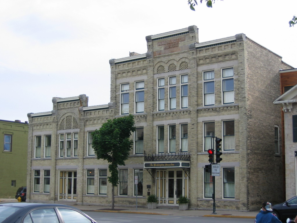

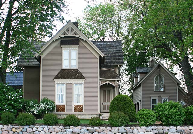


Cedarburg, Wisconsin
Cedarburg is a city of 12,605 people in Ozaukee County, Wisconsin, founded in 1843.
Why visit Cedarburg
Townapedia lists 34 museums and landmarks, 21 parks and trails, 35 places to eat, 2 places to stay and 5 attractions in and around town.
Highlights include Rivoli, Highland Avenue Bridge, Bigelow School and Cedarburg Covered Bridge.
July is the warmest month, with average highs of 81°F; January lows average 17°F.
Weather in Cedarburg
Forecast from the National Weather Service. Full forecast
About Cedarburg
Cedarburg is a city in Ozaukee County, Wisconsin, United States. Located about 20 miles (32 km) north of Milwaukee and in close proximity to Interstate 43, it is a suburb in the Milwaukee metropolitan area. The city incorporated in 1885, and at the time of the 2020 census the population was 12,121.
From the Wikipedia article Cedarburg, Wisconsin (this version), under CC BY-SA 4.0.
Things to do5

Rivoli
Cinema and theater
Historic single-screen cinema showing mostly family-friendly, 2nd run features.
W62N567 Washington Avenue, Cedarburg

Highland Avenue Bridge
Bridge · 0.7 mi
Bridge in Cedarburg, Wisconsin

Museums and landmarks34

Bigelow School
Monument and historic site · National Register of Historic Places · 2.7 mi
Former school in Mequon, Wisconsin
Cedarburg Covered Bridge
Bridge · National Register of Historic Places · 2.7 mi
Covered bridge in Cedarburg, Wisconsin, US
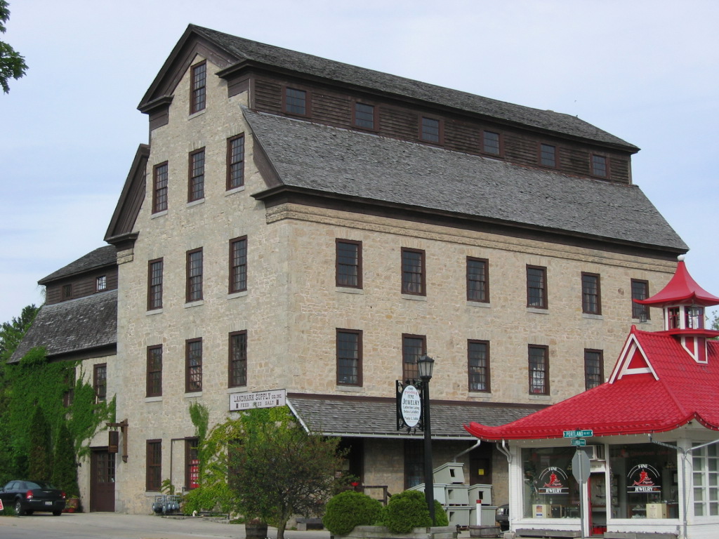
Cedarburg Mill
Monument and historic site · National Register of Historic Places
Gristmill and historic landmark in Cedarburg, Wisconsin

Cedarburg Woolen Co. Worsted Mill
Monument and historic site · National Register of Historic Places · 2.3 mi
Building in Wisconsin, United States

Columbia Historic District
Monument and historic site · National Register of Historic Places
Historic district in Cedarburg, Wisconsin

Edwin J. Nieman Sr. House
Monument and historic site · National Register of Historic Places · 3.1 mi
Historic house in Wisconsin, United States
Grafton Flour Mill
Monument and historic site · National Register of Historic Places · 2.3 mi
Mill in Grafton, Wisconsin, United States
Hamilton Historic District
Monument and historic site · National Register of Historic Places · 1.4 mi
Listed on the NRHP in Ozaukee County, Wisconsin

Hilgen and Wittenberg Woolen Mill
Monument and historic site · National Register of Historic Places
Former textile mill in Cedarburg, Wisconsin
John Reichert Farmhouse
Monument and historic site · National Register of Historic Places · 2.0 mi
Historic house in Wisconsin, United States

Jonathan Clark House
Monument and historic site · National Register of Historic Places · 2.4 mi
Historic house in Wisconsin, United States


Milwaukee Falls Lime Company
Monument and historic site · National Register of Historic Places · 1.7 mi
Historic landmark in Ozaukee County, Wisconsin
22 more on the map.
Parks, trails and playgrounds21

Rappold Park
Park
Park on Washington Avenue in Cedarburg Wi. USA
Washington Avenue, Cedarburg


9 more on the map.
Restaurants and cafes35

Jim's Grille
Restaurant · Pizza, Salad, Chicken, Wings, Sandwich, Soup, Fish, Pasta, Burger, Steak, Fried Chicken, Breakfast, American, Dessert · 1.3 mi
W63N144 Washington Avenue, Cedarburg
Mo-Tu 06:00-14:00; We-Th 06:00-20:00; Fr 06:00-15:00; Sa 07:00-14:00

The Fermentorium Brewery and Tasting Room
Brewery and winery · 1.7 mi
The brainchild of a locally-raised homebrewer, The Fermentorium opened its doors early in 2016. Currently offering ten beers on tap with...
7481 WI-60 Trunk, cedarburg
Tu-Fr 16:00-22:00; Sa 12:00-22:00; Su 12:00-18:00
Toast Cedarburg
Restaurant · 1.8 mi
1302 Washington Avenue, Cedarburg
Mo,Th 08:00-14:00; Sa,Su 08:00-16:00
Hefner's Custard
Restaurant · Custard, Burger · 0.7 mi
N71 W5184 Columbia Road, Cedarburg
11:00-21:00
Out and Out
Restaurant · Burger · 0.9 mi
W61N305 Washington Avenue, Cedarburg
Mo-Sa 10:00-21:00; Su 10:00-20:00

five20 Social Stop
Bar and pub · 0.4 mi
520 Washington Avenue, Cedarburg
16:00-22:00
Le's Pho Vietnamese Cuisine
Restaurant · Vietnamese · 1.3 mi
W63N148 Washington Avenue, Cedarburg
23 more on the map.
History
The earliest evidence of humans in the Cedarburg area is the Hilgen Spring Mound Site, located in the eastern part of the city of Cedarburg, near Cedar Creek. The site consists of three conical burial mounds constructed by early Woodland period Mound Builders. In 1968, archaeologists from the Milwaukee Public Museum found human burials and artifacts, including stone altars, arrowheads, and pottery shards, during an excavation of one of the mounds. Radiocarbon samples from the excavation date the mounds' construction to approximately 480 BCE, making it one of the oldest mound groups in the state.
In the early 19th century, the land was inhabited by Native Americans, including the Potawatomi and Sauk tribes. The Potawatomi surrendered the land to the United States Federal Government in 1833 through the 1833 Treaty of Chicago, which (after being ratified in 1835) required them to leave Wisconsin by 1838. While many Native people moved west of the Mississippi River to Kansas, some chose to remain, and were referred to as "strolling Potawatomi" in contemporary documents because many of them were migrants who subsisted by squatting on their ancestral lands which were now owned by white settlers. Eventually the Native people who evaded forced removal gathered in northern Wisconsin, where they formed the Forest County Potawatomi Community.
From the History section of Cedarburg, Wisconsin on Wikipedia, under CC BY-SA 4.0.
Where to stay2
Churches and places of worship8
First Church of Christ, Scientist
Church · Christ Scientist · 1.4 mi
W63N108 Washington Avenue, Cedarburg
Shopping9
Gas and EV charging3
Schools, colleges and libraries22
Healthcare3
Map of Cedarburg
142 places. The map loads OpenStreetMap tiles when you open it.
Climate by month
Monthly table
| Month | High | Low | Rain |
|---|---|---|---|
| Jan | 30°F | 17°F | 1.6 in |
| Feb | 33°F | 18°F | 1.7 in |
| Mar | 43°F | 26°F | 2.1 in |
| Apr | 54°F | 36°F | 3.9 in |
| May | 66°F | 46°F | 4.0 in |
| Jun | 76°F | 56°F | 4.5 in |
| Jul | 81°F | 62°F | 3.6 in |
| Aug | 80°F | 61°F | 3.8 in |
| Sep | 72°F | 54°F | 3.2 in |
| Oct | 60°F | 43°F | 3.0 in |
| Nov | 46°F | 31°F | 2.1 in |
| Dec | 35°F | 21°F | 2.0 in |
U.S. Climate Normals 1991-2020 for Grafton Wwtp (2 mi away), NOAA NCEI.
People and cost of living
American Community Survey 5-year estimates, 2020-2024, U.S. Census Bureau. Estimates have margins of error, larger for small towns.
Disaster history
Ozaukee County has had 7 federal disaster declarations since 2000, most often for biologicals.
- 2020-04-04: Covid-19 Pandemic (Biological)
- 2020-03-13: Covid-19 (Biological)
- 2018-10-18: Severe Storms, Tornadoes, Straight-Line Winds, Flooding, And Landslides (Flood)
- 2008-06-14: Severe Storms, Tornadoes, And Flooding (Severe Storm)
- 2005-09-13: Hurricane Katrina Evacuation (Hurricane)
- 2004-06-18: Severe Storms And Flooding (Severe Storm)
OpenFEMA disaster declarations summaries.
Getting there and nearby towns
West Bend Municipal Airport (ETB) is the nearest airport with scheduled flights listed in OpenStreetMap, 11 miles away.
- Grafton 3 mi northeast, about 4 min by car
- Thiensville 4 mi south, about 7 min by car
- Mequon 6 mi south, about 10 min by car
- Saukville 7 mi north, about 11 min by car
- Germantown 8 mi southwest, about 13 min by car
- Brown Deer 9 mi south, about 14 min by car
- Port Washington 9 mi northeast, about 15 min by car
- Milwaukee 16 mi south, about 26 min by car
- Brookfield 18 mi south, about 28 min by car
- Beaver Dam 44 mi west, about 1 h 15 min by car
Drive times are estimates from straight-line distance, not routes.
Local news
Headlines from INDB, the NEMICO news database.
Reviews, tips and questions
Loading what members have shared...
Sources and licences
- NCES EDGE (Public domain): public schools
- NOAA NCEI U.S. Climate Normals 1991-2020 (Public domain): climate by month
- OpenFEMA (Public domain): disaster declarations
- OpenStreetMap contributors (ODbL 1.0): places, airports, map data
- U.S. Census Bureau (Public domain): population, income, housing, education, commute
- Wikidata (CC0 1.0): elevation, founding date, time zone, website, landmarks and historic places
- Wikimedia Commons (see each image): photos
- Wikipedia (CC BY-SA 4.0): overview and history text
Photo credits
- Washington House Inn, Loopygrumpkins, Public domain
- Hamilton Historic District May09, Freekee, Public domain
- John Reichert Farmhouse May09, Freekee, Public domain
- Covered Bridge Cedarburg WI May-09, Freekee, Public domain
- Woolen Mill Grafton Dec09, Freekee, Public domain
- Grafton Flour Mill back Dec09, Freekee, Public domain
- Jonathan Clark House Mequon WI May-09, Freekee, Public domain
- Milwaukee Falls Lime Kiln, Sallyajackson, CC BY-SA 3.0
- Bigelow School Mequon Dec09, Freekee, Public domain
- Cedarburg Mill, Loopygrumpkins, Public domain
- Edwin J. Nieman Sr. House, Jim Roberts, CC BY-SA 4.0
- O'Brien-Peuschel Farmstead Mequon WI May-09, Freekee, Public domain
- Woolen Mill Cedarburg May09, Freekee /Kevin Hansen, CC BY-SA 3.0
- Columbia Historic District Jan2011, Freekee, Public domain
- Wayside House Cedarburg WI May-09, Freekee, Public domain
- Concordia Mill Hamilton WI May09, Freekee, Public domain
- Paramount Plaza Walk of Fame, Awkwafaba, CC BY-SA 3.0


Page built October 30, 2026. Spotted a mistake? Tell us or suggest a place.