


Central, South Carolina
Central is a town of 5,320 people in Pickens County, South Carolina, founded in 1875.
Why visit Central
Townapedia lists 9 museums and landmarks, 2 parks and trails, 20 places to eat and 3 attractions in and around town.
Highlights include Clemson Area Food Exchange, Southern Wesleyan University, Ashtabula and Central High School.
July is the warmest month, with average highs of 91°F; January lows average 32°F.
Weather in Central
Forecast from the National Weather Service. Full forecast
About Central
Central is a town in Pickens County, South Carolina, United States. As of the 2020 census, Central had a population of 5,247. It received its name from being halfway or the central point between Atlanta and Charlotte along the former Atlanta and Richmond Air-Line Railway line. Southern Wesleyan University's main campus is east of downtown Central.
From the Wikipedia article Central, South Carolina (this version), under CC BY-SA 4.0.
Things to do3

Clemson Area Food Exchange
Farm and orchard · 1.4 mi
Online farmers market offering local food and products from upstate growers.
364 Chapman Hill Rd
Tu 15:30-18:00

Southern Wesleyan University
School · 0.7 mi
Private university in South Carolina, U.S.A

Museums and landmarks9

Ashtabula
Monument and historic site · National Register of Historic Places · 2.5 mi
Plantation house in Anderson County, South Carolina

Central High School
Monument and historic site · National Register of Historic Places · 1.0 mi
Historic school building in Central, South Carolina, United States

Hanover House
Museum · National Register of Historic Places · 3.9 mi
Historic house in Clemson, South Carolina, United States

Morgan House
Monument and historic site · National Register of Historic Places · 0.9 mi
Listed on the NRHP in Pickens County

Central Roller Mills
Monument and historic site · National Register of Historic Places · 1.2 mi

J. C. Stribling Barn
Monument and historic site · National Register of Historic Places · 3.5 mi


.jpg)


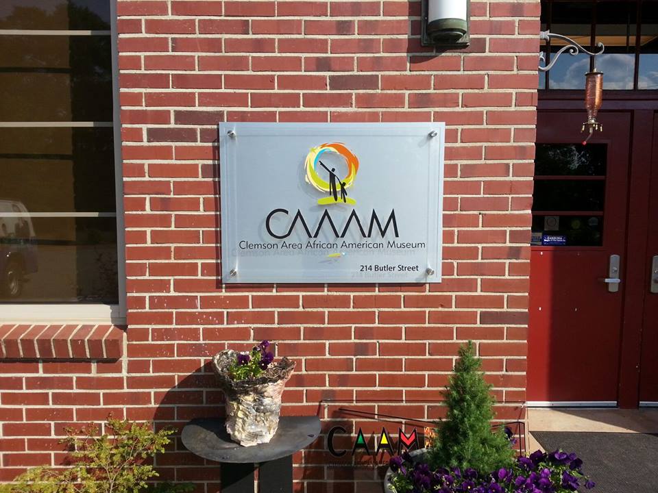
Clemson Area African American Museum
Museum · 3.6 mi
African American museum in Clemson, South Carolina

Parks, trails and playgrounds2


Restaurants and cafes20


Jitters Brewing Company
Cafe · Coffee Shop · 1.2 mi
104 Madden Bridge Road, Central

Pancho's Mexican Restaurant
Restaurant · Mexican · 1.1 mi
111 West Main Street, Central
The Mexican at Central
Restaurant · Mexican · 1.1 mi
217 West Main Street, Central

8 more on the map.
History
Central was founded by the Atlanta and Richmond Air Line Railway in a railroad boom that began in 1873. The town's name represents the fact that it is midway between Atlanta and Charlotte. Central was incorporated as a town on March 17, 1875.
In 1897, Southern Railway moved its headquarters from Central to Greenville; trains no longer stopped to change engines, and soon all shops and offices were closed. The establishment of Issaqueena Mill and, in 1906, Wesleyan Methodist Bible Institute (now Southern Wesleyan University) brought people back to the town.
Two buildings on Church Street in Central are listed on the National Register of Historic Places: Central High School and Morgan House. The Central Roller Mills on Madden Bridge Road was listed in 2013.
From the History section of Central, South Carolina on Wikipedia, under CC BY-SA 4.0.
Churches and places of worship13
Central Church of God
Church · Church Of God · 0.5 mi
204 College Street, Central
Central United Methodist Church
Church · United Methodist · 1.2 mi
722 West Main Street, Central
Mount Tabor Baptist Church
Church · Baptist · 2.0 mi
827 Old Greenville Highway, Clemson
Shopping5
Gas and EV charging4
Schools, colleges and libraries13
Pickens County Career And Technology Center
School · 3.7 mi
990 Chastain Road, Liberty
Healthcare3
AnMed Central Family Medicine
Clinic and pharmacy · 1.1 mi
1035 West Main Street, Central
Gastroenterology Associates - Clemson
Clinic and pharmacy · 2.2 mi
105 Chapman Hill Road, Clemson
Prisma Health Pediatric and Internal Medicine – Patrick Square
Clinic and pharmacy · 2.2 mi
101 Chapman Hill Road, Clemson
Map of Central
72 places. The map loads OpenStreetMap tiles when you open it.
Climate by month
Monthly table
| Month | High | Low | Rain | Snow |
|---|---|---|---|---|
| Jan | 53°F | 32°F | 4.9 in | 0.8 in |
| Feb | 57°F | 35°F | 4.4 in | 0.8 in |
| Mar | 65°F | 41°F | 4.8 in | 0.3 in |
| Apr | 73°F | 48°F | 4.2 in | 0.0 in |
| May | 81°F | 57°F | 4.1 in | 0.0 in |
| Jun | 88°F | 65°F | 4.2 in | 0.0 in |
| Jul | 91°F | 68°F | 4.1 in | 0.0 in |
| Aug | 90°F | 68°F | 5.3 in | 0.0 in |
| Sep | 84°F | 62°F | 3.8 in | 0.0 in |
| Oct | 74°F | 50°F | 3.8 in | 0.0 in |
| Nov | 64°F | 40°F | 3.9 in | 0.0 in |
| Dec | 56°F | 34°F | 5.1 in | 0.3 in |
U.S. Climate Normals 1991-2020 for Clemson Univ Hcn (5 mi away), NOAA NCEI.
People and cost of living
American Community Survey 5-year estimates, 2020-2024, U.S. Census Bureau. Estimates have margins of error, larger for small towns.
Disaster history
Pickens County has had 25 federal disaster declarations since 2000, most often for hurricanes.
- 2026-04-07: Severe Winter Storm (Winter Storm)
- 2026-01-23: Severe Winter Storm (Winter Storm)
- 2025-03-23: Table Rock Fire (Fire)
- 2025-03-23: Table Rock Fire Complex (Fire)
- 2024-09-29: Hurricane Helene (Hurricane)
- 2024-09-26: Hurricane Helene (Tropical Storm)
OpenFEMA disaster declarations summaries.
Getting there and nearby towns
Oconee County Regional Airport (CEU) is the nearest airport with scheduled flights listed in OpenStreetMap, 7 miles away.
- Clemson 3 mi southwest, about 5 min by car
- Arial 12 mi northeast, about 19 min by car
- Easley 13 mi northeast, about 20 min by car
- Centerville 13 mi south, about 21 min by car
- Anderson 15 mi southeast, about 24 min by car
- Powdersville 16 mi east, about 26 min by car
- Parker 20 mi northeast, about 32 min by car
- Belton 20 mi southeast, about 33 min by car
- Berea 21 mi northeast, about 33 min by car
- Gantt 21 mi east, about 34 min by car
Drive times are estimates from straight-line distance, not routes.
Local news
Headlines from INDB, the NEMICO news database.
Reviews, tips and questions
Loading what members have shared...
Sources and licences
- NCES EDGE (Public domain): public schools
- NOAA NCEI U.S. Climate Normals 1991-2020 (Public domain): climate by month
- OpenFEMA (Public domain): disaster declarations
- OpenStreetMap contributors (ODbL 1.0): places, airports, map data
- U.S. Census Bureau (Public domain): population, income, housing, education, commute
- Wikidata (CC0 1.0): elevation, founding date, time zone, website, landmarks and historic places
- Wikimedia Commons (see each image): photos
- Wikipedia (CC BY-SA 4.0): overview and history text
Photo credits
- CentralSCMon, Excel23, CC BY-SA 4.0
- Morgan House Central, SC Aug2010 02, Chris Pruitt, CC BY-SA 3.0
- Morgan House Central, SC Aug2010 01, Chris Pruitt, CC BY-SA 3.0
- Morgan House Central, SC Aug2010 03, Chris Pruitt, CC BY-SA 3.0
- Central SC High School Aug2010 03, Chris Pruitt, CC BY-SA 3.0
- Central SC High School Aug2010 02, Chris Pruitt, CC BY-SA 3.0
- Central SC High School Aug2010 01, Chris Pruitt, CC BY-SA 3.0
- Central High School, 304 N. Church St., Central ( Pickens County, South Carolina), KudzuVine, Public domain
- Ashtabula, off S.C. Hwy. 88, Pendleton vicinity, Anderson County, South Carolina), KudzuVine, Public domain
- Clemson - Hanover House, P. Hughes, CC BY-SA 4.0
- Central Roller Mill, Central, SC, Wilson59604, CC BY-SA 3.0
- J. C. Striblin Barn, Pickens County, 220 Issaqueena Trail, Clemson (Pickens County, South Carolina), KudzuVine, Public domain
- Correll Hall, Surfer654321 ( talk ), CC BY-SA 3.0
- Clemson Area African American Museum, FefePipepipe, CC BY-SA 3.0
- Morgan House, Bill Fitzpatrick, CC BY-SA 3.0
- A pink flower leaf on the grass, Harshit Shukla, CC BY-SA 4.0
- ISS063-E-26861 - View of Earth, Earth Science and Remote Sensing Unit, NASA Johnson Space Center, Public domain
- ISS063-E-26862 - View of Earth, Earth Science and Remote Sensing Unit, NASA Johnson Space Center, Public domain
- ISS063-E-26859 - View of Earth, Earth Science and Remote Sensing Unit, NASA Johnson Space Center, Public domain
- ISS063-E-26864 - View of Earth, Earth Science and Remote Sensing Unit, NASA Johnson Space Center, Public domain
- ISS063-E-26858 - View of Earth, Earth Science and Remote Sensing Unit, NASA Johnson Space Center, Public domain
- ISS063-E-26863 - View of Earth, Earth Science and Remote Sensing Unit, NASA Johnson Space Center, Public domain
- ISS027-E-32585 - View of Earth, Earth Science and Remote Sensing Unit , Lyndon B. Johnson Space Center, Public domain
- ISS063-E-26865 - View of Earth, Earth Science and Remote Sensing Unit, NASA Johnson Space Center, Public domain
- ISS063-E-26860 - View of Earth, Earth Science and Remote Sensing Unit, NASA Johnson Space Center, Public domain
- ISS027-E-38296 - View of Earth, Earth Science and Remote Sensing Unit , Lyndon B. Johnson Space Center, Public domain
- ISS063-E-26856 - View of Earth, Earth Science and Remote Sensing Unit, NASA Johnson Space Center, Public domain
- ISS063-E-26857 - View of Earth, Earth Science and Remote Sensing Unit, NASA Johnson Space Center, Public domain


Page built October 30, 2026. Spotted a mistake? Tell us or suggest a place.