


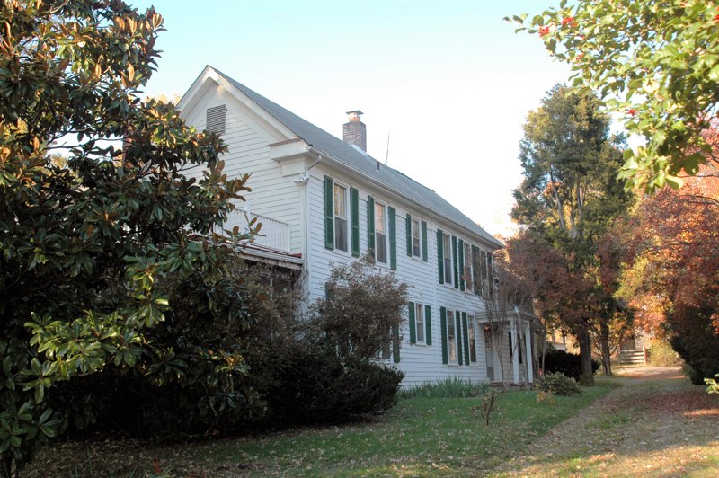

Chantilly, Virginia
Chantilly is a community of 24,036 people in Fairfax County, Virginia.
Why visit Chantilly
Townapedia lists 26 museums and landmarks, 52 parks and trails, 177 places to eat, 13 places to stay and 4 attractions in and around town.
Highlights include Airbus IMAX Theater, Rock Hill, Steven F. Udvar-Hazy Center and Floris Historic District.
July is the warmest month, with average highs of 88°F; January lows average 25°F, and about 21 inches of snow fall in a normal year.
Weather in Chantilly
Forecast from the National Weather Service. Full forecast
About Chantilly
Chantilly is a census-designated place (CDP) in western Fairfax County, Virginia, United States. The population was 24,301 as of the 2020 census.
From the Wikipedia article Chantilly, Virginia (this version), under CC BY-SA 4.0.
Things to do4


Museums and landmarks26

Steven F. Udvar-Hazy Center
Museum · 1.5 mi
14390 Air and Space Museum Parkway, Chantilly
Mo-Su 10:00-17:30

Floris Historic District
Monument and historic site · National Register of Historic Places · 3.9 mi
Historic district in Virginia, United States
Merrybrook
Monument and historic site · National Register of Historic Places · 4.9 mi
Historic house in Virginia, United States

Sully Historic Site
Monument and historic site · National Register of Historic Places
Human settlement in Virginia, United States of America

Vale School-Community House
Monument and historic site · National Register of Historic Places · 5.0 mi
Place in Virginia listed on National Register of Historic Places

Haymarket School house
Monument and historic site · 1.4 mi
Log schoolhouse, originally from Antioch Farm, in Haymarket, Virginia. Moved to Sully for preservation in 1963. Restrooms on lower level.
Trail Marker 6
Monument and historic site · 1.6 mi
Cain's Branch Archaeological Trail "Loudoun Branch" of the Historic Manassas Gap Railroad
14 more on the map.
Parks, trails and playgrounds52


Ellanor C. Lawrence Park
Park · 2.2 mi
Park in the United States of America
5040 Walney Road, Chantilly

Frying Pan Farm Park
Park · 3.7 mi
Park in Virginia, United States of America, United States of America
Ox Hill Battlefield Park
Park · 4.3 mi
Park located on the site of a Civil War battlefield in Fairfax, Virginia, USA

40 more on the map.
Restaurants and cafes177


Baskin-Robbins
Ice cream · Ice Cream · 2.3 mi
13344 Franklin Farm Road, Herndon
Mo-Th 11:00-21:30; Fr-Sa 11:00-22:00; Su 11:00-21:30
Big Buns
Restaurant · Burger · 2.3 mi
13300 Franklin Farm Road, Herndon
Su-Th 11:00-21:05; Fr-Sa 11:00-22:05

Cafein
Cafe · Coffee Shop · 1.1 mi
13924 Metrotech Drive, Chantilly
Mo-Fr 07:00-18:00; Sa-Su 08:00-19:00
Charcoal Chicken - Pakistani & Indian Cuisine
Restaurant · International, Grill, Mediterranean, Chicken, Arab, Kebab, Indian, Curry, Barbecue · 0.9 mi
13969 Metrotech Drive, Chantilly
Tu-Su 11:00-22:00
Dolan Uyghur Restaurant.
Restaurant · Chicken, Ramen, Noodle, Kebab, Coffee Shop · 1.1 mi
13872 Metrotech Drive, Chantilly
Mo-Su 11:30-22:00
First Watch
Restaurant · American, Breakfast · 2.5 mi
13027 Lee Jackson Memorial Hwy, Fairfax
Mo-Su 07:00-14:30
Hooters
Restaurant · Burger
14441 Brookfield Tower Drive, Chantilly
Mo-Th 11:00-00:00; Fr-Sa 11:00-01:00; Su 11:00-23:00
Hunan Cafe
Restaurant · Chinese · 2.6 mi
4096 Majestic Lane, Fairfax
Mo-Th 11:00-22:00,Fr-Sa 11:00-22:30, Su 11:30-22:00
165 more on the map.
History
Chantilly was home to a number of colonial plantations in the 1700s, including the Sully Plantation (now the Sully Historic Site) built by Richard Bland Lee I. Other plantations included George Richard Lee Turberville's "Leeton Grove" (originally a 5,000+ acre plantation, the main house of which still stands at 4619 Walney Rd.), the John Hutchison Farm, and the Chantilly Plantation. During the Civil War, federal troops destroyed by fire the Chantilly Plantation manor house. One building remains, a stone house across Route 50 from the Greenbriar Shopping Center. While it is not clear what this stone house was used for, most historical evidence suggests it was probably a plantation overseer's quarters during the antebellum period, and a tavern or boarding house following the war. After the war, Cornelia Stuart, who had become deeply in debt, sold her 1,064-acre (431 ha) Chantilly estate. The advertisement for the sale referenced several "tenements", one of which was the Stone House.
The village grew during the 19th century, particularly following the construction of the Little River Turnpike to Winchester.
The evolution of the Chantilly area into an outer suburb of Washington, D.C., gained momentum after 1980, as developers built residential subdivisions and commercial areas, filling in the farmland south of Dulles Airport.
From the History section of Chantilly, Virginia on Wikipedia, under CC BY-SA 4.0.
Where to stay13
Fairfield Inn & Suites Dulles Airport Chantilly
Motel and hotel · 0.7 mi
3960 Corsair Court, Chantilly
Residence Inn Chantilly Dulles South
Motel and hotel · 0.7 mi
14440 Chantilly Crossing Lane, Chantilly
Westfields Marriott Washington Dulles
Motel and hotel · 1.2 mi
14750 Conference Center Drive, Chantilly
Holiday Inn Chantilly-Dulles Expo (Airport)
Motel and hotel
4335 Chantilly Shopping Center, Chantilly
MainStay Suites
Motel and hotel · 0.5 mi
4506 Brookfield Corporate Drive, Chantilly
Staybridge Suites Chantilly Dulles Airport
Motel and hotel · 0.9 mi
3860 Centerview Drive, Chantilly
Wingate by Wyndham Chantilly / Dulles Airport
Motel and hotel · 0.7 mi
3940 Centerview Drive, Chantilly
Churches and places of worship30
Frying Pan Meetinghouse
Church · National Register of Historic Places · 3.8 mi
Shopping17
Al Makkah Mart (Zabihah Halal Meat and Groceries)
Grocery · 0.7 mi
14504 Lee Road, Chantilly
Gas and EV charging18
Schools, colleges and libraries61
Healthcare6
Map of Chantilly
250 places. The map loads OpenStreetMap tiles when you open it.
Climate by month
Monthly table
| Month | High | Low | Rain | Snow |
|---|---|---|---|---|
| Jan | 43°F | 25°F | 2.9 in | 6.9 in |
| Feb | 46°F | 27°F | 2.6 in | 7.0 in |
| Mar | 55°F | 34°F | 3.5 in | 3.9 in |
| Apr | 67°F | 43°F | 3.5 in | 0.1 in |
| May | 75°F | 53°F | 4.7 in | 0.0 in |
| Jun | 83°F | 62°F | 4.3 in | 0.0 in |
| Jul | 88°F | 67°F | 4.2 in | 0.0 in |
| Aug | 86°F | 65°F | 3.5 in | 0.0 in |
| Sep | 79°F | 58°F | 3.9 in | 0.0 in |
| Oct | 68°F | 45°F | 3.6 in | 0.0 in |
| Nov | 56°F | 36°F | 3.1 in | 0.3 in |
| Dec | 46°F | 29°F | 3.3 in | 2.8 in |
U.S. Climate Normals 1991-2020 for Washington Dc Dulles Ap 72403 (4 mi away), NOAA NCEI.
People and cost of living
American Community Survey 5-year estimates, 2020-2024, U.S. Census Bureau. Estimates have margins of error, larger for small towns.
Disaster history
Fairfax County has had 14 federal disaster declarations since 2000, most often for hurricanes.
- 2026-01-23: Severe Winter Storm (Winter Storm)
- 2020-04-02: Covid-19 Pandemic (Biological)
- 2020-03-13: Covid-19 (Biological)
- 2018-09-11: Hurricane Florence (Hurricane)
- 2016-03-07: Severe Winter Storm And Snowstorm (Snowstorm)
- 2012-10-29: Hurricane Sandy (Hurricane)
OpenFEMA disaster declarations summaries.
Getting there and nearby towns
Washington Dulles International Airport (IAD) is the nearest airport with scheduled flights listed in OpenStreetMap, 5 miles away.
- Brambleton 8 mi northwest, about 13 min by car
- Bull Run 9 mi southwest, about 14 min by car
- Broadlands 9 mi northwest, about 15 min by car
- Ashburn 10 mi north, about 15 min by car
- Burke Centre 10 mi southeast, about 16 min by car
- Cascades 11 mi north, about 18 min by car
- Burke 12 mi southeast, about 20 min by car
- Buckhall 12 mi south, about 19 min by car
- Annandale 14 mi east, about 22 min by car
- Potomac 16 mi northeast, about 26 min by car
Drive times are estimates from straight-line distance, not routes.
Local news
Headlines from INDB, the NEMICO news database.
Reviews, tips and questions
Loading what members have shared...
Sources and licences
- NCES EDGE (Public domain): public schools
- NOAA NCEI U.S. Climate Normals 1991-2020 (Public domain): climate by month
- OpenFEMA (Public domain): disaster declarations
- OpenStreetMap contributors (ODbL 1.0): places, airports, map data
- U.S. Census Bureau (Public domain): population, income, housing, education, commute
- Wikidata (CC0 1.0): elevation, founding date, time zone, website, landmarks and historic places
- Wikimedia Commons (see each image): photos
- Wikipedia (CC BY-SA 4.0): overview and history text
Photo credits
- 2016-02-28 15 39 37 View east along Lee Jackson Memorial Highway (U.S. Route 50) from Sully Road (Virginia State Route 28) in Chantilly, Virginia, Famartin, CC BY-SA 4.0
- FryingPanMeetingHouse south, Cecouchman, CC BY-SA 3.0
- FallHouse, Sonofkenny ( talk ), Public domain
- KidwellFarm 2, Cecouchman, CC BY-SA 3.0
- Merrybrook Exterior, Shape Of Air at en.wikipedia, Public domain
- VALE SCHOOL, JERRYE & ROY KLOTZ MD, CC BY-SA 3.0
- Walney Visitor Center, VA Student4, CC BY-SA 3.0
Page built October 30, 2026. Spotted a mistake? Tell us or suggest a place.