


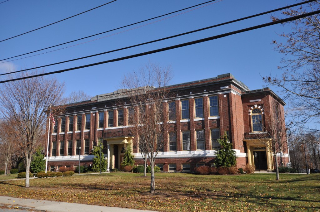

Chepachet, Rhode Island
Chepachet is a community of 1,923 people in Providence County, Rhode Island.
Why visit Chepachet
Townapedia lists 8 museums and landmarks, 2 parks and trails, 3 places to eat and 4 attractions in and around town.
Highlights include Absalona Hill, Acote Hill, Glocester Town Pound and Chepachet.
July is the warmest month, with average highs of 80°F; January lows average 18°F, and about 62 inches of snow fall in a normal year.
Weather in Chepachet
Forecast from the National Weather Service. Full forecast
About Chepachet
Chepachet is a village and census-designated place (CDP) in the town of Glocester in the northwestern part of the U.S. state of Rhode Island. It is centered at the intersection of U.S. Route 44 (a.k.a. Putnam Pike) and Rhode Island Route 102 (also known as Victory Highway and Chopmist Hill Road). Chepachet's ZIP code is 02814.
From the Wikipedia article Chepachet, Rhode Island (this version), under CC BY-SA 4.0.
Things to do4

Museums and landmarks8

Glocester Town Pound
Monument and historic site · National Register of Historic Places · 1.1 mi
Historic animal pound in Glocester, Rhode Island

Chepachet
Monument and historic site · National Register of Historic Places · 0.6 mi
Village and census-designated place in the town of Glocester, Rhode Island
Harmony Chapel and Cemetery
Monument and historic site · National Register of Historic Places · 3.5 mi
Historic site in Providence County, Rhode Island, US
Manton-Hunt-Farnum Farm
Monument and historic site · National Register of Historic Places · 2.3 mi
Building in Glocester, Rhode Island, United States
Oakland
Monument and historic site · National Register of Historic Places · 3.3 mi
Village in Burrillville, Rhode Island,
Pascoag Grammar School
Monument and historic site · National Register of Historic Places · 4.2 mi
School building in Rhode Island, United States of America

Parks, trails and playgrounds2


Restaurants and cafes3





History
"Chepachet" was originally inhabited by the Pequot and Nipmuc natives; the name means "where rivers meet".
Leading up to the American Revolution, the area was a hotbed for supporters of independence, and the Gloucester Light Infantry was founded in the Chepachet in 1774. During the Revolutionary War Loyalists from Newport were exiled near Chepachet, including Thomas Vernon, who recorded election celebrations in Chepachet in 1776:
This being the day for the choice of Deputies (members of the General Assembly). We are told that there is a very great resort of people of all kinds at Chepasseh, and that it is a day of great frolicking. Our landlord and his three sons are gone, having rigged themselves out in the best manner. [A] man on horseback passed by (together with many others) with a very large bag full of cakes made by Granne West (mother to the General William West) which are to be sold to the people.
In 1842, Chepachet was the setting of the endgame of the Dorr Rebellion, which helped to win voting rights for non-landowners in a new state Constitution.
From the History section of Chepachet, Rhode Island on Wikipedia, under CC BY-SA 4.0.
Churches and places of worship4
Chepachet Free Will Baptist
Church · Baptist · 0.6 mi
1213 Putnam Pike, Chepachet
Shopping2
Gas and EV charging1
Schools, colleges and libraries11
Healthcare1
Map of Chepachet
36 places. The map loads OpenStreetMap tiles when you open it.
Climate by month
Monthly table
| Month | High | Low | Rain | Snow |
|---|---|---|---|---|
| Jan | 35°F | 18°F | 4.5 in | 15.5 in |
| Feb | 38°F | 20°F | 3.9 in | 15.6 in |
| Mar | 46°F | 27°F | 5.2 in | 13.4 in |
| Apr | 58°F | 37°F | 4.7 in | 2.6 in |
| May | 68°F | 46°F | 3.8 in | 0.0 in |
| Jun | 76°F | 56°F | 4.5 in | 0.0 in |
| Jul | 80°F | 61°F | 3.6 in | 0.0 in |
| Aug | 79°F | 60°F | 4.5 in | 0.0 in |
| Sep | 72°F | 53°F | 4.4 in | 0.0 in |
| Oct | 61°F | 42°F | 5.0 in | 0.5 in |
| Nov | 50°F | 33°F | 4.5 in | 2.0 in |
| Dec | 40°F | 24°F | 5.2 in | 12.4 in |
U.S. Climate Normals 1991-2020 for N Foster 1 E (5 mi away), NOAA NCEI.
People and cost of living
American Community Survey 5-year estimates, 2020-2024, U.S. Census Bureau. Estimates have margins of error, larger for small towns.
Disaster history
Providence County has had 17 federal disaster declarations since 2000, most often for severe storms.
- 2024-03-20: Severe Storms And Flooding (Severe Storm)
- 2024-03-20: Severe Storm And Flooding (Severe Storm)
- 2024-01-07: Severe Storms, Flooding, And Tornadoes (Severe Storm)
- 2022-05-12: Severe Winter Storm And Snowstorm (Snowstorm)
- 2021-08-21: Hurricane Henri (Hurricane)
- 2020-03-30: Covid-19 Pandemic (Biological)
OpenFEMA disaster declarations summaries.
Getting there and nearby towns
North Central State Airport (SFZ) is the nearest airport with scheduled flights listed in OpenStreetMap, 9 miles away.
- Woonsocket 10 mi northeast, about 17 min by car
- East Douglas 12 mi north, about 20 min by car
- Cranston 13 mi southeast, about 21 min by car
- Putnam 13 mi west, about 21 min by car
- Danielson 13 mi southwest, about 22 min by car
- Providence 14 mi southeast, about 22 min by car
- Central Falls 14 mi east, about 22 min by car
- Valley Falls 14 mi east, about 22 min by car
- Webster 14 mi northwest, about 23 min by car
- Pawtucket 15 mi east, about 24 min by car
Drive times are estimates from straight-line distance, not routes.
Local news
Headlines from INDB, the NEMICO news database.
Reviews, tips and questions
Loading what members have shared...
Sources and licences
- NCES EDGE (Public domain): public schools
- NOAA NCEI U.S. Climate Normals 1991-2020 (Public domain): climate by month
- OpenFEMA (Public domain): disaster declarations
- OpenStreetMap contributors (ODbL 1.0): places, airports, map data
- U.S. Census Bureau (Public domain): population, income, housing, education, commute
- Wikidata (CC0 1.0): landmarks and historic places
- Wikimedia Commons (see each image): photos
- Wikipedia (CC BY-SA 4.0): overview and history text
Photo credits
- Chepachet general store, Swampyank at English Wikipedia, CC BY-SA 3.0
- Family Dollar (Chepachet, Rhode Island) (38611416232), JJBers from Willimantic, Connecticut, USA, CC BY 2.0
- Glocester Town Pound Glocester Rhode Island, Swampyank at en.wikipedia, CC BY-SA 3.0
- OaklandRI MillRuin, User:Magicpiano, CC BY-SA 4.0
- PascoagRI PascoagGrammarSchool, User:Magicpiano, CC BY-SA 4.0
- New Pond, Glocester, RI (31790953030), Doug McGrady from Warwick, RI, USA, CC BY 2.0
- Jay Fraga, Redline Cup 2007, Rhode Island, Jay Fraga, CC BY-SA 2.0
- ISS063-E-26981 - View of Earth, Earth Science and Remote Sensing Unit, NASA Johnson Space Center, Public domain
- ISS027-E-13691 - View of Earth, Earth Science and Remote Sensing Unit , Lyndon B. Johnson Space Center, Public domain
- ISS063-E-26985 - View of Earth, Earth Science and Remote Sensing Unit, NASA Johnson Space Center, Public domain
- ISS063-E-26984 - View of Earth, Earth Science and Remote Sensing Unit, NASA Johnson Space Center, Public domain
- ISS063-E-26982 - View of Earth, Earth Science and Remote Sensing Unit, NASA Johnson Space Center, Public domain
- ISS027-E-34499 - View of Earth, Earth Science and Remote Sensing Unit , Lyndon B. Johnson Space Center, Public domain
- ISS026-E-21995 - View of Earth, Earth Science and Remote Sensing Unit , Lyndon B. Johnson Space Center, Public domain
- ISS063-E-26983 - View of Earth, Earth Science and Remote Sensing Unit, NASA Johnson Space Center, Public domain
- ISS023-E-57740 - View of Earth, Earth Science and Remote Sensing Unit , Lyndon B. Johnson Space Center, Public domain
- GlocesterRI MantonHuntFarnumFarm 2, Magicpiano, CC BY-SA 3.0
- GlocesterRI MantonHuntFarnumFarm 1, Magicpiano, CC BY-SA 3.0


Page built October 30, 2026. Spotted a mistake? Tell us or suggest a place.