



Chula Vista, California
Chula Vista is a city of 276,375 people in San Diego County, California, founded in 1911.
Why visit Chula Vista
Townapedia lists 15 museums and landmarks, 71 parks and trails, 244 places to eat, 4 places to stay and 9 attractions in and around town.
Highlights include North Island Credit Union Amphitheatre, AMC Otay Ranch 12, Granger Hall and National City station.
September is the warmest month, with average highs of 77°F; December lows average 46°F.
Weather in Chula Vista
Forecast from the National Weather Service. Full forecast
About Chula Vista
Chula Vista ( CHOO-lə VIST-ə; Spanish for 'Beautiful/Pretty View', Spanish pronunciation: [ˈtʃula ˈβista] ) is a city in San Diego County, California, United States. It is the second-most populous city in the San Diego metropolitan area, the seventh-most populous city in Southern California, the 15th-most populous city in the state of California, and the 81st-most populous city in the United States. The population was 275,487 as of the 2020 census, up from 243,916 as of the 2010 census. It is located in the South Bay, about halfway, 7.5 miles (12.1 km), between the two downtowns of the San Diego–Tijuana region.
From the Wikipedia article Chula Vista, California (this version), under CC BY-SA 4.0.
Things to do9

North Island Credit Union Amphitheatre
Cinema and theater · 2.8 mi
2050 Entertainment Circle, Chula Vista

San Diego Continuing Education
School · 7.0 mi
Educational institution in California, USA
Vogue Theatre
Cinema and theater · 4.0 mi
Former movie theater in Chula Vista, California, United States
Regal Rancho Del Rey
Cinema and theater · 0.8 mi
1025 Tierra del Rey, Chula Vista

Museums and landmarks15
Granger Hall
Monument and historic site · National Register of Historic Places · 5.9 mi
Music hall in National City, San Diego County, California
National City station
Monument and historic site · National Register of Historic Places · 6.0 mi
Railway station in National City, California
United States Custom House
Monument and historic site · National Register of Historic Places · 5.9 mi
1933 Spanish Revival building located 50 feet (15 m) north of the Mexico–United States border at the San Ysidro Port of Entry

Centro Cultural Tijuana
Museum · 6.8 mi
Cultural center in Tijuana, Mexico
Living Coast Discovery Center
Museum · 5.6 mi
Nature center, aquarium and zoo in Chula Vista, California

Rosita's Harmony Hills
Monument and historic site · 2.8 mi
Climb, crawl, and create beautiful “música” as you play on the rolling green hillsides of Rosita’s Harmony Hills!
3 more on the map.
Parks, trails and playgrounds71


Sesame Place San Diego
Sports field and stadium · 2.8 mi
Children's theme and water park in Chula Vista, California
2052 Entertainment Circle, Chula Vista
Discovery Park
Park · 1.2 mi
Park in San Diego County, California, United States of America

59 more on the map.
Restaurants and cafes244

California Sushi
Restaurant · Sushi · 3.8 mi
337 3rd Avenue, Chula Vista
Mo,Tu 11:00-21:00;We-Fr 11:00-22:00;Sa 12:00-22:00;Su 12:00-20:00
Casa Nori Sushi
Restaurant · Japanese · 1.8 mi
1730 East Palomar Street, Chula Vista
Mo-Su 13:00-22:00
El Pollo Grill Bonita
Restaurant · Mexican · 2.9 mi
3041 Bonita Road, Chula Vista
Mo-Th 10:00-21:00; Fr-Su 09:00-21:00
Himalayan Tandoori & Curry House
Restaurant · Indian, Himalayan · 4.2 mi
555 Broadway, Chula Vista
Su-Th 11:00-21:00; Fr-Sa 11:00-22:00
Italianissimo Trattoria
Restaurant · Italian · 3.8 mi
323 3rd Avenue, Chula Vista
Mo-Th 11:00-21:00;Fr,Sa 11:00-22:00;Su 12:00-20:30
La Bella
Restaurant · Italian Pizza, Pasta · 3.8 mi
373 3rd Avenue
Su-Th 09:00-21:30; Fr-Sa 09:00-22:00
La Bella Cafe & Games
Restaurant · Italian, Pasta, Pizza · 3.7 mi
289 G Street, Chula Vista
Su 12:00-22:00; Mo, We-Th 16:00-22:00; Tu closed; Fr 15:30-23:00;...

La Nacional
Bar and pub · Mexican · 3.9 mi
279 3rd Avenue, Chula Vista
Mo-Th 15:00-00:00; Fr 12:00-01:30; Sa 09:00-01:30; Su 09:00-00:00
232 more on the map.
Where to stay4
Days Inn by Wyndham San Diego Chula Vista South Bay
Motel and hotel · 4.9 mi
699 E Street, Chula Vista
Howard Johnson Inn And Suites San Diego Area/Chula Vista
Motel and hotel · 4.8 mi
235 Woodlawn Avenue, Chula Vista
Churches and places of worship67
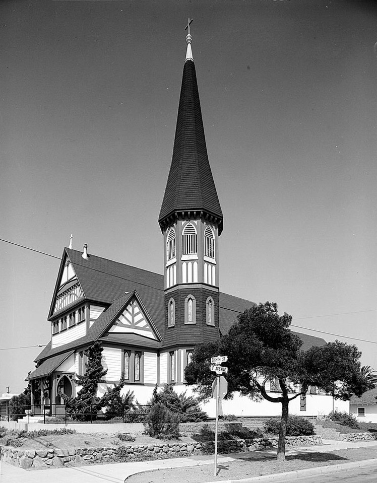
St. Matthew's Episcopal Church
Church · National Register of Historic Places · 6.1 mi
Christian Science Reading Room
Church · Christ Scientist · 3.9 mi
300 3rd Avenue, Chula Vista
Most Precious Blood Catholic Church
Church · Roman Catholic · 3.5 mi
1245 4th Avenue, Chula Vista
Shopping60
Gas and EV charging20
Stars and Stripes Gas and Diesel
Gas station · 2.7 mi
4430 Main Street, San Diego
Schools, colleges and libraries119
Mater Dei Catholic High School
School · Roman Catholic · 2.3 mi
1615 Mater Dei Drive, Chula Vista
Healthcare16
Paradise Valley Hospital Bayview Behavioral Health Campus
Hospital · 3.3 mi
330 Moss Street, Chula Vista
Passport Health Chula Vista Travel Clinic
Clinic and pharmacy · 3.3 mi
821 Kuhn Drive, Chula Vista
Rady Children's Health Services
Clinic and pharmacy · 2.1 mi
386 East H Street, Chula Vista
Map of Chula Vista
250 places. The map loads OpenStreetMap tiles when you open it.
Climate by month
Monthly table
| Month | High | Low | Rain | Snow |
|---|---|---|---|---|
| Jan | 68°F | 46°F | 1.8 in | 0.0 in |
| Feb | 67°F | 48°F | 2.3 in | 0.0 in |
| Mar | 67°F | 51°F | 1.4 in | 0.0 in |
| Apr | 68°F | 54°F | 0.7 in | 0.0 in |
| May | 69°F | 58°F | 0.3 in | 0.0 in |
| Jun | 71°F | 61°F | 0.1 in | 0.0 in |
| Jul | 75°F | 65°F | 0.1 in | 0.0 in |
| Aug | 77°F | 66°F | 0.0 in | 0.0 in |
| Sep | 77°F | 64°F | 0.1 in | 0.0 in |
| Oct | 75°F | 58°F | 0.4 in | 0.0 in |
| Nov | 71°F | 51°F | 0.6 in | 0.0 in |
| Dec | 66°F | 46°F | 1.6 in | 0.0 in |
U.S. Climate Normals 1991-2020 for Chula Vista Hcn (4 mi away), NOAA NCEI.
People and cost of living
American Community Survey 5-year estimates, 2020-2024, U.S. Census Bureau. Estimates have margins of error, larger for small towns.
Disaster history
San Diego County has had 35 federal disaster declarations since 2000, most often for fires.
- 2024-02-19: Severe Storm And Flooding (Flood)
- 2023-01-14: Severe Winter Storms, Flooding, Landslides, And Mudslides (Flood)
- 2023-01-09: Severe Winter Storms, Flooding, And Mudslides (Flood)
- 2020-10-16: Wildfires (Fire)
- 2020-03-22: Covid-19 Pandemic (Biological)
- 2020-03-13: Covid-19 (Biological)
OpenFEMA disaster declarations summaries.
Getting there and nearby towns
Brown Field Municipal Airport (SDM) is the nearest airport with scheduled flights listed in OpenStreetMap, 4 miles away.
- Bonita 3 mi north, about 5 min by car
- National City 6 mi northwest, about 9 min by car
- La Presa 6 mi north, about 9 min by car
- Imperial Beach 7 mi southwest, about 12 min by car
- Spring Valley 7 mi north, about 12 min by car
- Lemon Grove 7 mi north, about 12 min by car
- Coronado 8 mi west, about 14 min by car
- La Mesa 10 mi north, about 16 min by car
- Casa de Oro-Mount Helix 10 mi north, about 16 min by car
- Rancho San Diego 11 mi northeast, about 17 min by car
Drive times are estimates from straight-line distance, not routes.
Local news
Headlines from INDB, the NEMICO news database.
Reviews, tips and questions
Loading what members have shared...
Sources and licences
- NCES EDGE (Public domain): public schools
- NOAA NCEI U.S. Climate Normals 1991-2020 (Public domain): climate by month
- OpenFEMA (Public domain): disaster declarations
- OpenStreetMap contributors (ODbL 1.0): places, airports, map data
- U.S. Census Bureau (Public domain): population, income, housing, education, commute
- Wikidata (CC0 1.0): elevation, founding date, time zone, website, landmarks and historic places
- Wikimedia Commons (see each image): photos
- Wikipedia (CC BY-SA 4.0): overview and history text
Photo credits
- Gateway Buildings, Chula Vista, WeaponizingArchitecture, CC BY-SA 4.0
- National City Depot (National City, CA), Edward Gohlich, photographer, Public domain
- Granger Music Hall (National City, CA), Unknown author Unknown author, Public domain
- U.S. Custom House (San Ysidro, California) front, National Register of Historic Places, National Park Service, Public domain
- St. Matthew's Episcopal Church (National City, CA), Marvin Rand, HABS photographer, Public domain
Page built October 30, 2026. Spotted a mistake? Tell us or suggest a place.