
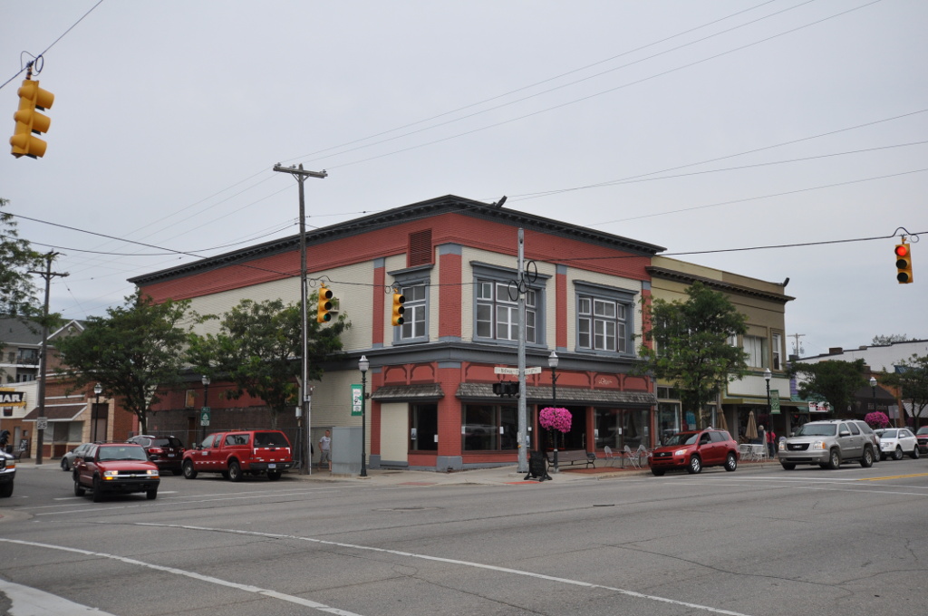

Clare, Michigan
Clare is a city of 3,324 people in Clare County, Michigan, founded in 1870.
Why visit Clare
Townapedia lists 2 museums and landmarks, 8 parks and trails, 20 places to eat, 3 places to stay and 1 attraction in and around town.
Highlights include Ideal Theatre, Clare Downtown Historic District, Barnes Island Park and Brookwood Park.
July is the warmest month, with average highs of 84°F; January lows average 16°F.
Weather in Clare
Forecast from the National Weather Service. Full forecast
About Clare
Clare is a city in the U.S. state of Michigan. Located near the center of Michigan's Lower Peninsula, the city is located mostly in Clare County, while a small portion extends south into Isabella County. The city had a population of 3,254 at the 2020 census.
From the Wikipedia article Clare, Michigan (this version), under CC BY-SA 4.0.
Things to do1

Museums and landmarks2
Clare Downtown Historic District
Monument and historic site · National Register of Historic Places · 0.6 mi
Historic district in Clare, Michigan

Parks, trails and playgrounds8

Restaurants and cafes20

Leprechaun Lounge
Restaurant · Sandwich, Burger, Regional · 0.5 mi
604 North McEwan Street
Mo-Th 07:00-20:00; Fr 07:00-21:00; Sa 08:00-21:00; Su 08:00-20:00
Whitehouse Restaurant
Restaurant · American, Burger · 0.5 mi
613 North McEwan Street
Mo-Su 07:00-22:00

Ruckle's Pier
Restaurant · 0.7 mi
405 North McEwan Street, Clare
Mo-Th 10:00-23:00; Fr-Sa 10:00-14:00; Su 11:00-22:00

Timeout Tavern
Diner · American · 0.5 mi
601 North McEwan Street



Burger King
Fast food · Burger · 1.1 mi
10210 South Clare Avenue, Clare
Mo-Sa 06:00-22:00; Su 07:00-22:00
8 more on the map.
History
Clare was founded with the coming of the Pere Marquette Railroad in 1870. It was named after the county, which was named after County Clare in Ireland. The Clare post office opened on January 20, 1871. It incorporated as a village in 1879 and as a city in 1891.
Cops & Doughnuts is a bakery that opened in 2009 in the former Clare City Bakery that dates back to 1896.
From the History section of Clare, Michigan on Wikipedia, under CC BY-SA 4.0.
Where to stay3
Churches and places of worship11
Clare Congregational Church
Church · National Register of Historic Places · 0.6 mi
Shopping3
Gas and EV charging9
Schools, colleges and libraries8
Healthcare2
Map of Clare
67 places. The map loads OpenStreetMap tiles when you open it.
Climate by month
Monthly table
| Month | High | Low | Rain |
|---|---|---|---|
| Jan | 30°F | 16°F | 2.1 in |
| Feb | 32°F | 16°F | 1.7 in |
| Mar | 43°F | 24°F | 1.9 in |
| Apr | 56°F | 34°F | 3.6 in |
| May | 69°F | 46°F | 3.7 in |
| Jun | 80°F | 56°F | 3.9 in |
| Jul | 84°F | 61°F | 3.2 in |
| Aug | 82°F | 59°F | 3.8 in |
| Sep | 74°F | 51°F | 2.8 in |
| Oct | 60°F | 40°F | 3.5 in |
| Nov | 46°F | 31°F | 2.8 in |
| Dec | 35°F | 22°F | 2.4 in |
U.S. Climate Normals 1991-2020 for Central Michigan Univ Hcn (17 mi away), NOAA NCEI.
People and cost of living
American Community Survey 5-year estimates, 2020-2024, U.S. Census Bureau. Estimates have margins of error, larger for small towns.
Disaster history
Clare County has had 4 federal disaster declarations since 2000, most often for biologicals.
- 2020-03-27: Covid-19 Pandemic (Biological)
- 2020-03-13: Covid-19 (Biological)
- 2005-09-07: Hurricane Katrina Evacuation (Hurricane)
- 2001-01-10: Snow (Snowstorm)
OpenFEMA disaster declarations summaries.
Getting there and nearby towns
Mount Pleasant Municipal Airport (MOP) is the nearest airport with scheduled flights listed in OpenStreetMap, 14 miles away.
- Beaverton 14 mi east, about 23 min by car
- Mount Pleasant 16 mi south, about 26 min by car
- Midland 30 mi southeast, about 48 min by car
- Canadian Lakes 32 mi southwest, about 51 min by car
- Breckenridge 32 mi southeast, about 52 min by car
- Auburn 38 mi southeast, about 1 h by car
- Cadillac 44 mi northwest, about 1 h 15 min by car
- Carson City 45 mi south, about 1 h 15 min by car
- Bay City 47 mi east, about 1 h 15 min by car
- Saginaw 49 mi southeast, about 1 h 15 min by car
Drive times are estimates from straight-line distance, not routes.
Local news
Headlines from INDB, the NEMICO news database.
Reviews, tips and questions
Loading what members have shared...
Sources and licences
- NCES EDGE (Public domain): public schools
- NOAA NCEI U.S. Climate Normals 1991-2020 (Public domain): climate by month
- OpenFEMA (Public domain): disaster declarations
- OpenStreetMap contributors (ODbL 1.0): places, airports, map data
- U.S. Census Bureau (Public domain): population, income, housing, education, commute
- Wikidata (CC0 1.0): elevation, founding date, time zone, website, landmarks and historic places
- Wikimedia Commons (see each image): photos
- Wikipedia (CC BY-SA 4.0): overview and history text
Photo credits
- ClareMI HistoricDistrict1, Magicpiano, CC BY-SA 4.0
Page built October 30, 2026. Spotted a mistake? Tell us or suggest a place.