




Clark Mills, New York
Clark Mills is a community of 1,591 people in Oneida County, New York.
Why visit Clark Mills
Townapedia lists 5 museums and landmarks, 1 park or trail and 7 places to eat in and around town.
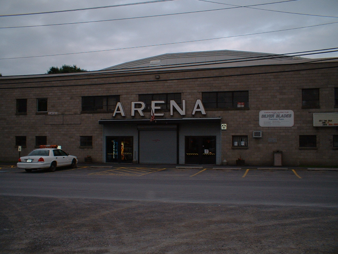
Highlights include Clinton Arena, Clinton Village Historic District and Heron Creek Golf Club.
July is the warmest month, with average highs of 80°F; January lows average 14°F.
Weather in Clark Mills
Forecast from the National Weather Service. Full forecast
About Clark Mills
Clark Mills is a hamlet (and census-designated place) in Oneida County, New York, United States. As of the 2020 census, Clark Mills had a population of 2,049.
From the Wikipedia article Clark Mills, New York (this version), under CC BY-SA 4.0.
Museums and landmarks5
Clinton Arena
Monument and historic site · National Register of Historic Places · 2.2 mi
Indoor arena in New York, United States

Clinton Village Historic District
Monument and historic site · National Register of Historic Places · 3.4 mi
Historic district in New York, United States


Elihu Root House
Monument and historic site · National Register of Historic Places · 2.8 mi
Historic house in New York, United States
Rev. Asahel Norton Homestead
Monument and historic site · National Register of Historic Places · 2.6 mi
Kirkland, New York

Ruth and Elmer Wellin Museum of Art
Museum · 2.7 mi
Art museum in Clinton, New York
Parks, trails and playgrounds1

Restaurants and cafes7

Bella Cucina
Restaurant · Italian · 0.7 mi
4910 Westmoreland Road, Clark Mills;Whitesboro

Churches and places of worship3
Hamilton College Chapel
Church · National Register of Historic Places · 2.7 mi
Historical chapel in New York

St. Mark's Church
Church · National Register of Historic Places · 0.4 mi
Church building in Clark Mills, New York, United States
History
The hamlet of Clark Mills, part of modern-day Town of Kirkland, is named for the Clark Mills Company, a textile mill on Oriskany Creek, and its founders: Ralph, Ammi, and Eneas Clark. The family business was established around 1845 and flourished for several years. In 1891 the company name changed to the Hind & Harrison Plush Co. and remained in operation until its closure in 1949.
St. Mark's Church was listed on the National Register of Historic Places in 1996.
On June 22, 2025, the hamlet was struck by a deadly high-end EF1 tornado. It downed dozens of trees, including some that fell on and heavily damaged homes. Three people were killed, which made this the second deadliest tornado in the state's history.
From the History section of Clark Mills, New York on Wikipedia, under CC BY-SA 4.0.
Gas and EV charging2
Schools, colleges and libraries21
Donald H Crane Junior/Senior High School
School · 2.4 mi
5176 Rt 233, Westmoreland
Mohawk Valley Psychiatric Center For Children & Youth
School · 5.9 mi
1400 Noyes St, Utica
Map of Clark Mills
39 places. The map loads OpenStreetMap tiles when you open it.
Climate by month
Monthly table
| Month | High | Low | Rain |
|---|---|---|---|
| Jan | 30°F | 14°F | 2.6 in |
| Feb | 32°F | 15°F | 2.3 in |
| Mar | 40°F | 23°F | 3.0 in |
| Apr | 55°F | 34°F | 3.9 in |
| May | 68°F | 46°F | 3.9 in |
| Jun | 76°F | 55°F | 4.5 in |
| Jul | 80°F | 60°F | 4.2 in |
| Aug | 79°F | 58°F | 4.7 in |
| Sep | 72°F | 51°F | 3.5 in |
| Oct | 59°F | 41°F | 4.3 in |
| Nov | 46°F | 31°F | 3.6 in |
| Dec | 35°F | 21°F | 3.6 in |
U.S. Climate Normals 1991-2020 for Utica Oneida Co Ap Hcn (4 mi away), NOAA NCEI.
People and cost of living
American Community Survey 5-year estimates, 2020-2024, U.S. Census Bureau. Estimates have margins of error, larger for small towns.
Disaster history
Oneida County has had 23 federal disaster declarations since 2000, most often for severe storms.
- 2022-11-20: Severe Winter Storm And Snowstorm (Winter Storm)
- 2021-10-08: Remnants Of Tropical Storm Fred (Hurricane)
- 2020-03-20: Covid-19 Pandemic (Biological)
- 2020-03-13: Covid-19 (Biological)
- 2019-12-19: Severe Storms, Straight-Line Winds, And Flooding (Severe Storm)
- 2017-07-12: Severe Winter Storm And Snowstorm (Snowstorm)
OpenFEMA disaster declarations summaries.
Getting there and nearby towns
Griffiss International Airport (RME) is the nearest airport with scheduled flights listed in OpenStreetMap, 10 miles away.
- Utica 8 mi east, about 12 min by car
- Rome 11 mi northwest, about 18 min by car
- Oneida 15 mi west, about 24 min by car
- Boonville 27 mi north, about 44 min by car
- DeWitt 36 mi west, about 58 min by car
- Syracuse 39 mi west, about 1 h by car
- Canajoharie 43 mi east, about 1 h 15 min by car
- Oneonta 46 mi south, about 1 h 15 min by car
- Gloversville 52 mi east, about 1 h 30 min by car
- Cortland 53 mi southwest, about 1 h 30 min by car
Drive times are estimates from straight-line distance, not routes.
Local news
Headlines from INDB, the NEMICO news database.
Reviews, tips and questions
Loading what members have shared...
Sources and licences
- NCES EDGE (Public domain): public schools
- NOAA NCEI U.S. Climate Normals 1991-2020 (Public domain): climate by month
- OpenFEMA (Public domain): disaster declarations
- OpenStreetMap contributors (ODbL 1.0): places, airports, map data
- U.S. Census Bureau (Public domain): population, income, housing, education, commute
- Wikidata (CC0 1.0): elevation, founding date, time zone, website, landmarks and historic places
- Wikimedia Commons (see each image): photos
- Wikipedia (CC BY-SA 4.0): overview and history text
Photo credits
- Clark Mills tornado grist mill, National Weather Service, Public domain
- St. March's Church, Clark Mills, Agreen54, CC BY-SA 4.0
- Clark Mills tornado damage tree into home, National Weather Service, Public domain
- Clinton Arena, Dron31 at English Wikipedia, Public domain
- HamiltonCollegeChapelFront, Lvklock, CC BY-SA 4.0
- ElihuRootHouse1, lvklock, CC BY-SA 4.0
- NY 233 sb at NY 5, July 2023, Mr. Matté (if there is an issue with this image, contact me using this image's Commons talk page , my Commons user talk page , or my English Wikipedia user talk page ; I'll know about it a lot faster), CC BY-SA 4.0

Page built October 30, 2026. Spotted a mistake? Tell us or suggest a place.