


Clarksville, Indiana
Clarksville is a town of 22,016 people in Clark County, Indiana, founded in 1783.
Why visit Clarksville
Townapedia lists 60 museums and landmarks, 28 parks and trails, 124 places to eat, 9 places to stay and 8 attractions in and around town.
Highlights include Derby Dinner Playhouse, Regal Cinemas New Albany 16, Old Clarksville Site and 32nd Indiana Monument.
July is the warmest month, with average highs of 89°F; January lows average 26°F.
Weather in Clarksville
Forecast from the National Weather Service. Full forecast
About Clarksville
Clarksville is a town in Clark County, Indiana, United States, along the Ohio River and is a part of the Louisville Metropolitan area. The population was 22,333 at the 2020 census. The town was founded in 1783 by early resident George Rogers Clark at the only seasonal rapids on the entire Ohio River, it is the oldest American town in the former Northwest Territory. The town is home to the Colgate clock, one of the largest clocks in the world and the Falls of the Ohio State Park, home to the world's largest exposed Devonian period fossil bed.
From the Wikipedia article Clarksville, Indiana (this version), under CC BY-SA 4.0.
Things to do8

Derby Dinner Playhouse
Cinema and theater · 2.9 mi
Dinner theatre in Clarksville, Indiana, United States
525 Marriott Drive, Clarksville

Abraham Lincoln Bridge
Bridge · 4.2 mi
Cable-stayed bridge carrying Interstate 65 across the Ohio River
Fourteenth Street Bridge
Bridge · 3.6 mi
Railroad bridge over the Ohio River between Louisville, Kentucky, and Clarksville, Indiana

Indiana University Southeast
School · 3.2 mi
Public regional campus of Indiana University
Kentucky & Indiana Terminal Bridge
Bridge · 3.3 mi
Bridge in United States of America
The Kentucky Center
Cinema and theater · 4.5 mi
Performing arts center in Louisville, Kentucky, United States
Museums and landmarks60

Old Clarksville Site
Monument and historic site · National Register of Historic Places · 2.5 mi
Archaeological site in Clarksville, United States of America

32nd Indiana Monument
Monument and historic site · National Register of Historic Places · 4.4 mi
US Civil War monument

Belle of Louisville
Monument and historic site · National Register of Historic Places · 4.7 mi
Steamboat owned and operated by the city of Louisville, Kentucky

Cedar Bough Place Historic District
Monument and historic site · National Register of Historic Places · 3.2 mi
Historic district in Indiana, United States

Culbertson Mansion
Monument and historic site · National Register of Historic Places · 3.5 mi
Mansion in New Albany, Indiana

DePauw Avenue Historic District
Monument and historic site · National Register of Historic Places · 2.7 mi
National historic district in New Albany, Indiana
Division Street School
Monument and historic site · National Register of Historic Places · 2.9 mi

East Spring Street Historic District
Monument and historic site · National Register of Historic Places · 3.5 mi
Historic district in Indiana, United States

Firehouse No. 13
Monument and historic site · National Register of Historic Places · 4.6 mi
Historic building in Louisville, Kentucky, United States
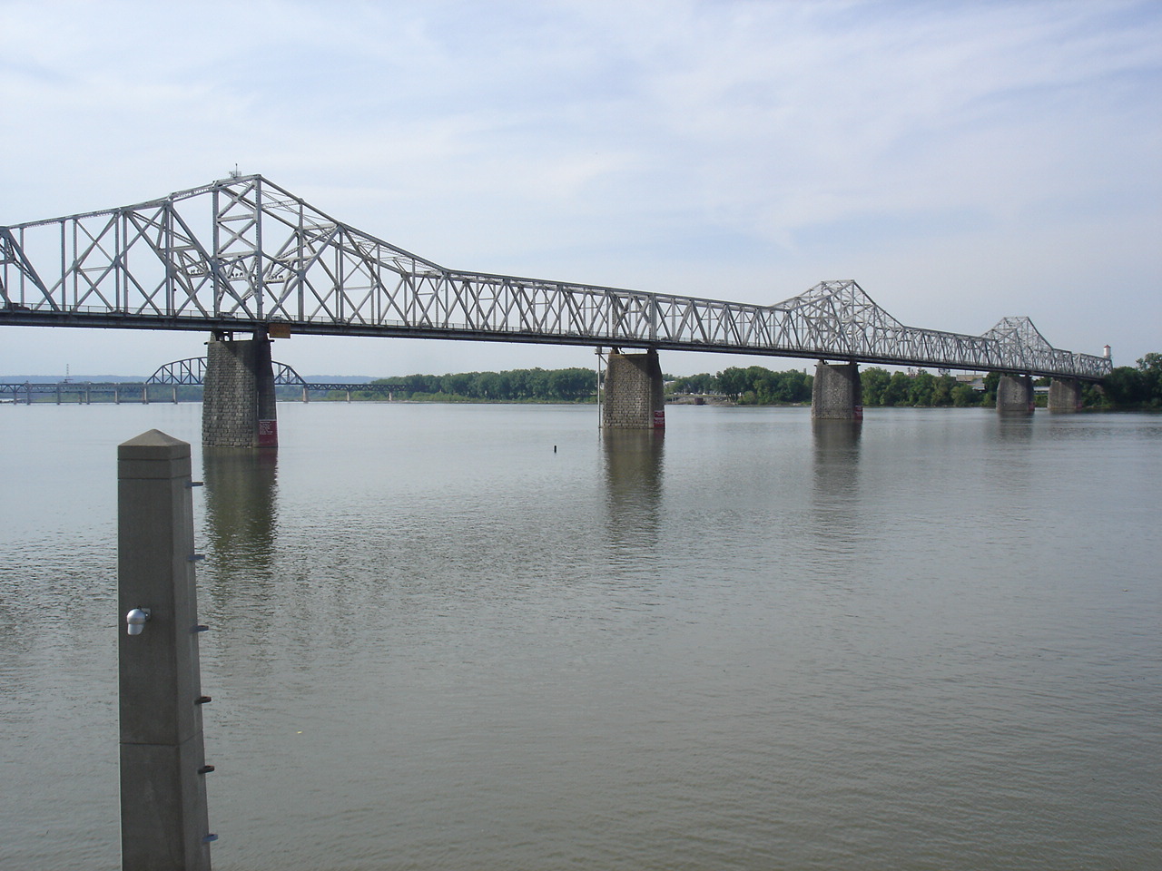


George Rogers Clark Memorial Bridge
Monument and historic site · National Register of Historic Places · 4.1 mi
Crossing of the Ohio River between Louisville, Kentucky, and Jeffersonville, Indiana
German Bank Building
Monument and historic site · National Register of Historic Places · 4.6 mi
Historic Building in Louisville, Kentucky, US
Grisamore House
Monument and historic site · National Register of Historic Places · 3.8 mi
Building in Indiana, United States
48 more on the map.
Parks, trails and playgrounds28

Lapping Park
Park · 1.2 mi
Park in Clarksville, United States of America
Boone Square
Park · 4.3 mi
Park in Kentucky, United States of America
Fort Nelson
Park · 4.5 mi
Fort built in area of Louisville, Kentucky, United States of America
Louisville Extreme Park
Park · 4.7 mi
Park in Kentucky, United States of America
Louisville Waterfront Park
Park · 4.5 mi
Along the Ohio River in Louisville, Kentucky, which opened in 1999
Warder Park
Park · 3.5 mi
Park located in Jeffersonville, Indiana, U.S.

16 more on the map.
Restaurants and cafes124

BoomBozz Pizza & Taphouse
Restaurant · Pizza · 1.2 mi
1450 Veterans Parkway, Jeffersonville
Mo-Th,Su 11:00-22:00; Fr-Sa 11:00-23:00
Hing Wang
Restaurant · Chinese · 2.4 mi
2123 East Spring Street, New Albany
Mo-Sa 11:00-21:00; Su 12:30-21:00

Homemade Ice Cream & Pie Kitchen
Bakery · Dessert, Sandwich · 1.8 mi
3113 Blackiston Mill Road, New Albany
Mo-Th 10:00-21:00; Fr-Sa 10:00-22:00; Su 12:00-21:00
Legacy Pizza & Bakery
Restaurant · Italian, Pizza · 2.9 mi
1001 Vincennes St, New Albany
Su-Mo off; Tu-Sa 11:30-21:00

Seven Brew
Cafe · Coffee Shop · 1.4 mi
1626 Veterans Parkway, Jeffersonville
Mo-Th,Su 05:30-22:00; Fr-Sa 05:30-23:00
Storming Crab
Restaurant · Seafood · 0.8 mi
1360 Veterans Parkway, Clarksville
Su-Th 11:00-21:30; Fr-Sa 11:00-22:30
Walk-On's Sports Bistreaux
Restaurant · Cajun · 0.8 mi
970 East Lewis and Clark Parkway, Clarksville
Su-Th 11:00-22:00; Fr-Sa 11:00-23:00

Uncommon Cups and Cones
Ice cream · 2.9 mi
518 Vincennes Street, New Albany
Th-Sa 14:00-20:00; Su-We off; PH off
112 more on the map.
History
The site that would become Clarksville was first used as a base of operations by George Rogers Clark during the American Revolutionary War. In 1778 he established a post on an island at the head of the Falls of the Ohio, from which he trained his 175-man regiment. After the war, Clark was granted a tract of 150,000 acres (610 km2) for his services in the war. In 1783, 1,000 acres (4 km2) were set aside for the development of a town, Clarksville. The same year a stockade was built and settlement began.
The explorer William Clark was a younger brother of George Rogers Clark. Historian Stephen Ambrose writes of Meriwether Lewis and William Clark in Undaunted Courage, "When they shook hands [at Clarksville], the Lewis and Clark Expedition began." A two-figure statue near the falls commemorates the expedition. Several localities other than Clarksville claim precedence for the start of the Lewis and Clark Expedition, most notably St. Louis, Missouri.
From the History section of Clarksville, Indiana on Wikipedia, under CC BY-SA 4.0.
Where to stay9
Days Inn & Suites by Wyndham Jeffersonville IN
Motel and hotel · 2.2 mi
354 Eastern Boulevard, Jeffersonville
Home2 Suites by Hilton Clarksville Louisville North
Motel and hotel · 0.7 mi
1624 Leisure Way, Clarksville
Holiday Inn Express & Suites Louisville N - Jeffersonville, an IHG Hotel;Holiday Inn Express & Suites
Motel and hotel · 1.4 mi
1635 Veterans Parkway;Hamburg Pike, Jeffersonville
Churches and places of worship12
Eastside Christian Church
Church · 1.9 mi
2319 Charlestown New Albany Road, Jeffersonville
Shopping30
Gas and EV charging14
Schools, colleges and libraries51
Central High Magnet Career Academy
School · 5.0 mi
1130 West Chestnut Street, Louisville
Healthcare6
PAM Health Rehabilitation Hospital of Greater Indiana
Hospital · 0.5 mi
2101 Broadway Street, Clarksville
Community Medical Center
Clinic and pharmacy · 2.8 mi
elberta Drive, Jeffersonville
Map of Clarksville
250 places. The map loads OpenStreetMap tiles when you open it.
Climate by month
Monthly table
| Month | High | Low | Rain | Snow |
|---|---|---|---|---|
| Jan | 43°F | 26°F | 3.5 in | 2.3 in |
| Feb | 48°F | 29°F | 3.5 in | 0.3 in |
| Mar | 57°F | 37°F | 4.5 in | 0.3 in |
| Apr | 69°F | 47°F | 4.8 in | 0.0 in |
| May | 77°F | 58°F | 4.8 in | 0.0 in |
| Jun | 85°F | 66°F | 4.4 in | 0.0 in |
| Jul | 89°F | 70°F | 3.5 in | 0.0 in |
| Aug | 88°F | 69°F | 3.3 in | 0.0 in |
| Sep | 82°F | 62°F | 3.9 in | 0.0 in |
| Oct | 70°F | 50°F | 3.5 in | 0.0 in |
| Nov | 57°F | 38°F | 3.8 in | 0.0 in |
| Dec | 47°F | 31°F | 4.5 in | 1.4 in |
U.S. Climate Normals 1991-2020 for Louisville Mcalpine (3 mi away), NOAA NCEI.
People and cost of living
American Community Survey 5-year estimates, 2020-2024, U.S. Census Bureau. Estimates have margins of error, larger for small towns.
Disaster history
Clark County has had 14 federal disaster declarations since 2000, most often for severe storms.
- 2026-01-24: Severe Winter Storm (Winter Storm)
- 2025-07-22: Severe Storms, Straight-Line Winds, Tornadoes, And Flooding (Flood)
- 2020-04-03: Covid-19 Pandemic (Biological)
- 2020-03-13: Covid-19 (Biological)
- 2018-05-04: Severe Storms And Flooding (Flood)
- 2012-03-09: Severe Storms, Straight-Line Winds, And Tornadoes (Severe Storm)
OpenFEMA disaster declarations summaries.
Getting there and nearby towns
Bowman Field (LOU) is the nearest airport with scheduled flights listed in OpenStreetMap, 9 miles away.
- New Albany 3 mi west, about 5 min by car
- Jeffersonville 4 mi east, about 6 min by car
- Sellersburg 5 mi north, about 9 min by car
- Indian Hills 6 mi southeast, about 9 min by car
- Floyds Knobs 6 mi west, about 10 min by car
- Utica 6 mi east, about 10 min by car
- Glenview 6 mi east, about 10 min by car
- Rolling Fields 6 mi southeast, about 10 min by car
- Louisville/Jefferson County 13 mi southeast, about 20 min by car
- Bedford 54 mi northwest, about 1 h 30 min by car
Drive times are estimates from straight-line distance, not routes.
Local news
Headlines from INDB, the NEMICO news database.
Reviews, tips and questions
Loading what members have shared...
Sources and licences
- NCES EDGE (Public domain): public schools
- NOAA NCEI U.S. Climate Normals 1991-2020 (Public domain): climate by month
- OpenFEMA (Public domain): disaster declarations
- OpenStreetMap contributors (ODbL 1.0): places, airports, map data
- U.S. Census Bureau (Public domain): population, income, housing, education, commute
- Wikidata (CC0 1.0): elevation, founding date, time zone, website, landmarks and historic places
- Wikimedia Commons (see each image): photos
- Wikipedia (CC BY-SA 4.0): overview and history text
Photo credits
- Ryder Used Trucks in Clarksville, IN, Yonikasz, CC BY-SA 4.0
- George Rogers Clark cabin reproduction at Clarksville, distant, Bedford, Public domain
- George Rogers Clark cabin reproduction at Clarksville, closeup, Bedford, Public domain
- Louisville science center, Unknown author, CC BY 2.0
- Louisville water tower, W.marsh, Public domain
- William Young House, Nyttend, Public domain
- Culbertson Mansion front, Nyttend, Public domain
- Spring Street Freight House 1, Bedford at English Wikipedia, Public domain
- St. Anthony's Catholic Church, Louisville, Nyttend, Public domain
- Clarkmemorial, Unknown author, CC BY 2.0
- Jefferson County Jail in Louisville, Nyttend, Public domain
- Louisville - Hamilton Brothers Warehouse, Publichall, CC BY-SA 3.0
- Roosevelt Elementary, Louisville, Nyttend, Public domain
- DePauw Avenue Historic District, Bedford at English Wikipedia, Public domain
- 32nd Indiana Monument Louisville, Bedford at English Wikipedia, Public domain
- Cedar Bough Place Historic District North Entrance, Bedford at en.wikipedia, Public domain
- New Albany National Cemetery graves, C. Bedford Crenshaw, aka Bedford at en.wikipedia, Attribution
- First Baptist Church in New Albany, Bedford, Public domain
- Old State Bank 47150, Bedford at en.wikipedia, Public domain
- U.S. Marine Hospital, Louisville, Kentucky, Censusdata at en.wikipedia, Public domain
- Jefferson County Courthouse Annex, Nyttend, Public domain
- Jefferson County Courthouse in Louisville, Nyttend, Public domain
- Firehouse No. 13, Louisville, Nyttend, Public domain
- Tyler block, Unknown author, Public domain
- Victor Pepin House in Mansion Row, Nyttend, Public domain
- Belle of Louisville 2, Bo, CC BY 2.0
- EarickHouse, Angry Aspie ( talk ), Public domain
- 1500 block of Shelby Place, Nyttend, Public domain
- Scribner House in New Albany, closeup, Nyttend, Public domain
- St. Peter's German Evangelical Church in Louisville, Nyttend, Public domain
- National Tobacco Work Branch Stemmery, Nyttend, Public domain
- St. Patrick's Church and Rectory in Louisville, Nyttend, Public domain
- Kentucky International Convention Center at the Tyler Hotel site, Nyttend, Public domain
- This is one of Transit Authority of River City's E-Tran commuter buses its fully loaded with WiFi and overhead storage compartments comfortable seating seats 40 and has passenger operated overhead..., User:RMcNair26, CC BY-SA 3.0
- Photo of Daniel McLoyd, A.K.A. IceJJFish, Taken on the 12th of December, 2020., Thinxusa, CC BY-SA 4.0
- ISS066-E-179657 - View of Earth, Earth Science and Remote Sensing Unit , Lyndon B. Johnson Space Center, Public domain
- Hedden's Grove Historic District, Nyttend, Public domain
- 90l024 High water covering Falls of the Ohio (25351820297), William Alden from Louisville, Kentucky, USA, CC BY-SA 2.0
- 90l024 detail Downtown Louisville buildings (26350238148), William Alden from Louisville, Kentucky, USA, CC BY-SA 2.0
- 95a017 Looking SSE from across from Goose Island dike (near foot of Stansifer Ave.) (17977996892), William Alden from Louisville, Kentucky, USA, CC BY-SA 2.0


Page built October 30, 2026. Spotted a mistake? Tell us or suggest a place.