
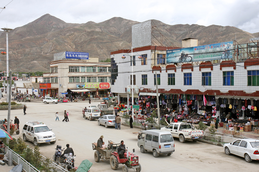


Why visit Jiangzi
Townapedia lists 3 museums and landmarks, 2 parks and trails, 4 places to stay and 2 attractions in and around town.
Highlights include Gyantse Fortress, Pala Manor and Dzong Park.
Weather in Jiangzi
Forecast from MET Norway (CC BY 4.0). Full forecast
About Jiangzi
Gyantse, officially Gyangzê Town (also spelled Gyangtse; Tibetan: རྒྱལ་རྩེ, Wylie: rgyal rtse, ZWPY: Gyangzê; simplified Chinese: 江孜镇; traditional Chinese: 江孜鎮; pinyin: Jiāngzī Zhèn), is a town located in Gyantse County, Shigatse Prefecture, Tibet Autonomous Region, China. It was historically considered the third largest and most prominent town in Tibet (after Lhasa and Shigatse), but there are now at least ten larger Tibetan cities.
From the Wikipedia article Gyantse (this version), under CC BY-SA 4.0.
Travel tips from other travellers: Jiangzi on Wikivoyage (CC BY-SA 4.0).
Things to do2

Museums and landmarks3




Parks, trails and playgrounds2

Where to stay4

History
In 1904, the British expedition to Tibet reached Gyantse on 11 April. The town's garrison had already fled, and the expedition's members entered the town bloodlessly through the front gates, which were opened for them, and occupied Gyantse. After the town was occupied, several British officers visited the Palcho Monastery and seized several statues and scrolls. During the occupation, the town's inhabitants continued to go about their business, and the expedition's medical officer, Herbert James Walton, attended to their medical needs, including performing several operations to correct the common problem of cleft palates. The expedition's officers spent time exploring the town and carrying out fishing or hunting trips in the surrounding countryside. Eventually, the expedition concluded a treaty with the Tibetan authorities, which stipulated that a British trade agent and garrison would be stationed at Gyantse.
From the History section of Gyantse on Wikipedia, under CC BY-SA 4.0.
Churches and places of worship4
Schools, colleges and libraries4
Healthcare1
Map of Jiangzi
20 places. The map loads OpenStreetMap tiles when you open it.
Getting there and nearby towns
Shigatse Peace Airport (RKZ) is the nearest airport with scheduled flights listed in OpenStreetMap, 56 km away.
- Luobuqiongzi 44 km northwest, about 44 min by car
- Xigazê 79 km northwest, about 1 h 15 min by car
- Nyêmo 78 km northeast, about 1 h 15 min by car
Drive times are estimates from straight-line distance, not routes.
Local news
Headlines from INDB.
Reviews, tips and questions
Loading what members have shared...
Sources and licences
- GeoNames (CC BY 4.0): population, coordinates, regions and time zone
- OpenStreetMap contributors (ODbL 1.0): places, airports, map data
- Wikidata (CC0 1.0): elevation, founding date, time zone, website
- Wikimedia Commons (see each image): photos
- Wikipedia (CC BY-SA 4.0): overview and history text
Photo credits
- Gyantse, Shanghai Middle Road - panoramio, Banja-Frans Mulder, CC BY 3.0
- Tibet Gyantse, Göran Höglund (Kartläsarn) from Gothenburg, Sweden, CC BY 2.0
- Palcho Monastery, en:user:Alberrosidus, CC BY-SA 3.0
- Tsechen Monastery and Dzong in Gyantse, Tibet, Candler, Edmund (1874-1926), Public domain
- IMG 1800 Gyantze Kum Bum Palkhor Choide, Luca Galuzzi ( Lucag ), CC BY-SA 2.5
Page built November 3, 2026. Spotted a mistake? Tell us or suggest a place.