


Weather in Lop
Forecast from MET Norway (CC BY 4.0). Full forecast
About Lop
Lop County (, Uyghur: لوپ ناھىيىسى), also Luopu (from Mandarin Chinese), is a county in Hotan Prefecture, in the southwest of the Xinjiang Uyghur Autonomous Region, China. Almost all the residents of the county are Uyghur and live around oases situated between the desolate Taklamakan Desert and Kunlun Mountains. The county is bordered to the north by Aksu and Awat County in Aksu Prefecture, to the east by Qira/Chira County, to the northwest by Karakax County, to the west by Hotan (Khotan) and to the south and west by Hotan County.
From the Wikipedia article Lop County (this version), under CC BY-SA 4.0.
Schools, colleges and libraries2

History
Local inhabitants at Sampul cemetery (Shanpula; سامپۇل / 山普拉) around 14 km (8.7 mi) where art such as the Sampul tapestry has been found, buried their dead from roughly 217 BCE to 283 CE. The analysis of mtDNA haplogroup distribution showed that the Sampula inhabitants had a large mixture of East Asian, West-Asian and European characteristics. According to Chengzhi et al. (2007), analysis of maternal mitochondrial DNA of the human remains has revealed genetic affinities at the maternal side to Ossetians and Iranians, an Eastern-Mediterranean paternal lineage.
Archaeologist Aurel Stein visited Rawak Stupa during his First Central Asian expedition in April 1901.
In May 1956, Abdimit, a Sufi shaykh from Khotan, attempted to incite insurrection in the county which was put down by armed troops and police forces.
The Sampul tapestry was discovered in Sampul in the mid-1980s.
Between August 1986 and May 1987, an outbreak of viral hepatitis occurred in Dol (Duolu) township resulting in 9,371 cases of acute hepatitis and 47 deaths.
From the History section of Lop County on Wikipedia, under CC BY-SA 4.0.
Map of Lop
2 places. The map loads OpenStreetMap tiles when you open it.
Getting there and nearby towns
Hotan Kungang Airport (HTN) is the nearest airport with scheduled flights listed in OpenStreetMap, 29 km away.
- Gujangbagh 22 km west, about 22 min by car
- Bageqi 32 km west, about 32 min by car
- Ying'airike 32 km northwest, about 32 min by car
- Buzhake 34 km west, about 34 min by car
- Layka 40 km west, about 40 min by car
- Ying’awati 40 km northwest, about 40 min by car
- Jiahanbage 44 km west, about 44 min by car
- Qaraqash 45 km northwest, about 45 min by car
- Akesalayi 45 km west, about 45 min by car
- Saybag 47 km west, about 47 min by car
Drive times are estimates from straight-line distance, not routes.
Local news
Headlines from INDB.
Reviews, tips and questions
Loading what members have shared...
Sources and licences
- GeoNames (CC BY 4.0): population, coordinates, regions and time zone
- OpenStreetMap contributors (ODbL 1.0): places, airports, map data
- Wikidata (CC0 1.0): elevation, founding date, time zone, website
- Wikimedia Commons (see each image): photos
- Wikipedia (CC BY-SA 4.0): overview and history text
Photo credits
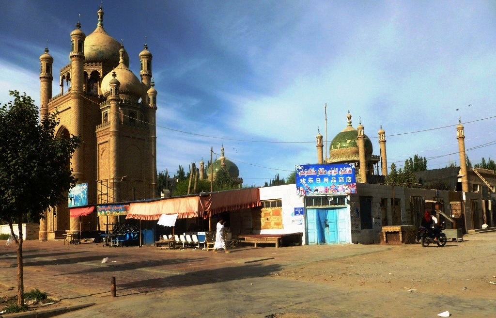
- Old and new Mosques in Lop, John Hill, CC BY-SA 3.0
- ISS054-E-2762 - View of Earth, Earth Science and Remote Sensing Unit, NASA Johnson Space Center, Public domain
- ISS054-E-2761 - View of Earth, Earth Science and Remote Sensing Unit, NASA Johnson Space Center, Public domain
- ISS054-E-4756 - View of Earth, Earth Science and Remote Sensing Unit, NASA Johnson Space Center, Public domain
- ISS054-E-4757 - View of Earth, Earth Science and Remote Sensing Unit, NASA Johnson Space Center, Public domain
- ISS054-E-2763 - View of Earth, Earth Science and Remote Sensing Unit, NASA Johnson Space Center, Public domain
- ISS054-E-4758 - View of Earth, Earth Science and Remote Sensing Unit, NASA Johnson Space Center, Public domain

Page built November 3, 2026. Spotted a mistake? Tell us or suggest a place.