
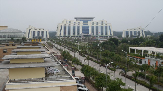

Why visit Qinzhou
Townapedia lists 8 museums and landmarks, 20 parks and trails, 43 places to eat, 10 places to stay and 4 attractions in and around town.
Weather in Qinzhou
Forecast from MET Norway (CC BY 4.0). Full forecast
About Qinzhou
Qinzhou (postal: Yamchow or Yen Chow, simplified Chinese: 钦州; traditional Chinese: 欽州; pinyin: Qīnzhōu, Jyutping: Jam1 zau1 (Canton/Ham1 zau1 (Local)) is a prefecture-level city in south-central Guangxi, southern China, lying on the Gulf of Tonkin and having a total population of 3,302,238 as of the 2020 census whom 1,400,134 lived in the built-up (or metro) area made of Qinbei and Qinnan urban Districts. By the end of 2024, the total registered population of the city was 4,213,300.
From the Wikipedia article Qinzhou (this version), under CC BY-SA 4.0.
Things to do4

Museums and landmarks8


Parks, trails and playgrounds20


8 more on the map.
Restaurants and cafes43


31 more on the map.
History
The area originally belonged to Guangdong and was transferred to Guangxi in 1965. The city was originally a county Qinxian (postal: Yamhsien). From the beginning of the present era, Qinzhou (Wade-Giles: K'in-chou) was for many centuries "the center of Chinese overland trade with Indo-China".
From the History section of Qinzhou on Wikipedia, under CC BY-SA 4.0.
Where to stay10
Shopping15
Gas and EV charging1
Schools, colleges and libraries41
Healthcare10
Map of Qinzhou
152 places. The map loads OpenStreetMap tiles when you open it.
Getting there and nearby towns
Beihai Fucheng Airport (BHY) is the nearest airport with scheduled flights listed in OpenStreetMap, 83 km away.
- Fangchenggang 38 km southwest, about 38 min by car
- Wujia 46 km southeast, about 46 min by car
- Qisha 49 km south, about 49 min by car
- Xichang 50 km southeast, about 50 min by car
- Shagang 53 km southeast, about 53 min by car
- Xingdaohu 58 km southeast, about 58 min by car
- Dangjiang 61 km southeast, about 1 h by car
- Shiwan 62 km southeast, about 1 h by car
- Hepu 67 km southeast, about 1 h by car
- Beihai 73 km southeast, about 1 h 15 min by car
Drive times are estimates from straight-line distance, not routes.
Local news
Headlines from INDB.
Reviews, tips and questions
Loading what members have shared...
Sources and licences
- GeoNames (CC BY 4.0): population, coordinates, regions and time zone
- OpenStreetMap contributors (ODbL 1.0): places, airports, map data
- Wikidata (CC0 1.0): elevation, founding date, time zone, website
- Wikimedia Commons (see each image): photos
- Wikipedia (CC BY-SA 4.0): overview and history text
Photo credits
- Qinzhou, Charny, CC BY-SA 3.0
Page built November 3, 2026. Spotted a mistake? Tell us or suggest a place.