




Why visit Tai’an
Townapedia lists 152 museums and landmarks, 33 parks and trails, 50 places to eat, 46 places to stay and 140 attractions in and around town.
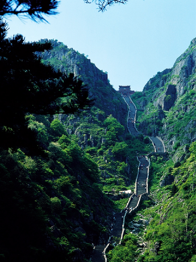
Highlights include Mount Tai and Jade Emperor Peak.
Weather in Tai’an
Forecast from MET Norway (CC BY 4.0). Full forecast
About Tai’an
Tai'an (Chinese: 泰安; pinyin: Tài'ān) is a prefecture-level city in Western Shandong Province of the People's Republic of China. Centered on Mount Tai, the city borders the provincial capital of Jinan to the north, Zibo to the east, Linyi to the southeast, Liaocheng to the extreme west and Jining to the south. To the west, Tai'an is separated from the province of Henan by the Yellow River.
From the Wikipedia article Tai'an (this version), under CC BY-SA 4.0.
Travel tips from other travellers: Tai’an on Wikivoyage (CC BY-SA 4.0).
Things to do140
Mount Tai
Monument and historic site · 9.2 km
Mountain in Shandong, China


Rock of Old Granny
Scenic view · 7.3 km
The Rock of Old Granny is a naturally formed pillar of several rocks piled up. In many directions it looks like an old woman with curved...
Water Curtained Cave (ruined by geological events)
Scenic view · 4.5 km
Water Curtained Cave (Cave behind Curtain-like Waterfall) was destroyed by geological events. As of 1990~2025, visitors can still find...

128 more on the map.
Museums and landmarks152

Night Fair
Monument and historic site · 0.9 km
每当夜幕降临的时候,各种卖服装鞋帽和生活物品的小商贩们纷纷支起摊位来。每晚上都会吸引附近的居民和学生前来。 When night falls, small vendors selling all kinds of clothing, shoes, hats and...
Rose Wall
Monument and historic site · 1.2 km
Https://xw.qq.com/cmsid/20210429V029MF00 农大南墙的蔷薇每年4、5月份开放。

Ancient Platform for National Blessing Ceremony (stair7591)
Monument and historic site · 8.1 km
Copper-Stone-Mark for Beginning of Shibapan Stairs (stair5089)
Monument and historic site · 7.5 km
Four Locust Tree (relic from Tang Dynasty)(stair1674)
Monument and historic site · 5.4 km
Geopark Mark for Outcrop of Allgovite (stair441)
Monument and historic site · 3.8 km
140 more on the map.
Parks, trails and playgrounds33



21 more on the map.
Restaurants and cafes50




38 more on the map.
Where to stay46
Churches and places of worship24
Shopping14
Gas and EV charging5
Schools, colleges and libraries89
Healthcare25
Map of Tai’an
250 places. The map loads OpenStreetMap tiles when you open it.
Getting there and nearby towns
Jining Da´an Airport (JNG) is the nearest airport with scheduled flights listed in OpenStreetMap, 69 km away.
- Feicheng 33 km west, about 33 min by car
- Laiwu 48 km east, about 48 min by car
- Jinan 55 km north, about 55 min by car
- Changqing 54 km northwest, about 54 min by car
- Ningyang 55 km southwest, about 55 min by car
- Sishui 61 km south, about 1 h by car
- Pingyin 61 km west, about 1 h by car
- Xintai 65 km southeast, about 1 h by car
- Dongdu 64 km southeast, about 1 h by car
- Qufu 66 km south, about 1 h by car
Drive times are estimates from straight-line distance, not routes.
Local news
Headlines from INDB.
Reviews, tips and questions
Loading what members have shared...
Sources and licences
- GeoNames (CC BY 4.0): population, coordinates, regions and time zone
- OpenStreetMap contributors (ODbL 1.0): places, airports, map data
- Wikidata (CC0 1.0): elevation, founding date, time zone, website, landmarks and historic places
- Wikimedia Commons (see each image): photos
- Wikipedia (CC BY-SA 4.0): overview and history text
Photo credits
- 20200127 泰安山脚下, WFan, CC BY-SA 4.0
- 泰山 南天门, Charlie fong, Public domain
- 50151-岱庙宋天贶殿, xiquinhosilva, CC BY 2.0
- 岱廟正陽門, Boreas Sawada, CC BY-SA 4.0
- 泰安街景 - Street View of Tai'an - 2012.06 - panoramio (1), rheins, CC BY 3.0
- 泰安老縣衙, 鏌翷, CC0
- Tai'an - 53689355185, xiquinhosilva, CC BY 2.0
- 50100-泰安市区建筑-, xiquinhosilva, CC BY 2.0
- 泰安街景 - Street View of Tai'an - 2012.06 - panoramio, rheins, CC BY 3.0
- 泰安蕭大亨故居, 鏌翷, CC0
- Dai Temple 50104-Taishan (49055185038), xiquinhosilva, CC BY 2.0
- Tai'an Dai Miao 2015.08.13 09-37-45, Zhangzhugang, CC BY-SA 4.0
- 遥参坊 - Yaocan Archway - 2012.06 - panoramio, rheins, CC BY 3.0
- Tai'an Dai Miao 2015.08.13 09-40-54, Zhangzhugang, CC BY-SA 4.0
- Tai'an Dai Miao 2015.08.13 09-38-15, Zhangzhugang, CC BY-SA 4.0
- Tai'an Dai Miao 2015.08.13 09-38-32, Zhangzhugang, CC BY-SA 4.0
- Dai Temple 50109-Taishan (49055185628), xiquinhosilva, CC BY 2.0
- Dai Temple 50107-Taishan (49055698661), xiquinhosilva, CC BY 2.0
- Tai'an Dai Miao 2015.08.13 09-40-25, Zhangzhugang, CC BY-SA 4.0
- Tai'an Dai Miao 2015.08.13 09-37-10, Zhangzhugang, CC BY-SA 4.0
- Tai'an Dai Miao 2015.08.13 09-40-33, Zhangzhugang, CC BY-SA 4.0
- Tai'an Dai Miao 2015.08.13 09-37-26, Zhangzhugang, CC BY-SA 4.0
- Tai'an Dai Miao 2015.08.13 09-40-11, Zhangzhugang, CC BY-SA 4.0
- Taishan Railway Station 20230629, Steven Sun, CC BY-SA 4.0
- Tai'an Dai Miao 2015.08.13 09-43-05, Zhangzhugang, CC BY-SA 4.0
- Tai'an Dai Miao 2015.08.13 09-43-51, Zhangzhugang, CC BY-SA 4.0
- 泰安 岱庙一角 - panoramio, Nyx Ning, CC BY-SA 3.0
- Dai Temple 50111-Taishan (49055185858), xiquinhosilva, CC BY 2.0
- 遥参亭 - Yaocan Pavilion - 2012.06 - panoramio, rheins, CC BY 3.0
- Tai'an Dai Miao 2015.08.13 09-44-32, Zhangzhugang, CC BY-SA 4.0
- Tai'an Dai Miao 2015.08.13 09-44-15, Zhangzhugang, CC BY-SA 4.0
- 50127-岱庙 Taishan, xiquinhosilva, CC BY 2.0
- Dai Temple 50122-Taishan (49055700381), xiquinhosilva, CC BY 2.0
- 50120-Taishan (49055193243), xiquinhosilva, CC BY 2.0
- Dai Temple 50119-Taishan (49055699631), xiquinhosilva, CC BY 2.0
- Tai'an - 53689354120, xiquinhosilva, CC BY 2.0
- 岱廟-鼎, Boreas Sawada, CC BY-SA 4.0
- Tai'an Dai Miao 2015.08.13 09-45-03, Zhangzhugang, CC BY-SA 4.0
- Tai'an Dai Miao 2015.08.13 09-45-15, Zhangzhugang, CC BY-SA 4.0
- Tai'an Dai Miao 2015.08.13 09-45-23, Zhangzhugang, CC BY-SA 4.0


Page built November 3, 2026. Spotted a mistake? Tell us or suggest a place.