




Why visit Tashqorghan
Townapedia lists 5 museums and landmarks, 2 parks and trails, 13 places to stay and 2 attractions in and around town.
Weather in Tashqorghan
Forecast from MET Norway (CC BY 4.0). Full forecast
About Tashqorghan
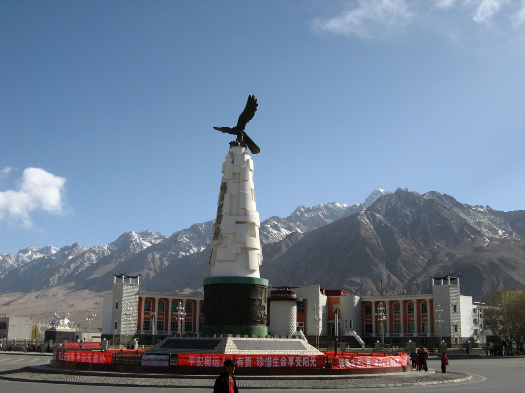
Tashkurgan, historically known as Sarikol and Shitoucheng, is a town in the far west of China, close to the country's border with Tajikistan. It is seat of Tashkurgan Tajik Autonomous County, in the autonomous region of Xinjiang. Tajiks – ethnic Pamiris who live in the Pamir Mountains of Xinjiang – make up a little over half of Tashkurgan's population.
From the Wikipedia article Tashkurgan (this version), under CC BY-SA 4.0.
Travel tips from other travellers: Tashqorghan on Wikivoyage (CC BY-SA 4.0).
Things to do2


Museums and landmarks5


Parks, trails and playgrounds2

Where to stay13

Kute International Youth Hostel
Motel and hotel
Mo-Su 06:00-02:00
1 more on the map.
Shopping1
Gas and EV charging2
Schools, colleges and libraries4
Healthcare2
Map of Tashqorghan
31 places. The map loads OpenStreetMap tiles when you open it.
Getting there and nearby towns
Taxkorgan Airport (HQL) is the nearest airport with scheduled flights listed in OpenStreetMap, 14 km away.
Local news
Headlines from INDB.
Reviews, tips and questions
Loading what members have shared...
Sources and licences
- GeoNames (CC BY 4.0): population, coordinates, regions and time zone
- OpenStreetMap contributors (ODbL 1.0): places, airports, map data
- Wikidata (CC0 1.0): elevation, founding date, time zone, website
- Wikimedia Commons (see each image): photos
- Wikipedia (CC BY-SA 4.0): overview and history text
Photo credits
- Tashkurgan Eagle (39959879770), David Stanley from Nanaimo, Canada, CC BY 2.0
- 塔什库尔干客运站 - Taxkorgan Bus Station - 2015.04 - panoramio, rheins, CC BY 3.0
- Tashkurgan Xinjiang, Betta27, Public domain
- Sample of China International Coach Ticket, HuangWending18072009, CC0
- 帕米尔雄鹰 - Eagle of the Pamirs - 2015.04 - panoramio, rheins, CC BY 3.0
- Tashkurgan - panoramio, Raki_Man, CC BY 3.0
- 塔什库尔干街景 - Street View of Taxkorgan County - 2015.04 - panoramio, rheins, CC BY 3.0
- Tashkurgan Western Mountains, Martin Jung, CC BY-SA 3.0
- 热依格瓦德路 - Raygwad Road - 2015.04 - panoramio, rheins, CC BY 3.0
- Tashkurgan River Delta Meadow, Preston Rhea, CC BY-SA 2.0
- Tashkurgan Fort in Tashkurgan, Preston Rhea, CC BY-SA 2.0
- Shadow on the Meadow, Preston Rhea, CC BY-SA 2.0
- Ancient Tashkurgan (41062197074), David Stanley from Nanaimo, Canada, CC BY 2.0
- Tashkurgan Stone Fort (41730264102), David Stanley from Nanaimo, Canada, CC BY 2.0
- 阿拉尔古孜湿地 - Alarguz Wetlands - 2015.04 - panoramio (1), rheins, CC BY 3.0
- Taskhkurgan, Xinjian Province PR China, Drgkl, CC BY-SA 3.0
- 阿拉尔古孜湿地 - Alarguz Wetlands - 2015.04 - panoramio, rheins, CC BY 3.0
- Silk Road (40891202075), David Stanley from Nanaimo, Canada, CC BY 2.0
- 栈道上的羊群 - Sheep on Boardwalk - 2015.04 - panoramio, rheins, CC BY 3.0
- 慕士塔格峰 - Muztag Ata - 2015.04 - panoramio, rheins, CC BY 3.0
- 塔什库尔干石头城 - Taxkorgan Stone City Site - 2015.04 - panoramio, rheins, CC BY 3.0
- River in Tashkurgan Meadow, Preston Rhea, CC BY-SA 2.0
- Kunlun Mountains, Preston Rhea, CC BY-SA 2.0
- Tashkurgan Meadow, Preston Rhea, CC BY-SA 2.0
- Old Stone House in Tashkurgan Meadow, Preston Rhea, CC BY-SA 2.0
- Tashkurgan Meadow Mountain, Preston Rhea, CC BY-SA 2.0
- Welcome to Tashkurgan Deceptively Pastoral Meadow, preston.rhea, CC BY-SA 2.0
- Tashkurgan Meadow Fake Yurts, Preston Rhea, CC BY-SA 2.0
- Muslim family tomb near Tashgurkan, near China's far western borders, Tariq Dennison, CC BY-SA 4.0
- 新疆塔吉克族牧民, Voidvector, CC BY-SA 4.0
- Tashkurgan - panoramio (2), jackylim, CC BY-SA 3.0
- ISS006-E-15466 - View of Tajikistan, Earth Science and Remote Sensing Unit , Lyndon B. Johnson Space Center, Public domain
- Khunjerab Border Permit, Preston Rhea, Public domain


Page built November 3, 2026. Spotted a mistake? Tell us or suggest a place.