




Weather in Tongchuan
Forecast from MET Norway (CC BY 4.0). Full forecast
About Tongchuan
Santai County (Chinese: 三台县; pinyin: Sāntái Xiàn; Wade–Giles: San1-t῾ai2 Hsien4; Sichuanese romanization: San1-t῾ai2 Shien4; formerly known as Tungchwanfu, Sichuanese romanization: Tongchuanfu) is a county under the administration of the prefecture-level city of Mianyang, in the northeast of Sichuan Province of China. It has an area of 2,660.58 km2 (1,027.26 sq mi). According to the 2020 census, its population stands at 955,800. At the end of 2024 and the beginning of 2025, the resident population is 944,000, the urbanization rate is 34.14%, the urban population is 322,300, and the registered population is 1,334,500.
From the Wikipedia article Santai County (this version), under CC BY-SA 4.0.
Churches and places of worship2

Schools, colleges and libraries2

Healthcare1

Map of Tongchuan
5 places. The map loads OpenStreetMap tiles when you open it.
Getting there and nearby towns
Mianyang Nanjiao Airport (MIG) is the nearest airport with scheduled flights listed in OpenStreetMap, 50 km away.
- Mianyang 57 km northwest, about 57 min by car
- Luojiang 60 km northwest, about 1 h by car
- Deyang 67 km west, about 1 h by car
- Suining 80 km southeast, about 1 h 15 min by car
- Jiangyou 83 km northwest, about 1 h 30 min by car
- Mianzhu, Deyang, Sichuan 87 km west, about 1 h 30 min by car
Drive times are estimates from straight-line distance, not routes.
Local news
Headlines from INDB.
Reviews, tips and questions
Loading what members have shared...
Sources and licences
- GeoNames (CC BY 4.0): population, coordinates, regions and time zone
- OpenStreetMap contributors (ODbL 1.0): places, airports, map data
- Wikidata (CC0 1.0): elevation, founding date, time zone, website
- Wikimedia Commons (see each image): photos
- Wikipedia (CC BY-SA 4.0): overview and history text
Photo credits
- 云台观照片, Nekitarc, CC BY-SA 4.0
- Grammatical tree, Victor Bob, CC BY-SA 4.0
- 少陵草堂碑, Shizhao, CC BY-SA 3.0
- 潼川古城墙国保碑, Nekitarc, CC BY-SA 4.0
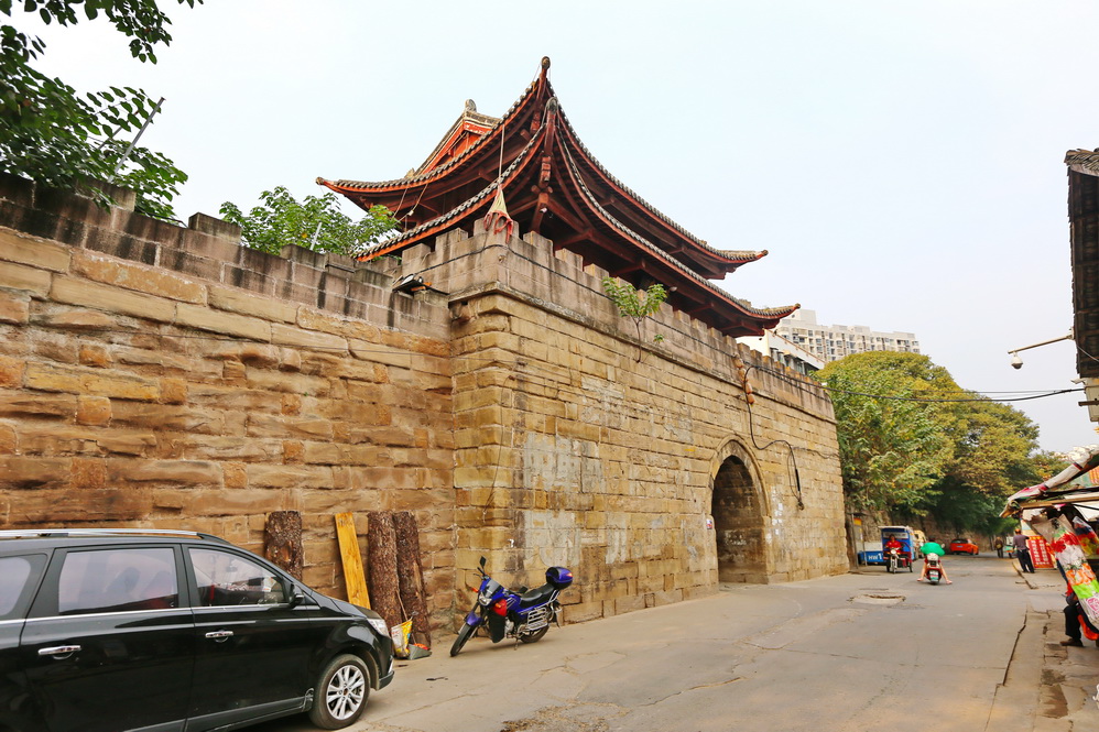
- 潼川古城墙照片, Nekitarc, CC BY-SA 4.0
- ISS043-E-49751 - View of Earth, Earth Science and Remote Sensing Unit , Lyndon B. Johnson Space Center, Public domain
- ISS043-E-46671 - View of Earth, Earth Science and Remote Sensing Unit , Lyndon B. Johnson Space Center, Public domain
- ISS023-E-33779 - View of Earth, Earth Science and Remote Sensing Unit , Lyndon B. Johnson Space Center, Public domain
- ISS043-E-49752 - View of Earth, Earth Science and Remote Sensing Unit , Lyndon B. Johnson Space Center, Public domain
- ISS043-E-46670 - View of Earth, Earth Science and Remote Sensing Unit , Lyndon B. Johnson Space Center, Public domain


Page built November 3, 2026. Spotted a mistake? Tell us or suggest a place.