


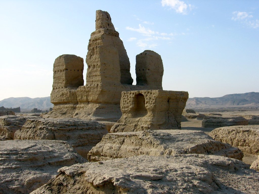

Why visit Turpan
Townapedia lists 23 museums and landmarks, 1 park or trail, 3 places to eat, 8 places to stay and 1 attraction in and around town.
Highlights include Turpan Museum and Site of Yar City.
Weather in Turpan
Forecast from MET Norway (CC BY 4.0). Full forecast
About Turpan
Gaochang or Karahoja (Uyghur: قاراھوجا, romanized: Qarahoja, Қарахоҗа; Chinese: 高昌; pinyin: Gāochāng), is the only district and the seat of the oasis city of Turpan, in the Xinjiang Uyghur Autonomous Region, China. Its population was 254,900 at the end of 2003.
From the Wikipedia article Gaochang, Turpan (this version), under CC BY-SA 4.0.
Things to do1

Museums and landmarks23


Yarkhoto
Monument and historic site · 9.4 km
Abandoned city along the Silk Road in western China




11 more on the map.
Parks, trails and playgrounds1

Restaurants and cafes3


Mixue Ice Cream & Tea
Cafe · Ice Cream, Bubble Tea · 0.7 km
中国连锁冰淇淋与茶饮品牌,提供高性价比的现制饮品
Mo-Su 09:00-23:00
History
The district was created on 12 April 2015 after Turpan was upgraded from a county-level city into a prefecture-level city. The district has the same size and population as the former Turpan county-level city.
From the History section of Gaochang, Turpan on Wikipedia, under CC BY-SA 4.0.
Where to stay8
Star Hotel CNY120〜 (foreigner ok)星辰酒店
Motel and hotel
422 高昌中路ئوتتۇرا ئىدىقۇت يولى
Churches and places of worship1
Gas and EV charging1
Schools, colleges and libraries6
Turpan Gaochang District Secondary Vocational and Technical School
School · 4.8 km
Map of Turpan
44 places. The map loads OpenStreetMap tiles when you open it.
Getting there and nearby towns
Turpan Jiaohe Airport (TLQ) is the nearest airport with scheduled flights listed in OpenStreetMap, 11 km away.
Local news
Headlines from INDB.
Reviews, tips and questions
Loading what members have shared...
Sources and licences
- GeoNames (CC BY 4.0): population, coordinates, regions and time zone
- OpenStreetMap contributors (ODbL 1.0): places, airports, map data
- Wikidata (CC0 1.0): elevation, founding date, time zone, website, landmarks and historic places
- Wikimedia Commons (see each image): photos
- Wikipedia (CC BY-SA 4.0): overview and history text
Photo credits
- Turpan-minarete-emir-d09, Unknown author, CC BY-SA 2.5 es
- 2015-09-18-131512 - Turpan-Museum, Zossolino, CC BY-SA 4.0
- Turpan-jiaohe-ruinas-d27, Colegota, CC BY-SA 2.5 es
- Emin Minaret in 2024, Ryan Wang, CC BY-SA 4.0
- Turpan-jiaohe-ruinas-d28, Colegota, CC BY-SA 2.5 es
- Turpan Karez Paradice, Yoshi Canopus, CC BY-SA 3.0
- 苏公塔全景 2023, HaziiDozen, CC BY-SA 4.0

Page built November 3, 2026. Spotted a mistake? Tell us or suggest a place.