
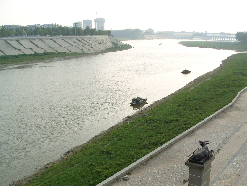


Why visit Zhoukou
Townapedia lists 5 museums and landmarks, 6 parks and trails, 12 places to eat, 1 place to stay and 6 attractions in and around town.
Weather in Zhoukou
Forecast from MET Norway (CC BY 4.0). Full forecast
About Zhoukou
Zhoukou (Chinese: 周口; pinyin: Zhōukǒu; Wade–Giles: Chou-k’ou; postal: Chowkow) is a prefecture-level city in eastern Henan province, China. It borders Zhumadian to the southwest, Xuchang and Luohe to the west, Kaifeng to the northwest, Shangqiu to the northeast, and the province of Anhui on all other sides. As of the 2020 census, its population was 9,026,015 inhabitants. However, as of the 2018 estimation, 1,601,300 lived in the built-up (or metro) made up of Chuanhui district and the northern part of Shangshui county.
From the Wikipedia article Zhoukou (this version), under CC BY-SA 4.0.
Travel tips from other travellers: Zhoukou on Wikivoyage (CC BY-SA 4.0).
Things to do6


Museums and landmarks5


Parks, trails and playgrounds6


Restaurants and cafes12


Mixue Ice Cream & Tea
Fast food · Ice Cream, Bubble Tea · 3.8 km
中国连锁冰淇淋与茶饮品牌,提供高性价比的现制饮品
Mo-Su 09:00-23:00
History
For thousands of years, Chen (now at Huaiyang) had been the center of this area and a nationally well-known city. The ancient city site founded at Pingliangtai (near Huaiyang) is over 4600 years old, which is one of the oldest cities in China. According to the legend, Fu Xi, the first of the Three Sovereigns of ancient China, died in the city. During the Spring and Autumn period, Chen was the capital of Chen State and then annexed by Chu. Therefore, the area was usually referred to as "Chen Chu" in ancient times. The leaders of the first Chinese peasant uprising (the Dazexiang uprising) established the government at Chen.
From the History section of Zhoukou on Wikipedia, under CC BY-SA 4.0.
Where to stay1
Churches and places of worship1
Shopping12
Gas and EV charging7
Schools, colleges and libraries19
Healthcare9
Map of Zhoukou
78 places. The map loads OpenStreetMap tiles when you open it.
Getting there and nearby towns
Bozhou Airport (BZJ) is the nearest airport with scheduled flights listed in OpenStreetMap, 117 km away.
- Wacheng Neighborhood 22 km northwest, about 22 min by car
- Huaidian 41 km southeast, about 41 min by car
- Dancheng 49 km east, about 49 min by car
- Luohe 57 km west, about 57 min by car
- Jishui 71 km east, about 1 h 15 min by car
- Runan 74 km southwest, about 1 h 15 min by car
- Jieshou 77 km southeast, about 1 h 15 min by car
- Xuchang 86 km northwest, about 1 h 30 min by car
Drive times are estimates from straight-line distance, not routes.
Local news
Headlines from INDB.
Reviews, tips and questions
Loading what members have shared...
Sources and licences
- GeoNames (CC BY 4.0): population, coordinates, regions and time zone
- OpenStreetMap contributors (ODbL 1.0): places, airports, map data
- Wikidata (CC0 1.0): elevation, founding date, time zone, website
- Wikimedia Commons (see each image): photos
- Wikipedia (CC BY-SA 4.0): overview and history text
Photo credits
- ShayingRiver Zhoukou, Standingtooth, Public domain
- 20260913 Chuanhui District, Zhoukou, Windmemories, CC BY-SA 4.0
- 20210411 Zhoukoudong Railway Station - Platform, Windmemories, CC BY-SA 4.0
- 20230714 Platforms of Zhoukoudong Railway Station 01, Windmemories, CC BY-SA 4.0
- 20230714 CRH380B-5837 and CRH380B-5856 at Zhoukoudong Railway Station, Windmemories, CC BY-SA 4.0
- 20230714 Platforms of Zhoukoudong Railway Station 03, Windmemories, CC BY-SA 4.0
- 20260913 Zhoukou Emperor Guan Temple 03, Windmemories, CC BY-SA 4.0
- Drought refugees from Oklahoma camping by the roadside, 8b38481, Dorothea Lange, Public domain
- 20240428 豫P00318D on Zhanghuatai Road, Windmemories, CC BY-SA 4.0
- 20240428 豫P01968D on Zhanghuatai Road, Windmemories, CC BY-SA 4.0
- 20240428 豫P01898D on Chensheng Avenue, Windmemories, CC BY-SA 4.0


Page built November 3, 2026. Spotted a mistake? Tell us or suggest a place.