



Why visit Colfax
Townapedia lists 2 museums and landmarks, 2 parks and trails, 2 places to eat and 2 places to stay in and around town.
Highlights include Colfax Spring City Commercial Historic District and James Norman Hall House.
July is the warmest month, with average highs of 84°F; January lows average 13°F.
Weather in Colfax
Forecast from the National Weather Service. Full forecast
About Colfax
Colfax is a city in Jasper County, Iowa, United States. Colfax is located approximately 24 miles east of Des Moines. The town was founded in 1866, and was named after Schuyler Colfax, vice president under Ulysses S. Grant.
From the Wikipedia article Colfax, Iowa (this version), under CC BY-SA 4.0.
Museums and landmarks2

Colfax Spring City Commercial Historic District
Monument and historic site · National Register of Historic Places · 0.5 mi
Historic district in Colfax, Iowa, USA
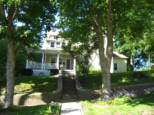
James Norman Hall House
Monument and historic site · National Register of Historic Places
Historic residence located in Colfax, Iowa, United States
Parks, trails and playgrounds2


Restaurants and cafes2

Punjab Kabab House
Restaurant · Indian · 1.2 mi
1405 North Walnut Street, Colfax
Mo-Sa 08:00-22:00; Su 09:00-19:00

Where to stay2

Microtel Inn & Suites by Wyndham Colfax/Newton
Motel and hotel · 1.2 mi
11000 Federal Avenue, Colfax
History
Colfax was laid out in 1866. It is named for Schuyler Colfax.
In its heyday, the city of Colfax had two main industries that drew thousands to the area: the mining of coal, and the use of the mineral springs discovered near the city.
The first large scale coal mine in Jasper County was the Watson No. 1 Mine, 5 miles southeast of town, connected to the Rock Island by a long railroad spur. From 1881 to 1900, the Jasper County Coal and Railway Company operated a number of mines north of Colfax. The Colfax Consolidated Coal Company formed in 1902, bringing the mines of Colfax under a common operator. They opened mine No. 8 in 1905; this was one of the best equipped mines in the state. The coal camp of Severs was run by this company.
United Mine Workers local 56 was organized in Colfax in 1899; by 1907, it had 352 members. Mine wages varied from $2.36 to $2.56 per day. In 1912, the UMW union had two locals based in Colfax, Local 56, with 350 members, and Local 671, with 230 members.
From the History section of Colfax, Iowa on Wikipedia, under CC BY-SA 4.0.
Churches and places of worship7
Shopping1
Gas and EV charging1
Schools, colleges and libraries6
Prairie City Elementary School
School · 5.9 mi
309 East Plainsmen Road, Prairie City
Map of Colfax
23 places. The map loads OpenStreetMap tiles when you open it.
Climate by month
Monthly table
| Month | High | Low | Rain |
|---|---|---|---|
| Jan | 30°F | 13°F | 1.0 in |
| Feb | 35°F | 17°F | 1.4 in |
| Mar | 49°F | 28°F | 2.3 in |
| Apr | 62°F | 39°F | 3.8 in |
| May | 71°F | 51°F | 4.8 in |
| Jun | 80°F | 60°F | 5.6 in |
| Jul | 84°F | 64°F | 3.9 in |
| Aug | 82°F | 61°F | 4.2 in |
| Sep | 76°F | 53°F | 3.2 in |
| Oct | 63°F | 41°F | 2.9 in |
| Nov | 48°F | 29°F | 1.9 in |
| Dec | 35°F | 19°F | 1.6 in |
U.S. Climate Normals 1991-2020 for Des Moines 17 E 74448 (9 mi away), NOAA NCEI.
People and cost of living
American Community Survey 5-year estimates, 2020-2024, U.S. Census Bureau. Estimates have margins of error, larger for small towns.
Disaster history
Jasper County has had 13 federal disaster declarations since 2000, most often for severe storms.
- 2026-09-01: Severe Storms And Flooding (Severe Storm)
- 2024-05-24: Severe Storms, Tornadoes, And Flooding (Severe Storm)
- 2020-08-17: Severe Storms (Severe Storm)
- 2020-03-23: Covid-19 Pandemic (Biological)
- 2020-03-13: Covid-19 (Biological)
- 2019-03-23: Severe Storms And Flooding (Flood)
OpenFEMA disaster declarations summaries.
Getting there and nearby towns
Newton Municipal Airport (TNU) is the nearest airport with scheduled flights listed in OpenStreetMap, 11 miles away.
- Newton 10 mi east, about 16 min by car
- Bondurant 11 mi west, about 18 min by car
- Altoona 13 mi west, about 21 min by car
- Pleasant Hill 15 mi west, about 24 min by car
- Carlisle 17 mi southwest, about 27 min by car
- Ankeny 19 mi west, about 31 min by car
- Des Moines 21 mi west, about 33 min by car
- Johnston 25 mi west, about 41 min by car
- Pella 25 mi southeast, about 40 min by car
- Urbandale 28 mi west, about 45 min by car
Drive times are estimates from straight-line distance, not routes.
Local news
Headlines from INDB, the NEMICO news database.
Reviews, tips and questions
Loading what members have shared...
Sources and licences
- NCES EDGE (Public domain): public schools
- NOAA NCEI U.S. Climate Normals 1991-2020 (Public domain): climate by month
- OpenFEMA (Public domain): disaster declarations
- OpenStreetMap contributors (ODbL 1.0): places, airports, map data
- U.S. Census Bureau (Public domain): population, income, housing, education, commute
- Wikidata (CC0 1.0): elevation, founding date, time zone, website, landmarks and historic places
- Wikimedia Commons (see each image): photos
- Wikipedia (CC BY-SA 4.0): overview and history text
Photo credits
- Colfax, Iowa, Billwhittaker ( talk ), CC BY-SA 3.0
- JamesNormanHallHouse (2), CelticClicker, CC BY-SA 3.0
Page built October 30, 2026. Spotted a mistake? Tell us or suggest a place.