
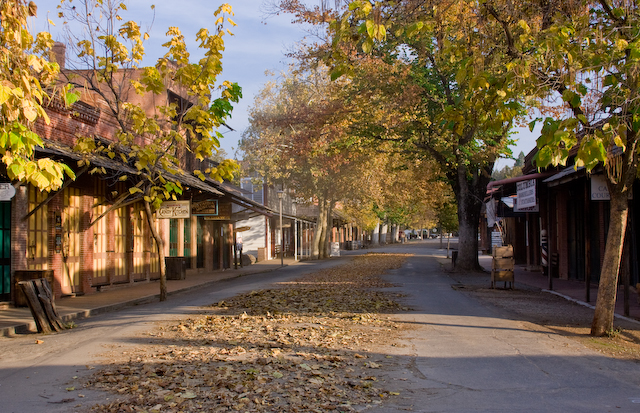


Columbia, California
Columbia is a community of 2,235 people in Tuolumne County, California.
Why visit Columbia
Townapedia lists 19 museums and landmarks, 6 parks and trails, 13 places to eat, 2 places to stay and 6 attractions in and around town.
Highlights include Moaning Cavern, Bell Hill, San Diego Ditch and Columbia State Historic Park.
July is the warmest month, with average highs of 97°F; December lows average 38°F.
Weather in Columbia
Forecast from the National Weather Service. Full forecast
About Columbia
Columbia is a census-designated place (CDP) located in the Sierra Nevada foothills in Tuolumne County, California, United States. As of the 2020 census, Columbia had a population of 2,577. It was founded as a boomtown in 1850 when gold was found during the California Gold Rush, and was known as the "Gem of the Southern Mines."
From the Wikipedia article Columbia, California (this version), under CC BY-SA 4.0.
Things to do6

Moaning Cavern
Monument and historic site · 3.9 mi
Solutional cave in the Calaveras County, California


Museums and landmarks19

Columbia State Historic Park
Monument and historic site · National Register of Historic Places · 0.8 mi
California State Historic Park
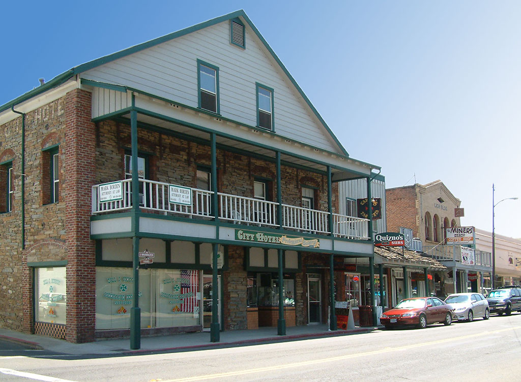
City Hotel
Monument and historic site · National Register of Historic Places · 3.7 mi
Listed on the National Register of Historic Places (NRHP) in Tuolumne County


Sugg House
Monument and historic site · National Register of Historic Places · 3.7 mi
Historic house in Sonora, California, United States

7 more on the map.
Parks, trails and playgrounds6

Restaurants and cafes13




Columbia House
Restaurant · American, Breakfast · 0.7 mi
11209 State Street, Columbia


1 more on the map.
History
The original indigenous people in the Columbia region were the Miwok.
Rev. John Steele wrote about his time in the gold rush era and about the "Mi-wuk" of Columbia in his memoirs In Camp and Cabin.
Within weeks of finding gold in the vicinity of Columbia, thousands of people arrived and the population climbed to 5,000. By 1852, there were 8 hotels, 4 banks, 17 general stores, 2 bookstores, 1 newspaper, 3 churches, and over 40 drinking/gambling establishments. Between 1850 and the early 1900s, $87 million (~$2.61 billion in 2025) in gold was removed from the surrounding hills.
In 1851, the local community brass band, a popular institution, greeted the arrival of the first "white woman" in town. Columbia had five cemeteries, including a Boot Hill, where burials were made without markers.
In 1854, Columbia's first major fire destroyed a majority of the city. The wealthier merchants began rebuilding their business using brick with iron construction materials, the remainder of town was rebuilt of wood and canvas. In 1857, another fire burned down nearly everything else, except three brick buildings. The Columbia one-room school house was built in 1860, renovated in 1872, and finally closed in 1937. It was purchased by the state of California for $1 in 1947, and incorporated into the historic district park.
From the History section of Columbia, California on Wikipedia, under CC BY-SA 4.0.
Where to stay2
Churches and places of worship2
Church of the 49ers (Presbyterian Church of Columbia)
Church · Presbyterian · 0.7 mi
Gas and EV charging1
Schools, colleges and libraries16
Tuolumne County Special Education Preschool
School · 3.8 mi
175 Fairview Ln., Sonora
Map of Columbia
65 places. The map loads OpenStreetMap tiles when you open it.
Climate by month
Monthly table
| Month | High | Low | Rain | Snow |
|---|---|---|---|---|
| Jan | 57°F | 38°F | 5.8 in | 0.0 in |
| Feb | 61°F | 40°F | 4.8 in | 0.0 in |
| Mar | 65°F | 44°F | 4.8 in | 0.2 in |
| Apr | 70°F | 46°F | 2.6 in | 0.0 in |
| May | 79°F | 52°F | 1.5 in | 0.0 in |
| Jun | 89°F | 59°F | 0.4 in | 0.0 in |
| Jul | 97°F | 65°F | 0.0 in | 0.0 in |
| Aug | 96°F | 64°F | 0.0 in | 0.0 in |
| Sep | 91°F | 60°F | 0.2 in | 0.0 in |
| Oct | 80°F | 52°F | 1.5 in | 0.0 in |
| Nov | 66°F | 44°F | 2.9 in | 0.0 in |
| Dec | 57°F | 38°F | 5.2 in | 0.0 in |
U.S. Climate Normals 1991-2020 for New Melones Dam Hq (4 mi away), NOAA NCEI.
People and cost of living
American Community Survey 5-year estimates, 2020-2024, U.S. Census Bureau. Estimates have margins of error, larger for small towns.
Disaster history
Tuolumne County has had 15 federal disaster declarations since 2000, most often for fires.
- 2026-07-26: Dove Fire (Fire)
- 2023-04-03: Severe Winter Storms, Straight-Line Winds, Flooding, Landslides, And Mudslides (Severe Storm)
- 2023-03-10: Severe Winter Storms, Flooding, Landslides, And Mudslides (Flood)
- 2023-01-14: Severe Winter Storms, Flooding, Landslides, And Mudslides (Flood)
- 2020-08-22: Wildfires (Fire)
- 2020-03-22: Covid-19 Pandemic (Biological)
OpenFEMA disaster declarations summaries.
Getting there and nearby towns
Columbia Airport (COA) is the nearest airport with scheduled flights listed in OpenStreetMap, 0 miles away.
- Angels 8 mi west, about 13 min by car
- Cedar Ridge 8 mi east, about 13 min by car
- Arnold 15 mi north, about 25 min by car
- Oakdale 30 mi southwest, about 48 min by car
- Riverbank 36 mi southwest, about 58 min by car
- Modesto 42 mi southwest, about 1 h 15 min by car
- Ceres 43 mi southwest, about 1 h 15 min by car
- Turlock 44 mi southwest, about 1 h 15 min by car
- Manteca 47 mi west, about 1 h 15 min by car
- Stockton 49 mi west, about 1 h 15 min by car
Drive times are estimates from straight-line distance, not routes.
Local news
Headlines from INDB, the NEMICO news database.
Reviews, tips and questions
Loading what members have shared...
Sources and licences
- NCES EDGE (Public domain): public schools
- NOAA NCEI U.S. Climate Normals 1991-2020 (Public domain): climate by month
- OpenFEMA (Public domain): disaster declarations
- OpenStreetMap contributors (ODbL 1.0): places, airports, map data
- U.S. Census Bureau (Public domain): population, income, housing, education, commute
- Wikidata (CC0 1.0): elevation, founding date, time zone, website, landmarks and historic places
- Wikimedia Commons (see each image): photos
- Wikipedia (CC BY-SA 4.0): overview and history text
Photo credits
- ColumbiaCAMainSt, Chris Krylov, CC BY 3.0
- Columbia Airport Plaque of Grumman TS-2A Tracker, Keavon, CC BY-SA 4.0
- Columbia, CA, USA - panoramio, Wayne Baker, CC BY 3.0
- Columbia, CA, USA - panoramio (2), Wayne Baker, CC BY 3.0
- Columbia, CA-11, Almonroth, CC BY-SA 4.0
- Columbia, CA-23, Almonroth, CC BY-SA 4.0
- Columbia, CA-17, Almonroth, CC BY-SA 4.0
- Columbia, CA-13, Almonroth, CC BY-SA 4.0
- Columbia, CA-10, Almonroth, CC BY-SA 4.0
- Columbia, CA-19, Almonroth, CC BY-SA 4.0
- Columbia, CA-16, Almonroth, CC BY-SA 4.0
- Columbia, CA-25, Almonroth, CC BY-SA 4.0
- Columbia, CA-14, Almonroth, CC BY-SA 4.0
- Columbia, CA-15, Almonroth, CC BY-SA 4.0
- Columbia, CA-2, Almonroth, CC BY-SA 4.0
- Columbia, CA-21, Almonroth, CC BY-SA 4.0
- Columbia, CA-6, Almonroth, CC BY-SA 4.0
- Columbia, CA-24, Almonroth, CC BY-SA 4.0
- Columbia, CA-12, Almonroth, CC BY-SA 4.0
- Columbia, CA-18, Almonroth, CC BY-SA 4.0
- Columbia, CA-26, Almonroth, CC BY-SA 4.0
- Columbia, CA-20, Almonroth, CC BY-SA 4.0
- Columbia, CA-22, Almonroth, CC BY-SA 4.0
- Columbia, CA-3, Almonroth, CC BY-SA 4.0
- Columbia, CA-9, Almonroth, CC BY-SA 4.0
- Columbia, CA-4, Almonroth, CC BY-SA 4.0
- Columbia, CA-5, Almonroth, CC BY-SA 4.0
- Columbia, CA-27, Almonroth, CC BY-SA 4.0
- Columbia, CA-7, Almonroth, CC BY-SA 4.0
- Columbia, CA-8, Almonroth, CC BY-SA 4.0
- Columbia, CA-1, Almonroth, CC BY-SA 4.0
- Columbia, CA, USA - panoramio (1), Wayne Baker, CC BY 3.0
- Sugg House, Karl98007, CC BY-SA 3.0
- Sonora CA, G.Rogers ( Rodge500 ), CC BY-SA 2.5
- Moaning Cavern "chocolate fountain", UnifiedFunctionality, CC BY-SA 3.0
- Luscombelanding (4541614258), Bill Larkins, CC BY-SA 2.0
- Towle & Levett, Juicevicki, CC BY-SA 3.0
- Douglass Saloon, Juicevicki, CC BY-SA 3.0
- Colombia, ca gold rush town, Bryanhurren, CC BY-SA 3.0


Page built October 30, 2026. Spotted a mistake? Tell us or suggest a place.