


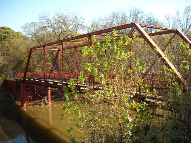


Corinth, Texas
Corinth is a city of 23,385 people in Denton County, Texas, founded in 1909.
Why visit Corinth
Townapedia lists 7 museums and landmarks, 32 parks and trails, 66 places to eat, 5 places to stay and 2 attractions in and around town.
Highlights include Lewisville Lake Toll Bridge, Old Alton Bridge, Rector Road Bridge and Briercliff Park.
July is the warmest month, with average highs of 96°F; January lows average 34°F.
Weather in Corinth
Forecast from the National Weather Service. Full forecast
About Corinth
Corinth is a city in Denton County, Texas, United States; it is a part of the Dallas-Fort Worth metroplex. Its population was 22,634 at the 2020 census.
From the Wikipedia article Corinth, Texas (this version), under CC BY-SA 4.0.
Things to do2

Lewisville Lake Toll Bridge
Bridge · 3.8 mi
Bridge in Little Elm and Lake Dallas

Museums and landmarks7
Old Alton Bridge
Bridge · National Register of Historic Places · 2.3 mi
Bridge in Denton County, Texas, United States

Parks, trails and playgrounds32

Briercliff Park
Park · 2.3 mi
9.62-acre, neighborhood park located at 3200 State School Rd. Trail (0.27 miles, concrete) Amenities include: Pavilion; capacity 48...
3200 State School Road, Denton
Mo-Su 06:00-22:00
Spc. Ernest W. Dallas Jr. Veterans Memorial Park
Park · 1.7 mi
5-acre, neighborhood park located at 6100 Sun Ray Dr. Amenities include: Playground with shade Benches Drinking fountains Picnic tables...
6100 Sun Ray Drive, Denton
Mo-Su 06:00-22:00
Harbor Lane Park
Park · 2.6 mi
This park has a beautiful playground area with picnic tables and benches and lots of privacy. This park has no access to boat ramps.
1500 Highland Road, Hickory Creek
Mo-Su 06:00-22:00
Pilot Knoll Park
Park · 2.7 mi
Pilot Knoll Park is a beautiful park bordering Lake Lewisville in Highland Village. This park is 65 to 85 acres (depending on the water...
218A Orchid Hill Lane, Highland Village
Mo-Su 05:00-23:00
Windsor Ridge Park
Park · 0.9 mi
Benches Playscape Picnic Tables Sidewalk Shade Structure Swing Sets
1800 Vintage Drive, Denton
Mo-Su 06:00-22:00
Corinth Farms Park
Park · 1.7 mi
Benches Playscape Sidewalk Shade Structure Swing Sets Water Fountains
4401 Buckboard Circle, Corinth
Mo-Su 06:00-22:00
Eagle Pass Park
Park · 0.9 mi
Benches Playscape Picnic Tables Sidewalk Shade Structure Swing Sets
1824 Vintage Drive, Corinth
Mo-Su 06:00-22:00
Fairview Park
Park · 1.4 mi
Benches Playscape Picnic Tables Parking Shade Structure Swing Sets
3640 Fairview Drive, Corinth
Mo-Su 06:00-22:00
Kensington Park
Park · 1.7 mi
Benches Playscape Picnic Tables Sidewalk Shade Structure
3608 Sussex Way, Corinth
Mo-Su 06:00-22:00
Meadow Oaks Park
Park · 0.5 mi
Benches Grills Playscape Picnic Tables Pavilion Sidewalk Shade Structure Swing Sets Water Fountains
3300 Meadow Oaks Drive, Corinth
Mo-Su 06:00-22:00
Meadowview Park
Park · 0.8 mi
Benches Basketball Court Grills Ponds Playscape Picnic Tables Shade Structure Swing Sets Trails
1723 Meadowview Drive, Corinth
Mo-Su 06:00-22:00
Mulholland Park
Park · 1.3 mi
Benches Playscape Picnic Tables Pavilion Sidewalk Shade Structure Swing Sets
3206 Mulholland Road, Corinth
Mo-Su 06:00-22:00
20 more on the map.
Restaurants and cafes66

Don Camillo Tuscan Grill
Restaurant · Italian, Pizza · 2.3 mi
1225 Turbeville Road, Hickory Creek
Su-Th 11:00-21:00; Fr,Sa 11:00-22:00

Starbucks
Cafe · Coffee Shop · 1.9 mi
4600 Swisher Road, Hickory Creek
Mo-Fr 05:00-20:00; Sa 05:00-21:00; Su 06:00-21:00
Angelina's
Restaurant · Tex-Mex · 2.3 mi
101 Turbeville Road
Mo-Th 11:00-21:00; Fr,Sa 11:00-22:00; Su 11:00-20:00

Elm Fork Taphouse & Kitchen
Diner · American · 2.4 mi
1221 Turbeville Road
Su-Th 11:00-21:00; Fr,Sa 11:00-22:00
54 more on the map.
Where to stay5
Churches and places of worship10
Faith United Methodist Church
Church · Methodist · 2.3 mi
6060 Teasley Lane, Denton
The Church of Jesus Christ of Latter-day Saints
Church · Mormon · 2.1 mi
4501 Teasley Lane, Denton
Shopping7
Gas and EV charging9
Schools, colleges and libraries48
Healthcare29
Complete Foot and Ankle Care of North Texas
Clinic and pharmacy · 2.6 mi
3321 Unicorn Lake Boulevard, Denton
Map of Corinth
215 places. The map loads OpenStreetMap tiles when you open it.
Climate by month
Monthly table
| Month | High | Low | Rain |
|---|---|---|---|
| Jan | 56°F | 34°F | 2.2 in |
| Feb | 60°F | 37°F | 2.8 in |
| Mar | 68°F | 45°F | 3.4 in |
| Apr | 76°F | 53°F | 3.7 in |
| May | 83°F | 63°F | 4.9 in |
| Jun | 91°F | 71°F | 3.6 in |
| Jul | 96°F | 75°F | 2.3 in |
| Aug | 96°F | 74°F | 2.4 in |
| Sep | 88°F | 67°F | 3.0 in |
| Oct | 78°F | 55°F | 4.6 in |
| Nov | 66°F | 44°F | 2.9 in |
| Dec | 57°F | 36°F | 2.7 in |
U.S. Climate Normals 1991-2020 for Denton 2 Se (4 mi away), NOAA NCEI.
People and cost of living
American Community Survey 5-year estimates, 2020-2024, U.S. Census Bureau. Estimates have margins of error, larger for small towns.
Disaster history
Denton County has had 17 federal disaster declarations since 2000, most often for hurricanes.
- 2024-05-17: Severe Storms, Straight-Line Winds, Tornadoes, And Flooding (Flood)
- 2021-02-19: Severe Winter Storms (Severe Ice Storm)
- 2021-02-14: Severe Winter Storm (Severe Ice Storm)
- 2020-03-25: Covid-19 Pandemic (Biological)
- 2020-03-13: Covid-19 (Biological)
- 2015-05-29: Severe Storms, Tornadoes, Straight-Line Winds And Flooding (Severe Storm)
OpenFEMA disaster declarations summaries.
Getting there and nearby towns
Dallas/Fort Worth International Airport (DFW) is the nearest airport with scheduled flights listed in OpenStreetMap, 17 miles away.
- Denton 7 mi northwest, about 11 min by car
- Lewisville 8 mi southeast, about 14 min by car
- Frisco 14 mi east, about 23 min by car
- Carrollton 14 mi southeast, about 23 min by car
- Colleyville 18 mi south, about 29 min by car
- Addison 18 mi southeast, about 30 min by car
- Plano 20 mi east, about 32 min by car
- Celina 20 mi northeast, about 32 min by car
- Irving 21 mi south, about 33 min by car
- Bedford 21 mi south, about 34 min by car
Drive times are estimates from straight-line distance, not routes.
Local news
Headlines from INDB, the NEMICO news database.
Reviews, tips and questions
Loading what members have shared...
Sources and licences
- NCES EDGE (Public domain): public schools
- NOAA NCEI U.S. Climate Normals 1991-2020 (Public domain): climate by month
- OpenFEMA (Public domain): disaster declarations
- OpenStreetMap contributors (ODbL 1.0): places, airports, map data
- U.S. Census Bureau (Public domain): population, income, housing, education, commute
- Wikidata (CC0 1.0): elevation, founding date, time zone, website, landmarks and historic places
- Wikimedia Commons (see each image): photos
- Wikipedia (CC BY-SA 4.0): overview and history text
Photo credits
- Corinth Shiloh Cemetery, Denton County, JoeLotz, CC0
- Old Alton Bridge, Ron from Denton, Texas, CC BY 2.0
- 1848 Denton County Seat (3), Camshy48, CC BY-SA 4.0
- Mcdonalds 2024 5 Dollar Meal Deal (53826002275), Wamploid Cthulhuloid, CC BY 2.0
- Guyer High School main hallway (from back end of the school), Nadia Eimandoust, CC BY-SA 4.0
- Old Alton Bridge, Denton, Texas (8979780387), Nicolas Henderson from Coppell, Texas, CC BY 2.0
- Goatman's Bridge - Old Alton Bridge from a Drone, Pixelsyndicate, CC BY-SA 4.0
- Anodorhynchus hyacinthinus -Fort Worth Zoo, USA-8a, Toby Jungen, CC BY 2.0
- A violet growing in a yard, Morcup, CC BY-SA 4.0
- North Texas Hospital 2, User:Mahanga, CC BY 3.0
- Denton Regional Hospital 2, User:Mahanga, CC BY 3.0


Page built October 30, 2026. Spotted a mistake? Tell us or suggest a place.