



Country Knolls, New York
Country Knolls is a community of 5,445 people in Saratoga County, New York.
Why visit Country Knolls
Townapedia lists 8 museums and landmarks, 10 parks and trails, 9 places to eat and 1 place to stay in and around town.
Highlights include Clifton Park Hotel, Jonesville Cemetery, Van Patten Golf Club and Dwaas Kill Nature Preserve.
July is the warmest month, with average highs of 84°F; January lows average 14°F, and about 64 inches of snow fall in a normal year.
Weather in Country Knolls
Forecast from the National Weather Service. Full forecast
About Country Knolls
Country Knolls is a census-designated place (CDP) in Saratoga County, New York, United States. The population was 5,349 at the 2020 census.
From the Wikipedia article Country Knolls, New York (this version), under CC BY-SA 4.0.
Museums and landmarks8

Clifton Park Hotel
Monument and historic site · National Register of Historic Places · 3.5 mi
Hotel in New York, United States of America

Jonesville Cemetery
Monument and historic site · National Register of Historic Places · 0.7 mi
Cemetery in Jonesville, New York, United States

Jonesville Store
Monument and historic site · National Register of Historic Places · 0.8 mi
Historic commercial building in New York, United States

Ruhle Road Lenticular Metal Truss Bridge
Bridge · National Register of Historic Places · 3.5 mi
Bridge in United States of America
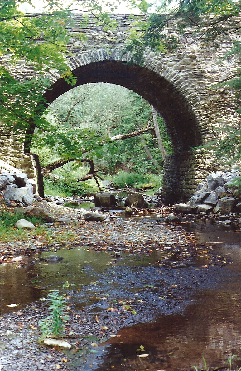
Ruhle Road Stone Arch Bridge
Monument and historic site · National Register of Historic Places · 3.5 mi
Destroyed bridge in Saratoga county, New York, United States of America

Smith's Grain and Feed Store
Monument and historic site · National Register of Historic Places · 1.3 mi
Historic feed store located at Elnora, Saratoga County, New York


Davis-Ferris Organ
Monument and historic site · National Register of Historic Places · 2.0 mi

Parks, trails and playgrounds10


Dwaas Kill Nature Preserve
Hiking and trails · 1.3 mi
Dwaas Kill Nature Preserve is owned by the Town of Clifton Park. Established in 2005, the preserve is 240 acres of mostly undisturbed...

Restaurants and cafes9






Where to stay1

History
The Country Knolls CDP is part of the "Country Knolls Estates" housing development. The area is sometimes also referred to as "Country Knolls North" or as the "original" Country Knolls to clarify it from a similar housing development called "Country Knolls South" that was built later a few miles south of Country Knolls. The census-designated place Country Knolls is within and is smaller than the larger Country Knolls Estates. Country Knolls (North), Country Knolls South, Country Knolls West, and the earlier Clifton Knolls were built by the local Clifton Park housing development company owned by Robert Van Patten.
The Country Knolls Civic Association has a description of the development and growth of the original Country Knolls from its initial homes built on Hillcrest Drive, Meridian Lane, Ridge Lane, and Manor Court in 1964, to the expansion of Country Knolls into the town of Malta, and the later addition of homes in 1988/89 on previously untouched land in the middle of Country Knolls in 1988 on the new Huntington Parkway. The housing development Country Knolls also includes adjacent homes in the "Longkill" and "Ashley" sections that are separated from the main development by Longkill Road and Ushers Road, respectively.
From the History section of Country Knolls, New York on Wikipedia, under CC BY-SA 4.0.
Churches and places of worship8
Clifton Park Center Baptist Church and Cemetery
Church · National Register of Historic Places · 3.7 mi
Corpus Christi Catholic Church
Church · Roman Catholic · 1.5 mi
2001 Route 9, Round Lake
Shopping2
Gas and EV charging7
Schools, colleges and libraries18
Burnt Hills-Ballston Lake Senior High School
School · 4.3 mi
88 Lakehill Rd, Burnt Hills
Francis L Stevens Elementary School
School · 3.8 mi
25 Lakehill Rd, Ballston Lake
Mechanicville Junior/Senior High School
School · 5.5 mi
25 Kniskern Ave, Mechanicville
Healthcare1
Map of Country Knolls
64 places. The map loads OpenStreetMap tiles when you open it.
Climate by month
Monthly table
| Month | High | Low | Rain | Snow |
|---|---|---|---|---|
| Jan | 32°F | 14°F | 3.4 in | 16.5 in |
| Feb | 35°F | 16°F | 2.6 in | 15.7 in |
| Mar | 45°F | 25°F | 3.4 in | 11.4 in |
| Apr | 60°F | 36°F | 3.8 in | 1.8 in |
| May | 72°F | 47°F | 3.9 in | 0.0 in |
| Jun | 80°F | 56°F | 4.8 in | 0.0 in |
| Jul | 84°F | 61°F | 5.0 in | 0.0 in |
| Aug | 82°F | 59°F | 4.1 in | 0.0 in |
| Sep | 75°F | 52°F | 3.8 in | 0.0 in |
| Oct | 62°F | 40°F | 4.1 in | 0.1 in |
| Nov | 49°F | 31°F | 3.5 in | 2.9 in |
| Dec | 37°F | 22°F | 3.9 in | 15.1 in |
U.S. Climate Normals 1991-2020 for Saratoga Springs 4 Sw Hcn (9 mi away), NOAA NCEI.
People and cost of living
American Community Survey 5-year estimates, 2020-2024, U.S. Census Bureau. Estimates have margins of error, larger for small towns.
Disaster history
Saratoga County has had 15 federal disaster declarations since 2000, most often for hurricanes.
- 2021-08-22: Hurricane Henri (Hurricane)
- 2020-03-20: Covid-19 Pandemic (Biological)
- 2020-03-13: Covid-19 (Biological)
- 2019-12-19: Severe Storms, Straight-Line Winds, And Flooding (Severe Storm)
- 2017-07-12: Severe Winter Storm And Snowstorm (Snowstorm)
- 2012-10-28: Hurricane Sandy (Hurricane)
OpenFEMA disaster declarations summaries.
Getting there and nearby towns
Schenectady County Airport (SCH) is the nearest airport with scheduled flights listed in OpenStreetMap, 7 miles away.
- Clifton Knolls-Mill Creek 4 mi south, about 6 min by car
- Clifton Gardens 4 mi south, about 7 min by car
- East Glenville 7 mi southwest, about 11 min by car
- Ballston Spa 7 mi north, about 11 min by car
- Niskayuna 8 mi southwest, about 13 min by car
- North Ballston Spa 8 mi north, about 13 min by car
- Stillwater 9 mi east, about 14 min by car
- Schenectady 10 mi southwest, about 15 min by car
- Cohoes 11 mi southeast, about 17 min by car
- Saratoga Springs 11 mi north, about 18 min by car
Drive times are estimates from straight-line distance, not routes.
Local news
Headlines from INDB, the NEMICO news database.
Reviews, tips and questions
Loading what members have shared...
Sources and licences
- NCES EDGE (Public domain): public schools
- NOAA NCEI U.S. Climate Normals 1991-2020 (Public domain): climate by month
- OpenFEMA (Public domain): disaster declarations
- OpenStreetMap contributors (ODbL 1.0): places, airports, map data
- U.S. Census Bureau (Public domain): population, income, housing, education, commute
- Wikidata (CC0 1.0): elevation, founding date, time zone, website, landmarks and historic places
- Wikimedia Commons (see each image): photos
- Wikipedia (CC BY-SA 4.0): overview and history text
Photo credits
- Smith's Grain and Feed Store, Peter Flass, CC BY 3.0
- Malta Ruhle Road Stone Bridge, Town of Malta, NY Historian, CC BY 3.0
- Clifton Park Center Baptist Church and Cemetery, Peter Flass, CC BY 3.0
- Jonesville Store, Peter Flass, CC BY 3.0
- Jonesville Cemetery, Jonesville NY, Peter Flass, CC BY 3.0
- Malta Ruhle Road Lenticular Truss Bridge 1, Peter Flass ( talk ), CC BY 3.0
- Clifton Park Hotel, Peter Flass, CC BY 3.0
- Davis-Ferris Organ Front View, Grace mayo, CC BY-SA 4.0
- All Saints Episcopal Church, Round Lake New York, Peter Flass, CC BY 3.0

Page built October 30, 2026. Spotted a mistake? Tell us or suggest a place.