




Cullowhee, North Carolina
Cullowhee is a community of 7,973 people in Jackson County, North Carolina.
Why visit Cullowhee
Townapedia lists 6 museums and landmarks, 5 parks and trails, 17 places to eat, 1 place to stay and 5 attractions in and around town.
Highlights include Western Carolina University, Berry Mountain, Elisha Calor Hedden House and Joyner Building.
July is the warmest month, with average highs of 85°F; January lows average 26°F.
Weather in Cullowhee
Forecast from the National Weather Service. Full forecast
About Cullowhee
Cullowhee () is a census-designated place (CDP) in Jackson County, North Carolina, United States. It is located on the Tuckasegee River, and the permanent population was 7,682 at the 2020 census up from 6,228 at the 2010 census.
From the Wikipedia article Cullowhee, North Carolina (this version), under CC BY-SA 4.0.
Things to do5
Western Carolina University
School
Coeducational public university in Cullowhee, North Carolina, United States


Museums and landmarks6

Elisha Calor Hedden House
Monument and historic site · National Register of Historic Places · 3.3 mi
Historic house in North Carolina, United States
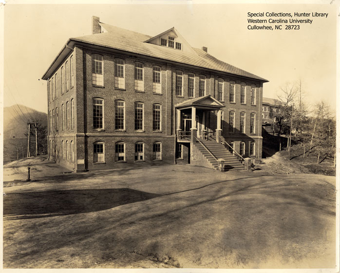
Joyner Building
Monument and historic site · National Register of Historic Places
Building in North Carolina, United States


Lucius Coleman Hall House
Monument and historic site · National Register of Historic Places · 3.6 mi
Historic house in North Carolina, United States

Webster Rock School
Monument and historic site · National Register of Historic Places · 3.4 mi
Historic school building in North Carolina, United States

Parks, trails and playgrounds5


Restaurants and cafes17


Peak Pizza Bar
Restaurant · Pizza · 0.7 mi
2968 Old Cullowhee Road, Cullowhee
Mo-Tu 11:30-21:00; Th 11:30-21:00; Fr-Sa 11:30-22:00; Su 11:30-20:00
The Cat’s Table
Restaurant · 0.6 mi
4685 Little Savannah Road, Cullowhee

Chick-fil-A
Fast food · Chicken
160 West University Way, Courtyard Food Court
Mo-Fr 10:00-19:00; Su off
5 more on the map.
History
Developed along a mountain river valley and by a creek, Cullowhee was known as a historic Cherokee village centered around an earthwork platform mound estimated to have been built by 1000 CE by people of the South Appalachian Mississippian culture. Archeological evidence from excavations at Cullowhee Mound suggests that this area had been occupied since 3000 BCE by cultures of indigenous peoples. The historic Cherokee developed a style of public architecture characterized by building large town houses, or council houses, on top of the mounds. This was the center place for the community to gather, and the town elders to meet in council. It expressed the consensus nature of their society.
The Cherokee were forced to cede their land in this area in the early nineteenth century. When European-American settlers moved in, they occupied the site of the former Cherokee village. Cullowhee became one of the first European-American settlements in Jackson County. Residents reportedly founded the first school in the area, a one-room school in 1830. They developed the floodplain area for agriculture. The settlers cleared more land during the 1800s than the Cherokee had cultivated.
From the History section of Cullowhee, North Carolina on Wikipedia, under CC BY-SA 4.0.
Where to stay1
Churches and places of worship7
Webster Baptist Church
Church · National Register of Historic Places · 3.3 mi
Webster United Methodist Church
Church · National Register of Historic Places · 3.3 mi
Gas and EV charging1
Schools, colleges and libraries7
Healthcare1
Map of Cullowhee
50 places. The map loads OpenStreetMap tiles when you open it.
Climate by month
Monthly table
| Month | High | Low | Rain | Snow |
|---|---|---|---|---|
| Jan | 48°F | 26°F | 4.8 in | 1.3 in |
| Feb | 53°F | 28°F | 4.6 in | 0.7 in |
| Mar | 61°F | 34°F | 4.6 in | 0.7 in |
| Apr | 70°F | 42°F | 4.7 in | 0.0 in |
| May | 77°F | 50°F | 4.3 in | 0.0 in |
| Jun | 82°F | 59°F | 5.1 in | 0.0 in |
| Jul | 85°F | 63°F | 5.0 in | 0.0 in |
| Aug | 84°F | 62°F | 4.3 in | 0.0 in |
| Sep | 79°F | 56°F | 4.3 in | 0.0 in |
| Oct | 70°F | 44°F | 3.2 in | 0.1 in |
| Nov | 60°F | 33°F | 4.0 in | 0.0 in |
| Dec | 51°F | 29°F | 5.1 in | 1.5 in |
U.S. Climate Normals 1991-2020 for Cullowhee (0 mi away), NOAA NCEI.
People and cost of living
American Community Survey 5-year estimates, 2020-2024, U.S. Census Bureau. Estimates have margins of error, larger for small towns.
Disaster history
Jackson County has had 15 federal disaster declarations since 2000, most often for hurricanes.
- 2026-01-24: Severe Winter Storm (Winter Storm)
- 2024-09-28: Tropical Storm Helene (Tropical Storm)
- 2024-09-26: Hurricane Helene (Tropical Storm)
- 2022-10-01: Hurricane Ian (Hurricane)
- 2021-09-08: Remnants Of Tropical Storm Fred (Hurricane)
- 2020-08-02: Hurricane Isaias (Hurricane)
OpenFEMA disaster declarations summaries.
Getting there and nearby towns
Angel Medical Center Heliport (93NC) is the nearest airport with scheduled flights listed in OpenStreetMap, 14 miles away.
- Cherokee 14 mi northwest, about 22 min by car
- Waynesville 16 mi northeast, about 26 min by car
- Bryson City 17 mi northwest, about 27 min by car
- Clyde 22 mi northeast, about 35 min by car
- Canton 25 mi northeast, about 40 min by car
- Brevard 26 mi east, about 42 min by car
- Mountain City 29 mi southwest, about 47 min by car
- Clayton 32 mi southwest, about 52 min by car
- Avery Creek 36 mi east, about 58 min by car
- Asheville 40 mi northeast, about 1 h by car
Drive times are estimates from straight-line distance, not routes.
Local news
Headlines from INDB, the NEMICO news database.
Reviews, tips and questions
Loading what members have shared...
Sources and licences
- NCES EDGE (Public domain): public schools
- NOAA NCEI U.S. Climate Normals 1991-2020 (Public domain): climate by month
- OpenFEMA (Public domain): disaster declarations
- OpenStreetMap contributors (ODbL 1.0): places, airports, map data
- U.S. Census Bureau (Public domain): population, income, housing, education, commute
- Wikidata (CC0 1.0): elevation, founding date, time zone, website, landmarks and historic places
- Wikimedia Commons (see each image): photos
- Wikipedia (CC BY-SA 4.0): overview and history text
Photo credits
- Cullowhee Skyline, RichardKenni, CC BY-SA 3.0
- Webster Baptist Church, RichardKenni, CC BY-SA 3.0
- Joyner Building, Unknown author Unknown author, Public domain
- Lucius Coleman Hall House, Webster, NC (46615212631), Warren LeMay from Cincinnati, OH, United States, CC0
- Elisha Calor Hedden House, Webster, NC (46615328691), Warren LeMay from Cincinnati, OH, United States, CC0
- Ramsey Regional Activity Center in Cullowhee, NC, Ncmattj at English Wikipedia, CC BY-SA 3.0
Page built October 30, 2026. Spotted a mistake? Tell us or suggest a place.