


Why visit Dahlonega
Townapedia lists 15 museums and landmarks, 8 parks and trails, 38 places to eat, 5 places to stay and 5 attractions in and around town.
Highlights include University of North Georgia, North Georgia College & State University, Consolidated Gold Mine and Dahlonega Gold Museum Historic Site.
July is the warmest month, with average highs of 86°F; January lows average 27°F.
Weather in Dahlonega
Forecast from the National Weather Service. Full forecast
About Dahlonega
Dahlonega is the county seat of Lumpkin County, Georgia, United States. As of the 2020 census, Dahlonega had a population of 7,537.
From the Wikipedia article Dahlonega, Georgia (this version), under CC BY-SA 4.0.
Things to do5

University of North Georgia
School
Public university in Georgia, United States



Museums and landmarks15

Consolidated Gold Mine
Monument and historic site · National Register of Historic Places · 0.6 mi
Historic site and former gold mine in Dahlonega, Georgia, USA
185 Consolidated Gold Mine Road, Dahlonega

Dahlonega Gold Museum Historic Site
Museum · National Register of Historic Places · 0.4 mi
Museum in Dahlonega, Georgia, USA

Fields Place-Vickery House
Monument and historic site · National Register of Historic Places · 0.5 mi
Historic building located in Dahlonega, Georgia
Holly Theatre
Cinema and theater · National Register of Historic Places · 0.4 mi
Historic theatre in Dahlonega, Lumpkin County, Georgia, USA

Lumpkin County Historical Jail
Monument and historic site · National Register of Historic Places
Museum in Dahlonega, United States of America
Price Memorial Hall
Monument and historic site · National Register of Historic Places · 0.4 mi
University building in Dahlonega, Georgia, U.S.
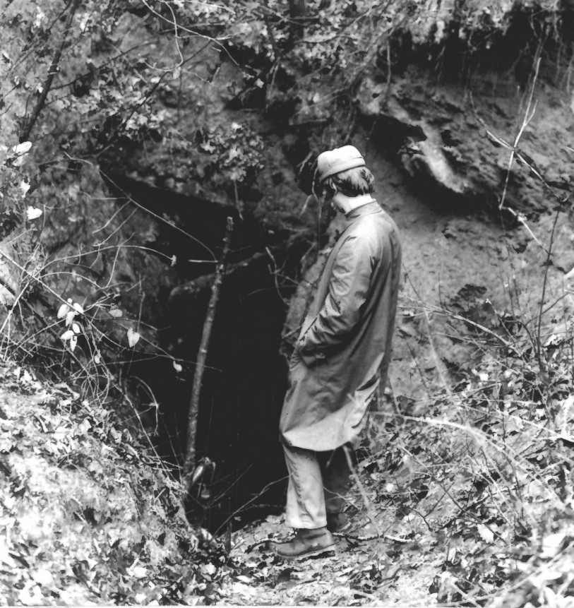
Calhoun Mine
Monument and historic site · National Register of Historic Places · 2.2 mi
The Diving Bell
Monument and historic site · 0.4 mi
The 1875 Chestatee river diving bell
3 more on the map.
Parks, trails and playgrounds8




Restaurants and cafes38

Gustavos Pizza
Restaurant · Pizza
16 Public Square South, Dahlonega
Tu-Th,Su 11:00-21:00; Fr,Sa 11:00-22:00; Mo off
Hickory Prime BBQ
Restaurant · Barbecue · 1.5 mi
1724 Morrison Moore Parkway West, Dahlonega
Su-Th 10:30-20:00; Fr-Sa 10:30-21:00
Ramen & Bento
Restaurant · Japanese · 0.4 mi
51 West Main Street, Dahlonega
Mo-Th 11:30-21:00; Fr,Sa 11:30-22:00; Su off
19° North Seafood & Grill
Restaurant · Seafood · 0.4 mi
19 North Chestatee Street, Dahlonega
Su-Th 11:00-21:00; Fr,Sa 11:00-22:00
Spirits Tavern
Restaurant · 0.4 mi
19 East Main Street, Dahlonega
Su-Th 11:00-22:00; Fr,Sa 11:00-23:00


26 more on the map.
Where to stay5
Holiday Inn Express & Suites Dahlonega - University Area
Motel and hotel
32 East Main Street, Dahlonega
Quality Inn Dahlonega Near University
Motel and hotel · 0.9 mi
619 North Grove Street
Churches and places of worship8
Kingdom Hall of Jehovah's Witnesses
Church · Jehovahs Witness · 2.7 mi
30 Buckhorn Tavern Road, Dahlonega
Saint Luke the Evangelist Roman Catholic Church
Church · Roman Catholic · 0.4 mi
91 North Park Street, Dahlonega
Shopping11
Gas and EV charging6
Schools, colleges and libraries8
Healthcare1
Map of Dahlonega
105 places. The map loads OpenStreetMap tiles when you open it.
Climate by month
Monthly table
| Month | High | Low | Rain | Snow |
|---|---|---|---|---|
| Jan | 50°F | 27°F | 6.0 in | 0.5 in |
| Feb | 54°F | 30°F | 5.7 in | 0.4 in |
| Mar | 61°F | 35°F | 6.0 in | 0.0 in |
| Apr | 70°F | 42°F | 5.2 in | 0.0 in |
| May | 77°F | 51°F | 4.8 in | 0.0 in |
| Jun | 83°F | 60°F | 5.1 in | 0.0 in |
| Jul | 86°F | 64°F | 4.8 in | 0.0 in |
| Aug | 84°F | 63°F | 6.0 in | 0.0 in |
| Sep | 80°F | 57°F | 4.7 in | 0.0 in |
| Oct | 71°F | 45°F | 5.4 in | 0.0 in |
| Nov | 62°F | 35°F | 5.2 in | 0.0 in |
| Dec | 53°F | 29°F | 6.5 in | 0.2 in |
U.S. Climate Normals 1991-2020 for Cleveland (13 mi away), NOAA NCEI.
People and cost of living
American Community Survey 5-year estimates, 2020-2024, U.S. Census Bureau. Estimates have margins of error, larger for small towns.
Disaster history
Lumpkin County has had 16 federal disaster declarations since 2000, most often for hurricanes.
- 2026-10-09: Hurricane Isaias (Tropical Storm)
- 2026-01-24: Severe Winter Storm (Winter Storm)
- 2024-09-30: Hurricane Helene (Hurricane)
- 2024-09-26: Hurricane Helene (Tropical Storm)
- 2021-05-05: Severe Storms And Tornadoes (Severe Storm)
- 2021-01-12: Tropical Storm Zeta (Hurricane)
OpenFEMA disaster declarations summaries.
Getting there and nearby towns
Lee Gilmer Memorial Airport (GVL) is the nearest airport with scheduled flights listed in OpenStreetMap, 20 miles away.
- Dawsonville 11 mi southwest, about 17 min by car
- Cleveland 13 mi east, about 21 min by car
- Gainesville 19 mi southeast, about 30 min by car
- Oakwood 22 mi south, about 35 min by car
- Cumming 24 mi south, about 39 min by car
- Baldwin 24 mi east, about 39 min by car
- Flowery Branch 25 mi south, about 40 min by car
- Cornelia 26 mi east, about 41 min by car
- Jasper 26 mi west, about 42 min by car
- Buford 28 mi south, about 46 min by car
Drive times are estimates from straight-line distance, not routes.
Local news
Headlines from INDB, the NEMICO news database.
Reviews, tips and questions
Loading what members have shared...
Sources and licences
- NCES EDGE (Public domain): public schools
- NOAA NCEI U.S. Climate Normals 1991-2020 (Public domain): climate by month
- OpenFEMA (Public domain): disaster declarations
- OpenStreetMap contributors (ODbL 1.0): places, airports, map data
- U.S. Census Bureau (Public domain): population, income, housing, education, commute
- Wikidata (CC0 1.0): elevation, founding date, time zone, website, landmarks and historic places
- Wikimedia Commons (see each image): photos
- Wikipedia (CC BY-SA 4.0): overview and history text
Photo credits
- Dahlonega Gold Museum Historic Site, HowardSF at English Wikipedia, CC BY-SA 3.0
- 2023-05-14 Consolidated Gold Mine Building Dahlonega Georgia, Clifflandis, CC0
- Public Square North, Dahlonega, GA, Gwringle, CC BY-SA 3.0
- Dahlonega GA banner, Gwringle, CC BY-SA 3.0
- 2023-05-14 Mine cart at Consolidated Gold Mine Dahlonega Georgia USA, Clifflandis, CC0
- Dahlonega Mine, BakedintheHole, CC0
- Consolidated Gold Mine, Glory Hole, Dahlonega (Lumpin County, Georgia), KudzuVine, Public domain
- Lumpkin County Jail, Dahlonega, Georgia, KudzuVine, Public domain
- CalhounMine1972NPS, National Park Service, Public domain
- University of North Georgia Cumming Library, Clifflandis, CC BY-SA 3.0
- Seven Oaks, Col. William P. Price Home, Circa 1875, front, Gwringle, CC BY-SA 3.0
- Seven Oaks, Col. William P. Price Home, Circa 1875, Gwringle, CC BY-SA 3.0
- Mike Cottrell College of Business, TheIndecisionEngine, CC BY-SA 3.0
- Buildings on the campus of North Georgia College and State University, Hermione1980, CC BY-SA 3.0
- 19-07-097-museum, Dsdugan, CC0
- 19-07-022-museum, Dsdugan, CC0
- 19-07-032-museum, Dsdugan, CC0
- 19-07-059-museum, Dsdugan, CC0
- 19-07-042-museum, Dsdugan, CC0
- 19-07-011-museum, Dsdugan, CC0
- 19-07-117-museum, Dsdugan, CC0
- I scream, you scream..... - panoramio, Miles Buddy, CC BY-SA 3.0
- Holly Theatre by Holly Bokash, HollyJoe28, CC BY-SA 3.0
- 2023-05-14 Chestatee River Diving Bell 04, Clifflandis, CC0
- 2023-05-14 Chestatee River Diving Bell 05, Clifflandis, CC0
- 2023-05-14 Chestatee River Diving Bell 01, Clifflandis, CC0
- 2023-05-14 Chestatee River Diving Bell 02, Clifflandis, CC0
- 2023-05-14 Chestatee River Diving Bell 08, Clifflandis, CC0
- 2023-05-14 Chestatee River Diving Bell 06, Clifflandis, CC0
- 2023-05-14 Chestatee River Diving Bell 07, Clifflandis, CC0
- 2023-05-14 Chestatee River Diving Bell 03, Clifflandis, CC0
- Price Memorial Hall by Holly Bokash, HollyJoe28, CC BY-SA 3.0
- Cross-cut saw demonstation (15180229742), ChattOconeeNF, CC BY 2.0
- Hawkins Street and North Park Street Crossing, Snarblox, CC BY-SA 4.0
- Local Coordinated Efforts (12487726353), Georgia National Guard from United States, CC BY 2.0
- Georgia Guard On The Way (12487732573), Georgia National Guard from United States, CC BY 2.0
- 124th MPAD trains in North Georgia Mountains (5385033646), Georgia National Guard from United States, CC BY 2.0
- 124th MPAD Soldiers hit the field (5384429155), Georgia National Guard from United States, CC BY 2.0
- 124th Mobile Public Affairs Detachment trains (5385031758), Georgia National Guard from United States, CC BY 2.0
- Refueling Point (12488069504), Georgia National Guard from United States, CC BY 2.0


Page built October 30, 2026. Spotted a mistake? Tell us or suggest a place.