

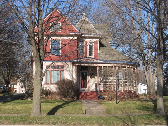


Dell Rapids, South Dakota
Dell Rapids is a city of 3,905 people in Minnehaha County, South Dakota, founded in 1871.
Why visit Dell Rapids
Townapedia lists 7 museums and landmarks, 7 parks and trails, 5 places to eat, 2 places to stay and 3 attractions in and around town.
Highlights include Dells Theatre, Dell Rapids Water Tower and Gina Smith Campbell Bathhouse.
July is the warmest month, with average highs of 83°F; January lows average 6°F.
Weather in Dell Rapids
Forecast from the National Weather Service. Full forecast
About Dell Rapids
Dell Rapids is a city in Minnehaha County, South Dakota, United States. The population was 3,996 at the 2020 census. It is known as "The Little City with the Big Attractions."
From the Wikipedia article Dell Rapids, South Dakota (this version), under CC BY-SA 4.0.
Things to do3


Museums and landmarks7
Dell Rapids Water Tower
Monument and historic site · National Register of Historic Places · 0.4 mi
Water tower in Dell Rapids, United States of America
Gina Smith Campbell Bathhouse
Monument and historic site · National Register of Historic Places · 0.7 mi
Public bath in Dell Rapids, South Dakota
Beach Avenue, Dell Rapids


Odd Fellows Home of Dell Rapids
Monument and historic site · National Register of Historic Places · 0.4 mi
Historic Independent Order of Odd Fellows lodge and former orphanage in Dell Rapids, South Dakota
100 West 10th Street, Dell Rapids
William G. Milne House
Monument and historic site · National Register of Historic Places · 0.4 mi
Historic house in South Dakota, United States
508 East 9th Street, Dell Rapids

Dell Rapids Warming House
Monument and historic site · 0.4 mi
State Avenue, Dell Rapids
Parks, trails and playgrounds7


Restaurants and cafes5




History
Dell Rapids was originally named Dell City, but was renamed after the rapids of the Big Sioux River. After a fire broke out on the main street and burned most of the town, it was rebuilt out of Sioux Quartzite, a common rock in the area. The Chicago, Milwaukee, and Saint Paul Railroad built a railroad into the area, reaching Dell Rapids from Egan in 1881. Two large Sioux Quartzite quarries owned by LG Everist are operated via this rail line, which is now operated by LG's subsidiary, the D&I Railroad. The community celebrates its heritage with the annual "Quarry Days" in July, and in June, the city hosts "Cootie Days", where rides and games are set up and available in the city's park.
From the History section of Dell Rapids, South Dakota on Wikipedia, under CC BY-SA 4.0.
Where to stay2
Churches and places of worship3
St. Peter's Lutheran Church
Church · Lutheran · National Register of Historic Places
701 Orleans Avenue, Dell Rapids
St. Mary Catholic Church
Church · Catholic · 0.4 mi
608 East 8th Street, Dell Rapids
Shopping2
Schools, colleges and libraries10
Healthcare2
Map of Dell Rapids
41 places. The map loads OpenStreetMap tiles when you open it.
Climate by month
Monthly table
| Month | High | Low | Rain |
|---|---|---|---|
| Jan | 24°F | 6°F | 0.7 in |
| Feb | 29°F | 11°F | 0.9 in |
| Mar | 42°F | 23°F | 1.8 in |
| Apr | 57°F | 34°F | 3.3 in |
| May | 69°F | 47°F | 3.8 in |
| Jun | 79°F | 58°F | 5.0 in |
| Jul | 83°F | 61°F | 3.4 in |
| Aug | 80°F | 59°F | 3.2 in |
| Sep | 73°F | 49°F | 3.1 in |
| Oct | 59°F | 37°F | 2.3 in |
| Nov | 42°F | 23°F | 1.3 in |
| Dec | 29°F | 12°F | 0.9 in |
U.S. Climate Normals 1991-2020 for Sioux Falls 14 Nne 72660 (8 mi away), NOAA NCEI.
People and cost of living
American Community Survey 5-year estimates, 2020-2024, U.S. Census Bureau. Estimates have margins of error, larger for small towns.
Disaster history
Minnehaha County has had 11 federal disaster declarations since 2000, most often for severe storms.
- 2024-08-15: Severe Storms, Straight-Line Winds, And Flooding (Flood)
- 2022-06-29: Severe Storm, Straight-Line Winds, Tornadoes, And Flooding (Severe Storm)
- 2020-04-05: Covid-19 Pandemic (Biological)
- 2020-03-13: Covid-19 (Biological)
- 2019-11-18: Severe Storms, Tornadoes, And Flooding (Severe Storm)
- 2019-06-07: Severe Winter Storm, Snowstorm, And Flooding (Flood)
OpenFEMA disaster declarations summaries.
Getting there and nearby towns
Sioux Falls Regional Airport (FSD) is the nearest airport with scheduled flights listed in OpenStreetMap, 17 miles away.
- Baltic 5 mi south, about 7 min by car
- Brandon 17 mi south, about 28 min by car
- Sioux Falls 20 mi south, about 32 min by car
- Pipestone 23 mi northeast, about 38 min by car
- Luverne 28 mi southeast, about 44 min by car
- Larchwood 29 mi southeast, about 47 min by car
- Brookings 33 mi north, about 53 min by car
- Canton 37 mi south, about 59 min by car
- Rock Rapids 39 mi southeast, about 1 h by car
- Adrian 41 mi east, about 1 h by car
Drive times are estimates from straight-line distance, not routes.
Local news
Headlines from INDB, the NEMICO news database.
Reviews, tips and questions
Loading what members have shared...
Sources and licences
- NCES EDGE (Public domain): public schools
- NOAA NCEI U.S. Climate Normals 1991-2020 (Public domain): climate by month
- OpenFEMA (Public domain): disaster declarations
- OpenStreetMap contributors (ODbL 1.0): places, airports, map data
- U.S. Census Bureau (Public domain): population, income, housing, education, commute
- Wikidata (CC0 1.0): elevation, founding date, time zone, website, landmarks and historic places
- Wikimedia Commons (see each image): photos
- Wikipedia (CC BY-SA 4.0): overview and history text
Photo credits
- Dell Rapids, South Dakota 1, AlexiusHoratius, CC BY-SA 3.0
- William G. Milne House, AlexiusHoratius, CC BY-SA 3.0
- Odd Fellows Home of Dell Rapids, Amitzel, CC BY-SA 4.0
- Dell Rapids watertower 1, AlexiusHoratius, CC BY-SA 3.0
- Gina Smith Campbell bathhouse 1, AlexiusHoratius, CC BY-SA 3.0
Page built October 30, 2026. Spotted a mistake? Tell us or suggest a place.