


Why visit Depew
Townapedia lists 26 museums and landmarks, 21 parks and trails, 73 places to eat, 17 places to stay and 5 attractions in and around town.
Highlights include Glen Falls, Lancaster Opera House, Broadway Historic District and Bruce-Briggs Brick Block.
July is the warmest month, with average highs of 80°F; January lows average 19°F, and about 95 inches of snow fall in a normal year.
Weather in Depew
Forecast from the National Weather Service. Full forecast
About Depew
Depew () is a village in Erie County, New York. As of the 2020 census, Depew had a population of 15,178. It is part of the Buffalo–Niagara Falls metropolitan area. The village is named for Chauncey Depew, a politician and one of the original investors who bought the land for the village, which was incorporated in 1894.
From the Wikipedia article Depew, New York (this version), under CC BY-SA 4.0.
Things to do5

Glen Falls
Waterfall · 4.1 mi
Waterfall in Erie County, New York, United States



Museums and landmarks26
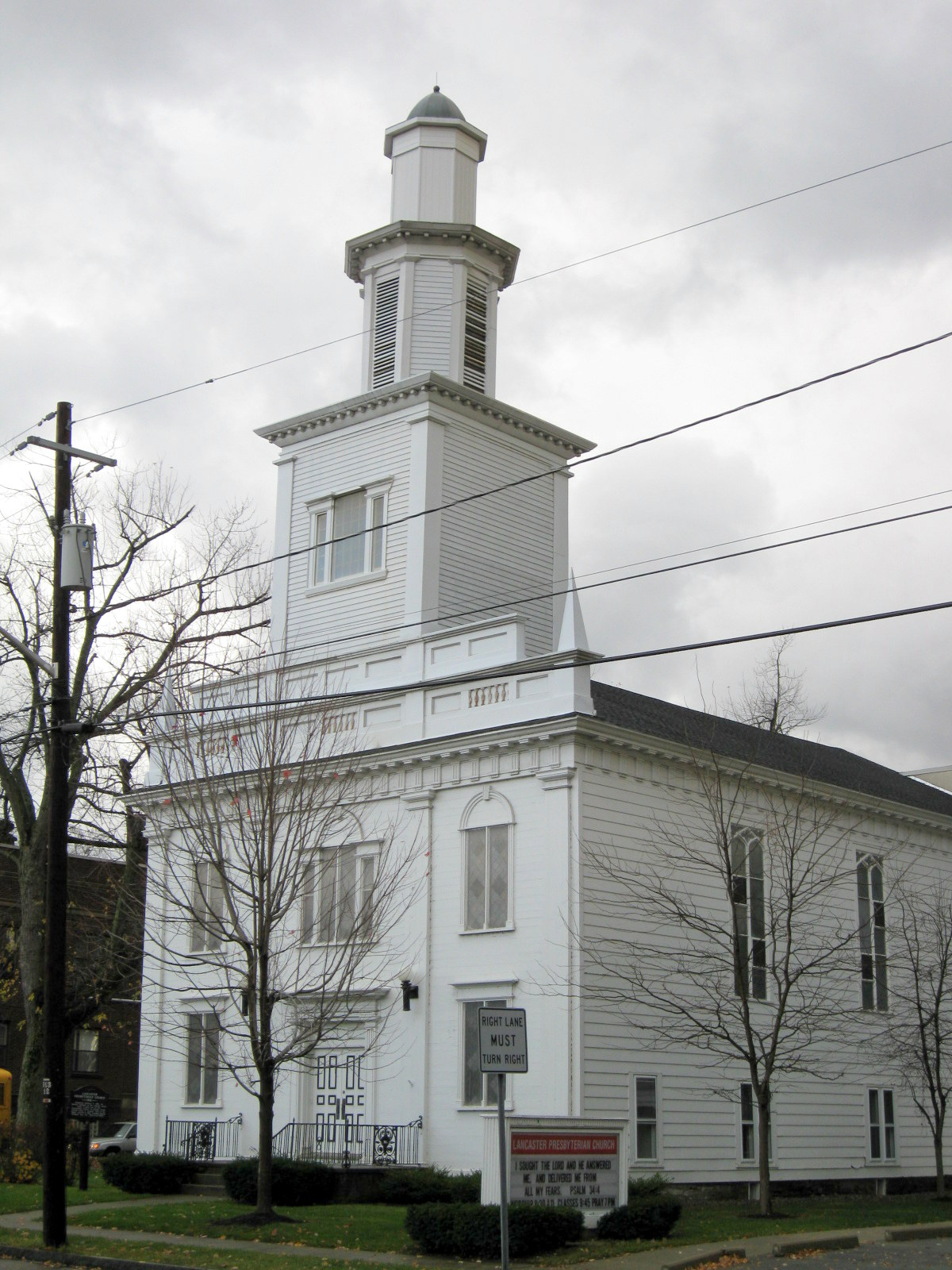
Broadway Historic District
Monument and historic site · National Register of Historic Places · 1.9 mi
Historic district in Lancaster, New York

Bruce-Briggs Brick Block
Monument and historic site · National Register of Historic Places · 2.1 mi
Historic houses in New York, United States

Central Avenue Historic District
Monument and historic site · National Register of Historic Places · 1.8 mi
Historic district in Lancaster, New York

Clark-Lester House
Monument and historic site · National Register of Historic Places · 2.0 mi
Lancaster, New York, listed on the NRHP in Erie County

DePew Lodge No. 823, Free and Accepted Masons
Monument and historic site · National Register of Historic Places · 2.1 mi
Historical building, Lancaster, Pennsylvania

Dr. John J. Nowak House
Monument and historic site · National Register of Historic Places · 2.3 mi
Historic house in New York, United States

Garrison Cemetery
Monument and historic site · National Register of Historic Places · 2.8 mi
Historic cemetery in New York, United States

Herman B. VanPeyma House
Monument and historic site · National Register of Historic Places · 2.4 mi
Historic house in New York, United States

John P. Sommers House
Monument and historic site · National Register of Historic Places · 2.1 mi
Historic house in New York, United States

John Richardson House
Monument and historic site · National Register of Historic Places · 2.6 mi
Property listed on the National Register of Historic Places in Lancaster, New York

Lancaster District School No. 6
Monument and historic site · National Register of Historic Places · 3.9 mi
Historic building in Lancaster, New York, United States


Lancaster Municipal Building
Monument and historic site · National Register of Historic Places · 1.9 mi
Listed on the National Register of Historic Places
14 more on the map.
Parks, trails and playgrounds21

Como Lake Park
Park · 2.8 mi
Park in Erie County, New York, United States

Reinstein Woods Nature Preserve And Environmental Education Center
Hiking and trails · 1.9 mi

9 more on the map.
Restaurants and cafes73

Flourish Cafe
Restaurant · Sandwich, Soup, Juice, Smoothie · 2.1 mi
A whole food plant-based café that focuses on real food and education. Soup, sandwiches, smoothies, cold press juice and many take out options.
5476 Broadway Street, Lancaster
Su-We off; Th 11:00-15:00; Fr 11:00- 18:00; Sa 11:00-17:00

Italian Village
Restaurant · Italian · 1.3 mi
6354 Transit Road
Mo-Th 11:30-21:00; Fr 11:30-22:00; Sa 15:00-22:00; Su 15:00-21:00
Teton Kitchen Thai & Japanese Cuisine
Restaurant · Japanese, Thai · 1.5 mi
415 Dick Road
Mo-We 11:00-21:30; Th 11:00-22:00; Fr 11:00-22:15; Sa 12:00-22:15;...
The Yelling Goat
Restaurant · Barbecue · 1.7 mi
205 Central Avenue, Lancaster
Mo-Th 11:00-22:00, Fr-Sa 11:00-23:00, Su 12:00-21:00

Tim Hortons
Cafe · Coffee Shop · 1.8 mi
4301 Genesee Street, Buffalo
Mo-Su 07:00-20:00
61 more on the map.
History
Part of the area that Depew currently inhabits was first settled in 1808 by Apollos Hitchcock, just north of Cayuga Creek on the main road that connected Buffalo (spelled as "Buffaloe" at the time) with Lancaster village in what was then Jukdowaageh (now Cheektowaga), which some say meant "land of the crab apple" or "land of fruit and flowers". The land had been bought and surveyed by the Holland Land Company.
The following is from Our County and Its People A Descriptive Work of Erie County New York, edited by Truman C. White:
From the History section of Depew, New York on Wikipedia, under CC BY-SA 4.0.
Where to stay17
Churches and places of worship13
Our Lady Help of Christians Chapel
Church · National Register of Historic Places · 2.7 mi
Williamsville Christian Church
Church · National Register of Historic Places · 4.1 mi
Kingdom Hall of Jehovah’s Witnesses
Church · Jehovahs Witness · 1.7 mi
1822 Como Park Boulevard, Lancaster
Saint Mary of the Assumption Catholic Church
Church · Roman Catholic · 1.5 mi
1 Saint Marys Hill, Lancaster
Saint Patrick's Episcopal Church
Church · Catholic · 1.8 mi
1395 George Urban Boulevard, Buffalo
Shopping14
Gas and EV charging12
Schools, colleges and libraries51
Buffalo Academy of Science Charter School Ii
School · 5.3 mi
335 Doat St, Buffalo
Healthcare5
Western New York Immediate Care
Clinic and pharmacy · 1.4 mi
6375 Transit Road, Depew
Map of Depew
237 places. The map loads OpenStreetMap tiles when you open it.
Climate by month
Monthly table
| Month | High | Low | Rain | Snow |
|---|---|---|---|---|
| Jan | 32°F | 19°F | 3.4 in | 26.7 in |
| Feb | 33°F | 20°F | 2.5 in | 18.1 in |
| Mar | 42°F | 26°F | 2.9 in | 14.1 in |
| Apr | 55°F | 36°F | 3.4 in | 2.5 in |
| May | 67°F | 48°F | 3.4 in | 0.0 in |
| Jun | 76°F | 58°F | 3.4 in | 0.0 in |
| Jul | 80°F | 63°F | 3.2 in | 0.0 in |
| Aug | 79°F | 62°F | 3.2 in | 0.0 in |
| Sep | 72°F | 54°F | 4.1 in | 0.0 in |
| Oct | 60°F | 44°F | 4.0 in | 0.9 in |
| Nov | 48°F | 34°F | 3.5 in | 7.8 in |
| Dec | 37°F | 26°F | 3.8 in | 25.3 in |
U.S. Climate Normals 1991-2020 for Buffalo Hcn 72528 (3 mi away), NOAA NCEI.
People and cost of living
American Community Survey 5-year estimates, 2020-2024, U.S. Census Bureau. Estimates have margins of error, larger for small towns.
Disaster history
Erie County has had 20 federal disaster declarations since 2000, most often for snowstorms.
- 2023-03-15: Severe Winter Storm And Snowstorm (Snowstorm)
- 2022-12-26: Severe Winter Storm (Winter Storm)
- 2022-11-20: Severe Winter Storm And Snowstorm (Winter Storm)
- 2020-03-20: Covid-19 Pandemic (Biological)
- 2020-03-13: Covid-19 (Biological)
- 2019-12-19: Severe Storms, Straight-Line Winds, And Flooding (Severe Storm)
OpenFEMA disaster declarations summaries.
Getting there and nearby towns
Buffalo-Niagara International Airport (BUF) is the nearest airport with scheduled flights listed in OpenStreetMap, 2 miles away.
- Cheektowaga 2 mi west, about 4 min by car
- Lancaster 2 mi southeast, about 3 min by car
- Williamsville 4 mi northwest, about 6 min by car
- Harris Hill 4 mi north, about 7 min by car
- Sloan 5 mi west, about 7 min by car
- West Seneca 6 mi southwest, about 9 min by car
- Eggertsville 6 mi northwest, about 10 min by car
- Elma Center 7 mi southeast, about 11 min by car
- Buffalo 8 mi west, about 13 min by car
- Batavia 27 mi east, about 44 min by car
Drive times are estimates from straight-line distance, not routes.
Local news
Headlines from INDB, the NEMICO news database.
Reviews, tips and questions
Loading what members have shared...
Sources and licences
- NCES EDGE (Public domain): public schools
- NOAA NCEI U.S. Climate Normals 1991-2020 (Public domain): climate by month
- OpenFEMA (Public domain): disaster declarations
- OpenStreetMap contributors (ODbL 1.0): places, airports, map data
- U.S. Census Bureau (Public domain): population, income, housing, education, commute
- Wikidata (CC0 1.0): elevation, founding date, time zone, website, landmarks and historic places
- Wikimedia Commons (see each image): photos
- Wikipedia (CC BY-SA 4.0): overview and history text
Photo credits
- Dean Architects - fmr Railway Branch YMCA - Depew, New York - 20210219, Andre Carrotflower, CC BY-SA 4.0
- Tortoiseshell cat in Depew, New York - 20220429, Andre Carrotflower, CC BY-SA 4.0
- Paranormal Oddities - fmr Rogers-Day Company, Robert J. Hutchinson Grocery et al. - Depew, New York - 20220603, Andre Carrotflower, CC BY-SA 4.0
- NFTA Metro Bus 46 @ Walden Ave & Transit Rd, Depew, New York - 20210219, Andre Carrotflower, CC BY-SA 4.0
- House at 323 River Street, Depew, New York - 20210707, Andre Carrotflower, CC BY-SA 4.0
- St. John's Lutheran Church, Depew, New York - 20230110, Andre Carrotflower, CC BY-SA 4.0
- Veterans' Park, Depew, New York - 20230110, Andre Carrotflower, CC BY-SA 4.0
- War memorials at Veterans Park, Depew, New York - 20210625, Andre Carrotflower, CC BY-SA 4.0
- Veterans Park, Depew, New York - 20210625, Andre Carrotflower, CC BY-SA 4.0
- Depew Post Office mural, J. Passepartout, CC BY-SA 4.0
- Main Street, Depew, New York - 20210510, Andre Carrotflower, CC BY-SA 4.0
- Freight trains at Buffalo–Depew station, September 2016, David Wilson from Oak Park, Illinois, USA, CC BY 2.0
- 20210625 05 Amtrak, Depew, New York (51529737619), David Wilson from Oak Park, Illinois, USA, CC BY 2.0
- Passengers at Buffalo–Depew station, September 2016, David Wilson from Oak Park, Illinois, USA, CC BY 2.0
- Buffalo-Depew station, You may select the license of your choice., CC BY-SA 3.0
- NFTA Metro Bus 46 @ Broadway bridge over Cayuga Creek, Depew, New York - 20220816, Andre Carrotflower, CC BY-SA 4.0
- NFTA Metro Bus 46 @ Buffalo-Depew Amtrak Station, Depew, New York - 20220708, Andre Carrotflower, CC BY-SA 4.0
- Lake Shore Limited at Buffalo–Depew station, September 2016, David Wilson from Oak Park, Illinois, USA, CC BY 2.0
- Home City Church - fmr SS. Peter & Paul RC Church - Depew, New York - 20210625, Andre Carrotflower, CC BY-SA 4.0
- Freight cars at Buffalo–Depew station, September 2016, David Wilson from Oak Park, Illinois, USA, CC BY 2.0
- U.S. Post Office (Depew, New York), Shine runner (talk), CC BY-SA 3.0
- Garrison Cemetery 1, Shinerunner, CC BY-SA 3.0
- Herman B. VanPeyma House Aug 10, Pubdog ( talk ), Public domain
- DePew Lodge No. 823, Free and Accepted Masons Aug 10, Pubdog ( talk ), Public domain
- Liebler-Rohl Station, Shine runner (talk), CC BY-SA 3.0
- Lancaster Presbyterian Church Lancaster NY Nov 09, Doug Kerr, CC BY-SA 2.0
- 20090412 Williamsville Water Mill Complex, TonyTheTiger, CC BY-SA 3.0
- Williamsville Christian Church Nov 09, Doug Kerr from Upstate New York, CC BY-SA 2.0
- Clark-Lester House Aug 10, Pubdog ( talk ), Public domain
- 20090412 Williamsville South High School, TonyTheTiger, CC BY-SA 3.0
- Miller-Mackey House Nov 09, Doug Kerr from Upstate New York, CC BY-SA 2.0
- John Richardson House Aug 10, Pubdog ( talk ), Public domain
- Lancaster Historical Society Museum (Potter-Eaton House), Central Avenue Historic District, Lancaster, New York, November 2009, Doug Kerr, CC BY-SA 2.0
- Lancaster Municipal Building (Lancaster, New York), Shine runner (talk), CC BY-SA 3.0
- Lancaster District School No. 6 Aug 10, Pubdog ( talk ), Public domain
- Bruce-Briggs Brick Block, Shinerunner (talk), CC BY-SA 3.0
- United States Post Office (Lancaster, New York), Shinerunner, CC BY-SA 3.0
- Chapel of Our Lady Help of Christians, Shine runner (talk), CC BY-SA 3.0
- Dr. John J. Nowak House Aug 10, Pubdog ( talk ), Public domain
- Zuidema-Idsardi House Aug 10, Pubdog ( talk ), Public domain


Page built October 30, 2026. Spotted a mistake? Tell us or suggest a place.