
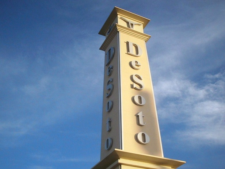


DeSoto, Texas
DeSoto is a city of 56,211 people in Dallas County, Texas, founded in 1847.
Why visit DeSoto
Townapedia lists 7 museums and landmarks, 25 parks and trails, 99 places to eat, 20 places to stay and 2 attractions in and around town.
Highlights include Cinemark Movies 14, University of North Texas at Dallas, Snake Encounters and American Airpower Heritage Museum.
August is the warmest month, with average highs of 96°F; January lows average 38°F.
Weather in DeSoto
Forecast from the National Weather Service. Full forecast
About DeSoto
DeSoto is a city in Dallas County, Texas, United States. DeSoto is a suburb of Dallas and is part of the Best Southwest area, which includes DeSoto, Cedar Hill, Duncanville, and Lancaster. As of the 2020 census, DeSoto had a population of 56,145.
From the Wikipedia article DeSoto, Texas (this version), under CC BY-SA 4.0.
Things to do2


University of North Texas at Dallas
School · 5.3 mi
Public university in Dallas, Texas
Museums and landmarks7

Snake Encounters
Monument and historic site · 2.7 mi
Enterainment
1455 Marsalis Road, Lancaster
Mo-Su 08:00-20:00

American Airpower Heritage Museum
Museum · 5.4 mi
Aviation museum in Dallas, Texas
International Museum of Cultures
Museum · 3.2 mi
411 East Highway 67, Duncanville
Parks, trails and playgrounds25


13 more on the map.
Restaurants and cafes99


Chili's
Restaurant · Tex-Mex · 3.4 mi
2503 West Wheatland Road, Dallas
Mo-Th,Su 10:45-22:00; Fr,Sa 10:45-23:00
Pappadeaux Seafood Kitchen
Restaurant · Seafood · 3.2 mi
800 East Highway 67, Duncanville
Su-Th 11:00-21:00; Fr-Sa 11:00-22:00
Touchdown Sports Bar & Lounge
Restaurant · Pizza, Burger, Sandwich, Mexican, Kebab, American, Fish, Barbeque · 2.1 mi
1409 N Cockrell Hill Rd, DeSoto
Su-Th 11:00-24:00, Fr-Sa 11:00-02:00


87 more on the map.
History
The area was first settled in 1847, making it one of the oldest communities in North Texas. A post office was established in 1881, and the settlement was named DeSoto in honor of Thomas Hernando DeSoto Stewart, a doctor dedicated to the community. By 1885, DeSoto was home to around 120 people, a cotton gin, and a general store. Soon after, the population declined to below 50. In 1930, 97 people were living in the community, with several businesses.
After World War II, DeSoto and surrounding areas began to grow. To improve the inadequate water distribution system, residents felt the need to incorporate the town. On February 17, 1949, a petition signed by 42 eligible voters was presented to the Dallas County judge requesting an election for incorporation. The vote took place on March 2. Of the 52 people who cast ballots, 50 voted in favor of incorporation and two were opposed. On March 3, 1949, the results were entered into the records of the Dallas County Commissioners Court, thereby creating the City of DeSoto. The new city was less than one square mile in size. On March 15, Wayne A. Chowning was elected mayor along with five aldermen. The first city council meeting was held two days later.
From the History section of DeSoto, Texas on Wikipedia, under CC BY-SA 4.0.
Where to stay20
Comfort Inn & Suites Cedar Hill Duncanville
Motel and hotel · 3.5 mi
1419 North Highway 67, Cedar Hill
Home2 Suites by Hilton Dallas DeSoto
Motel and hotel · 2.9 mi
1300 East Centre Park Boulevard, Desoto
Churches and places of worship54
Antioch Fellowship Missionary Baptist Church
Church · Baptist · 3.9 mi
7550 South Hampton Road
Crossroads of Life Assembly of God
Church · Assemblies Of God · 3.3 mi
123 West Highway 67, Duncanville
Galilean Baptist Church
Church · Baptist · 3.7 mi
1155 North Highway 67, Cedar Hill
Loving Fellowship Baptist Church
Church · Baptist · 1.4 mi
610 West Wintergreen Road, DeSoto
Whispering Hills Church of Christ
Church · Church Of Christ · 3.1 mi
2126 South Main Street, Duncanville
Shopping15
Gas and EV charging36
Schools, colleges and libraries71
International Leadership of Texas Lancaster K-8
School · 3.6 mi
1900 West Pleasant Run Road, Lancaster
Healthcare23
Map of DeSoto
250 places. The map loads OpenStreetMap tiles when you open it.
Climate by month
Monthly table
| Month | High | Low | Rain |
|---|---|---|---|
| Jan | 57°F | 38°F | 2.5 in |
| Feb | 62°F | 41°F | 2.6 in |
| Mar | 69°F | 48°F | 3.6 in |
| Apr | 76°F | 55°F | 3.7 in |
| May | 84°F | 64°F | 4.3 in |
| Jun | 91°F | 72°F | 3.9 in |
| Jul | 96°F | 75°F | 1.9 in |
| Aug | 96°F | 75°F | 1.8 in |
| Sep | 89°F | 68°F | 3.0 in |
| Oct | 79°F | 58°F | 4.5 in |
| Nov | 67°F | 47°F | 2.8 in |
| Dec | 59°F | 39°F | 3.1 in |
U.S. Climate Normals 1991-2020 for Dallas Redbird Ap (6 mi away), NOAA NCEI.
People and cost of living
American Community Survey 5-year estimates, 2020-2024, U.S. Census Bureau. Estimates have margins of error, larger for small towns.
Disaster history
Dallas County has had 18 federal disaster declarations since 2000, most often for hurricanes.
- 2024-05-17: Severe Storms, Straight-Line Winds, Tornadoes, And Flooding (Flood)
- 2021-02-19: Severe Winter Storms (Severe Ice Storm)
- 2021-02-14: Severe Winter Storm (Severe Ice Storm)
- 2020-08-24: Tropical Storms Marco And Laura (Hurricane)
- 2020-03-25: Covid-19 Pandemic (Biological)
- 2020-03-13: Covid-19 (Biological)
OpenFEMA disaster declarations summaries.
Getting there and nearby towns
Dallas Executive Airport (RBD) is the nearest airport with scheduled flights listed in OpenStreetMap, 6 miles away.
- Cedar Hill 6 mi west, about 9 min by car
- Grand Prairie 11 mi northwest, about 17 min by car
- Dallas 15 mi northeast, about 23 min by car
- Balch Springs 16 mi northeast, about 26 min by car
- Arlington 17 mi northwest, about 27 min by car
- Irving 19 mi north, about 30 min by car
- Mesquite 20 mi northeast, about 32 min by car
- Bedford 23 mi northwest, about 37 min by car
- Garland 25 mi northeast, about 41 min by car
- Carrollton 27 mi north, about 43 min by car
Drive times are estimates from straight-line distance, not routes.
Local news
Headlines from INDB, the NEMICO news database.
Reviews, tips and questions
Loading what members have shared...
Sources and licences
- NCES EDGE (Public domain): public schools
- NOAA NCEI U.S. Climate Normals 1991-2020 (Public domain): climate by month
- OpenFEMA (Public domain): disaster declarations
- OpenStreetMap contributors (ODbL 1.0): places, airports, map data
- U.S. Census Bureau (Public domain): population, income, housing, education, commute
- Wikidata (CC0 1.0): elevation, founding date, time zone, website, landmarks and historic places
- Wikimedia Commons (see each image): photos
- Wikipedia (CC BY-SA 4.0): overview and history text
Photo credits
- DeSotoTower, Acntx at en.wikipedia, CC BY-SA 3.0
- ISS065-E-158633 - View of Earth, Earth Science and Remote Sensing Unit , Lyndon B. Johnson Space Center, Public domain
- ISS065-E-158632 - View of Earth, Earth Science and Remote Sensing Unit , Lyndon B. Johnson Space Center, Public domain
- ISS065-E-158631 - View of Earth, Earth Science and Remote Sensing Unit , Lyndon B. Johnson Space Center, Public domain
- ISS052-E-76698 - View of Earth, Earth Science and Remote Sensing Unit , Lyndon B. Johnson Space Center, Public domain
- ISS016-E-28735 - View of Earth, Earth Science and Remote Sensing Unit , Lyndon B. Johnson Space Center, Public domain
- ISS016-E-28736 - View of Earth, Earth Science and Remote Sensing Unit , Lyndon B. Johnson Space Center, Public domain
- Cyprinella lutrensis 552058783, Joshua Ebright, CC BY 4.0
- Cyprinella lutrensis 552058804, Joshua Ebright, CC BY 4.0


Page built October 30, 2026. Spotted a mistake? Tell us or suggest a place.