


Why visit Douglas
Townapedia lists 10 museums and landmarks and 1 park or trail in and around town.
Highlights include Double Adobe Site, Douglas Historic District and City of Douglas Municipal Golf Course.
June is the warmest month, with average highs of 97°F; December lows average 30°F.
Weather in Douglas
Forecast from the National Weather Service. Full forecast
About Douglas
Douglas is a city in Cochise County, Arizona, United States, that lies in the north-west to south-east running Sulphur Springs Valley. Douglas has a border crossing with Mexico at Agua Prieta and a history of mining.
From the Wikipedia article Douglas, Arizona (this version), under CC BY-SA 4.0.
Museums and landmarks10

Double Adobe Site
Monument and historic site · National Register of Historic Places · 3.4 mi
Archaeological site in Arizona, United States
Douglas Historic District
Monument and historic site · National Register of Historic Places · 3.8 mi
Historic district in Douglas, Arizona
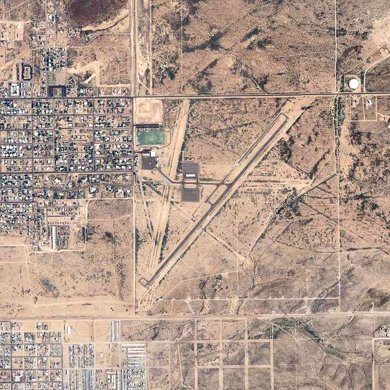
Douglas Municipal Airport
Monument and historic site · National Register of Historic Places · 4.4 mi
Airport
Douglas Residential Historic District
Monument and historic site · National Register of Historic Places · 3.8 mi
Historic district in Douglas, Arizona
Douglas Sonoran Historic District
Monument and historic site · National Register of Historic Places · 3.7 mi
Historic district in Douglas, Arizona, United States

El Paso and Southwestern Railroad Passenger Depot
Monument and historic site · National Register of Historic Places · 3.6 mi
Historic railway station in Douglas, Arizona, United States

El Paso and Southwestern Railroad YMCA
Monument and historic site · National Register of Historic Places · 3.9 mi
Building in Arizona, United States
Gadsden Hotel
Monument and historic site · National Register of Historic Places · 3.8 mi
United States historic place in Cochise County, Arizona

Grand Theatre
Cinema and theater · National Register of Historic Places · 3.9 mi
Theater in Douglas, Arizona, United States


United States Post Office and Customs House–Douglas Main
Monument and historic site · National Register of Historic Places · 3.8 mi
Custom house in Arizona, United States of America
Parks, trails and playgrounds1

City of Douglas Municipal Golf Course
Golf course · 1.8 mi
18 hole Par 71
1372 East Fairway Drive, Douglas
Schools, colleges and libraries19

Center For Academic Success #2 - Douglas 9-12
School · 4.2 mi
510 N G Ave, Douglas
Center For Academic Success #3 - Douglas K-4
School · 4.3 mi
919 E 3Rd St, Douglas
Liberty Traditional Charter School - Saddleback
School · 1.9 mi
3715 N Washington Ave, Douglas
7 more on the map.
History
The Douglas area was first settled by the Spanish in the 18th century. Presidio de San Bernardino was established in 1776 and abandoned in 1780. It was located a few miles east of present-day Douglas. The United States Army established Camp San Bernardino in the latter half of the 19th century near the presidio, and in 1910 Camp Douglas was built next to the town.
Douglas was founded as an American smelter town, to treat the copper ores of nearby Bisbee, Arizona. The town is named after mining pioneer Dr. James Douglas and was incorporated in 1905. Two copper smelters operated at the site. The Calumet and Arizona Company Smelter was built in 1902. The Copper Queen operated in Douglas from 1904 until 1931, when the Phelps Dodge Corporation purchased the Calumet and Arizona Company and took over their smelter. The Calumet and Arizona smelter then became the Douglas Reduction Works. Douglas was the site of the Phelps-Dodge Corporation Douglas Reduction Works until its closure in 1987. The smoke stacks of the smelter were not taken down until January 13, 1991. The town was the site of the Arizona Copper Mine Strike of 1983.
The "Cowboys Home Saloon" was the location of the fatal shooting of bar owner Lorenzo "Lon" Bass. The accused was Arizona Ranger William W. Webb. The date was February 8, 1903.
From the History section of Douglas, Arizona on Wikipedia, under CC BY-SA 4.0.
Map of Douglas
30 places. The map loads OpenStreetMap tiles when you open it.
Climate by month
Monthly table
| Month | High | Low | Rain |
|---|---|---|---|
| Jan | 65°F | 31°F | 0.9 in |
| Feb | 68°F | 35°F | 0.7 in |
| Mar | 73°F | 40°F | 0.6 in |
| Apr | 81°F | 45°F | 0.2 in |
| May | 89°F | 53°F | 0.4 in |
| Jun | 97°F | 62°F | 0.5 in |
| Jul | 95°F | 66°F | 3.5 in |
| Aug | 93°F | 65°F | 3.2 in |
| Sep | 90°F | 60°F | 1.7 in |
| Oct | 83°F | 49°F | 0.8 in |
| Nov | 74°F | 38°F | 0.6 in |
| Dec | 65°F | 30°F | 0.9 in |
U.S. Climate Normals 1991-2020 for Douglas (4 mi away), NOAA NCEI.
People and cost of living
American Community Survey 5-year estimates, 2020-2024, U.S. Census Bureau. Estimates have margins of error, larger for small towns.
Disaster history
Cochise County has had 9 federal disaster declarations since 2000, most often for fires.
- 2020-04-04: Covid-19 Pandemic (Biological)
- 2020-03-13: Covid-19 (Biological)
- 2017-06-11: Lizard Fire (Fire)
- 2011-06-12: Monument Fire (Fire)
- 2011-05-09: Horseshoe Two Fire (Fire)
- 2009-05-18: Mule Pass Fire (Fire)
OpenFEMA disaster declarations summaries.
Getting there and nearby towns
Douglas Municipal Airport (DGL) is the nearest airport with scheduled flights listed in OpenStreetMap, 4 miles away.
- Pirtleville 3 mi southwest, about 5 min by car
- Bisbee 23 mi west, about 37 min by car
- Naco 23 mi west, about 37 min by car
- Miracle Valley 36 mi west, about 58 min by car
- Tombstone 39 mi northwest, about 1 h by car
- Sierra Vista Southeast 40 mi west, about 1 h by car
- Sunsites 41 mi northwest, about 1 h by car
- Sierra Vista 47 mi west, about 1 h 15 min by car
- Whetstone 49 mi northwest, about 1 h 15 min by car
- Huachuca City 50 mi west, about 1 h 15 min by car
Drive times are estimates from straight-line distance, not routes.
Local news
Headlines from INDB, the NEMICO news database.
Reviews, tips and questions
Loading what members have shared...
Sources and licences
- NCES EDGE (Public domain): public schools
- NOAA NCEI U.S. Climate Normals 1991-2020 (Public domain): climate by month
- OpenFEMA (Public domain): disaster declarations
- OpenStreetMap contributors (ODbL 1.0): places, airports, map data
- U.S. Census Bureau (Public domain): population, income, housing, education, commute
- Wikidata (CC0 1.0): elevation, founding date, time zone, website, landmarks and historic places
- Wikimedia Commons (see each image): photos
- Wikipedia (CC BY-SA 4.0): overview and history text
Photo credits
- GadsdenHotel, The original uploader was Tillman at English Wikipedia ., CC BY 2.0
- 605 E. 10th St, Douglas, AZ, Charla Henney, CC BY-SA 3.0
- El Paso and Southwestern Railroad YMCA, Jeff Henley, CC BY-SA 3.0
- El Paso and Southwestern Railroad Passenger Depot, Jeff Henley, CC BY-SA 3.0
- Leggett building, Douglas AZ, Intoxyk8 (Charla Henney), CC BY-SA 3.0
- Douglas Municipal Airport-Arizona-2006-USGS, United States Geological Survey (USGS), Public domain
- Exterior of the Douglas, AZ post office., Intoxyk8 (Charla Henney), CC BY-SA 3.0
- Grand Theatre, Douglas, AZ, Jeff Henley, CC BY-SA 3.0
Page built October 30, 2026. Spotted a mistake? Tell us or suggest a place.