
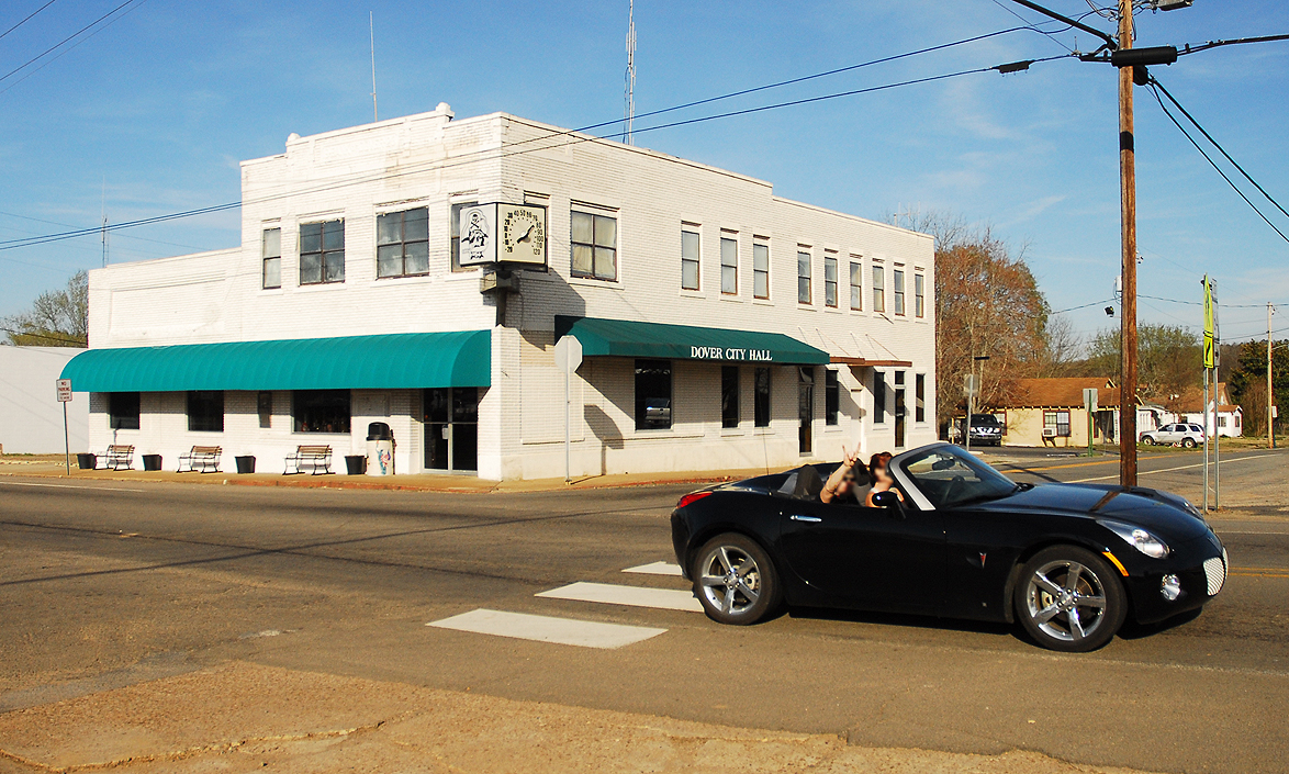

Dover, Arkansas
Dover is a city of 1,795 people in Pope County, Arkansas, founded in 1832.
Why visit Dover
Townapedia lists 1 museum or landmark, 1 park or trail, 2 places to eat and 2 attractions in and around town.
Highlights include Dover to Clarksville Road-Hickeytown Road Segment and Dover City Park.
July is the warmest month, with average highs of 92°F; January lows average 30°F.
Weather in Dover
Forecast from the National Weather Service. Full forecast
About Dover
Dover is a town in Pope County, Arkansas, United States. The population was 1,337 at the 2020 census. Dover is located in the Arkansas River Valley, and is part of the Russellville Micropolitan Statistical Area.
From the Wikipedia article Dover, Arkansas (this version), under CC BY-SA 4.0.
Things to do2

Museums and landmarks1


Dover to Clarksville Road-Hickeytown Road Segment
Monument and historic site · National Register of Historic Places · 2.0 mi
Parks, trails and playgrounds1

Restaurants and cafes2

El Barrio
Restaurant · Mexican · 0.8 mi
45 East Camp Street, Dover
Mo-Su 11:00-21:00; Fr,Sa 11:00-22:00

History
Dover was either named by British aristocrats in the 1830s for Dover, Kent, England or by Stephen Rye in 1832 for Dover, Tennessee. Incorporated December 31, 1852, Dover was the county seat for Pope County from 1841 to 1887 with the county's brick courthouse on the square bounded by present-day Camp, Market, Water, and Elizabeth Streets.
During the American Civil War, what little civil authority there was collapsed throughout Arkansas. By 1863, in most of the state, travel was dangerous, farming hazardous, and county government inoperative. Pope County records at Dover were moved to a cave for protection. Several skirmishes took place in the county, but there were no major engagements. On April 8, 1865, Dover, including the courthouse, was burned.
During the military reconstruction period (1867-1868), companies E and G of the Nineteenth Infantry were stationed in Pope County and headquartered at Dover for a year and a half. Arkansas became the second former Confederate state to be fully restored to the Union in June 1868. However, political and social stability was still years away.
Between 1865 and 1870, at least four county officials were assassinated: Sheriff Archibald D. Napier and Deputy Sheriff Albert Parks on October 24, 1865, County Clerk William Stout on December 4, 1865, and Sheriff W. Morris Williams on August 20, 1866.
From the History section of Dover, Arkansas on Wikipedia, under CC BY-SA 4.0.
Churches and places of worship1
Shopping2
Gas and EV charging1
Schools, colleges and libraries5
Healthcare1
Map of Dover
16 places. The map loads OpenStreetMap tiles when you open it.
Climate by month
Monthly table
| Month | High | Low | Rain |
|---|---|---|---|
| Jan | 50°F | 30°F | 3.2 in |
| Feb | 55°F | 33°F | 3.1 in |
| Mar | 64°F | 41°F | 4.4 in |
| Apr | 73°F | 49°F | 4.8 in |
| May | 80°F | 59°F | 4.7 in |
| Jun | 88°F | 68°F | 3.4 in |
| Jul | 92°F | 71°F | 3.5 in |
| Aug | 92°F | 70°F | 3.5 in |
| Sep | 86°F | 62°F | 3.0 in |
| Oct | 74°F | 50°F | 4.1 in |
| Nov | 62°F | 39°F | 4.6 in |
| Dec | 52°F | 32°F | 4.2 in |
U.S. Climate Normals 1991-2020 for Russellville Muni Ap (9 mi away), NOAA NCEI.
People and cost of living
American Community Survey 5-year estimates, 2020-2024, U.S. Census Bureau. Estimates have margins of error, larger for small towns.
Disaster history
Pope County has had 14 federal disaster declarations since 2000, most often for severe storms.
- 2026-01-24: Severe Winter Storm (Winter Storm)
- 2025-04-05: Severe Storms, Tornadoes, And Flooding (Severe Storm)
- 2020-08-27: Hurricane Laura (Hurricane)
- 2020-04-03: Covid-19 Pandemic (Biological)
- 2020-03-13: Covid-19 (Biological)
- 2019-06-08: Severe Storms And Flooding (Flood)
OpenFEMA disaster declarations summaries.
Getting there and nearby towns
Boone County Airport (HRO) is the nearest airport with scheduled flights listed in OpenStreetMap, 60 miles away.
- Russellville 8 mi south, about 13 min by car
- Dardanelle 12 mi south, about 19 min by car
- Atkins 14 mi southeast, about 23 min by car
- Danville 28 mi southwest, about 45 min by car
- Clinton 39 mi east, about 1 h by car
- Conway 43 mi southeast, about 1 h 15 min by car
- Booneville 49 mi west, about 1 h 15 min by car
- Hot Springs Village 51 mi south, about 1 h 30 min by car
- Charleston 53 mi west, about 1 h 30 min by car
- Maumelle 55 mi southeast, about 1 h 30 min by car
Drive times are estimates from straight-line distance, not routes.
Local news
Headlines from INDB, the NEMICO news database.
Reviews, tips and questions
Loading what members have shared...
Sources and licences
- NCES EDGE (Public domain): public schools
- NOAA NCEI U.S. Climate Normals 1991-2020 (Public domain): climate by month
- OpenFEMA (Public domain): disaster declarations
- OpenStreetMap contributors (ODbL 1.0): places, airports, map data
- U.S. Census Bureau (Public domain): population, income, housing, education, commute
- Wikidata (CC0 1.0): elevation, founding date, time zone, website, landmarks and historic places
- Wikimedia Commons (see each image): photos
- Wikipedia (CC BY-SA 4.0): overview and history text
Photo credits
- Doverffd, Photolitherland ( talk ) Chris Litherland, CC BY 3.0
- Dover to Clarksville Road-Hickeytown Road Segment, Valis55, CC BY-SA 3.0
Page built October 30, 2026. Spotted a mistake? Tell us or suggest a place.