


Why visit Dubuque
Townapedia lists 107 museums and landmarks, 98 parks and trails, 154 places to eat, 28 places to stay and 17 attractions in and around town.
Highlights include Five Flags Center, Clarke University, National Mississippi River Museum & Aquarium and Fenelon Place Elevator.
July is the warmest month, with average highs of 84°F; January lows average 10°F, and about 36 inches of snow fall in a normal year.
Weather in Dubuque
Forecast from the National Weather Service. Full forecast
About Dubuque
Dubuque is a city in Dubuque County, Iowa, United States, and its county seat. The population was 59,667 at the 2020 census. Settled in 1788 and chartered in 1833, Dubuque is the oldest city in Iowa. It was named after French-Canadian trader and miner Julien Dubuque.
From the Wikipedia article Dubuque, Iowa (this version), under CC BY-SA 4.0.
Things to do17

Five Flags Center
Cinema and theater · National Register of Historic Places · 2.1 mi
Theater in Dubuque, Iowa, United States
405 Main Street, Dubuque

Clarke University
School · Catholic · 1.1 mi
Private catholic university in Iowa, U.S.
1550 Clarke Drive, Dubuque

Dubuque Rail Bridge
Bridge · 2.9 mi
Bridge in United States of America
Eagle Point Bridge
Bridge · 4.2 mi
Bridge in United States of America

5 more on the map.
Museums and landmarks107

National Mississippi River Museum & Aquarium
Museum · 2.3 mi
Museum located in Dubuque, Iowa, USA
350 East 3rd Street, Dubuque
Mo-Fr 10:00-16:00; Sa-Su 10:00-17:00

Fenelon Place Elevator
Monument and historic site · National Register of Historic Places · 1.9 mi
Funicular railway in Dubuque, Iowa.

Andrew-Ryan House
Monument and historic site · National Register of Historic Places · 1.9 mi
Building in Indiana, United States
1375 Locust Street, Dubuque

Carnegie-Stout Public Library
Monument and historic site · National Register of Historic Places · 1.9 mi
Public library in Iowa
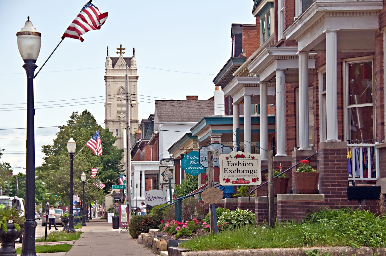
Cathedral Historic District
Monument and historic site · National Register of Historic Places · 2.0 mi
Historic district in Dubuque, Iowa

Dubuque County Jail
Monument and historic site · National Register of Historic Places · 2.2 mi
Prison in Iowa, United States of America
36 East 8th Street, Dubuque
Dubuque Star Brewery
Monument and historic site · National Register of Historic Places · 2.7 mi
Brewery in Dubuque, United States of America
500 Star Brewery Drive, Dubuque

Holy Ghost Catholic Church
Monument and historic site · Catholic · National Register of Historic Places · 2.2 mi
Church building in Iowa, United States of America

Jackson Park Historic District
Monument and historic site · National Register of Historic Places · 2.0 mi
Historic district in Dubuque, Iowa

Langworthy Historic District
Monument and historic site · National Register of Historic Places · 1.5 mi
Nationally recognized historic district located in Dubuque, Iowa, United States
Old Main Street Historic District
Monument and historic site · National Register of Historic Places · 2.2 mi
Historic district in Dubuque, Iowa, USA


Upper Main Street Historic District
Monument and historic site · National Register of Historic Places · 2.0 mi
Historic district in Dubuque, Iowa
95 more on the map.
Parks, trails and playgrounds98

Eagle Point Park
Park · National Register of Historic Places · 3.9 mi
Park in Dubuque, Dubuque County, United States of America
2601 Shiras Avenue, Dubuque


Port of Dubuque Marina
Marina and boat launch · 2.4 mi
450 East 3rd Street, Dubuque
Cottingham & Butler Park
Park · 2.0 mi
Pocket park where the house of china used to be
Derby Grange Golf & Recreation Center
Golf course · 3.1 mi
13079 Derby Grange Road, Dubuque
86 more on the map.
Restaurants and cafes154

Dottie's Cafe
Restaurant · Diner, Breakfast · 2.2 mi
504 Central Avenue, Dubuque
Tu-Sa 05:30-13:30; Su 05:30-11:00
1st & Main
Restaurant · Bar And Grill · 2.2 mi
101 Main Street, Dubuque
Mo-Fr 11:00-14:00; Su 08:00-14:00; Sa 09:00-14:00

Backpocket Dubuque
Bar and pub · 2.3 mi
333 East 10th Street, Dubuque
Mo-Th 14:00-22:00; Sa 11:00-24:00; Su 22:00+

Charlotte's Coffee House
Cafe · Breakfast, Coffee Shop · 2.2 mi
1104 White Street, Dubuque
Mo-Sa 07:00-17:00; Su 08:00-17:00

142 more on the map.
History
Spain gained control of the Louisiana Territory west of the Mississippi River following the 1763 defeat of the French; the British took over all territory to the east. The first permanent European settler in what is now Dubuque was Quebecois pioneer Julien Dubuque, who arrived in 1785. In 1788, he received permission from the Spanish government and the local Meskwaki people to mine the area's rich lead deposits. Control of Louisiana and Dubuque's mines shifted briefly back to France in 1800, then to the United States in 1803, following the Louisiana Purchase. The Meskwaki continued to mine with the full support of the U.S. government until 1830 when the Meskwaki were illegally pushed out of the mine region by American prospectors.
From the History section of Dubuque, Iowa on Wikipedia, under CC BY-SA 4.0.
Where to stay28
Churches and places of worship54
Shopping41
Gas and EV charging24
Schools, colleges and libraries53
Healthcare23
Map of Dubuque
250 places. The map loads OpenStreetMap tiles when you open it.
Climate by month
Monthly table
| Month | High | Low | Rain | Snow |
|---|---|---|---|---|
| Jan | 28°F | 10°F | 1.3 in | 11.7 in |
| Feb | 32°F | 13°F | 1.4 in | 8.6 in |
| Mar | 45°F | 25°F | 2.1 in | 3.7 in |
| Apr | 58°F | 38°F | 3.8 in | 0.9 in |
| May | 71°F | 49°F | 4.4 in | 0.0 in |
| Jun | 81°F | 60°F | 5.6 in | 0.0 in |
| Jul | 84°F | 64°F | 5.3 in | 0.0 in |
| Aug | 82°F | 62°F | 3.8 in | 0.0 in |
| Sep | 75°F | 54°F | 3.9 in | 0.0 in |
| Oct | 61°F | 42°F | 3.1 in | 0.1 in |
| Nov | 46°F | 29°F | 2.4 in | 1.2 in |
| Dec | 33°F | 18°F | 1.7 in | 9.9 in |
U.S. Climate Normals 1991-2020 for Dubuque L&D 11 (4 mi away), NOAA NCEI.
People and cost of living
American Community Survey 5-year estimates, 2020-2024, U.S. Census Bureau. Estimates have margins of error, larger for small towns.
Disaster history
Dubuque County has had 12 federal disaster declarations since 2000, most often for severe storms.
- 2024-06-24: Severe Storms, Flooding, Straight-Line Winds, And Tornadoes (Severe Storm)
- 2023-08-25: Flooding (Flood)
- 2020-03-23: Covid-19 Pandemic (Biological)
- 2020-03-13: Covid-19 (Biological)
- 2017-08-27: Severe Storms, Tornadoes, Straight-Line Winds, And Flooding (Severe Storm)
- 2011-08-30: Severe Storms And Flooding (Severe Storm)
OpenFEMA disaster declarations summaries.
Getting there and nearby towns
Dubuque Regional Airport (DBQ) is the nearest airport with scheduled flights listed in OpenStreetMap, 7 miles away.
- Asbury 4 mi west, about 6 min by car
- East Dubuque 4 mi east, about 7 min by car
- Peosta 8 mi southwest, about 12 min by car
- Kieler 8 mi northeast, about 12 min by car
- Menominee 9 mi east, about 14 min by car
- Dickeyville 10 mi northeast, about 17 min by car
- Epworth 12 mi west, about 19 min by car
- Potosi 13 mi north, about 21 min by car
- Hazel Green 14 mi east, about 23 min by car
- Clinton 51 mi southeast, about 1 h 15 min by car
Drive times are estimates from straight-line distance, not routes.
Local news
Headlines from INDB, the NEMICO news database.
Reviews, tips and questions
Loading what members have shared...
Sources and licences
- NCES EDGE (Public domain): public schools
- NOAA NCEI U.S. Climate Normals 1991-2020 (Public domain): climate by month
- OpenFEMA (Public domain): disaster declarations
- OpenStreetMap contributors (ODbL 1.0): places, airports, map data
- U.S. Census Bureau (Public domain): population, income, housing, education, commute
- Wikidata (CC0 1.0): elevation, founding date, time zone, website, landmarks and historic places
- Wikimedia Commons (see each image): photos
- Wikipedia (CC BY-SA 4.0): overview and history text
Photo credits
- Dubuque IA - overview, Dirk, CC BY 2.0
- Dubuque Cell Tower - panoramio, Corey Coyle, CC BY 3.0
- University of Dubuque-2, Wikideas1, CC0
- University of Dubuque, Wikideas1, CC0
- Dubuque City Hall 2016, Farragutful, CC BY-SA 4.0
- National Mississippi River Museum, Dirk Hansen, CC BY-SA 3.0
- Dubuque IA - 4th Street Elevator, Dirk, CC BY 2.0
- Dubuque IA - Public Library, Dirk, CC BY 2.0
- Jackson Park District, Kevin Schuchmann, CC BY-SA 3.0
- William m black dredge, Billwhittaker at English Wikipedia, CC BY-SA 3.0
- The Andrew-Ryan House, Boscophotos, CC BY-SA 3.0
- Dubuque IA - 4th street shops, Dirk, CC BY 2.0
- Holt Ghost Parish 01, Djh57, CC BY 3.0
- 1005 Main Street Dubuque, Iowa, Kevin Schuchmann, CC BY-SA 3.0
- Washington Park Gazebo Dubuque, Dirk Hansen, CC BY-SA 3.0
- 2162-2164 Washington Street, Boscophotos, CC BY-SA 3.0
- 1045 W. 3rd St, Boscophotos, CC BY-SA 3.0
- The Hancock House, Boscophotos, CC BY-SA 3.0
- The McMahon House, Boscophotos, CC BY-SA 3.0
- Bishop's Block, Clayton B. Fraser, Public domain
- The Old Chapel, Boscophotos, CC BY-SA 3.0
- SecurityDubuque, Teemu08 at en.wikipedia, CC BY-SA 3.0
- Interstate Power Company Building, Dubuque, Iowa, Jim Roberts, CC BY-SA 4.0
- Town Clock Building (Dubuque, Iowa), Jim Roberts, CC BY-SA 4.0
- Langworthy House, Jack Boucher, Public domain
- The Johann Christian Frederick Ratn House, Boscophotos, CC BY-SA 3.0
- Julien Dubuque Bridge 066951pr, The original uploader was Cuppysfriend at English Wikipedia ., Public domain
- 565 Fenlon Place, Boscophotos, CC BY-SA 3.0
- Diamond Jo Boat Store and Office - Dubuque Iowa, Ian Poellet, CC BY-SA 3.0
- Mathias Ham House 01, Dirk Hansen, CC BY-SA 3.0
- Red Stone, The original uploader was Kepper66 at English Wikipedia ., Public domain
- The Hollenfelz House, Boscophotos, CC BY-SA 3.0
- Schroeder-Klein-Grocery-Company-Warehouse, kevin schuchmann, CC BY-SA 3.0
- University of Dubuque-3, Wikideas1, CC0
- ISS043-E-87405 - View of Chicago at night, Earth Science and Remote Sensing Unit , Lyndon B. Johnson Space Center, Public domain
- ISS042-E-116838 - View of Earth, Earth Science and Remote Sensing Unit , Lyndon B. Johnson Space Center, Public domain
- ISS048-E-22277 - View of Earth, Earth Science and Remote Sensing Unit , Lyndon B. Johnson Space Center, Public domain
- ISS035-E-25815 - View of Earth, Earth Science and Remote Sensing Unit , Lyndon B. Johnson Space Center, Public domain
- ISS022-E-40807 - View of Earth, Earth Science and Remote Sensing Unit , Lyndon B. Johnson Space Center, Public domain
- ISS022-E-40806 - View of Earth, Earth Science and Remote Sensing Unit , Lyndon B. Johnson Space Center, Public domain


Page built October 30, 2026. Spotted a mistake? Tell us or suggest a place.